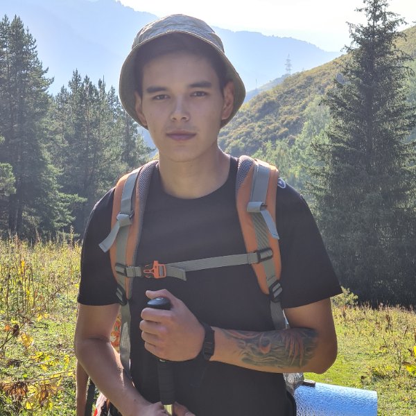
Day Hiking Tour to Furmanov Peak & Panorama from Almaty
From $65 per person


Overview
Is this hike right for you?
Perfect if you…
Good to know
Description
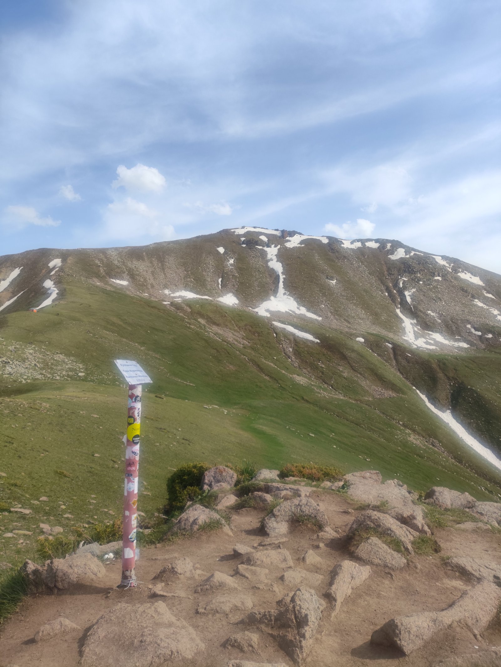
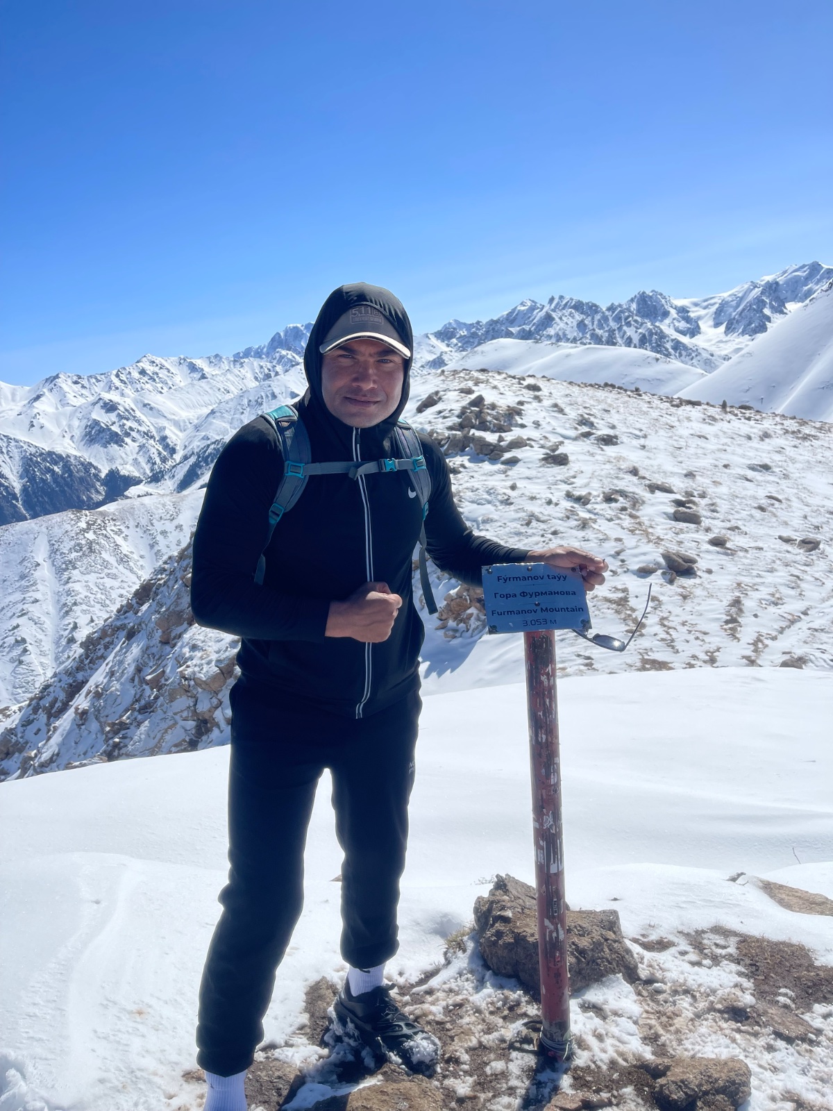
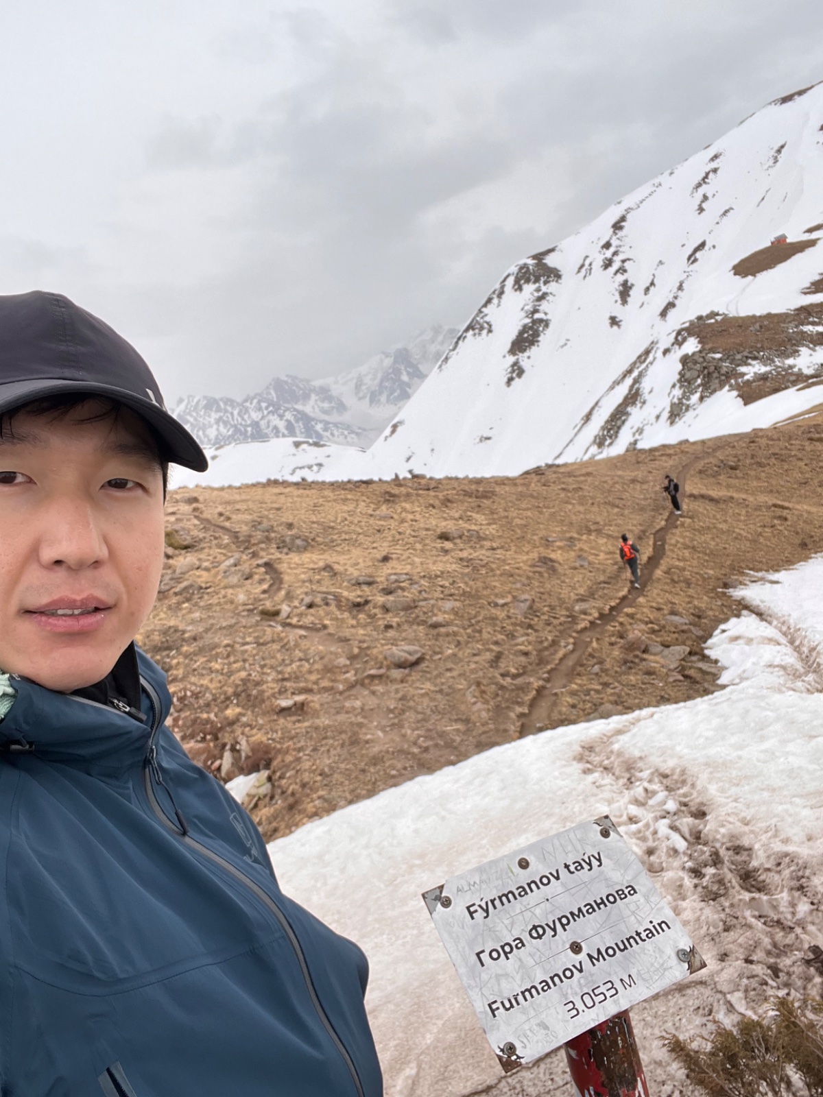
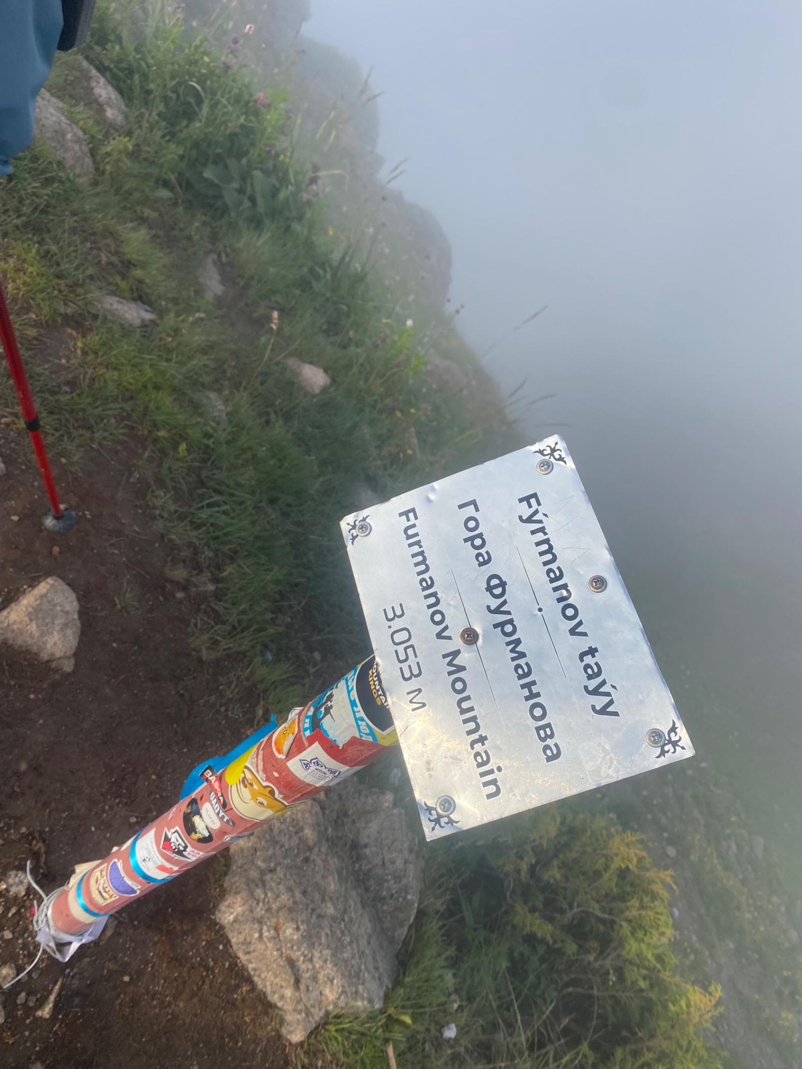
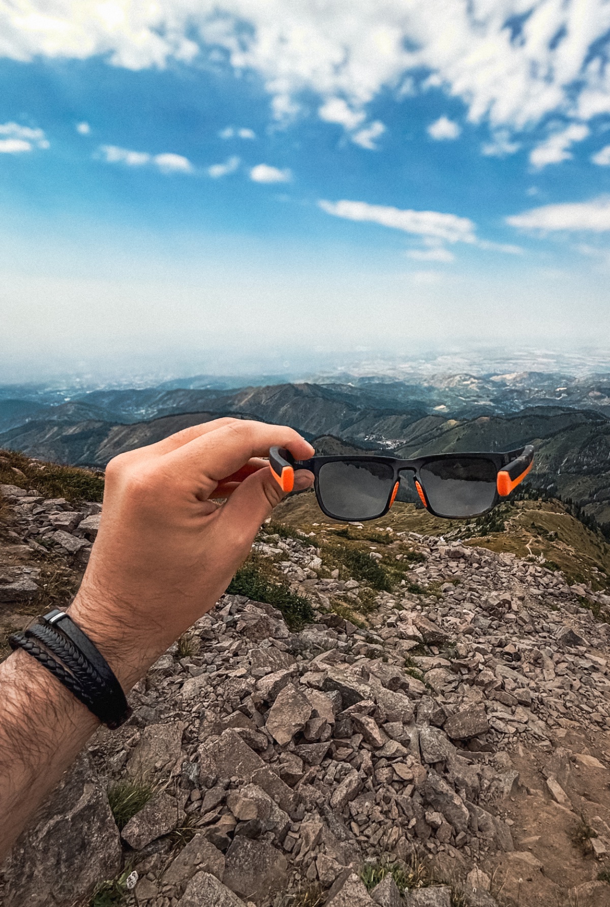
A guided Furmanov Peak hike from Almaty that climbs from Medeo (1,690 m) along the Kim Asar ridge to the famous mountain swing at 2,500 m, then continues to the summit of Furmanov Peak (3,053 m) and the spectacular viewpoint at Panorama Peak (3,260 m) — the first two peaks on the legendary Four Peaks Trail.
📹 Hiking video
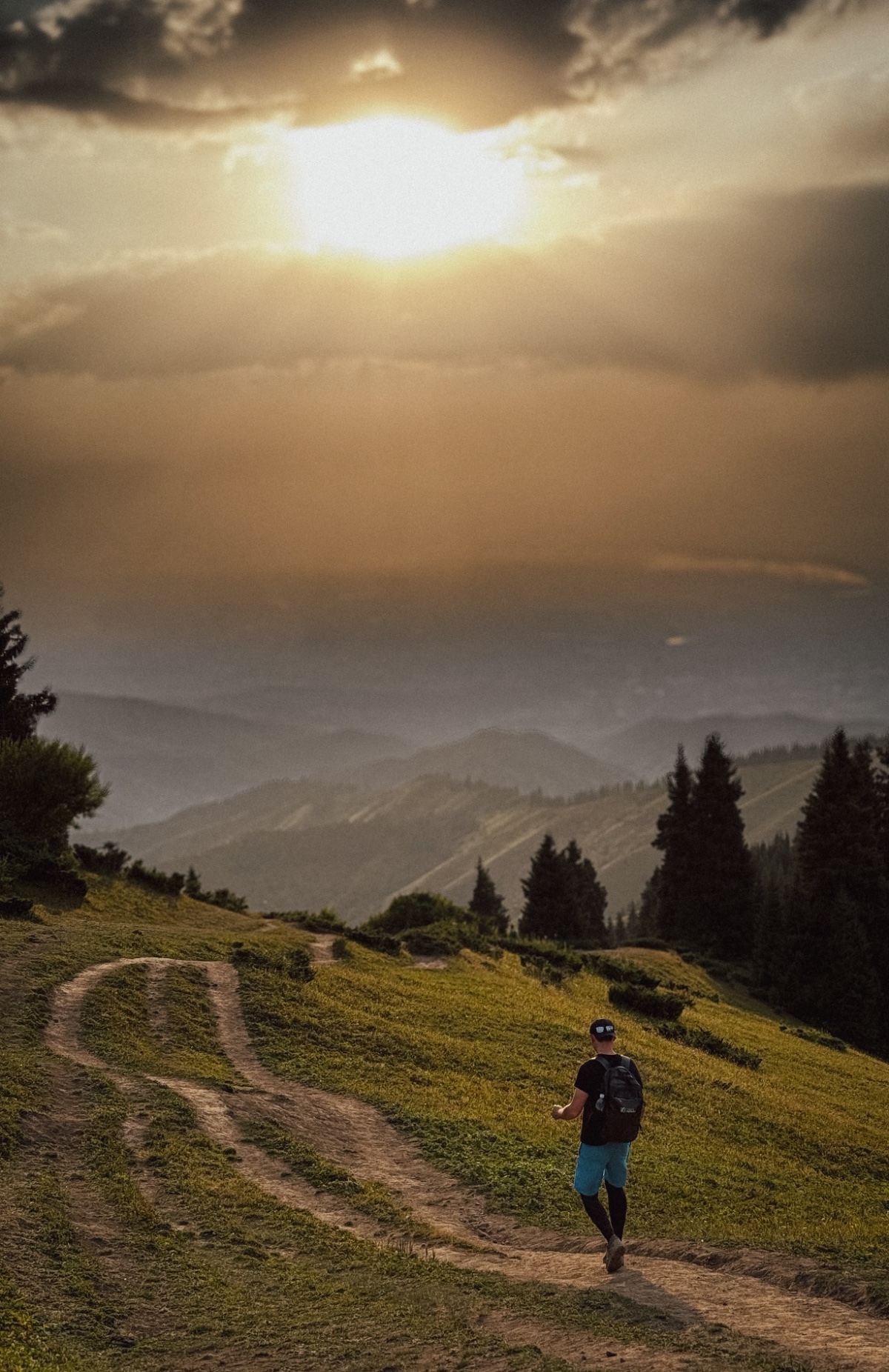
What to expect on the Furmanov Peak hike
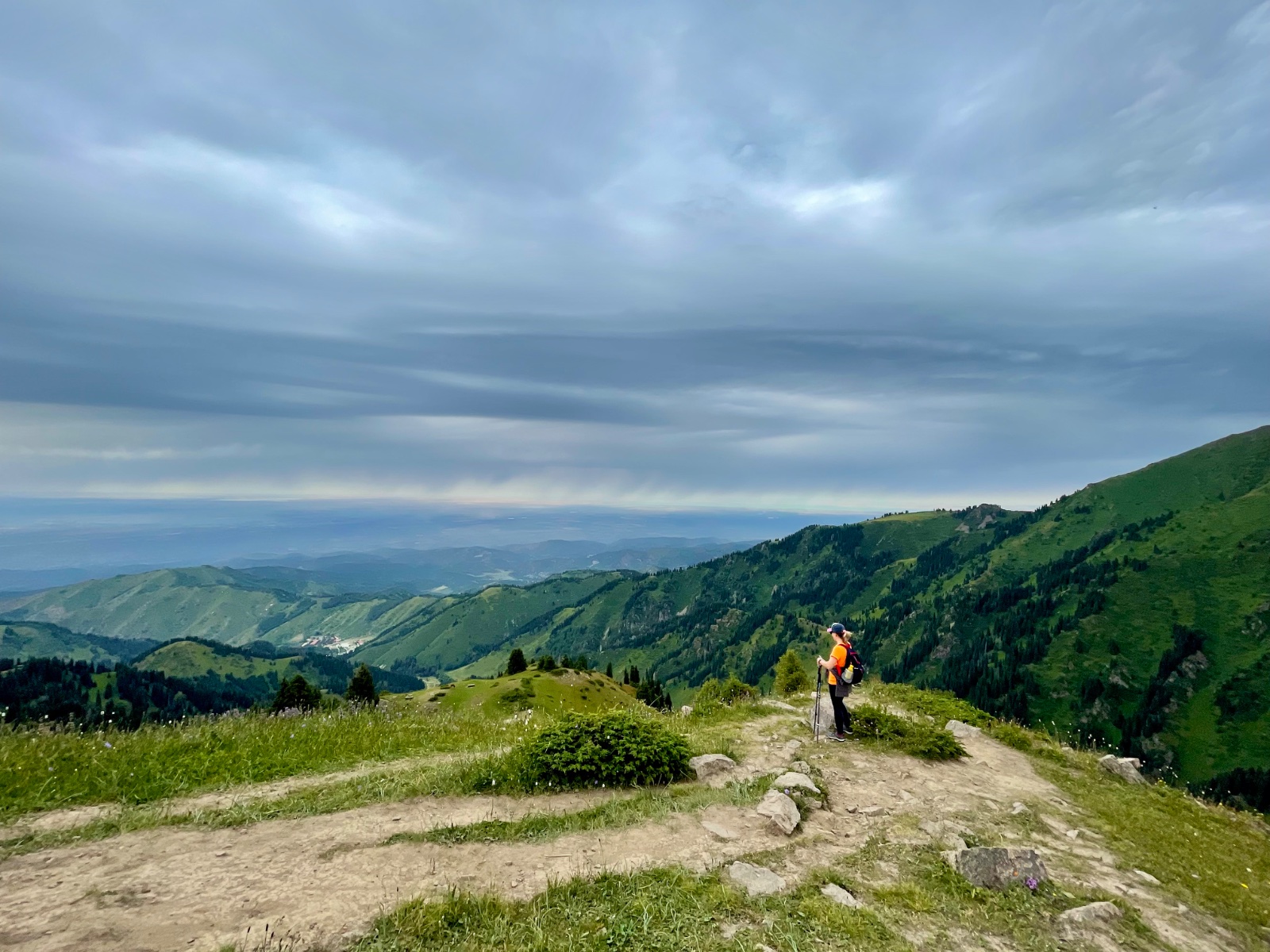
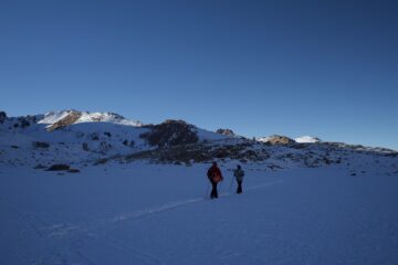
The Furmanov Peak hike from Almaty is the trail that separates casual walkers from mountain people. Where Kok-Zhailau is a meadow stroll, Furmanov is a proper summit: 1,360 metres of elevation gain, rocky scrambling near the top, and a reward that justifies every step — a 360-degree view from Almaty’s rooftops to the glaciated spine of the Zailiysky Alatau. The peak is named after Dmitry Furmanov (1891–1926), a Russian writer and Bolshevik commissar best known for his novel Chapaev about the Russian Civil War hero. Furmanov spent part of his life in Almaty (then Verny), and both a peak and a street in the city carry his name.
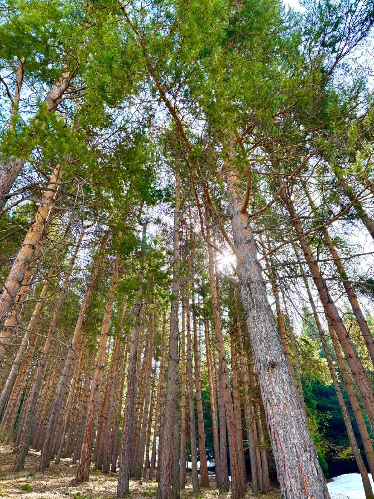
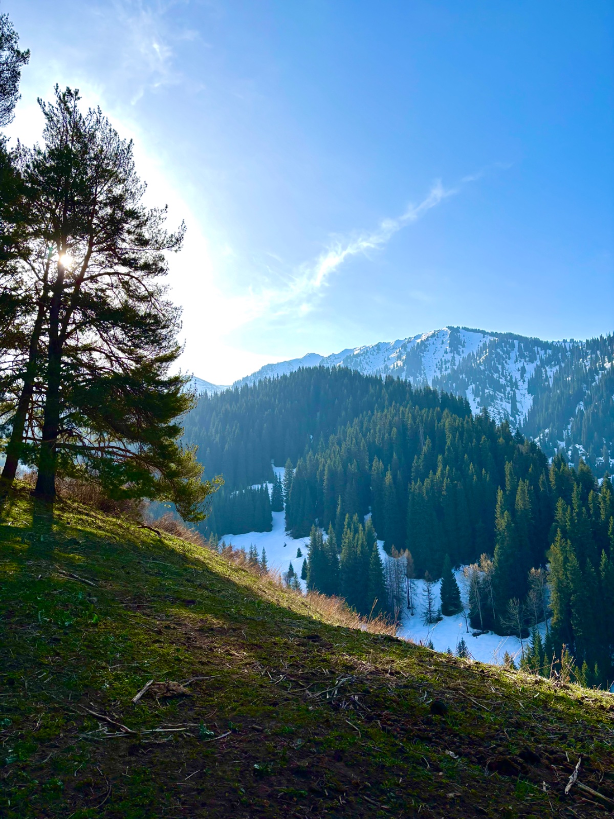
The trail starts at Medeo and climbs the eastern ridge of Kim Asar gorge through spruce forest, past abandoned Soviet-era infrastructure, and along an increasingly exposed alpine ridge. Two landmarks mark the journey: a ruined Soviet ski lift — built by engineers who carried every component up by hand — and the famous Furmanov swing at roughly 2,500 m, a metal frame swing positioned on the ridge with the entire city visible below. The swing has become one of Almaty’s most photographed locations and the emotional midpoint of the hike.
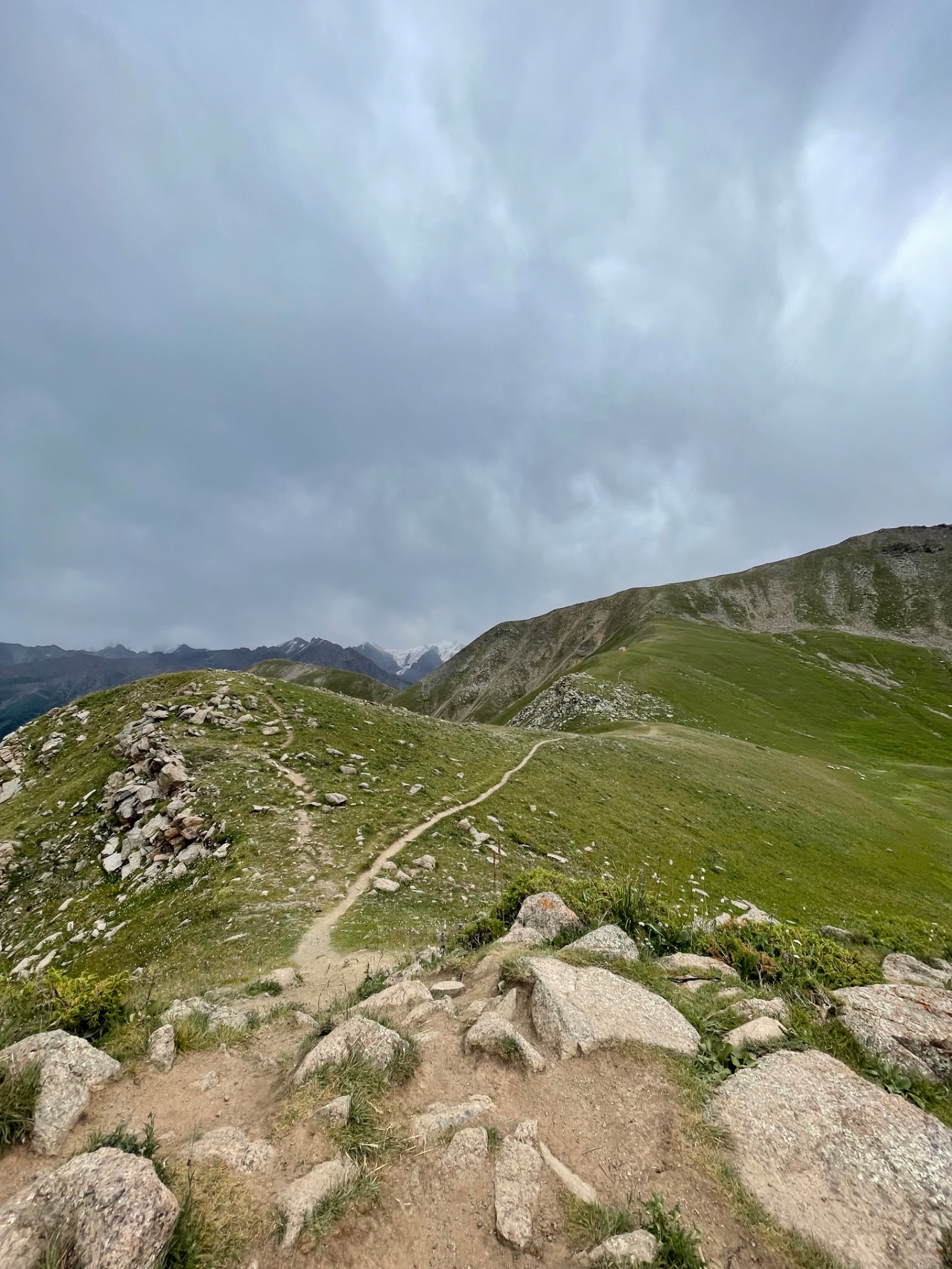
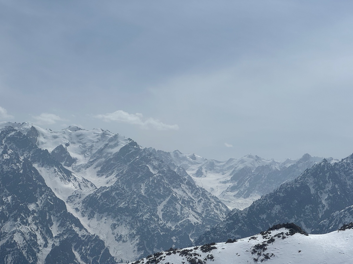
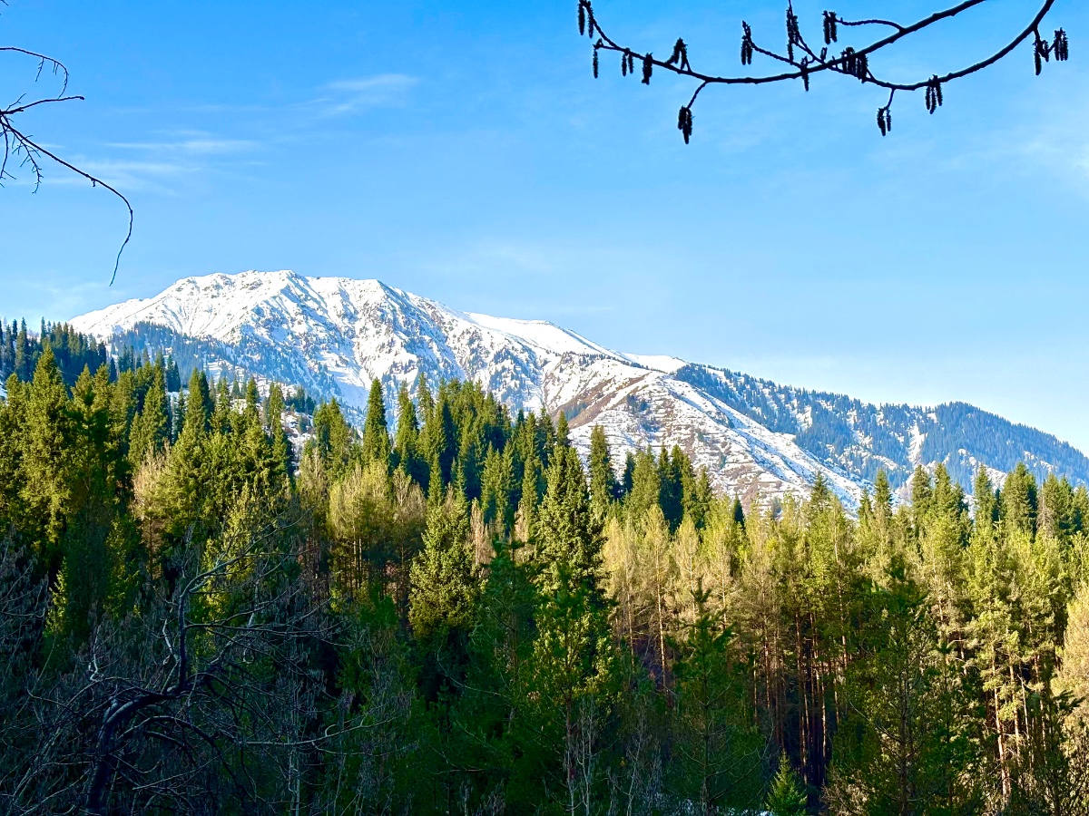
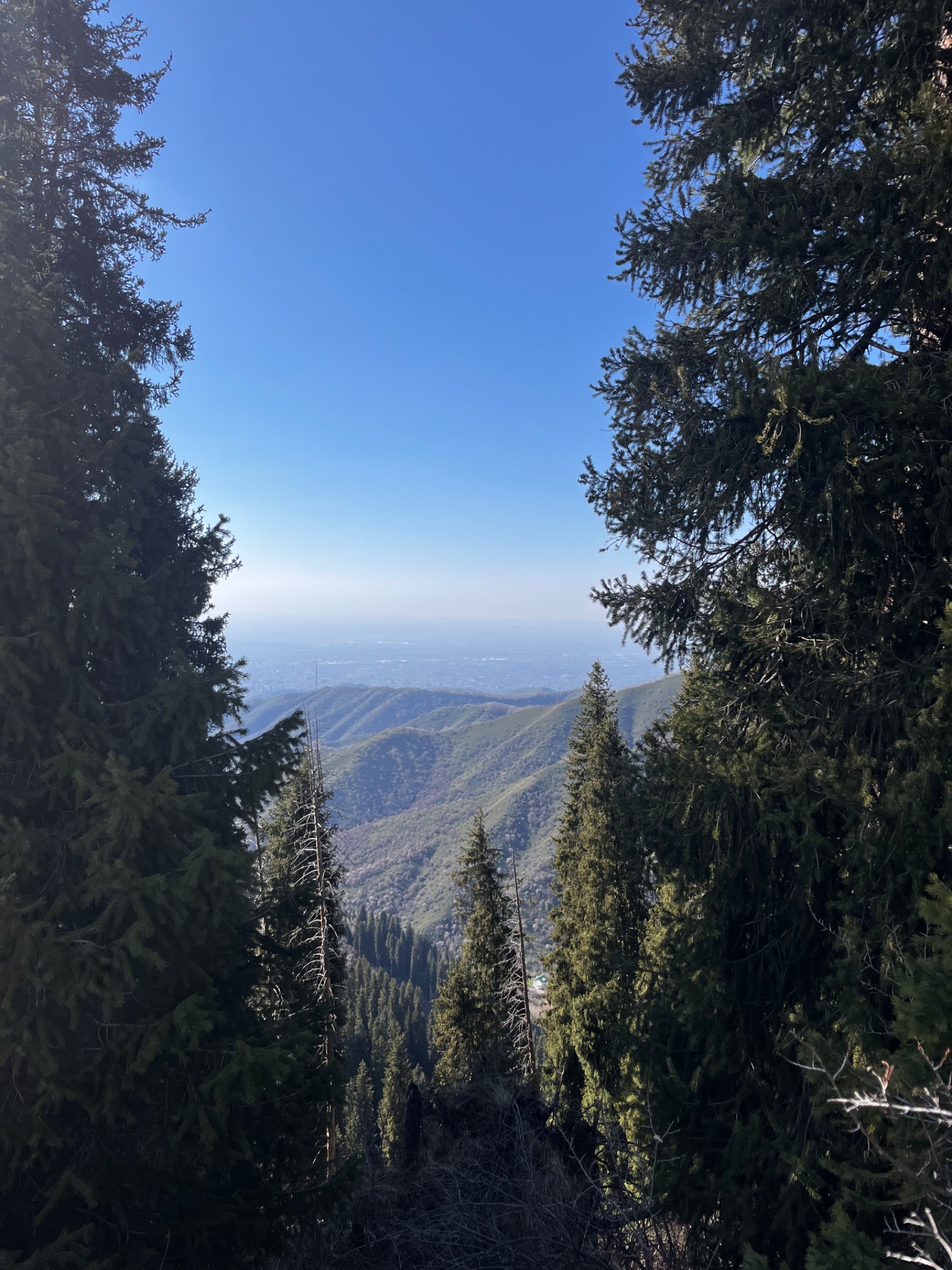
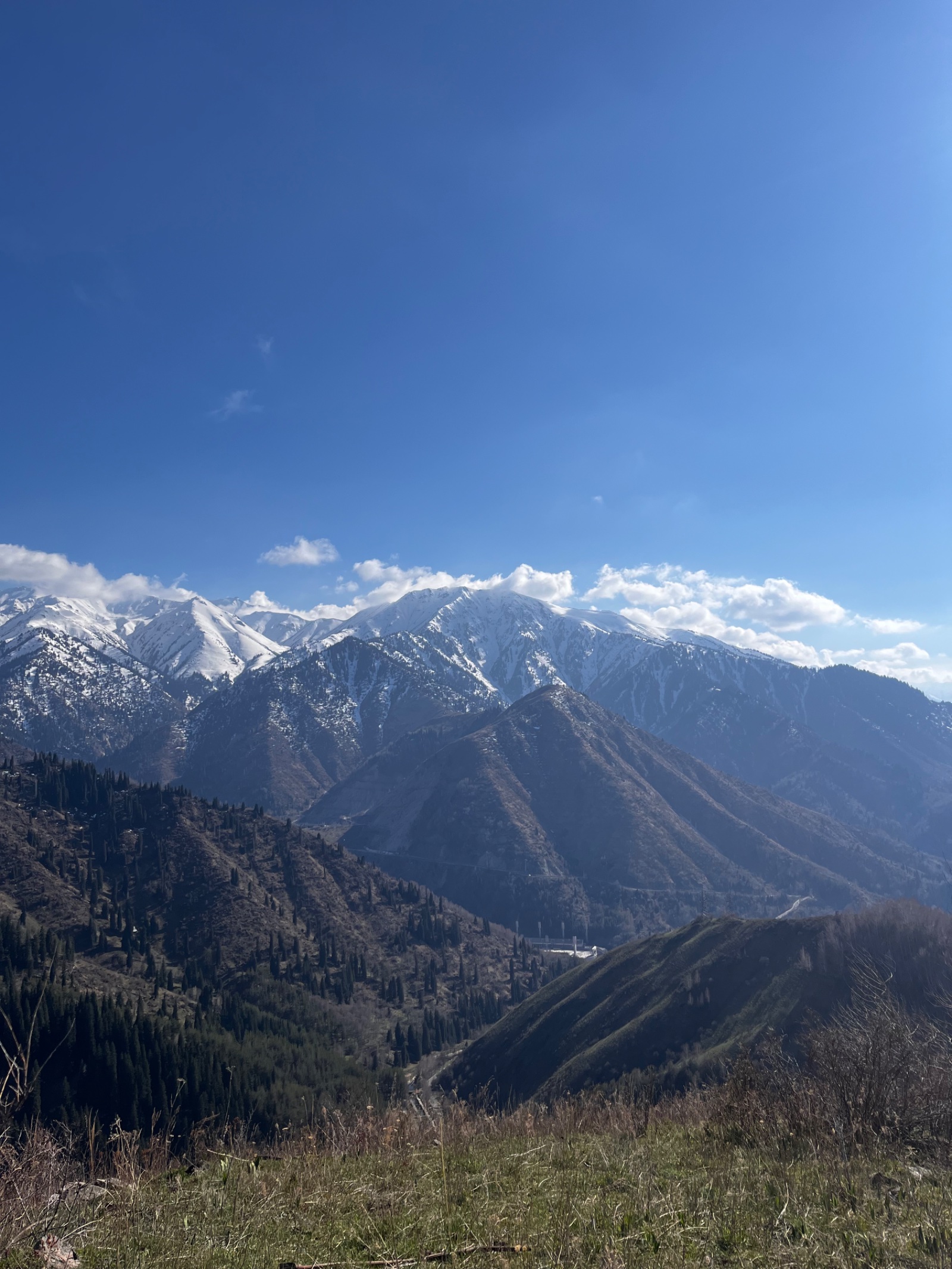
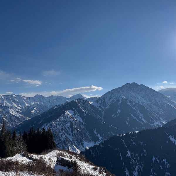
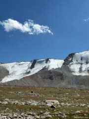
Beyond the swing, the terrain changes. The trail steepens, the trees disappear, and the final approach to Furmanov’s rocky summit requires scrambling over loose boulders. From the top, Almaty stretches to the north, the steppe rolling to the Kapchagai reservoir; to the south, the peaks of the Zailiysky Alatau reveal themselves — Komsomol (Nursultan), Molodezhny, and on clear days, Talgar Peak (5,017 m), the highest point in the range.
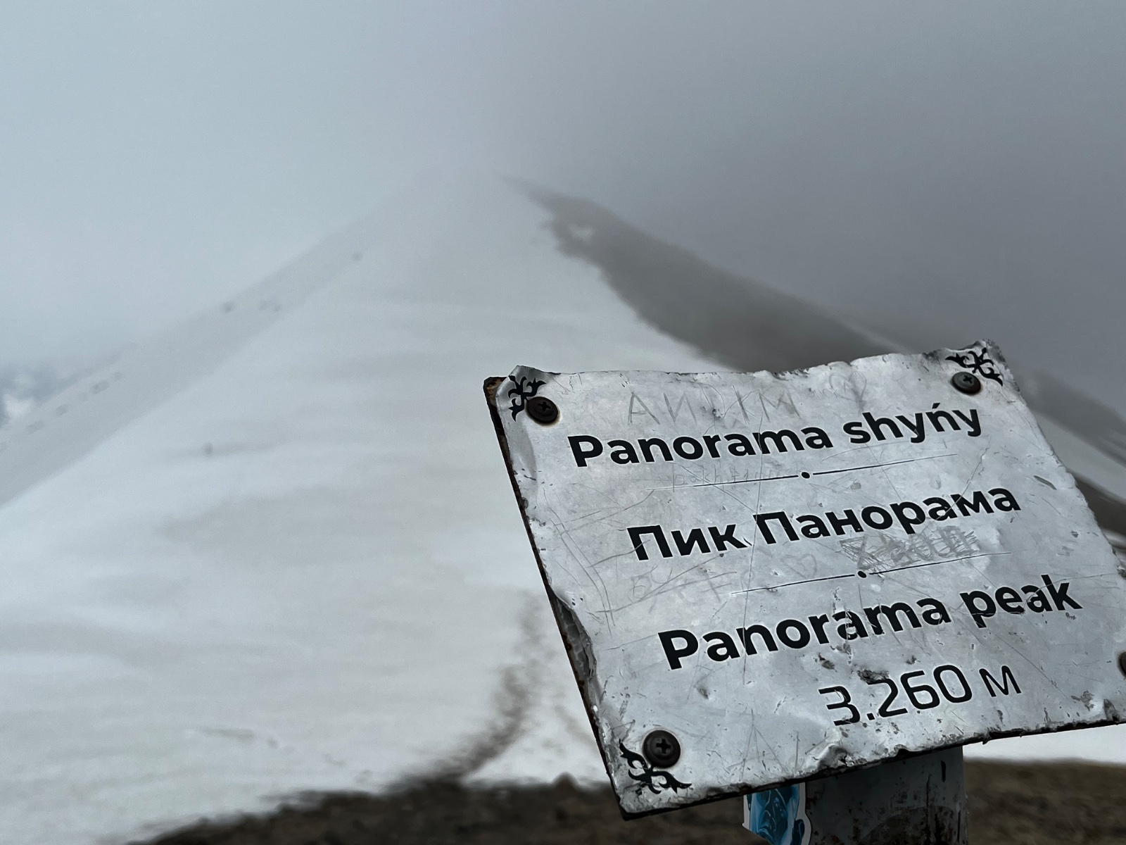
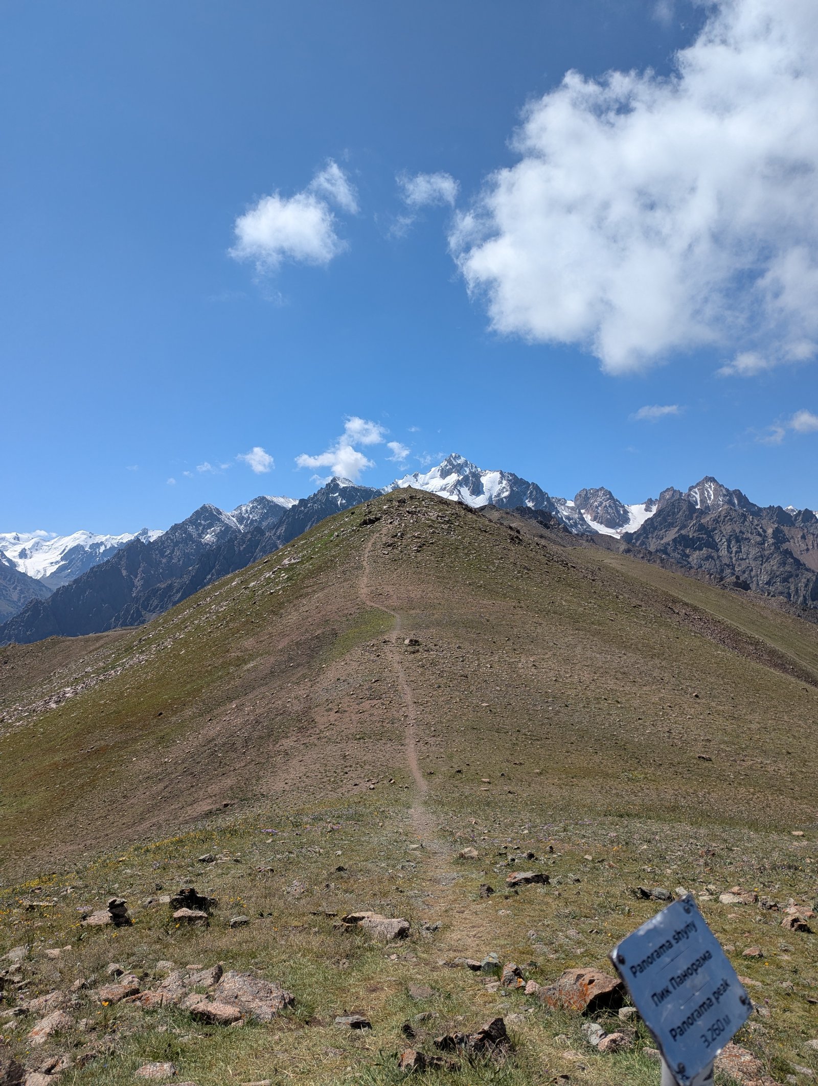
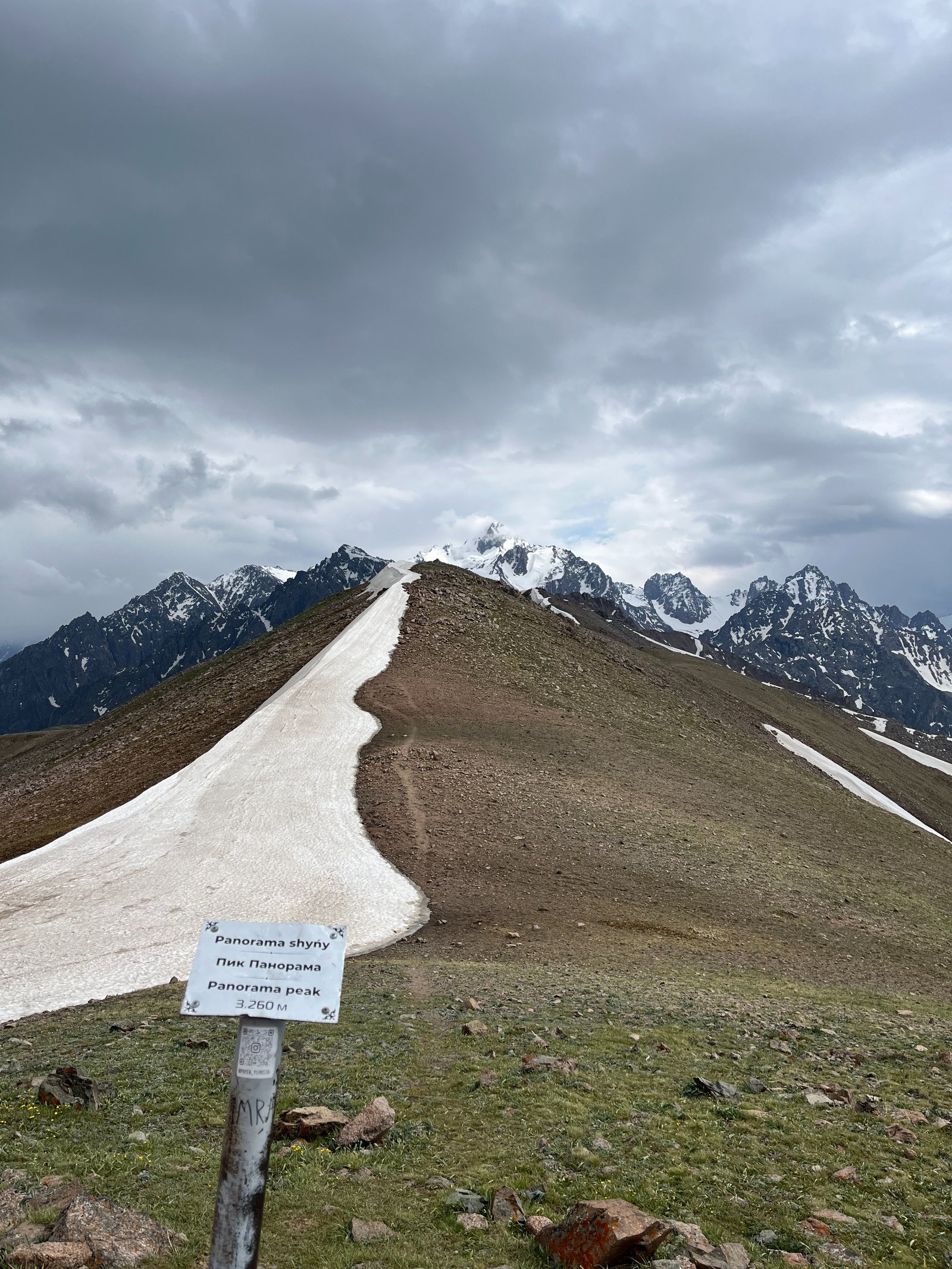
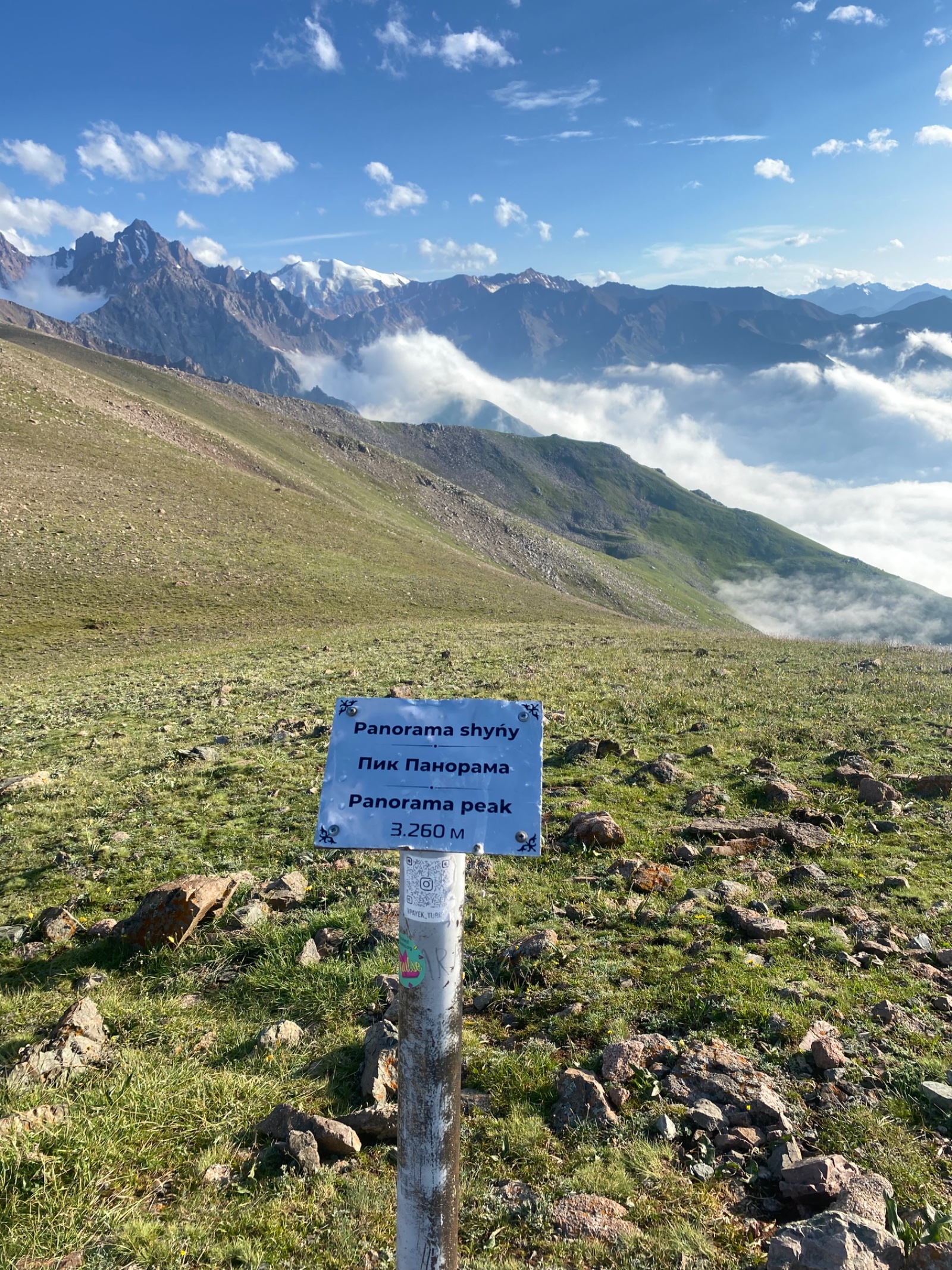
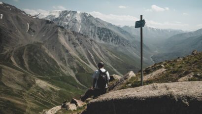
Panorama Peak (3,260 m) is another 30–40 minutes along the ridge from Furmanov and is, many argue, the better viewpoint. A wooden bench on its summit overlooks multiple valleys simultaneously. Together, Furmanov and Panorama form a natural day-hike pair — ambitious but achievable for fit hikers.
Detailed itinerary
Pickup and drive to Medeo
Your guide collects you from your Almaty hotel early (7:00–8:00 AM recommended — this is a long day). The drive to Medeo skating rink takes about 15 minutes from central Almaty along Dostyk Avenue.
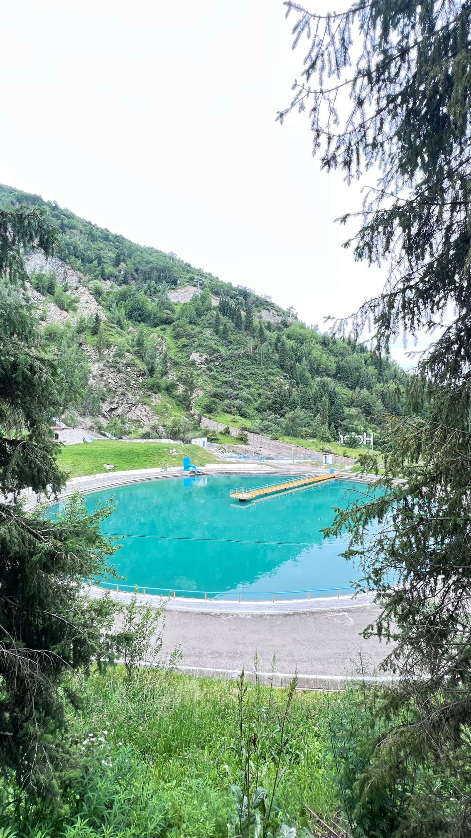
From the Medeo bus stop parking area (1,690 m), we walk downhill slightly and turn right toward Kim Asar gorge. The first section follows a paved road parallel to a small water canal — the same approach road used for the Butakovka and Kim Asar hikes.
Kim Asar gorge and the ridge
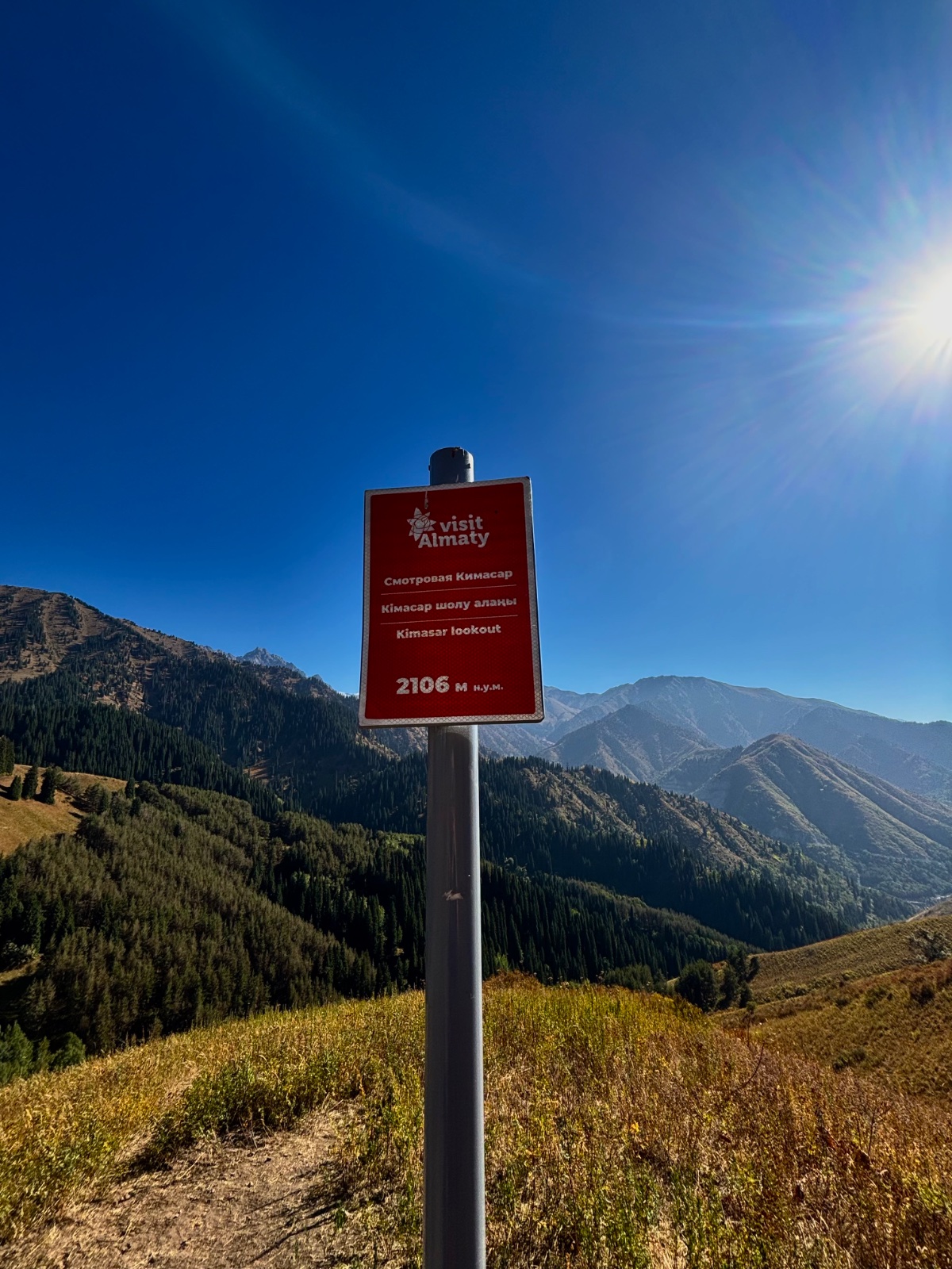
After about 1 km, we pass the turnoff for Kim Asar gorge swings (left) and Butakovka waterfall (also left). We continue straight, following signs for Furmanov Peak. The paved road becomes a dirt track, passing abandoned buildings where the asphalt ends.
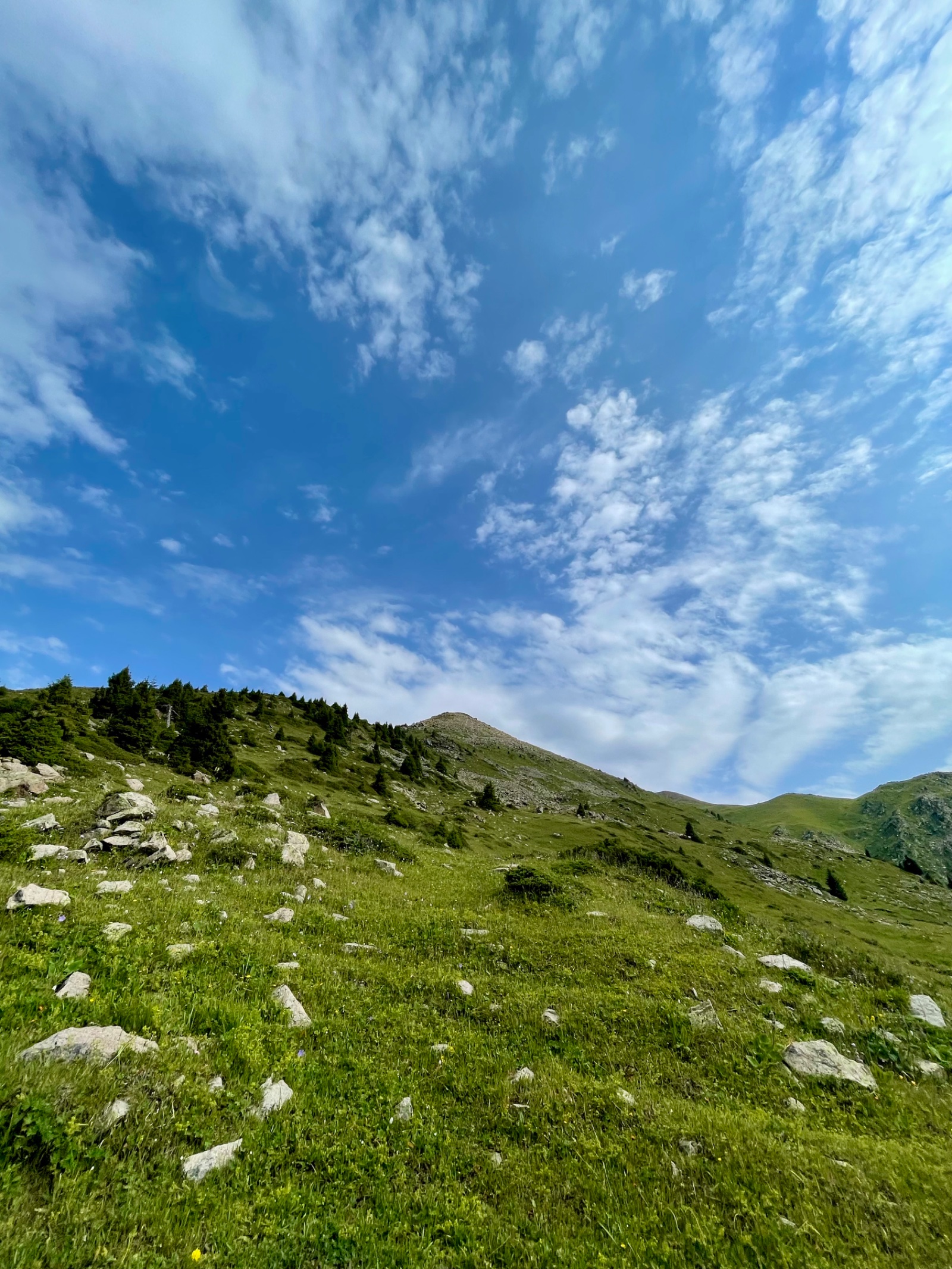
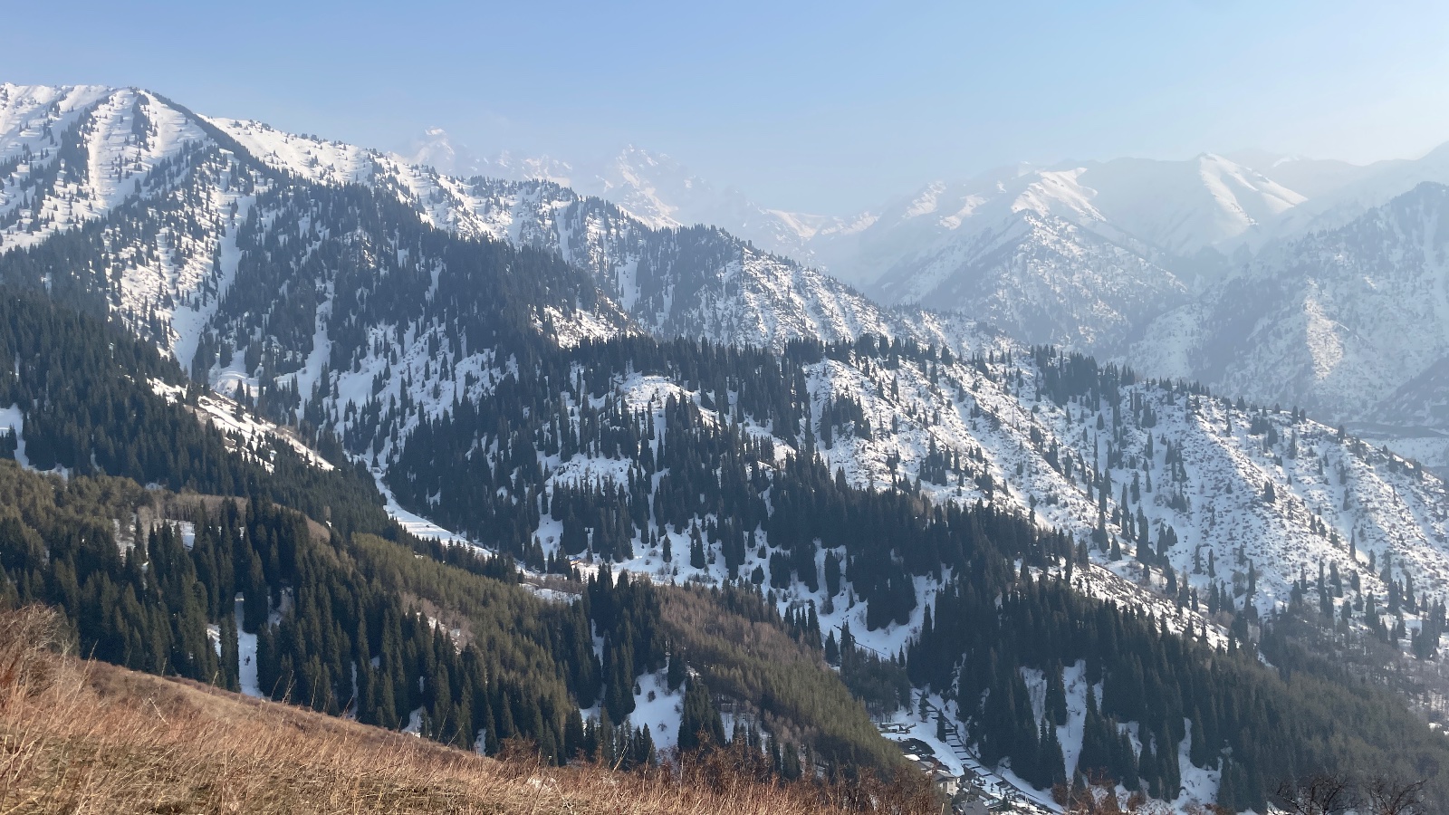
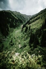
The trail enters spruce forest and begins climbing the eastern ridge of Kim Asar gorge. This is the meat of the hike: a steady, continuous ascent through fragrant forest with the Butakovka gorge visible on the right and Kim Asar on the left. The path is well-trodden and wide — you won’t get lost. Signs mark the way, though the time estimates on some signs are notoriously optimistic.
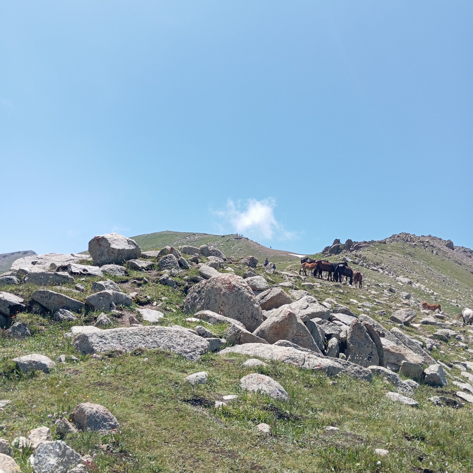
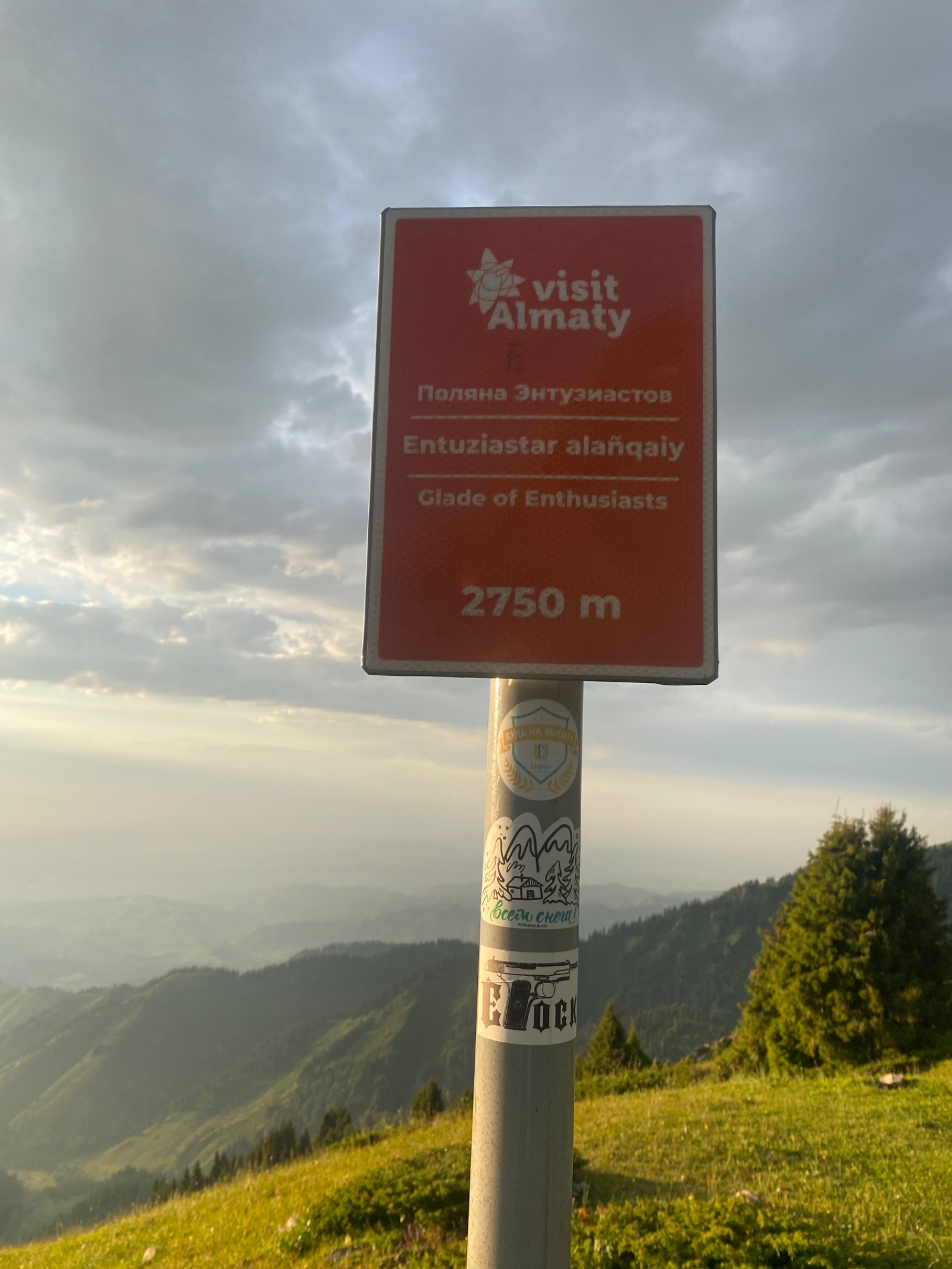
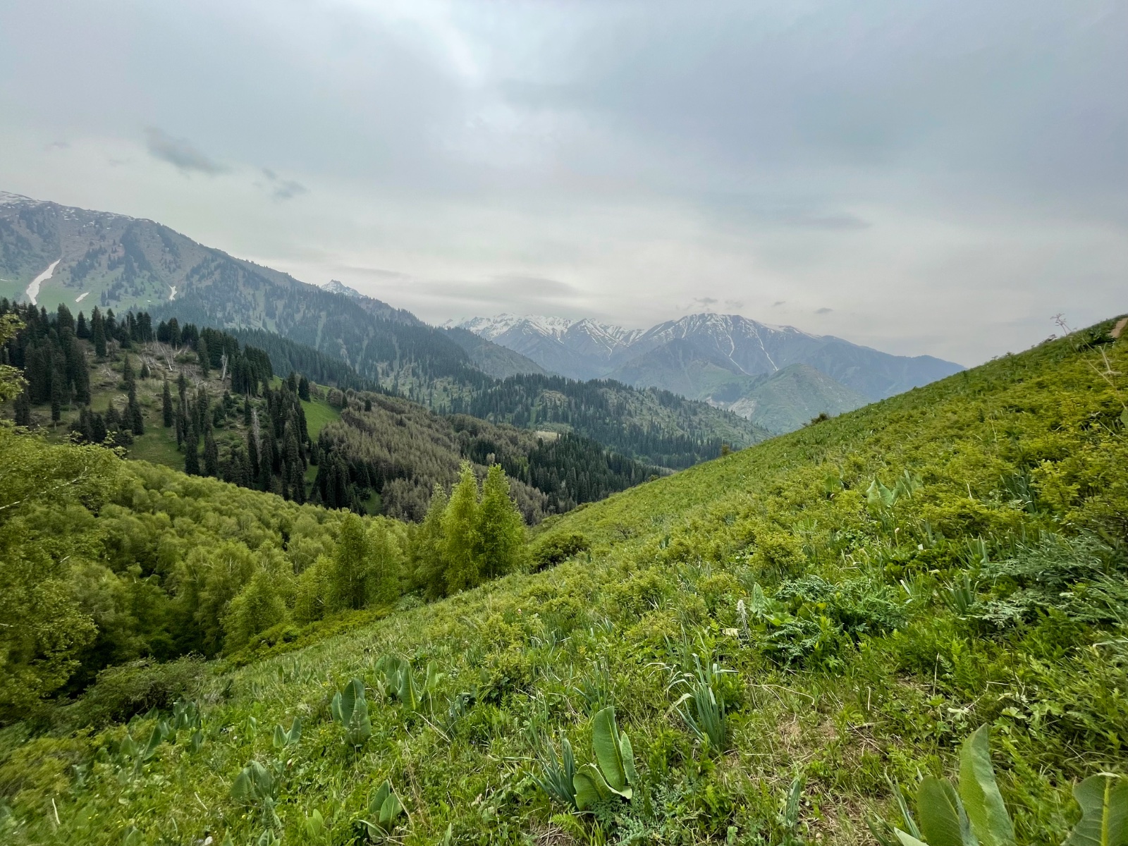
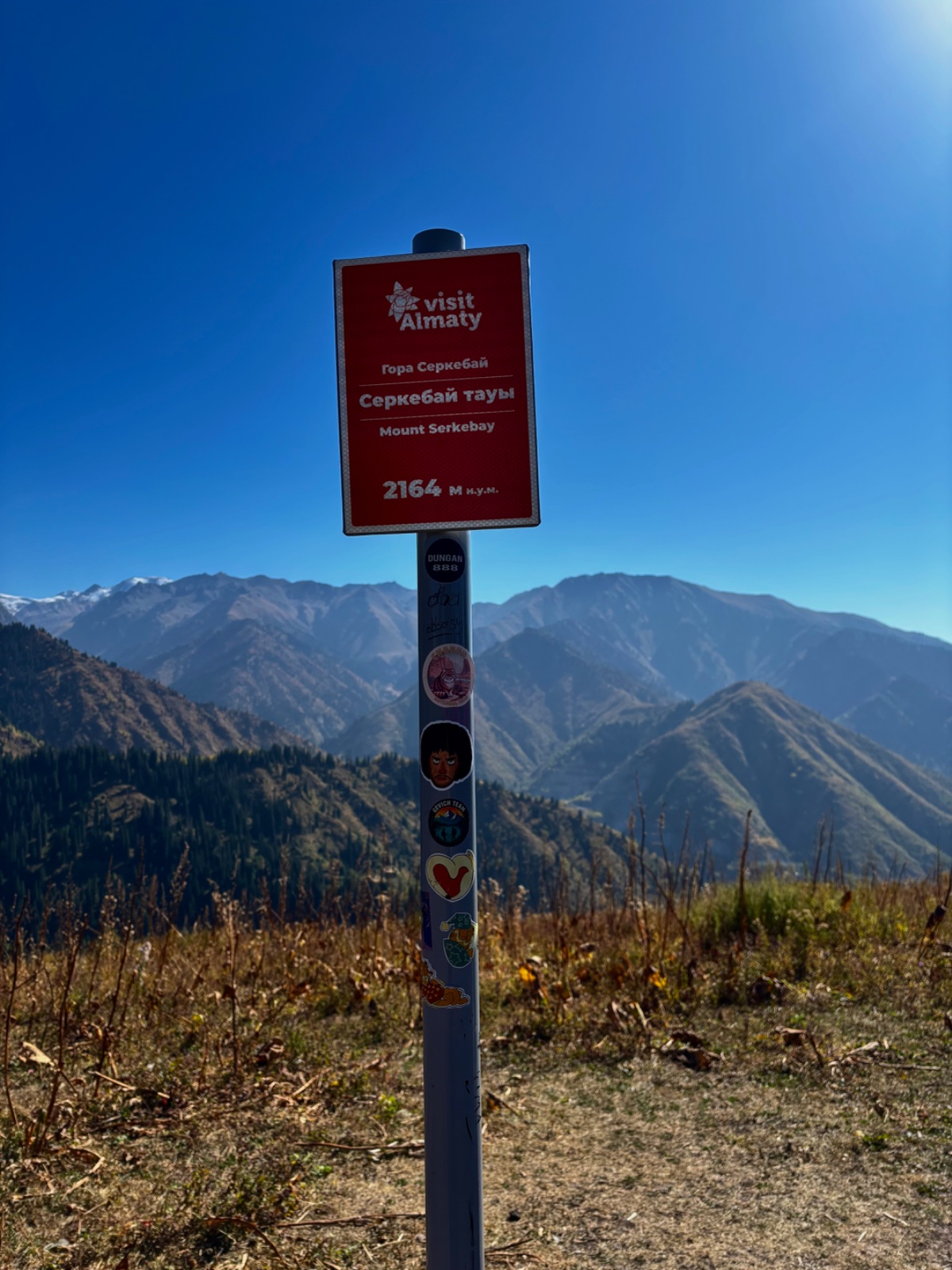
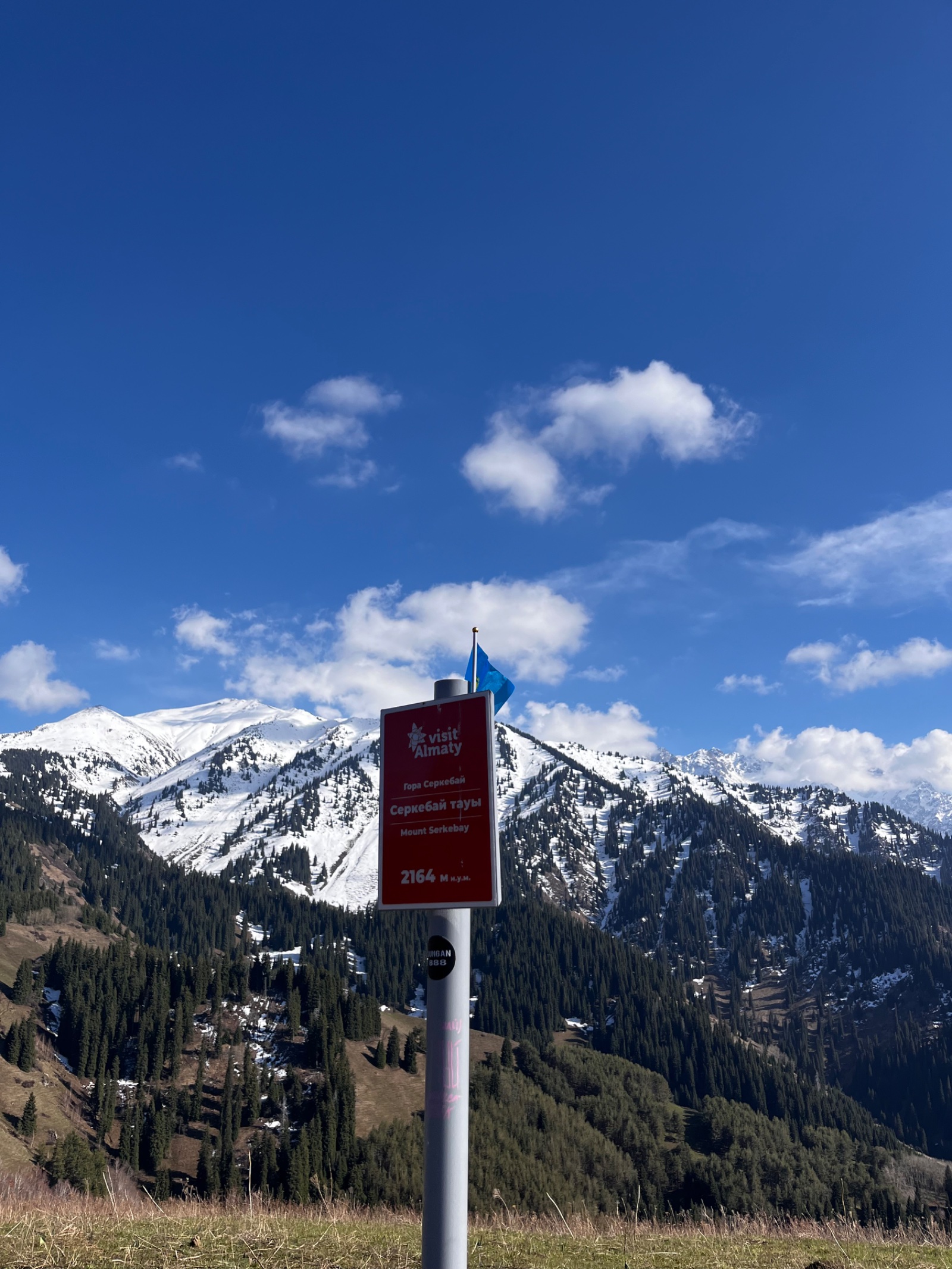
About 2 hours in, the trail opens onto a wide grassy valley where several paths converge. This is the junction known as the “Glade of Enthusiasts” (Polyana Entuziastov) — a traditional rest stop and decision point. One trail branches left toward Boukreev Peak; the main path continues right, up the ridge toward Furmanov.
The swing and Soviet ski lift
Continuing along the ridge, you first encounter the ruins of a Soviet-era ski lift — a remarkable piece of engineering. Soviet mountaineers carried every steel component up this ridge by hand to build a training lift. The rusting infrastructure is now a trail landmark and a reminder of the era when these mountains served as training grounds for Soviet alpinists.
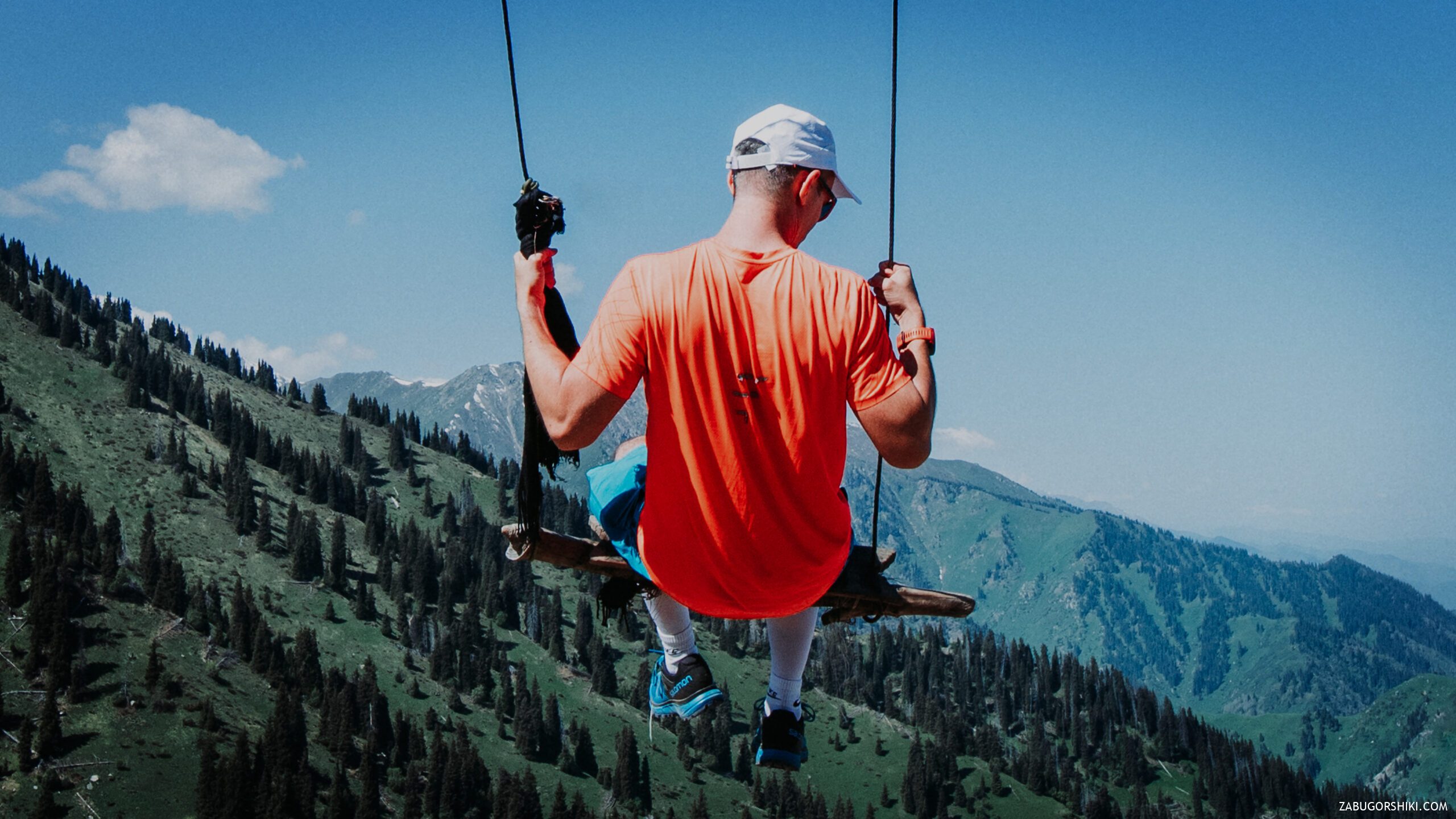
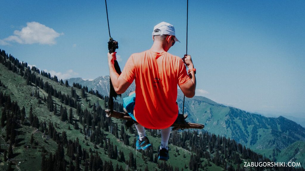
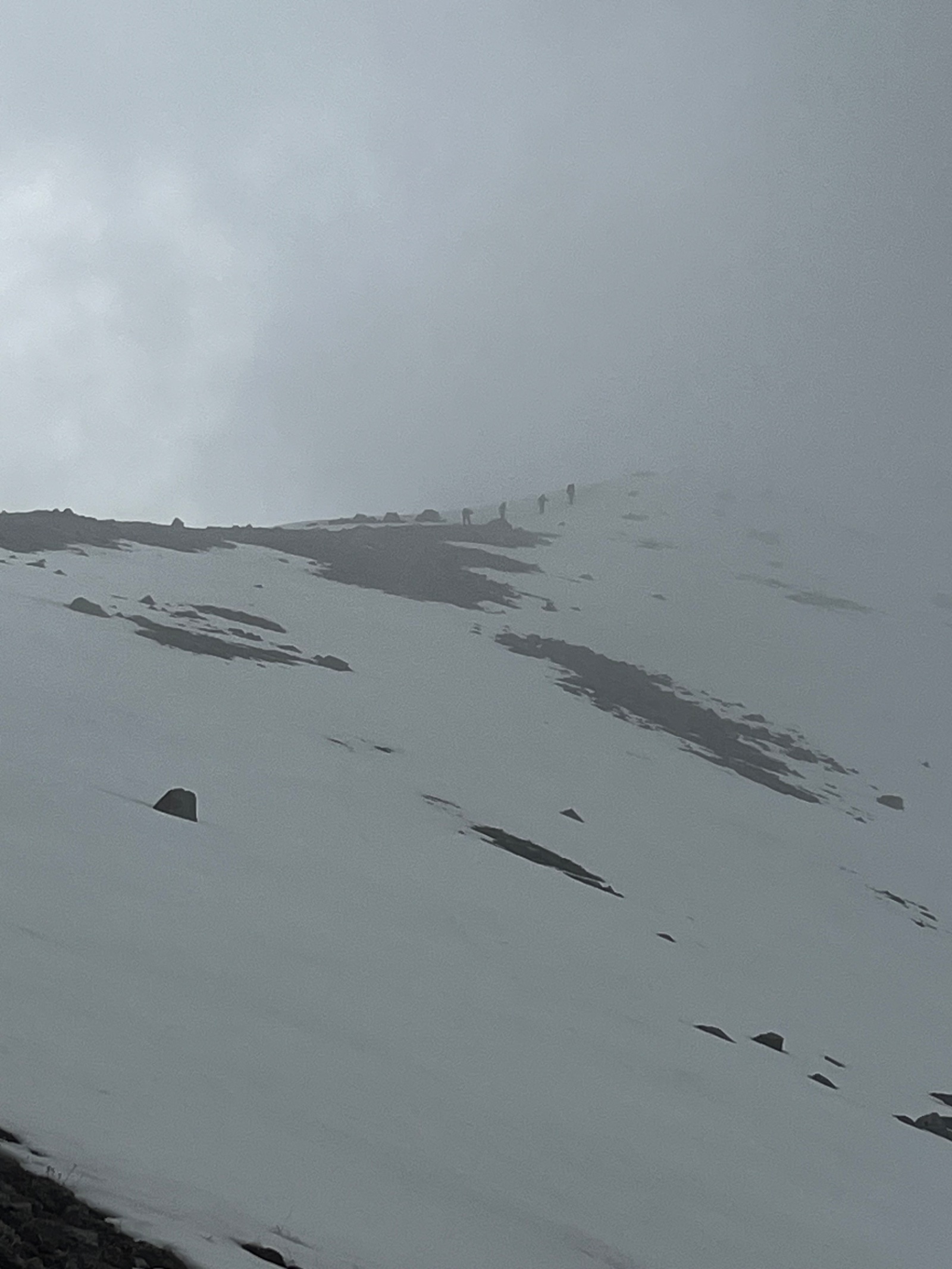
Shortly after, at roughly 2,500 m, you reach the famous Furmanov swing — a metal-frame swing built on the open ridge with an unobstructed view of Almaty and the steppe beyond. On a clear day, you can see the entire city from Al-Farabi Avenue to the CHP-2 power plant and the endless plains stretching toward Balkhash. The swing has become an Instagram icon and is the reason many people attempt this hike.
This is the ideal rest stop: eat a snack, catch your breath, take the swing photo, and prepare mentally — the hardest section is ahead.
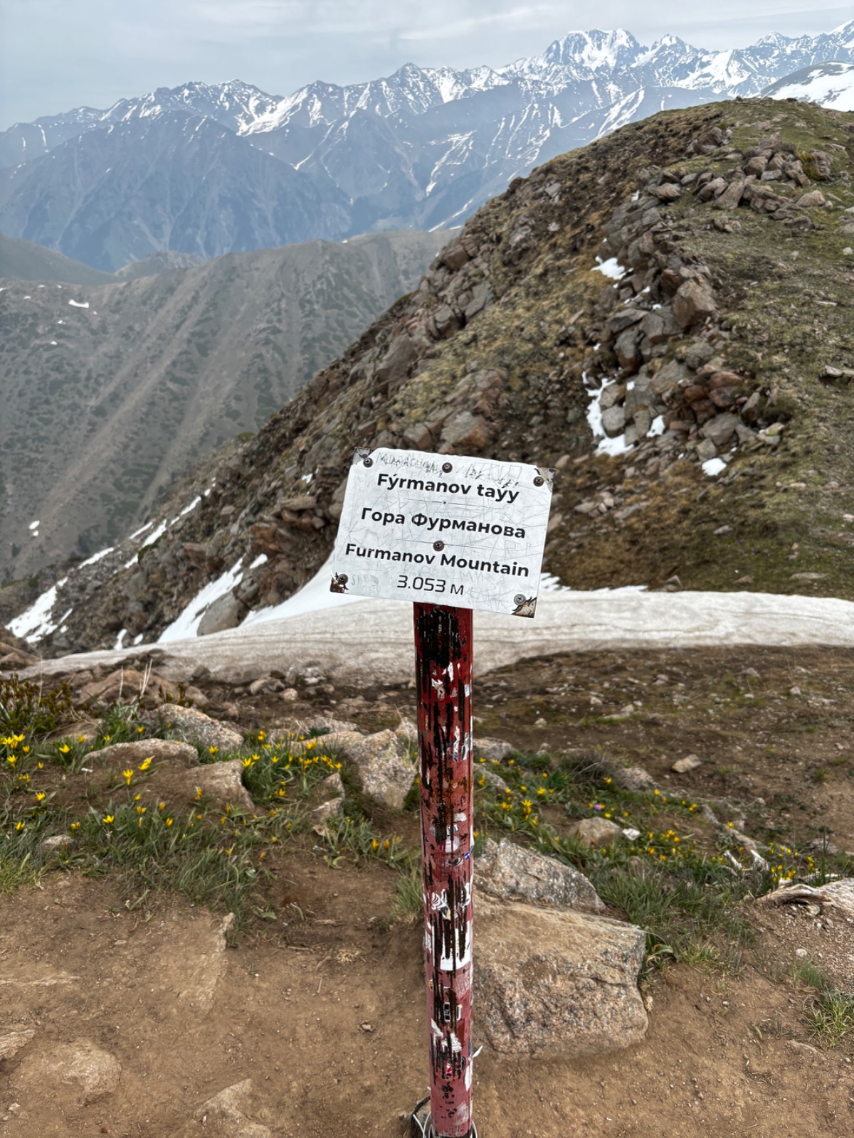
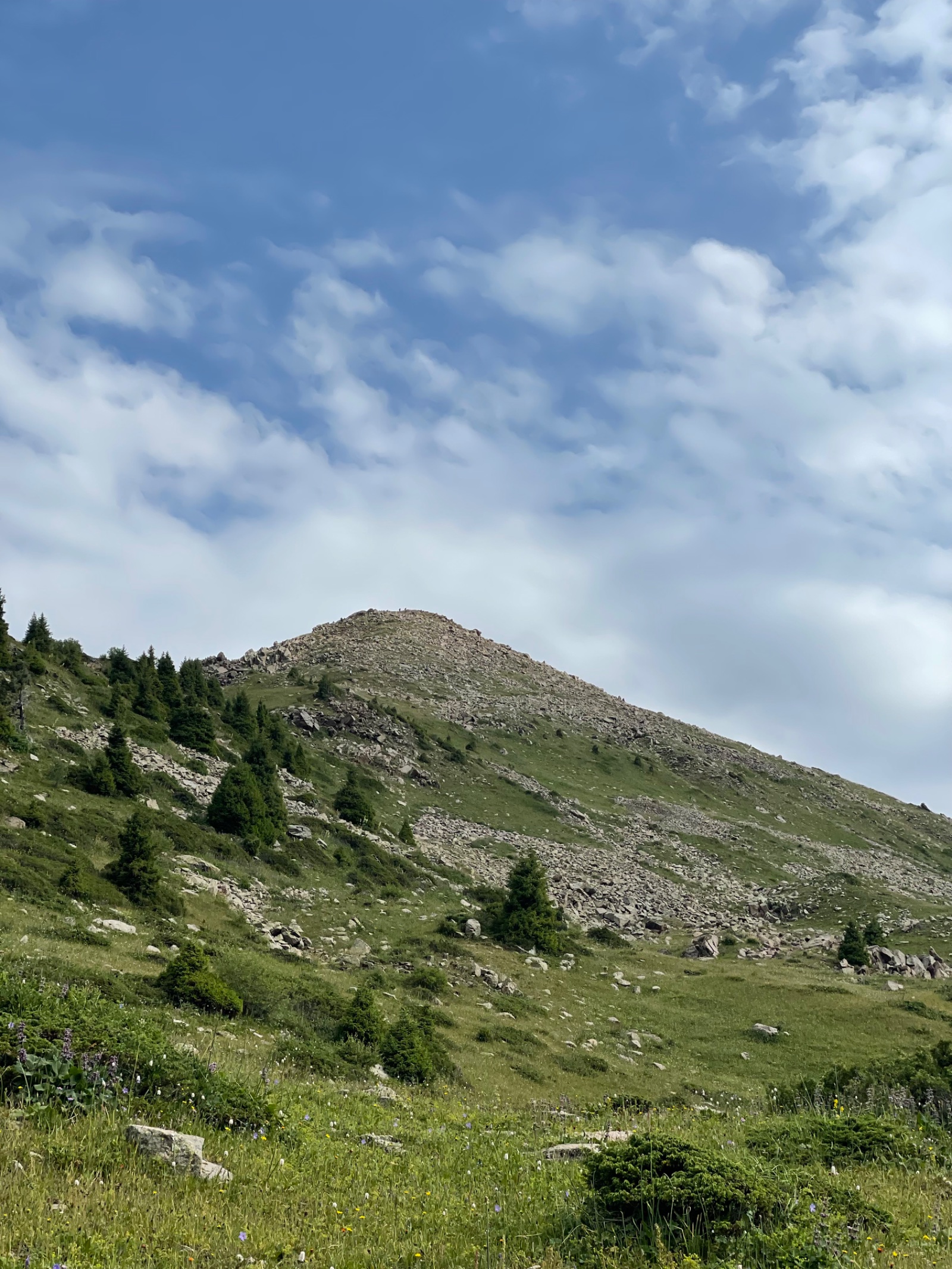
Summit push: Furmanov Peak (3,053 m)
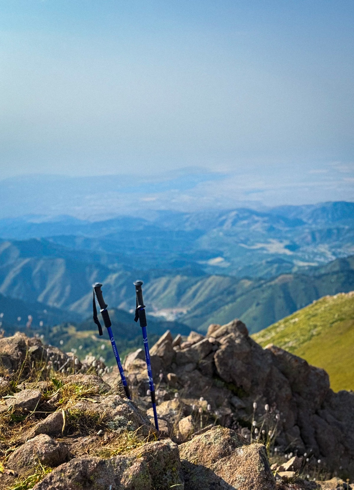
From the swing, it’s approximately 2 km and 550 m of additional elevation to the summit. The terrain changes dramatically: trees disappear, the ridge narrows, and the path becomes steep and rocky. The final 100–150 metres require minor scrambling over loose boulders — not technically difficult, but hands may be needed for balance. This is where trekking poles earn their weight.
The summit itself is a rocky outcrop with space for a small group. The view is extraordinary on clear days: the Almaty cityscape to the north, the Butakovsky and Kim Asar gorges on either side, the Left Talgar gorge to the east, and the snow-covered high peaks of the Zailiysky Alatau to the south — Komsomol (Nursultan) Peak, Molodezhny, Abay, and on exceptional days, the triple head of Talgar Peak (5,017 m) on the horizon.
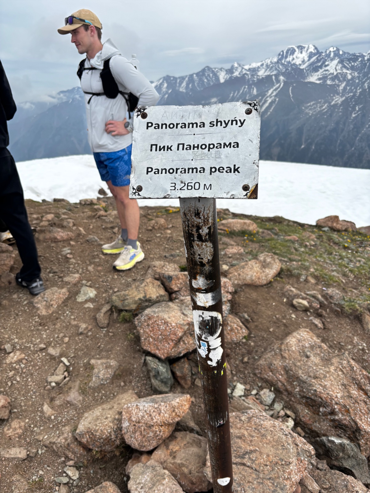
Panorama Peak (3,260 m) — optional but recommended
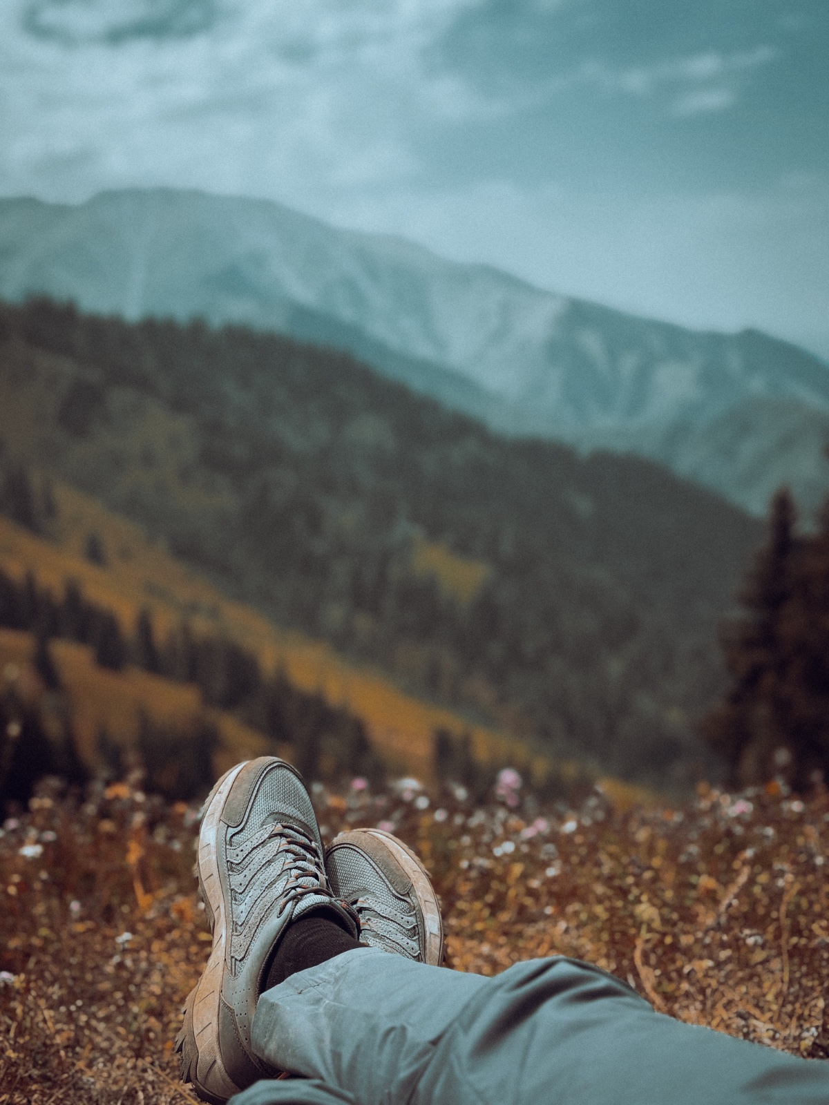
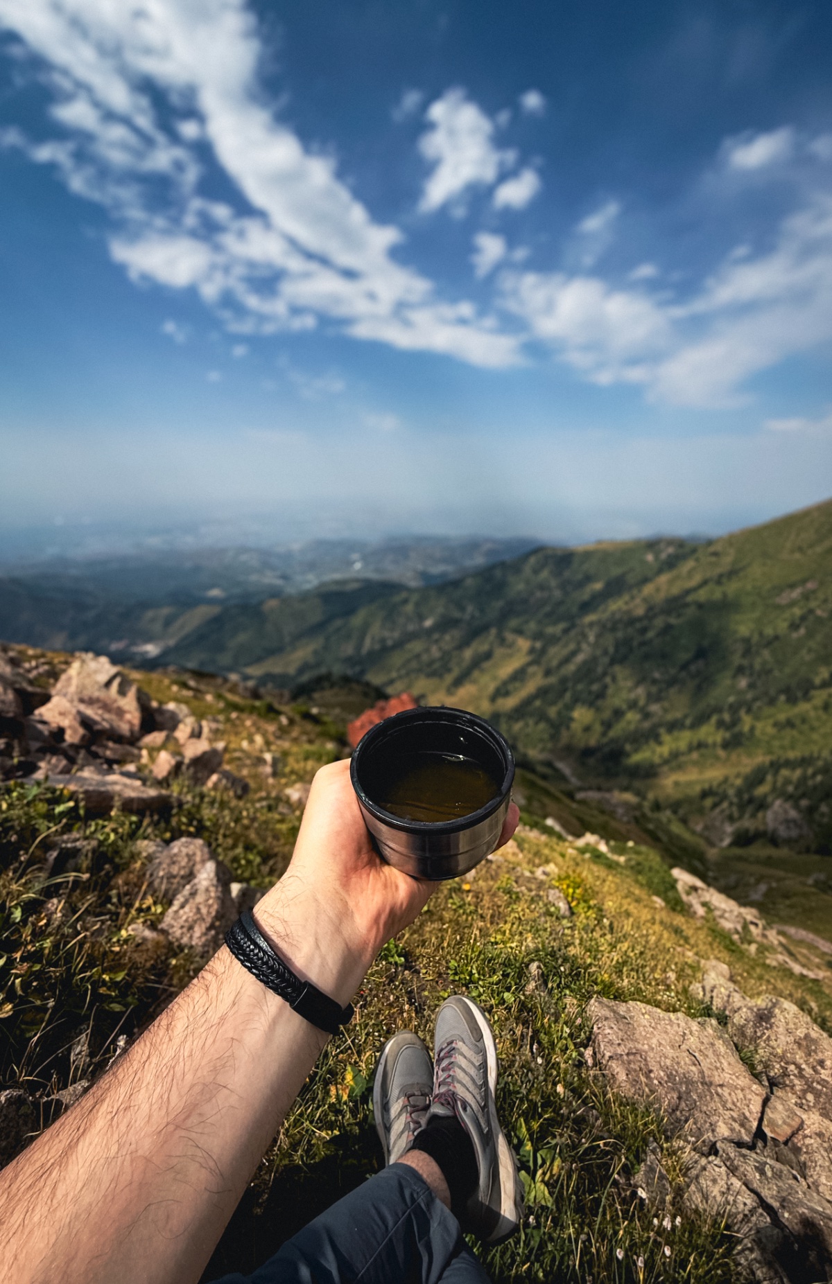
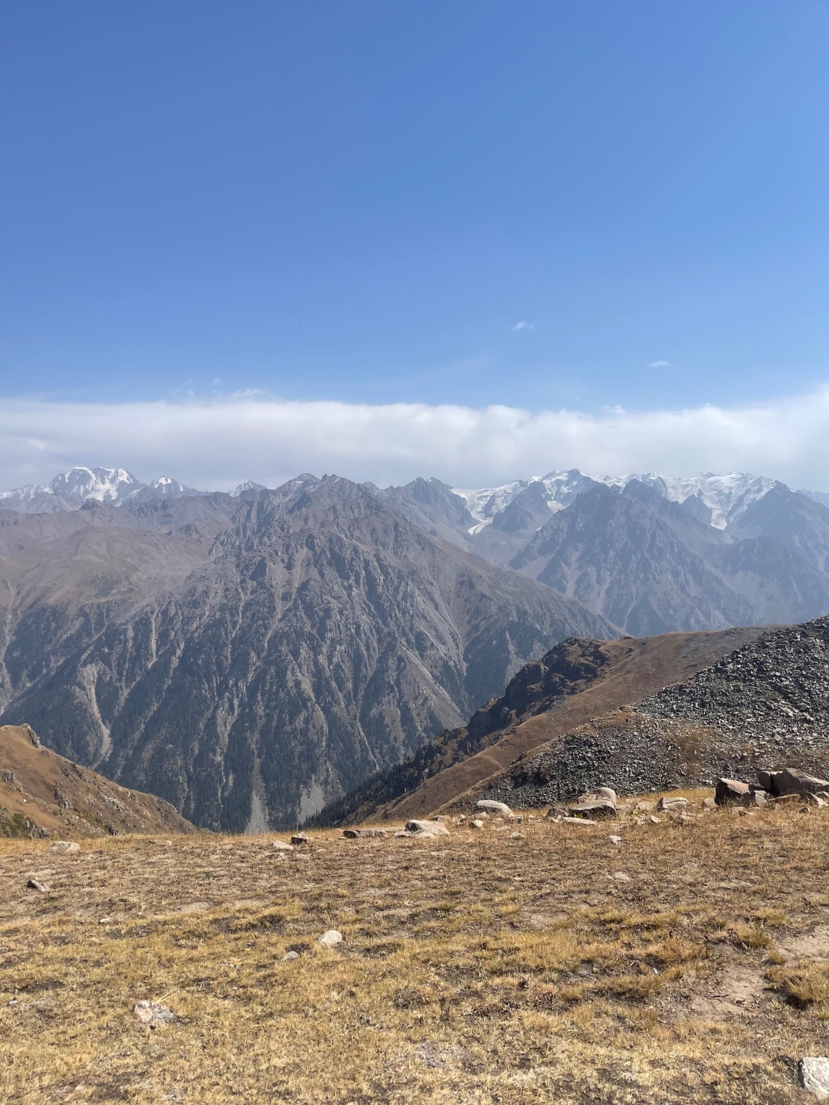
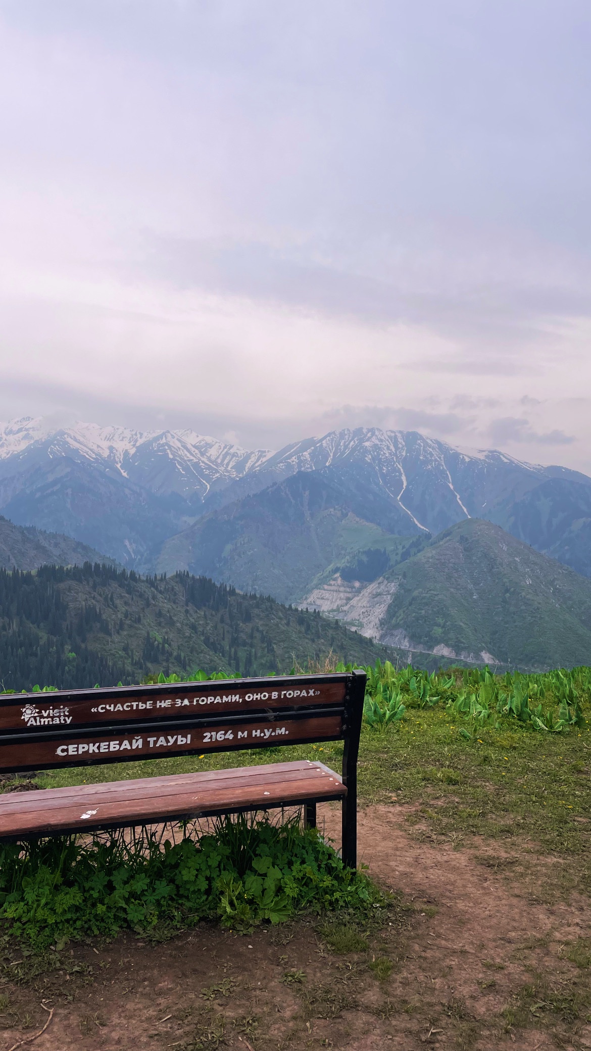
From Furmanov’s summit, a ridge trail continues south to Panorama Peak. The ascent is gentler than the Furmanov push — about 200 m of additional gain over 30–40 minutes. Panorama Peak is aptly named: a wooden bench on its summit provides a seat with perhaps the finest multi-valley view accessible as a day hike from Almaty. You see the Big Almaty gorge, the observatory ridge, Butakovsky gorge, Kim Asar, and on clear days the Kapchagai reservoir glinting in the steppe.
This is also where the Four Peaks Trail continues to Bashuta (3,355 m) and Shymbulak Peak (3,460 m) — but those are a different level of commitment and not part of this standard tour.
Lunch and descent
We eat lunch at either Furmanov or Panorama summit (depending on wind and conditions) with the panorama as our dining room. Descent follows the same ridge back to Medeo. Going down takes roughly 3 hours — the rocky sections require care, and tired legs make the steep forest trail feel longer than it did going up.
Back at Medeo by late afternoon, your guide drives you to your Almaty hotel.
Stats block:
| Stat | Furmanov Peak only | Furmanov + Panorama |
|---|---|---|
| Distance | ~14 km (round trip) | ~17 km (round trip) |
| Elevation gain | ~1,360 m | ~1,570 m |
| Walking time | 7–8 hours | 8–10 hours |
| Difficulty | 3/5 (Medium) | 3.5/5 (Medium–Hard) |
| Max elevation | 3,053 m | 3,260 m |
Start point: Medeo skating rink bus stop (1,690 m)
Price includes:
- Hotel pickup and drop-off in Almaty
- English-speaking mountain guide
- Picnic summit lunch
- Waterproof rain poncho
Price does not include:
- Hotel pickup/drop-off transportation (Almaty–Medeo–Almaty)
- Personal travel insurance
- Trekking poles (available for rent — strongly recommended)
- Tips for guide (optional)
Why book this guided Furmanov Peak hike?
Furmanov is the threshold hike in the Almaty mountains — the first where altitude, terrain, and weather demand respect. At 3,053 m, you’re above the treeline in terrain where conditions can change fast. Freak summer blizzards happen. The trail between Furmanov and Panorama becomes vague in cloud cover. Mobile phone reception is absent for most of the ridge section.
A guide provides pace management (the most common mistake is starting too fast on the lower trail and running out of energy before the summit), real-time weather assessment (turning back is sometimes the right call), and navigation confidence on the exposed upper ridge. The guide also handles the Medeo access logistics — construction in the Kim Asar trailhead area has periodically complicated the approach in recent years.
For the Almaty progression — Kok-Zhailau first, then Furmanov — having a guide on the harder summit ensures you actually reach the top and enjoy it.
Frequently asked questions
How hard is the Furmanov Peak hike? Rated 3/5 (Medium). The main challenges are the total elevation gain (1,360 m — comparable to a tough Alpine day hike), the rocky scrambling near the summit, and the altitude (3,053 m). Most reasonably fit adults can complete it, but it’s a full day and genuinely tiring. If Kok-Zhailau was comfortable for you, Furmanov is the logical next step.
How long does it take? 7–8 hours for Furmanov Peak, 8–10 hours for Furmanov + Panorama. This includes rest stops and lunch. Sporty hikers can do it faster (3 hours up to Furmanov), but most people should plan for a full day.
What’s the difference between Furmanov and Panorama? Furmanov Peak (3,053 m) is the rocky summit with scrambling. Panorama Peak (3,260 m) is 30–40 minutes further along the ridge and has the famous wooden bench with the multi-valley view. Many hikers agree that Panorama has the better views. We recommend doing both.
What is the Furmanov swing? A metal-frame swing built by hikers on the ridge at roughly 2,500 m, about two-thirds of the way to the summit. It’s become one of Almaty’s most photographed spots. The swing faces north toward the city — on a clear day, the entire Almaty skyline is visible below. There is a second, smaller swing lower on the trail.
Can I continue to Bashuta and Shymbulak peaks? Yes — this is the famous “Four Peaks Trail” (Furmanov → Panorama → Bashuta → Shymbulak). It’s a very demanding day hike (15 km, 2,000 m gain) that finishes at the Shymbulak cable car station at Talgar Pass (3,200 m), from where you can ride down. We offer this as a separate tour for experienced hikers. The ridge between Panorama and Bashuta has scree sections and loose rock — a guide is strongly recommended.
Is there mobile phone reception? Intermittent at best. You’ll have signal on the lower trail and may get it at the summit, but the ridge section between the swing and summit is largely a dead zone. Don’t rely on your phone for navigation — bring a GPS device or offline maps.
What about altitude sickness? At 3,053–3,260 m, mild altitude effects (headache, slight breathlessness) are possible for visitors arriving from sea level. The best prevention is acclimatisation — do an easier hike first (Kok-Zhailau, Butakovka, or Kim Asar). Drink plenty of water and pace yourself. Severe altitude sickness is unlikely at this elevation.
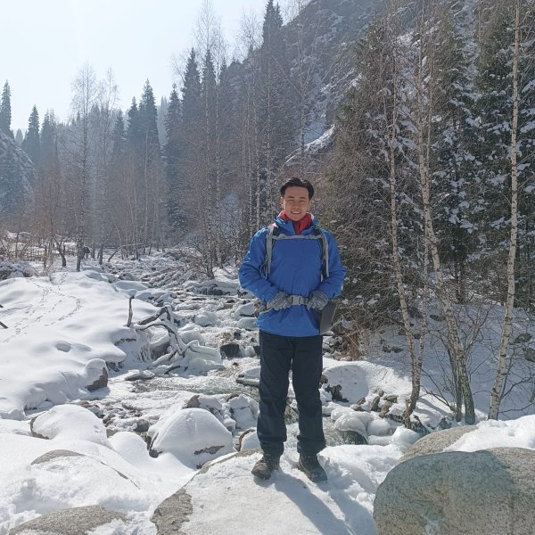
Can children do this hike? Your own page mentions a 7-year-old (Emil) reaching the summit. Fit, experienced hiking children aged 10+ can manage it with patience. It’s not a family-friendly casual walk — this is a serious day hike. For children under 10, Kok-Zhailau or Kim Asar is a better choice.
Who was Dmitry Furmanov? A Russian writer and Bolshevik commissar (1891–1926) who spent part of his life in Almaty. He’s famous for his novel Chapaev about a Russian Civil War hero, Vasily Chapaev. The book became one of the most influential works of Soviet literature and was adapted into a landmark 1934 film. In Almaty, both a peak and a central street (Furmanov Street) carry his name.
Itinerary
Detailed itinerary will be provided upon booking. Our typical tour includes daily hikes through diverse terrains and cultural experiences.
Pricing
| Group Size | 1 person | 2 people | 3 people | 4 people | 5 people | 6 people Best value |
|---|---|---|---|---|---|---|
| Standard | $144 $144 total | $97 $194 total | $81 $243 total | $73 $292 total | $68 $340 total | $65 $390 total |
100% private tour — prices are per person based on group size. The more friends you bring, the less everyone pays!
What's Included
Included
Not Included
Our Guarantee
If weather forces a cancellation, you choose a free reschedule or a full refund. If you're not satisfied with your experience, we'll work with you to make it right. No questions, no hassle.
Private tours only (max 6) · Reschedule or full refund if weather cancels · No payment until confirmed
Traveler Stories
Sarah K.
Our guide was incredible - he adjusted the pace perfectly for our group and knew exactly where to stop for the best photos. The whole experience felt effortless, like everything was taken care of before we even thought to ask.
Marco T.
We were a group of 4 friends and the per-person price made it a no-brainer. Private 4x4, lunch included, and the canyon was breathtaking. Way better than the big bus tours we saw there.
Anna W.
Solo traveler here. I was nervous about hiking alone in a foreign country but the guide made me feel completely safe. The trail to Kok-Zhailau was beautiful and the photos he took of me were amazing. Only wish the hike was longer!
David R.
Third time booking with these guys. Butakovka, Big Almaty Lake, and now Titov Peak. Every single time the service is flawless. The fact that it's always private and max 6 people makes such a difference compared to other operators.
Share Your Experience


21+ hikers
completed this trail
Tour At A Glance
Book This Tour
Private tours run any day of the week — weekends fill up fastest, so book early
Pay securely after confirmation


Weather Forecast
clear sky
H: 22°C
L: 14°C
Sun, Aug 2
clear sky
20°C
14° / 25°
Mon, Aug 3
light rain
19°C
14° / 25°
Tue, Aug 4
light rain
15°C
12° / 18°
Tour Location
From $65
per person · weather refund
Complete Your Booking
Tour:
Date:
Participants
Add-ons
You're Almost There!
We'll contact you within 24 hours to confirm your spot and share everything you need to prepare for your adventure.
Request sent
We confirm your spot
within 24 hours
Summoning perfect weather
Hit the trail
On the channel
83 h
Drone flight hours
What we’ve filmed
59
Hikes filmed
704 km
Kilometers covered
44,439 m
Elevation gained
27
Countries visited
Plan your hike with us
A few quick questions and we will email you a tailored hike plan & quote.
When do you want to hike?
What's your experience?
How many of you?
Where do we send your plan?
Private guided hikes · no obligation.