
Overview
Is this hike right for you?
Perfect if you…
No experience needed
Description
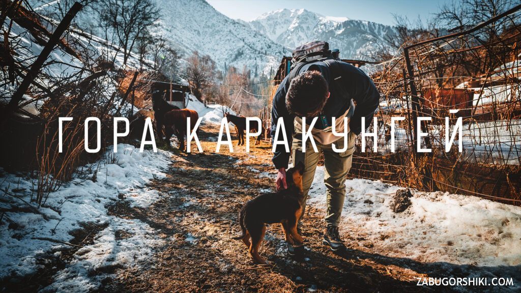
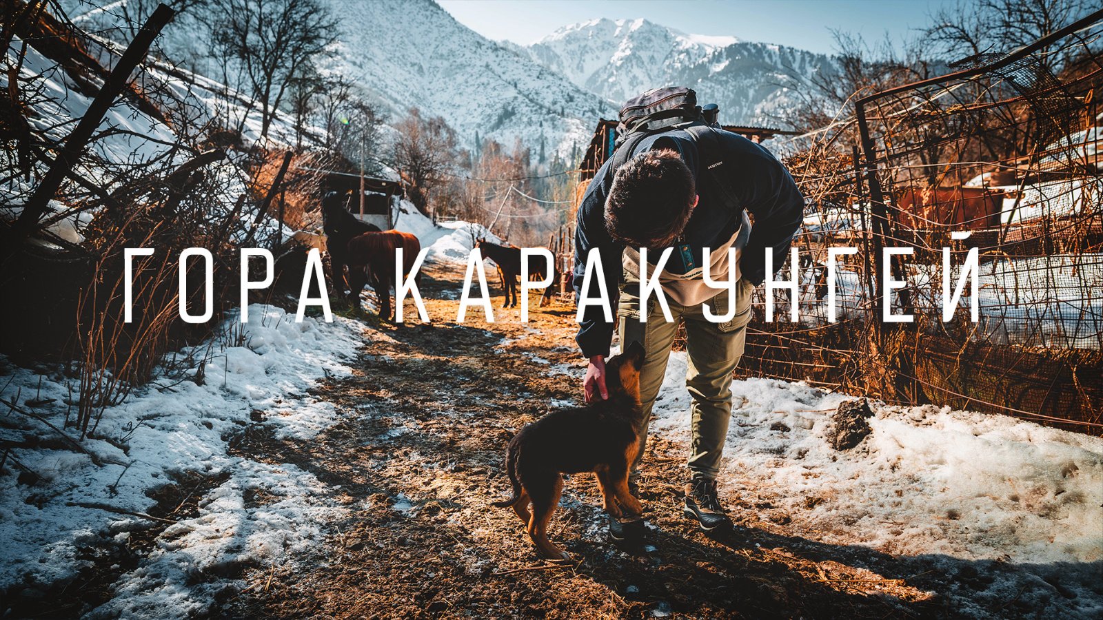
A short, easy hike from MeMedeo in Almaty: The Ultimate Ice Skating Rinkdeo to Karakungei Peak (1,821 m) — the sunny ridge between the Small Almaty and Butakovka gorges, with panoramic views of Medeo dam, Peak Abay, Kumbel, and Furmanovka, through abandoned Soviet-era apple orchards that still bear fruit.
What to expect on the Karakungei hike from Almaty
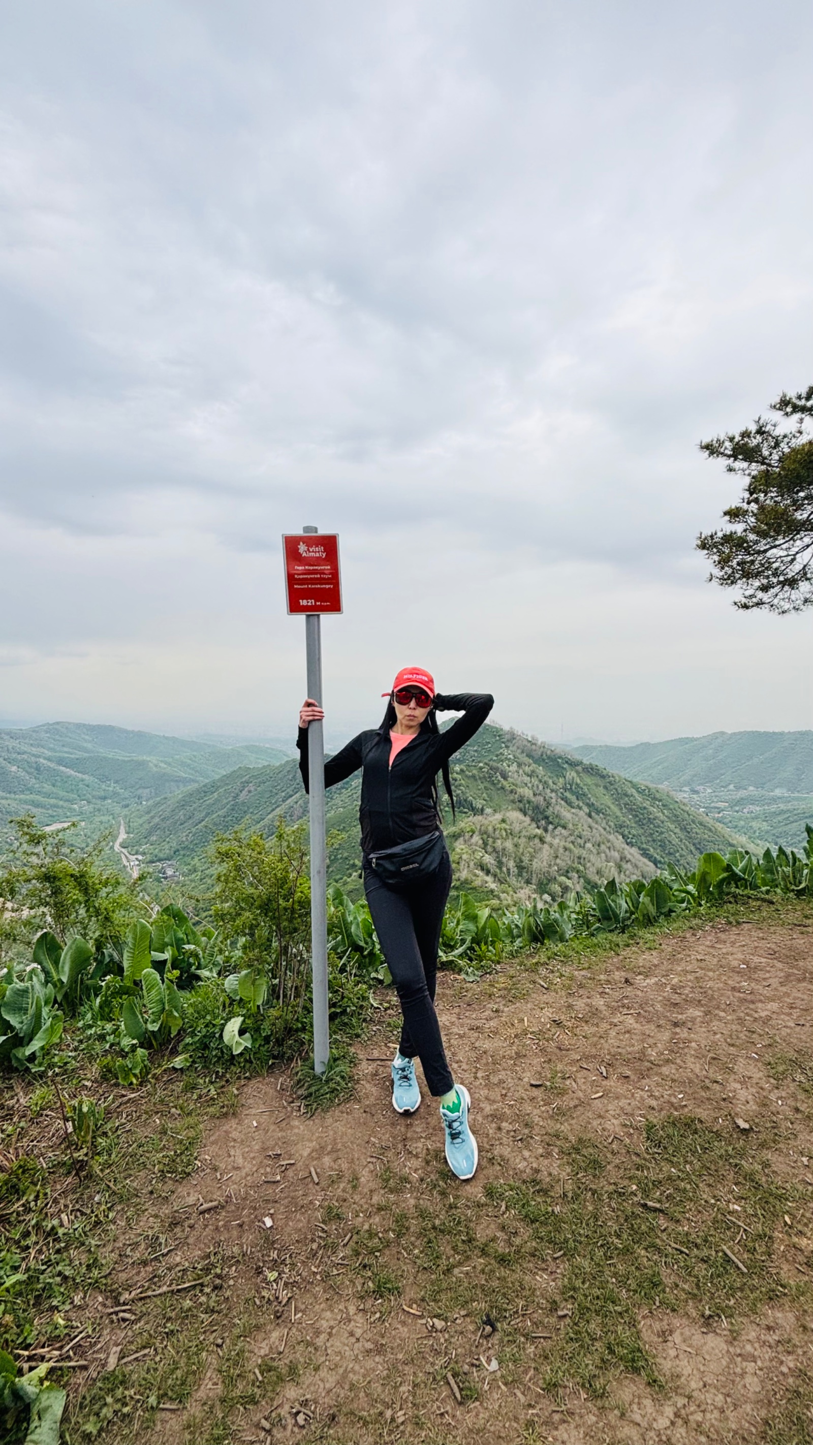
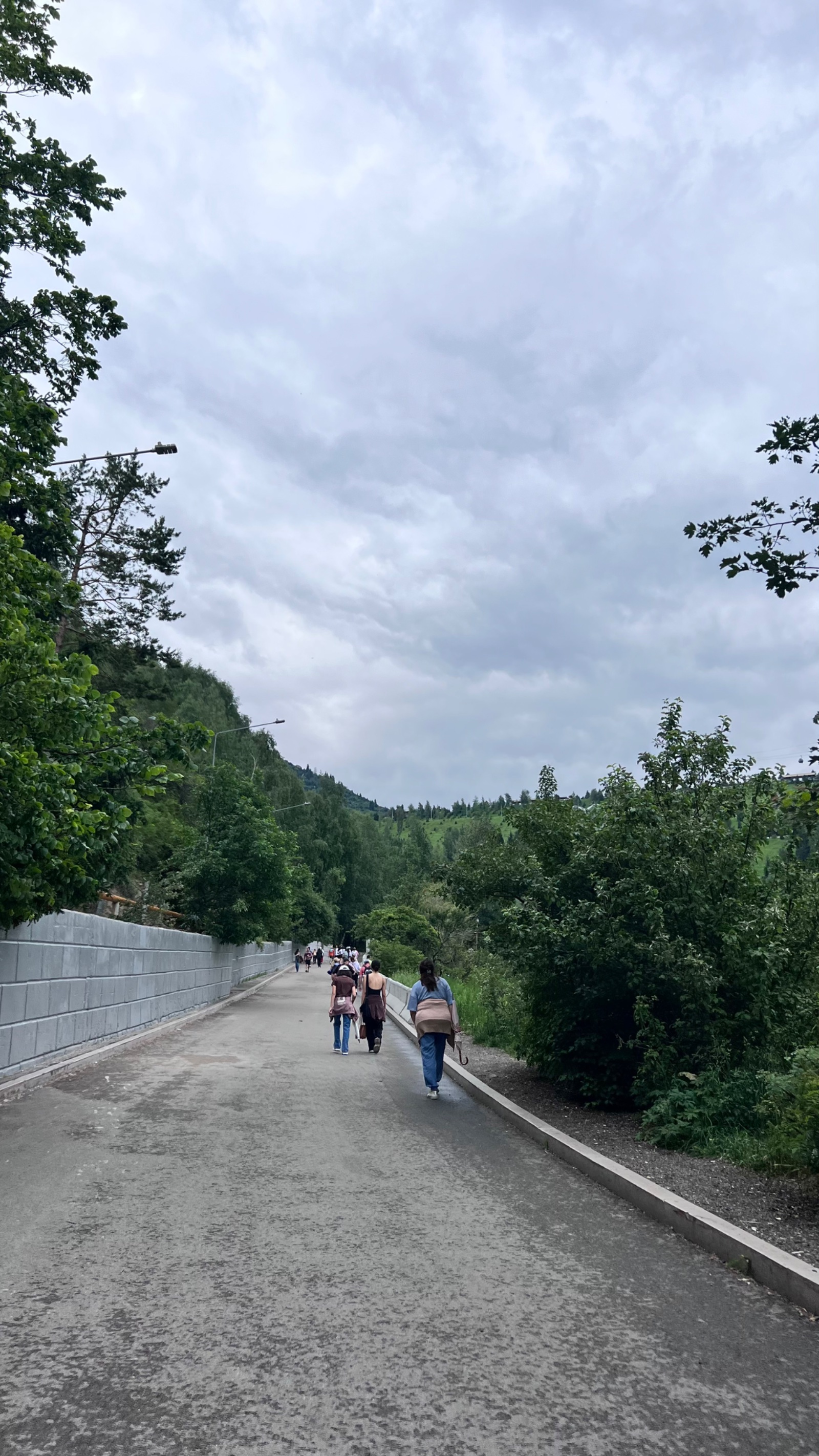
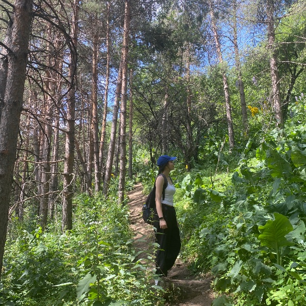
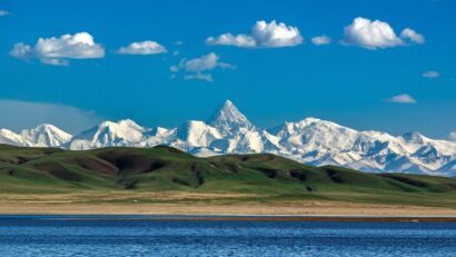
The Karakungei hike from Almaty is the shortest and most accessible mountain walk near Medeo — a 30-minute climb to a viewpoint that feels disproportionately rewarding for the effort. Karakungei is a small ridge (technically a watershed between the Malaya Almatinka and Butakovka river valleys) that rises directly above the Medeo skating rink. The peak itself is just 1,821 m, barely 220 m above the trailhead. But because the ridge sits between two major gorges, the panoramic views from the top punch well above what the elevation would suggest.
The name comes from Kazakh: “kungei” means the sunny side of the mountains. And Karakungei lives up to it — this is one of the warmest, most sun-exposed ridges in the Almaty foothills, which means it’s one of the first places to lose snow in spring and one of the last to get it in autumn. That sun exposure is also why the Soviet authorities established the Gorny Sadovod (Mountain Gardener) sovkhoz here in 1958, planting extensive apple orchards across the lower slopes. The sovkhoz has long since been abandoned, but the apple trees remain — still fruiting, still lining the trails, a living relic of Almaty’s apple heritage.
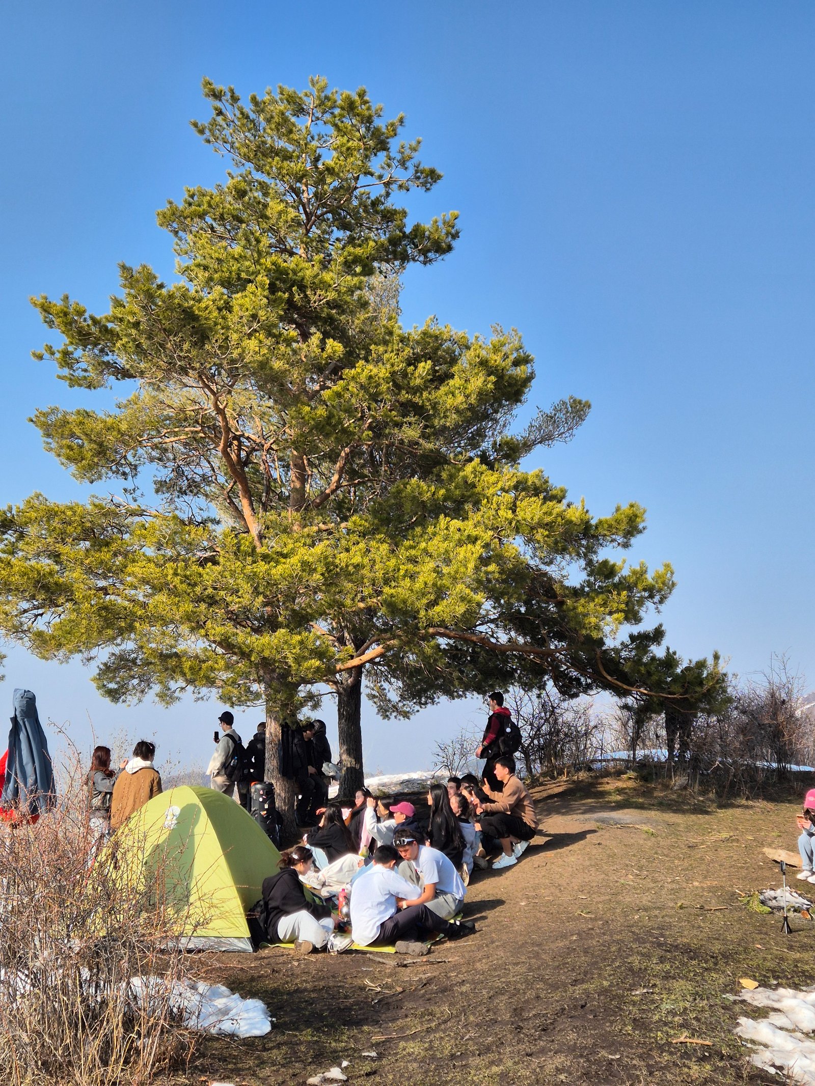
The trail starts from the lower parking area at Medeo, near the cable car station. It’s well-marked with benches and signposts at key points: Karakungei, Slonikha (Elephant viewpoint), Serkebay, and Kim Asar. For a short walk, you reach the Karakungei viewpoint in about 30 minutes. For a longer outing, you can continue along the ridge to Serkebay peak (2,170 m) and loop back to Medeo via the Kim Asar pass — a 7 km circuit that takes 3–4 hours and is still well within beginner-friendly territory.
Detailed Itinerary
Pickup and drive to Medeo (20–30 minutes)
We pick you up from your accommodation in Almaty and drive to Medeo, about 14 km south of the city center. The trailhead is at the lower parking area near the cable car station — you’ll see the multi-story residential building nearby. Elevation at the start: approximately 1,600 m.
If you’re arriving independently, bus 12 from Dostyk Avenue runs to the Medeo terminus.
Through the apple orchards (15–20 minutes)
From the parking area, we enter the Kim Asar gorge road, walk about 500 m along the asphalt, and before reaching the barrier gate (near the Kaz-Aul restaurant), turn left onto a trail. The path climbs gently at first, passing through the remnants of the Gorny Sadovod apple orchards.
These orchards are part of Almaty’s deep connection to the apple. The city’s name comes from “alma” — Kazakh for apple — and the wild Malus sieversii apple, ancestor of all modern cultivated apples, originated in the Tien Shan mountains of this region. The Soviet-era sovkhoz planted cultivated varieties across the Karakungei slopes starting in 1958, taking advantage of the sunny south-facing exposure. The orchards are now abandoned and overgrown, but the trees still produce fruit in autumn. Walking through them in September or October means stepping over fallen apples on the trail.
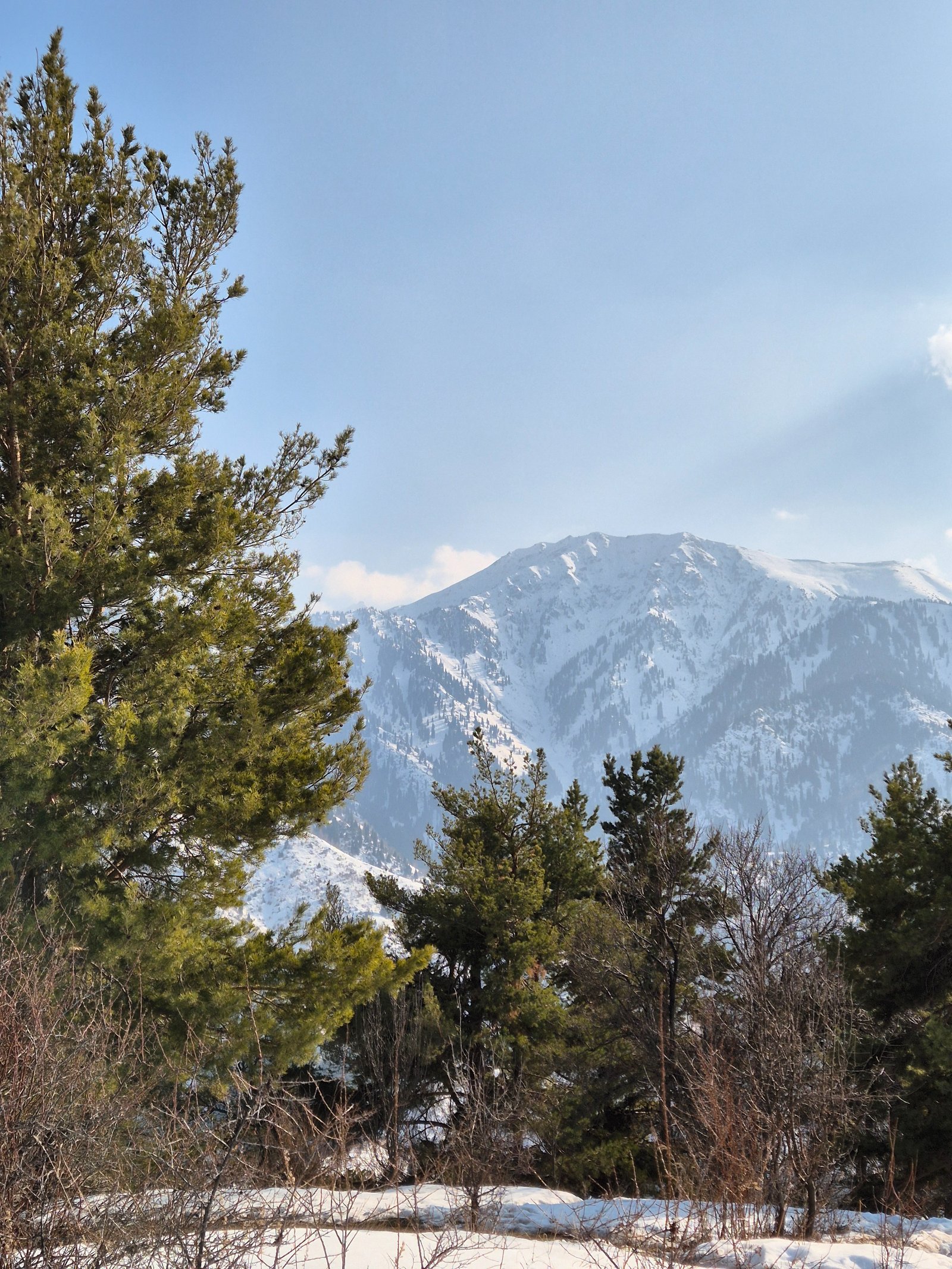
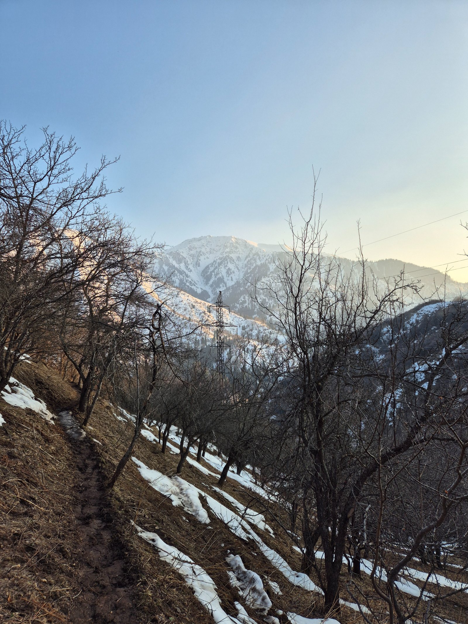
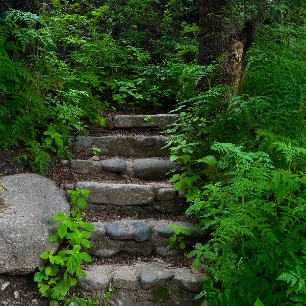
Beyond the orchards, the trail passes through aspen groves and into spruce forest — a visible progression through the vegetation belts of the Zailiysky Alatau in miniature.
Ridge climb to Karakungei viewpoint (15–20 minutes)
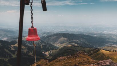
The trail steepens as it climbs to the ridge crest. After about 2 km from the trailhead, you reach the Karakungei ridge at approximately 1,820 m. There is a wooden fire observation tower at the crest — it’s unclear whether it’s still actively used for fire monitoring, but it’s a useful landmark.
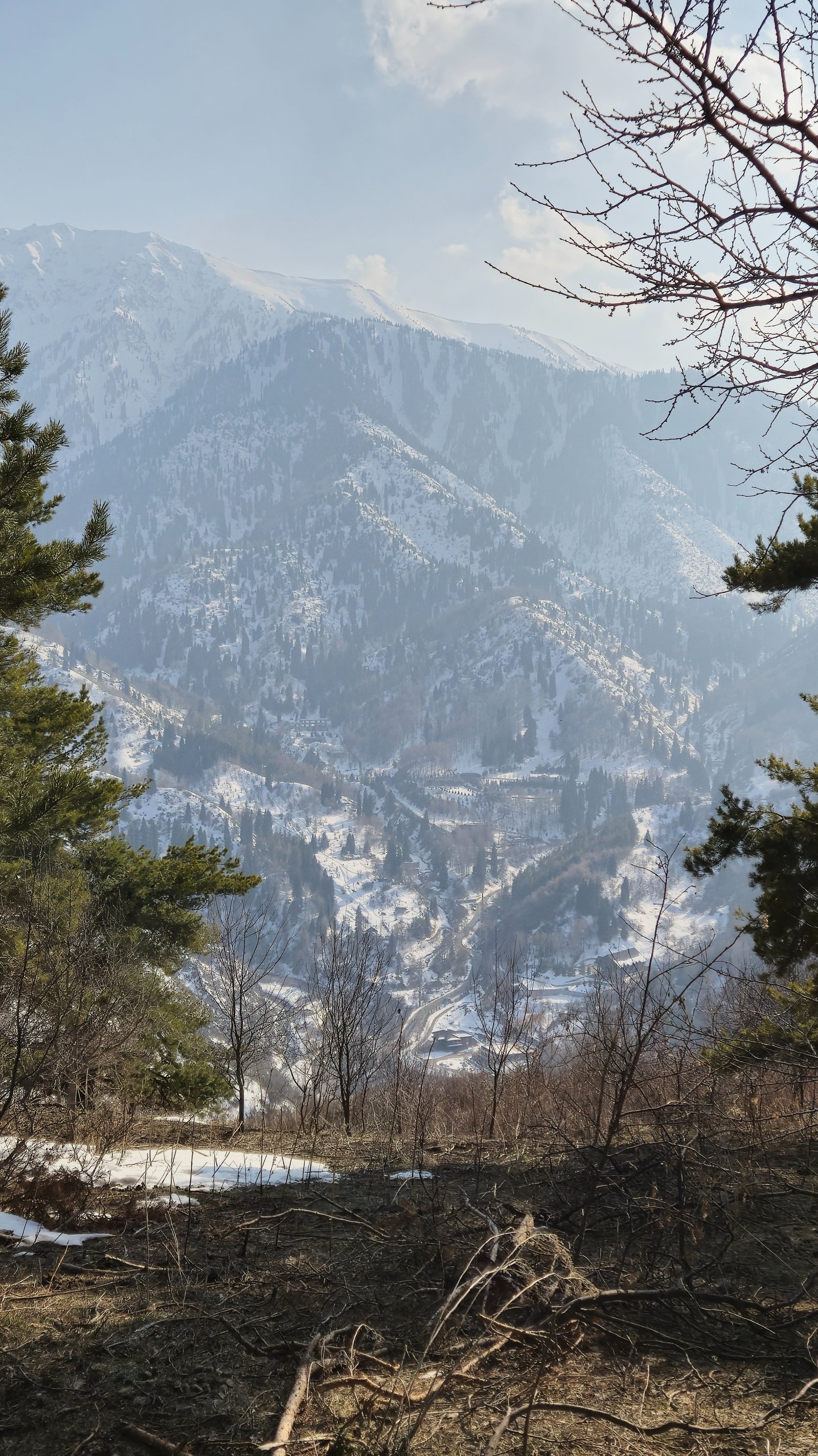
The ridge is the watershed between two major valleys: the Malaya Almatinka (Small Almaty Gorge — where Medeo, Shymbulak, and the route to Big Almaty Lake lie) to the west, and the Butakovka gorge (home to the Butakovka waterfalls and Kim Asar gorge) to the east.
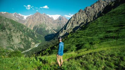
At the summit / viewpoint (20–40 minutes)
The views from Karakungei are excellent for such a modest climb:
- South: Peak Abay (4,010 m), one of the highest peaks visible from Almaty
- Southeast: Peak Kumbel (3,160 m) and the full ridge connecting Three Brothers to the Kok-Zhailau plateau
- East: Furmanov Peak (3,053 m) and Panorama (3,260 m) — the popular ridgeline hike
- North: Almaty city spread out below
- West: The Medeo dam and skating rink complex, with Shymbulak ski resort visible up the valley behind it
- Nearby: Mokhnatka Mountain visible across the Small Almaty Gorge — an unusual perspective that most hikers never see
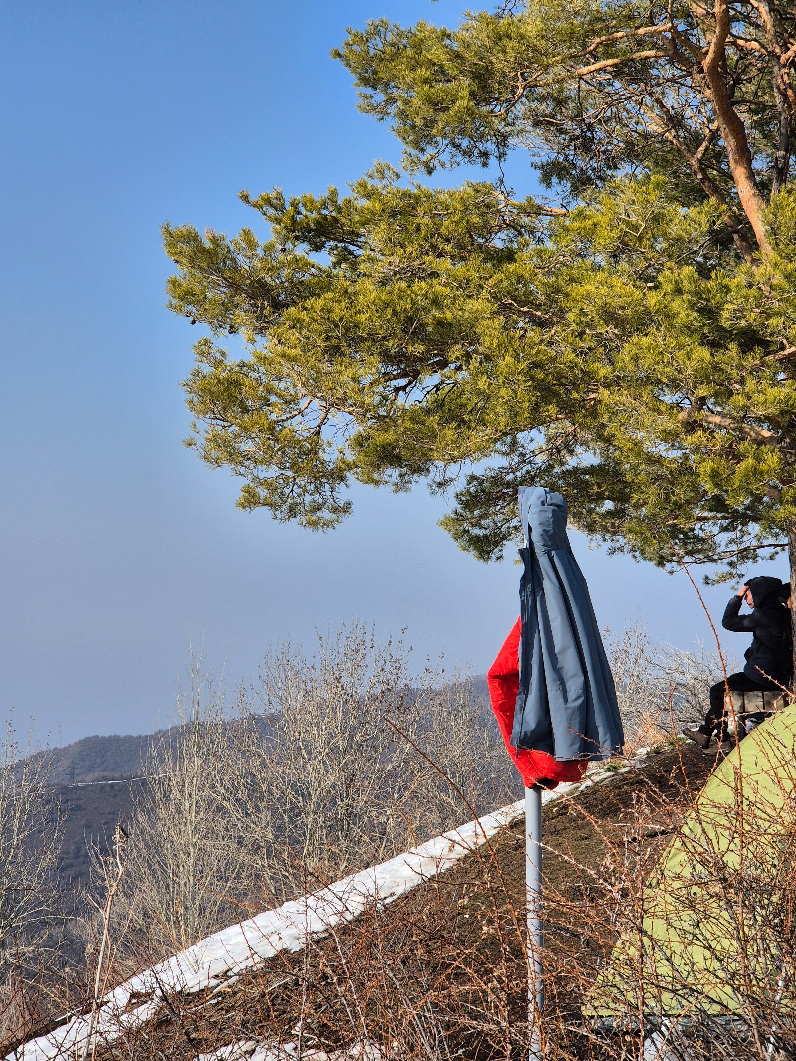
Benches are available for resting. The exposed, sunny position makes this a warm spot even in early spring when other trails are still buried in snow.
Option A: Return to Medeo (30 minutes)
Retrace the ascent route back to the Medeo parking area. Total walk: about 4 km, 1–1.5 hours including time at the viewpoint.
Option B: Extended ridge walk to Serkebay and Kim Asar loop (2.5–3 hours additional)
For hikers wanting more, continue along the Karakungei ridge southwest toward Serkebay peak (2,170 m). This adds about 1 km of gentle ridge walking with continuous views. From Serkebay, descend to the Kim Asar pass, then drop into the Kim Asar gorge and follow it back to the road leading to Medeo.
This loop is about 7 km total with approximately 600 m of elevation gain — comparable in difficulty to the Kok-Zhailau hike but with far fewer people. The loop passes through birch groves and offers a view of the Kim Asar gorge from above — a perspective that complements the gorge-level Kim Asar hike.
Drive back to Almaty (20–30 minutes)
The sunny ridge: why Karakungei is special
Most Almaty hikes take you into a gorge — up a valley between steep walls, through deep forest, following a river. Karakungei does the opposite. It takes you onto the ridge between the gorges, above the forest, into open sunlight with views in every direction. This makes it a fundamentally different experience from Kok-Zhailau, Gorelnik, Kim Asar, or any of the valley trails.
The south-facing exposure also gives Karakungei its microclimate. In early spring (late March to April), when most Almaty trails still have significant snow, the Karakungei ridge is often bare and dry. In autumn, the aspen groves along the trail turn brilliant gold and orange. And in winter, while the north-facing slopes across the valley are deep in snow, the Karakungei trail may require only light traction — making it one of the few year-round hiking options near Almaty.
Almaty’s apple orchards on the mountain
The abandoned Gorny Sadovod orchards along the Karakungei trail are a quietly remarkable feature. Almaty — originally called Alma-Ata, “Father of Apples” — sits at the global center of origin for the domesticated apple. The wild Malus sieversii still grows in the surrounding mountains and is the ancestor of virtually all cultivated apple varieties worldwide.
The Soviet-era Gorny Sadovod sovkhoz was established in 1958 to grow apples on the sunny Karakungei slopes. The enterprise eventually failed, but the trees endured. Hiking through these orchards in autumn, when the unpicked fruit litters the ground and the air smells of apples, connects you to a story that stretches from the ancient Silk Road (apples were one of the goods carried along it) to modern genetics.
Why book a guided Karakungei hike?
Karakungei is one of the most accessible hikes near Almaty — the trail is well-marked, short, and starts from a major landmark (Medeo). Many locals do it independently. But a guided tour adds value in several ways:
Context: The orchards, the ridge geology, the vegetation zones, and the views all have stories. Without context, it’s a pleasant walk. With a guide, you understand why the apples are here, what you’re seeing on the skyline, and how Karakungei fits into the larger geography of the Zailiysky Alatau.
Extension options: A guide can seamlessly extend the walk to Serkebay and the Kim Asar loop if you’re feeling strong, or combine it with Medeo sightseeing, a cable car ride to Shymbulak, or a visit to the nearby Kim Asar swings.
Combination tours: Karakungei works perfectly as a morning hike combined with an afternoon visit to Medeo/Shymbulak, the Butakovka waterfall, or even Kok-Zhailau — since all of these start from the same general area.
Door-to-door transport: Getting to Medeo is easy; getting back to your hotel at the right time is less convenient if you’re relying on public transport.
FAQ: Karakungei Peak Hike
How difficult is the Karakungei hike? Very easy — rated 1/5 for the short version (Karakungei Peak only). The trail gains just 220 m over about 2 km. Anyone who can walk uphill for 30 minutes can reach the viewpoint. The extended Serkebay loop (7 km, 600 m gain) is rated 2/5 — still easy, comparable to Kok-Zhailau.
Is this suitable for children? Yes — this is one of the most family-friendly hikes near Almaty. The short version to the Karakungei viewpoint is manageable for children aged 5+ with normal energy levels. The trail has benches for rest stops.
Where does the trail start? From the lower parking area at Medeo, near the cable car station to Shymbulak. You enter the Kim Asar gorge road and turn left onto the trail before reaching the barrier gate.
Can I do this year-round? Yes. Karakungei is the sunniest ridge in the Medeo area and is one of the first trails to clear of snow in spring, often accessible by late March. In winter, light microspikes or traction devices may help on shaded sections, but the sunny ridge itself is frequently bare.
What’s the difference between Karakungei, Slonikha, and Serkebay? These are all points along the same ridge system. Karakungei (1,821 m) is the first named viewpoint. Slonikha (Elephant viewpoint) is a nearby spot on the same ridge, often used interchangeably. Serkebay (2,170 m) is a higher peak further along the ridge — reaching it requires extending the hike significantly. The official 2GIS trail maps list them as separate waypoints on Route #167 and #168.
Can I combine Karakungei with other hikes? Absolutely — this is where Karakungei shines. Because it’s short and starts from Medeo, you can combine it with:
- A cable car ride to Shymbulak after the hike
- The Kim Asar gorge (on the other side of the ridge) — accessible via the extended Serkebay loop
- A visit to the Medeo skating rink and dam (842 stairs up the dam are a workout in themselves)
- An afternoon drive to Kok-Zhailau or Big Almaty Lake
How does Karakungei compare to Kok-Zhailau? Karakungei is significantly shorter and easier — about one-third the distance and one-third the elevation gain. Kok-Zhailau takes you to a broad alpine plateau; Karakungei takes you to a ridge viewpoint. Kok-Zhailau is the better “mountain experience” but requires 4–5 hours. Karakungei delivers big views for minimal effort and takes 1–1.5 hours. They complement each other well and can be done on separate days.
What’s the connection to Almaty’s apples? The trail passes through the abandoned orchards of the Gorny Sadovod sovkhoz (est. 1958), which grew cultivated apple varieties on the sunny Karakungei slopes. Almaty — originally Alma-Ata, “Father of Apples” — is the global center of origin for the domesticated apple. The wild ancestor, Malus sieversii, still grows in these mountains.
What views will I see? 360° panorama: Medeo dam and Shymbulak to the west, Peak Abay (4,010 m) and Kumbel (3,160 m) to the south, Furmanov and Panorama ridgeline to the east, Almaty city to the north, and Mokhnatka Mountain across the Small Almaty Gorge.
Itinerary
Detailed itinerary will be provided upon booking. Our typical tour includes daily hikes through diverse terrains and cultural experiences.
Pricing
| Group Size | 1 person | 2 people | 3 people | 4 people | 5 people | 6 people Best value |
|---|---|---|---|---|---|---|
| Standard | $114 $114 total | $79 $158 total | $68 $204 total | $62 $248 total | $58 $290 total | $56 $336 total |
100% private tour — prices are per person based on group size. The more friends you bring, the less everyone pays!
What's Included
Included
Not Included
Our Guarantee
If weather forces a cancellation, you choose a free reschedule or a full refund. If you're not satisfied with your experience, we'll work with you to make it right. No questions, no hassle.
Private tours only (max 6) · Reschedule or full refund if weather cancels · No payment until confirmed
Traveler Stories
Sarah K.
Our guide was incredible - he adjusted the pace perfectly for our group and knew exactly where to stop for the best photos. The whole experience felt effortless, like everything was taken care of before we even thought to ask.
Marco T.
We were a group of 4 friends and the per-person price made it a no-brainer. Private 4x4, lunch included, and the canyon was breathtaking. Way better than the big bus tours we saw there.
Anna W.
Solo traveler here. I was nervous about hiking alone in a foreign country but the guide made me feel completely safe. The trail to Kok-Zhailau was beautiful and the photos he took of me were amazing. Only wish the hike was longer!
David R.
Third time booking with these guys. Butakovka, Big Almaty Lake, and now Titov Peak. Every single time the service is flawless. The fact that it's always private and max 6 people makes such a difference compared to other operators.
Share Your Experience


10+ hikers
completed this trail
Tour At A Glance
Book This Tour
Private tours run any day of the week — weekends fill up fastest, so book early
Pay securely after confirmation


Weather Forecast
clear sky
H: 17°C
L: 17°C
Mon, Jul 27
clear sky
20°C
15° / 26°
Tue, Jul 28
clear sky
19°C
15° / 24°
Wed, Jul 29
clear sky
20°C
15° / 25°
Tour Location
From $56
per person · weather refund
Complete Your Booking
Tour:
Date:
Participants
Add-ons
You're Almost There!
We'll contact you within 24 hours to confirm your spot and share everything you need to prepare for your adventure.
Request sent
We confirm your spot
within 24 hours
Summoning perfect weather
Hit the trail
On the channel
83 h
Drone flight hours
What we’ve filmed
59
Hikes filmed
704 km
Kilometers covered
44,439 m
Elevation gained
27
Countries visited
Plan your hike with us
A few quick questions and we will email you a tailored hike plan & quote.
When do you want to hike?
What's your experience?
How many of you?
Where do we send your plan?
Private guided hikes · no obligation.