Guided Hike to Komsomol Pass (4,000 m) via Bogdanovich Glacier from Almaty
From $142 per person

Overview
Is this hike right for you?
Perfect if you…
Be prepared
Description
A guided 2-day alpine trek from Talgar Pass (3,200 m) across the Bogdanovich Glacier to Komsomol Pass (approximately 4,000 m) — the saddle between Komsomol/Almaty Peak (4,376 m) and Karlytau Peak (4,170 m). Camp at Nunatak (3,600 m) on the glacier. Stand at the highest pass accessible without technical climbing equipment in the Small Almaty Gorge system.
What to expect on the Komsomol Pass hike
If the Bogdanovich Glacier day hike left you wanting more — if you reached the glacier tongue at 3,500 m and looked up at the ice field stretching toward the massive northern wall of Komsomol Peak and thought “I want to go further” — then this is the next step.
The Komsomol Pass hike takes you beyond where the day trip ends. You camp overnight at Nunatak — a rocky outcrop rising from the glacier’s lateral moraine at 3,600 m, with a semi-established campsite beneath it — and the next morning you continue up the Bogdanovich Glacier to the pass itself at approximately 4,000 m. This is the saddle where the glacier tops out and the world drops away on the other side: a 1,200-metre plunge into the Left Talgar valley, with Talgar Peak (5,017 m) — the highest point in the entire Zailiyskiy Alatau — visible to the east on clear days.
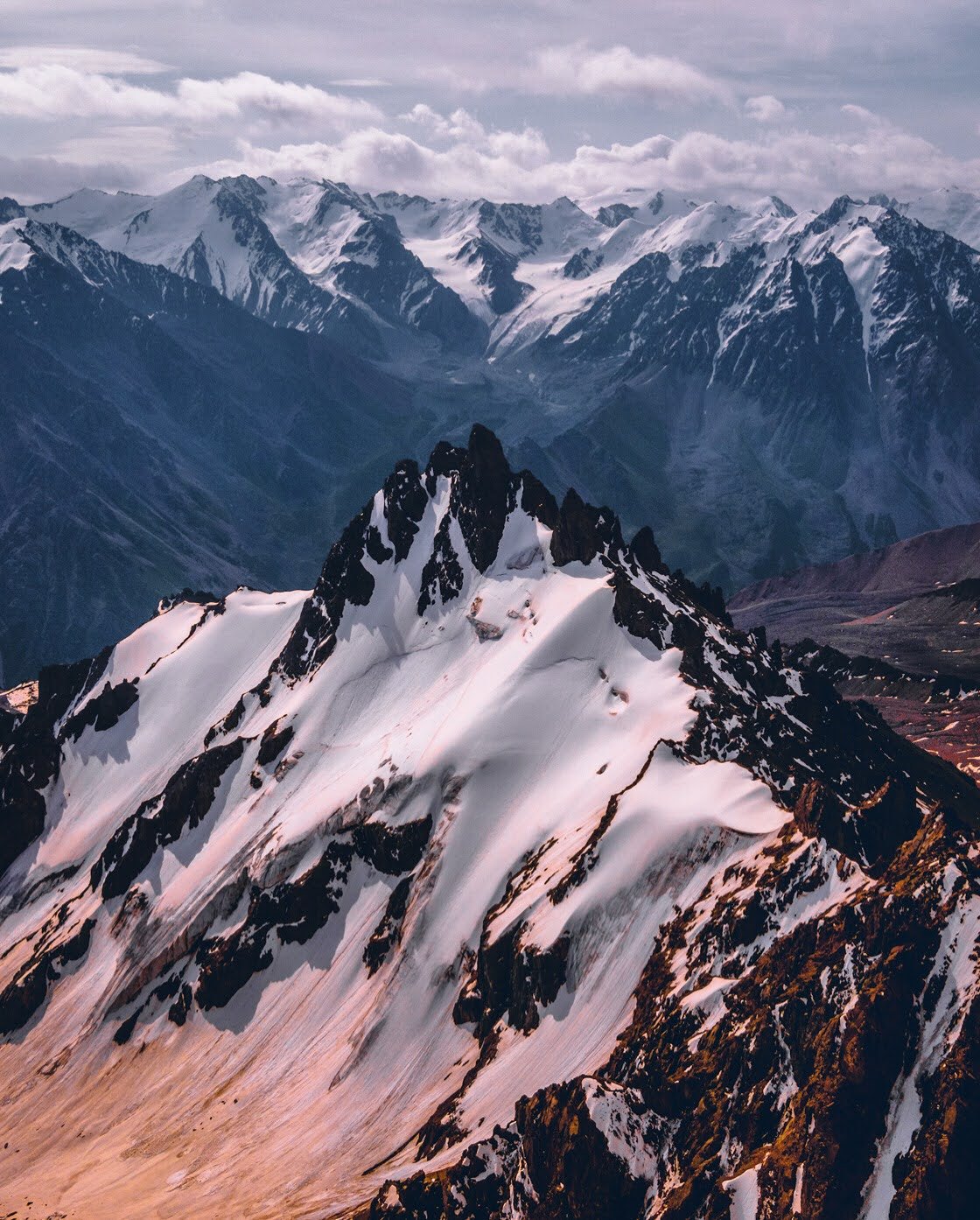
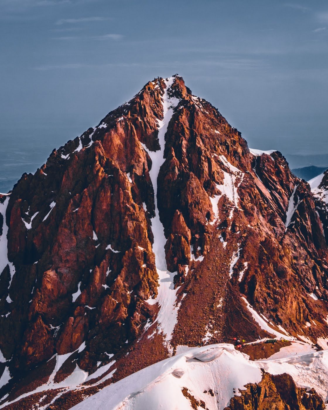
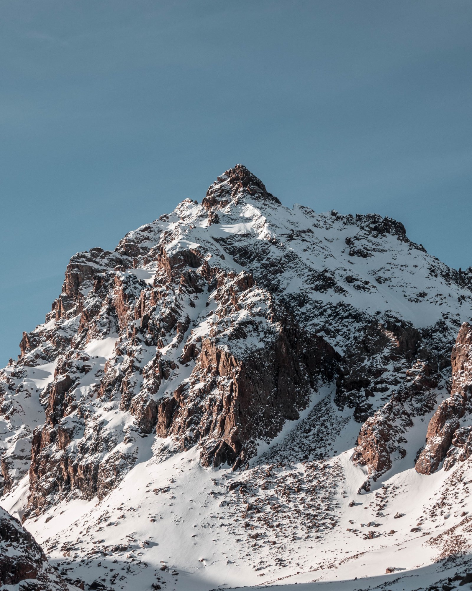
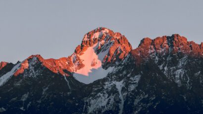
The pass sits between two formidable peaks. To the east: Komsomol Peak, 4,376 m — the highest point on the Almaty skyline, visible from most of the city. This peak has had four names in under a century: Malyy Almaty (pre-Soviet), Komsomol (after the 1935 Soviet Alpiniad), Nursultan (1997, honouring Kazakhstan’s first president), and most recently Almaty Peak — returning to an echo of its original name. The summit plaque now reads “Almaty Peak.” To the west: Karlytau Peak, 4,170 m, an ice-domed summit from whose northwestern slopes the Bogdanovich Glacier flows.
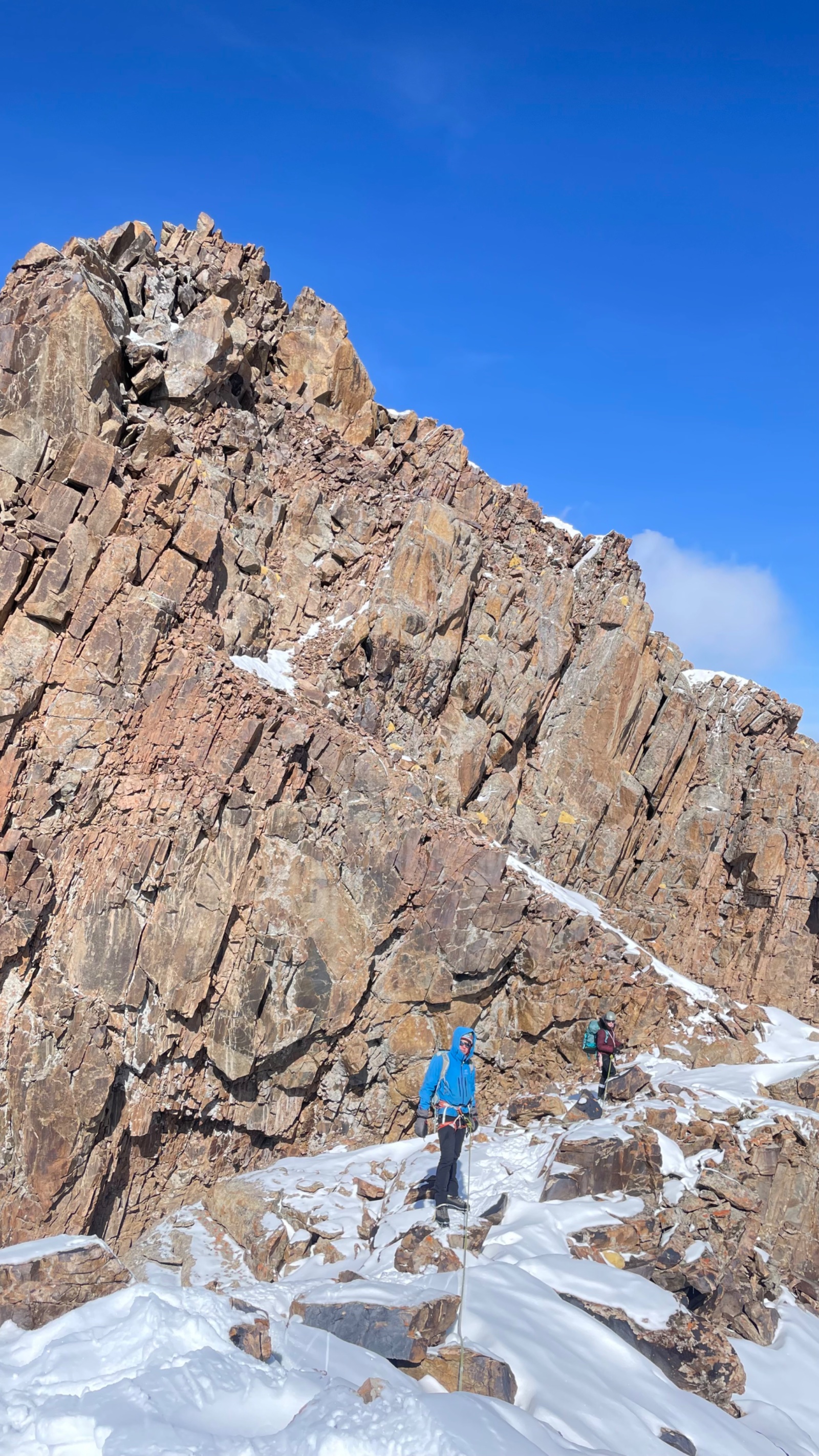
The pass itself is mountaineering category 2A — meaning it involves glacier travel with crevasse awareness and steep scree/talus above the ice. This is more demanding than any standard hiking trail in the Almaty region but does not require the multi-pitch rock climbing needed to summit the peak itself (category 2A-2B). With crampons, a competent guide, and appropriate fitness and acclimatisation, experienced mountain hikers can reach the pass.
Detailed itinerary
Day 1: Almaty to Nunatak Camp (3,600 m)
Morning: Almaty → Medeo → Shymbulak → Talgar Pass (3,200 m)
We pick you up at your hotel at 7:00 AM and drive to the Medeo skating rink — the famous high-altitude ice arena at 1,691 m. From Medeo, we take the cable car system through Shymbulak ski resort to the upper station at Talgar Pass (3,200 m). The 20-minute cable car ride offers a panoramic preview of the peaks ahead: Chkalov and Fizkulturnik peaks with the “hanging” glaciers Ayak and Til draped across their northern faces, and the sharp pyramid of Komsomol/Almaty Peak dominating the skyline to the south.
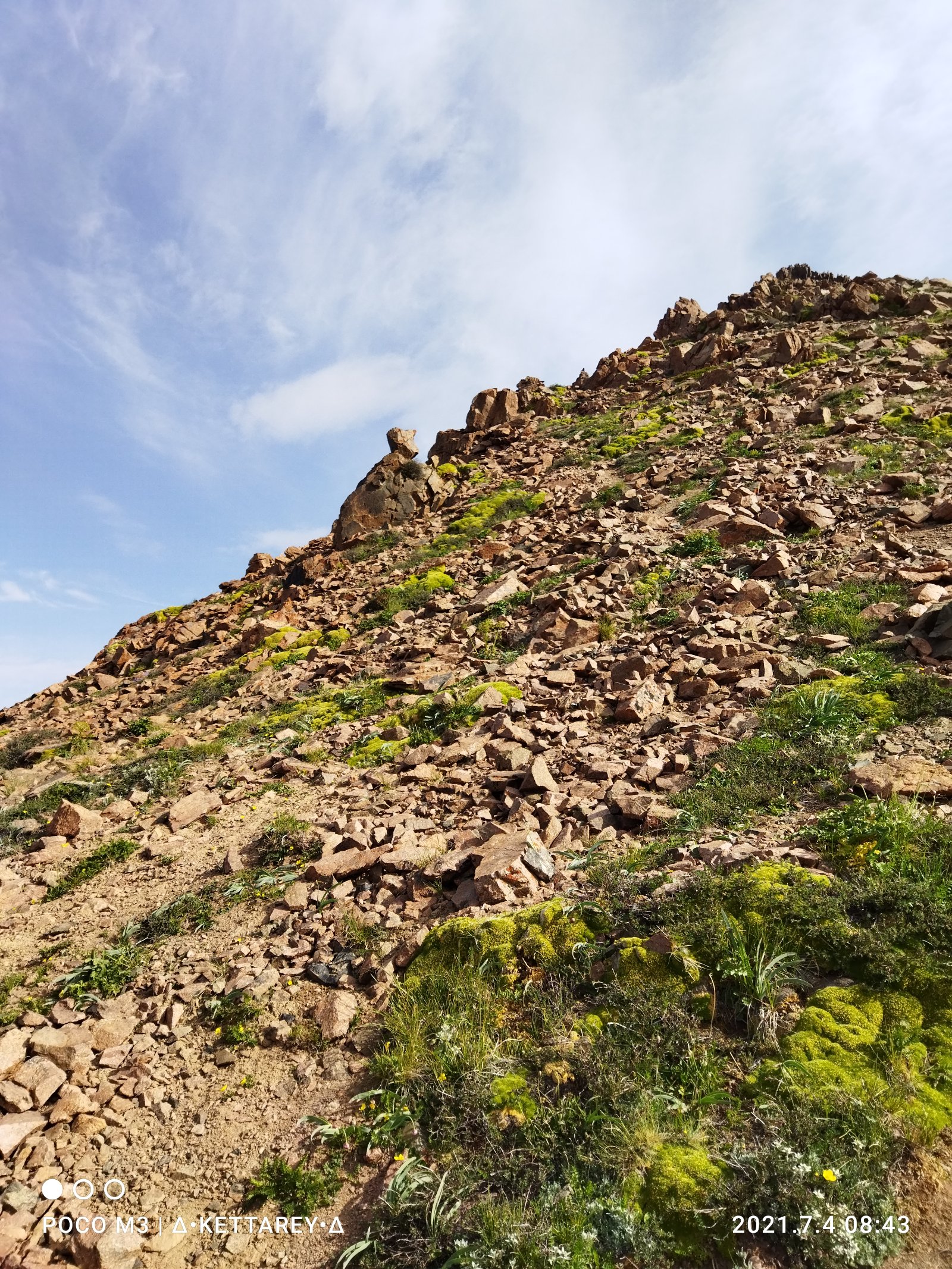
At Talgar Pass, you step off the cable car and into the alpine zone. Vegetation is sparse — low grasses, cushion plants, and then bare rock and moraine. The temperature drops noticeably. This is where the hiking begins.
Talgar Pass to Nunatak (3,600 m) — 6–7 km, +400 m, 2.5–3 hours
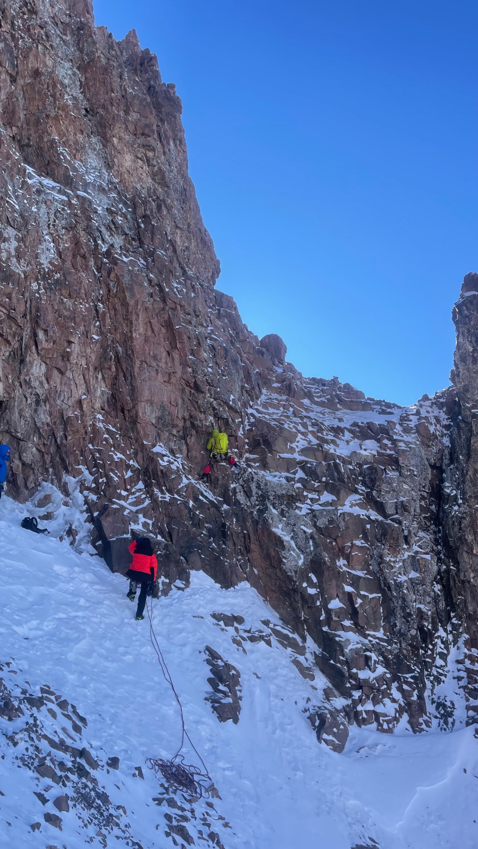
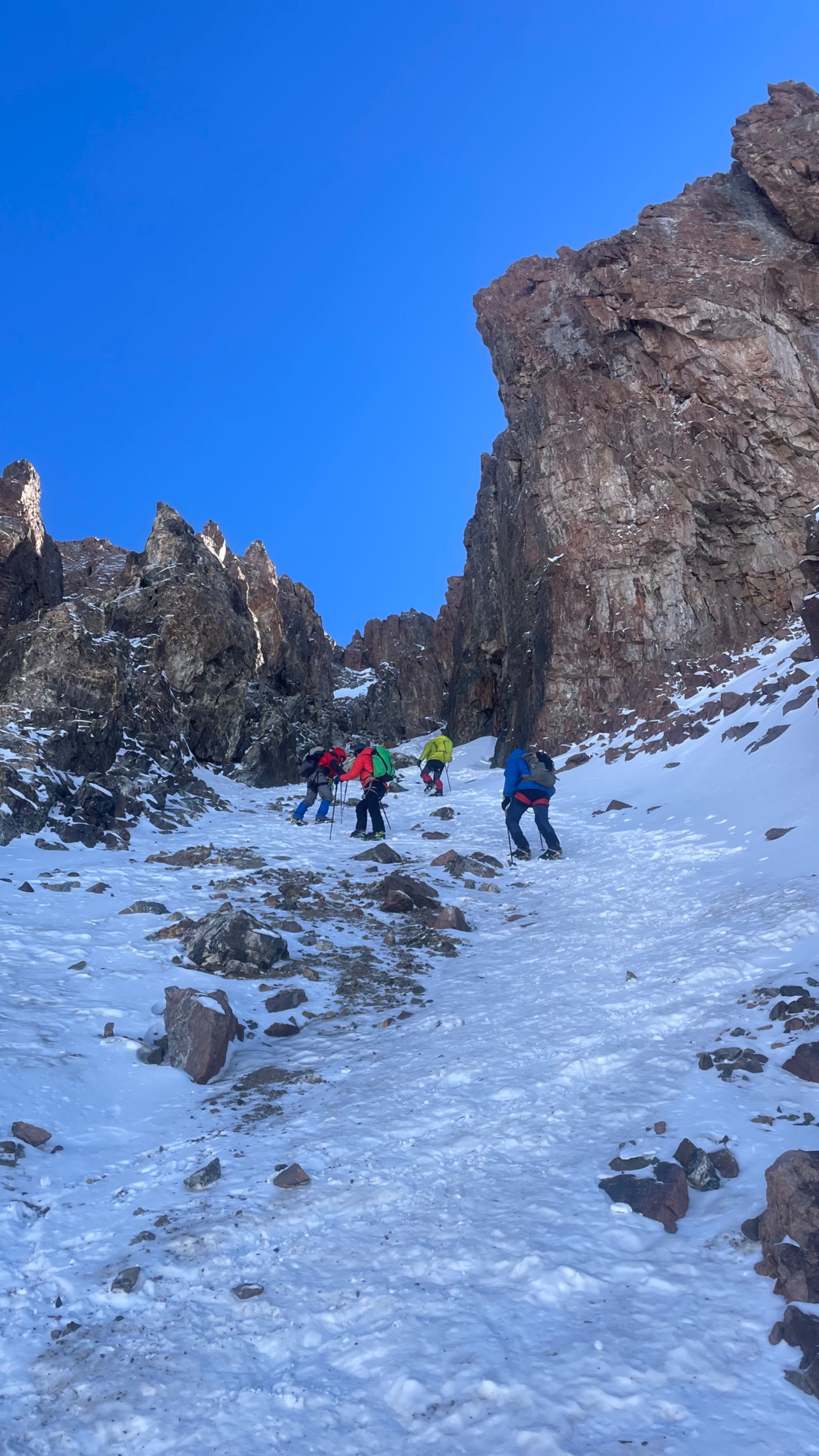
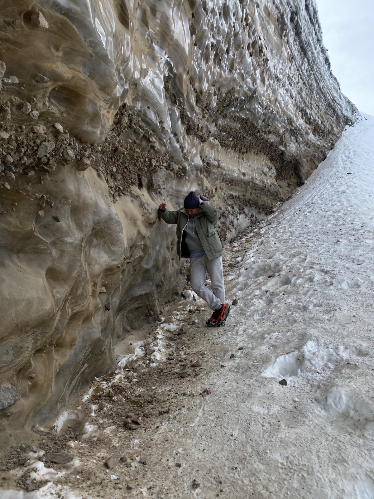
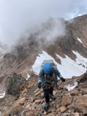
The trail heads south along the left side of the valley on a rough ground track. The path is marked intermittently by stone cairns and, in places, plastic bottles mounted on posts — the informal waymarking of Central Asian mountains. After approximately 1 km, the trail transitions to the left lateral moraine of the Bogdanovich Glacier. The path here becomes faint, weaving between boulders on the moraine crest. Navigation requires attention — this is not a marked hiking trail.
After about an hour of moraine walking, the path crosses to the middle of the valley around a large rocky ledge, then continues along the right side toward the glacier tongue. Along the way, you’re walking beneath the northern walls of Chkalov Peak and Fizkulturnik Peak. The Ayak and Til glaciers hang above — thick rivers of ice draped across the cliffs, with occasional distant sounds of ice and rockfall.
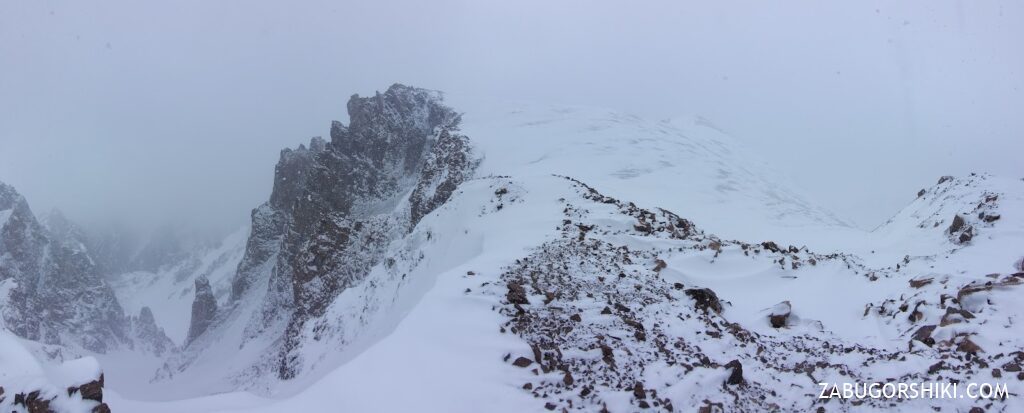
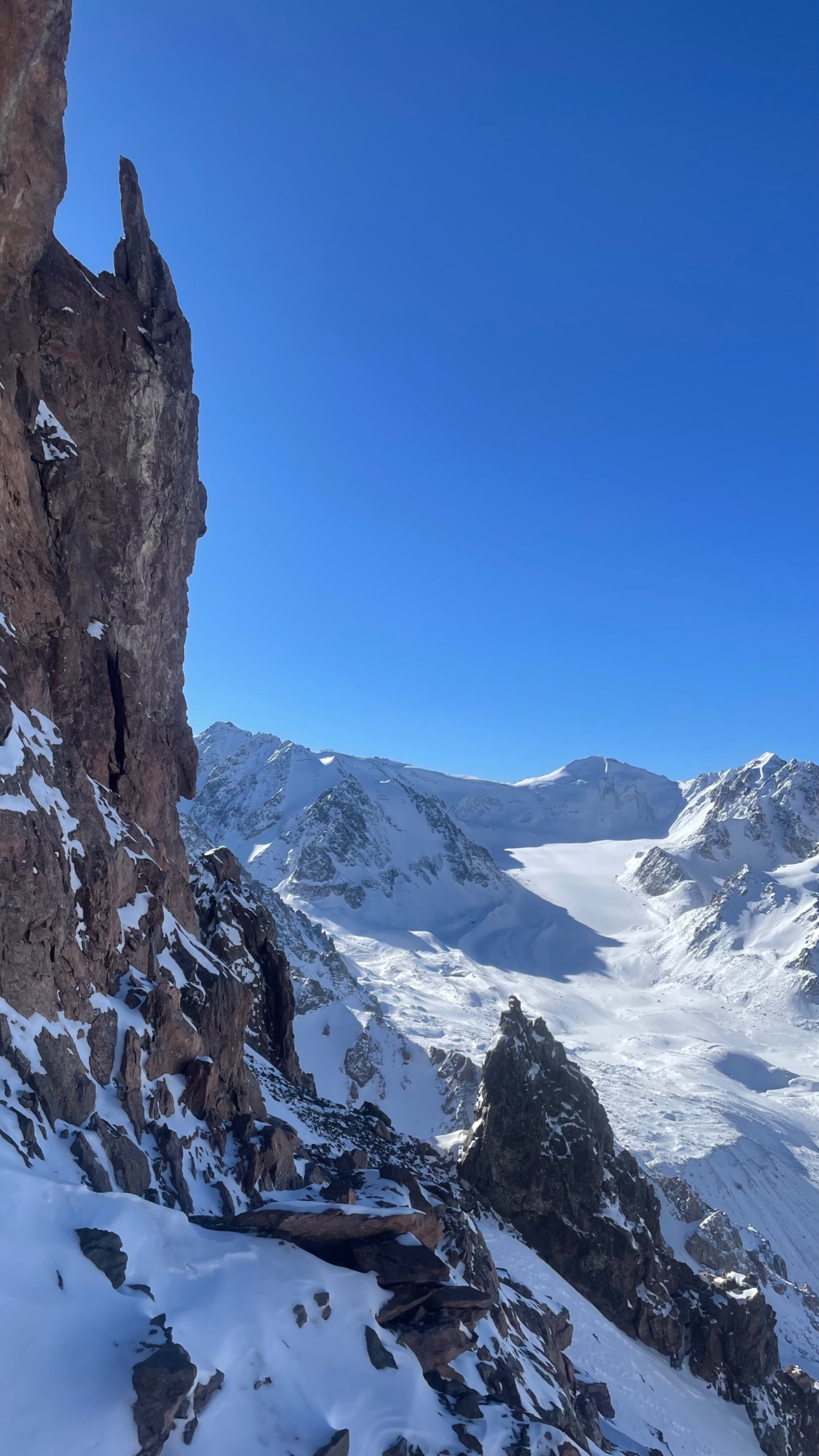
The Bogdanovich Glacier tongue appears at approximately 3,374 m — a grey-white mass of ice, debris, and moraine. The day hike turns back here. You continue.
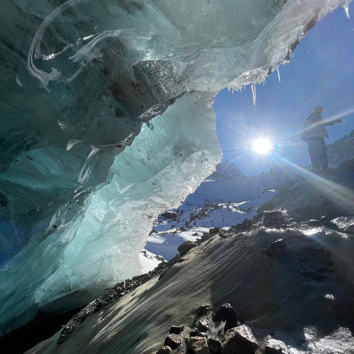
Nunatak Camp (3,600 m): Another 20–30 minutes beyond the glacier tongue brings you to Nunatak — a rocky outcrop (a true nunatak, a rock island surrounded by glacial ice) rising from the moraine. The flat areas beneath it provide the standard campsite for glacier expeditions. Altitude: approximately 3,600 m. Water is available from meltwater streams.
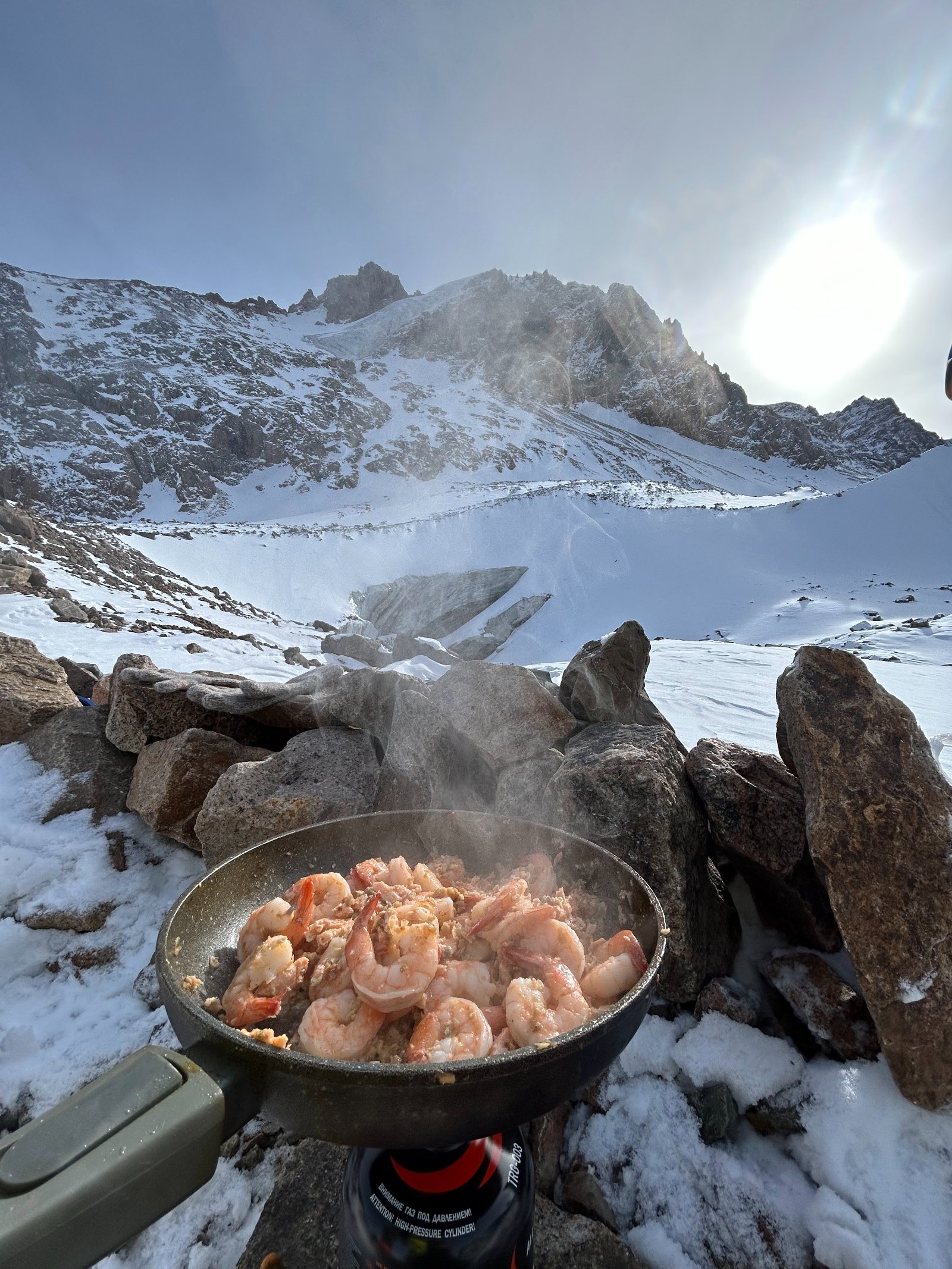
We set up camp, prepare a hot dinner, and your guide briefs you on tomorrow’s glacier route, including crevasse awareness, crampon technique, and turnaround protocol. Weather assessment determines whether the pass attempt proceeds in the morning.
Evening at Nunatak is extraordinary. You’re camped in the middle of a glacier system surrounded by 4,000 m+ peaks on three sides. The silence — when the ice isn’t creaking — is absolute. As the sun sets, the north face of Komsomol Peak turns from grey to gold to deep orange.
Day 2: Nunatak to Komsomol Pass (4,000 m) and Return
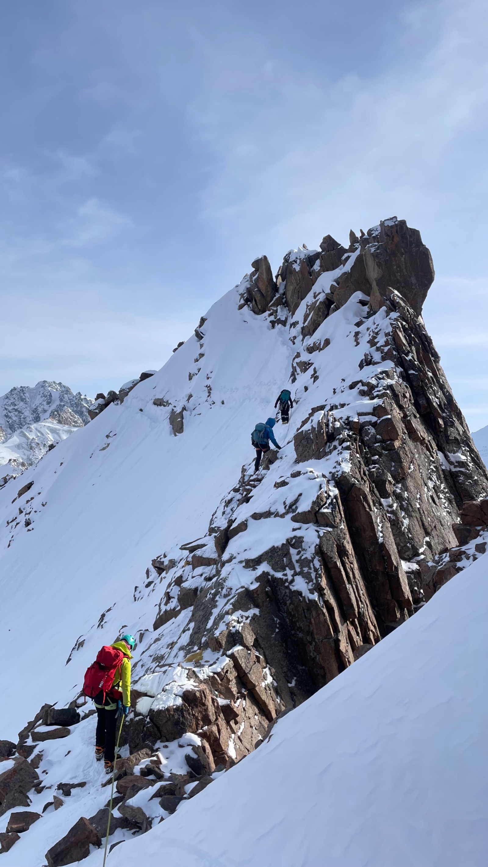
Pre-dawn start: Nunatak → Komsomol Pass (~4,000 m) — 2–3 km, +400 m, 2–3 hours
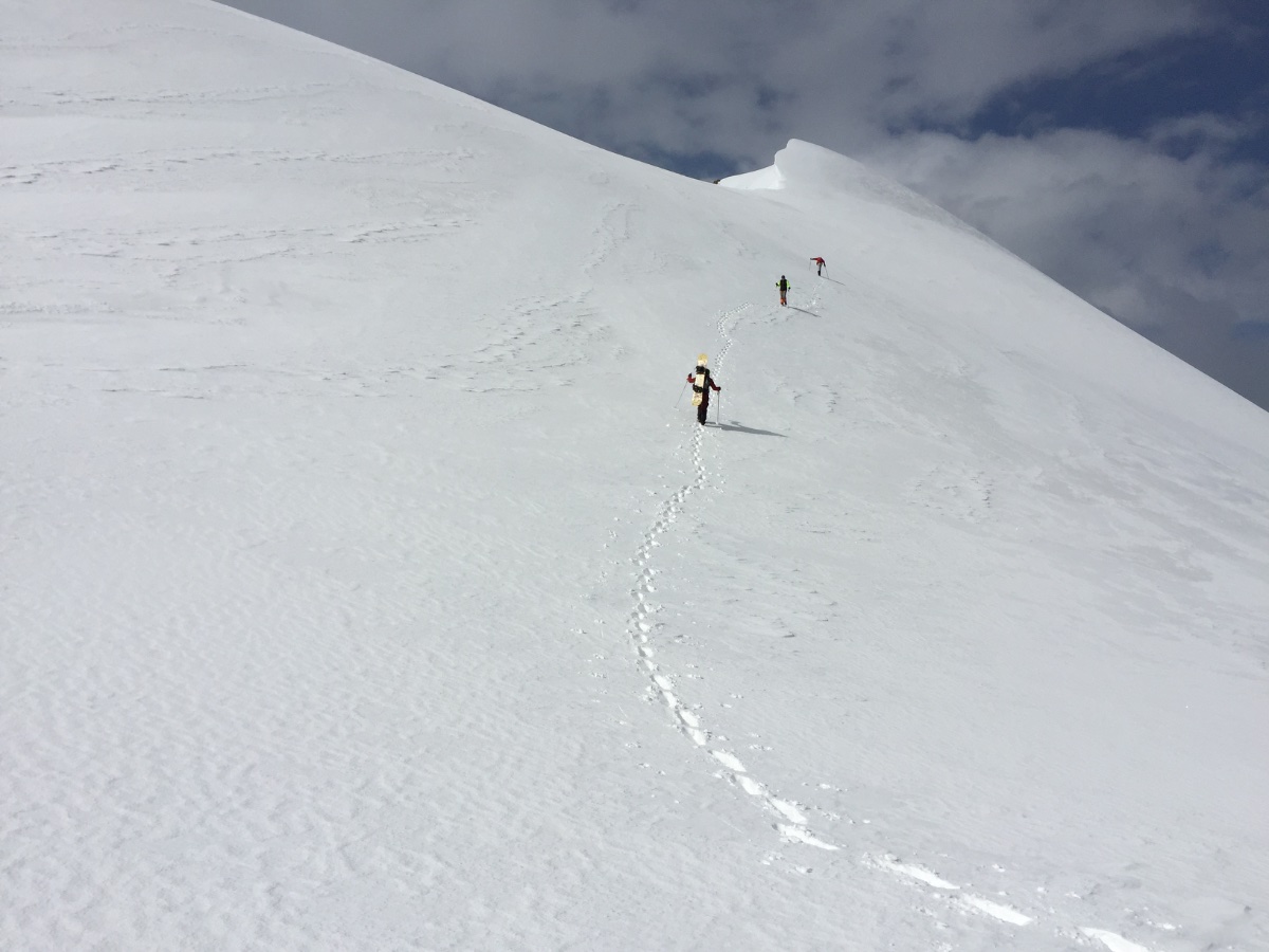
Wake at 4:00–5:00 AM. Cold breakfast, crampons on, and we begin moving up the Bogdanovich Glacier in the pre-dawn darkness. The glacier above Nunatak is low-angle but crevassed in sections. Your guide selects the safest line, which changes year to year as the glacier evolves. The ice surface is typically bare (no snow cover) in mid-summer, making crevasses visible.
The glacier ascends gradually toward the south. To your left (east), the eastern branch of the Bogdanovich Glacier flows down from the northern slopes of Komsomol Peak. To your right (west), the main branch extends from Karlytau’s ice dome. Ahead, the glacier narrows as it approaches the pass.
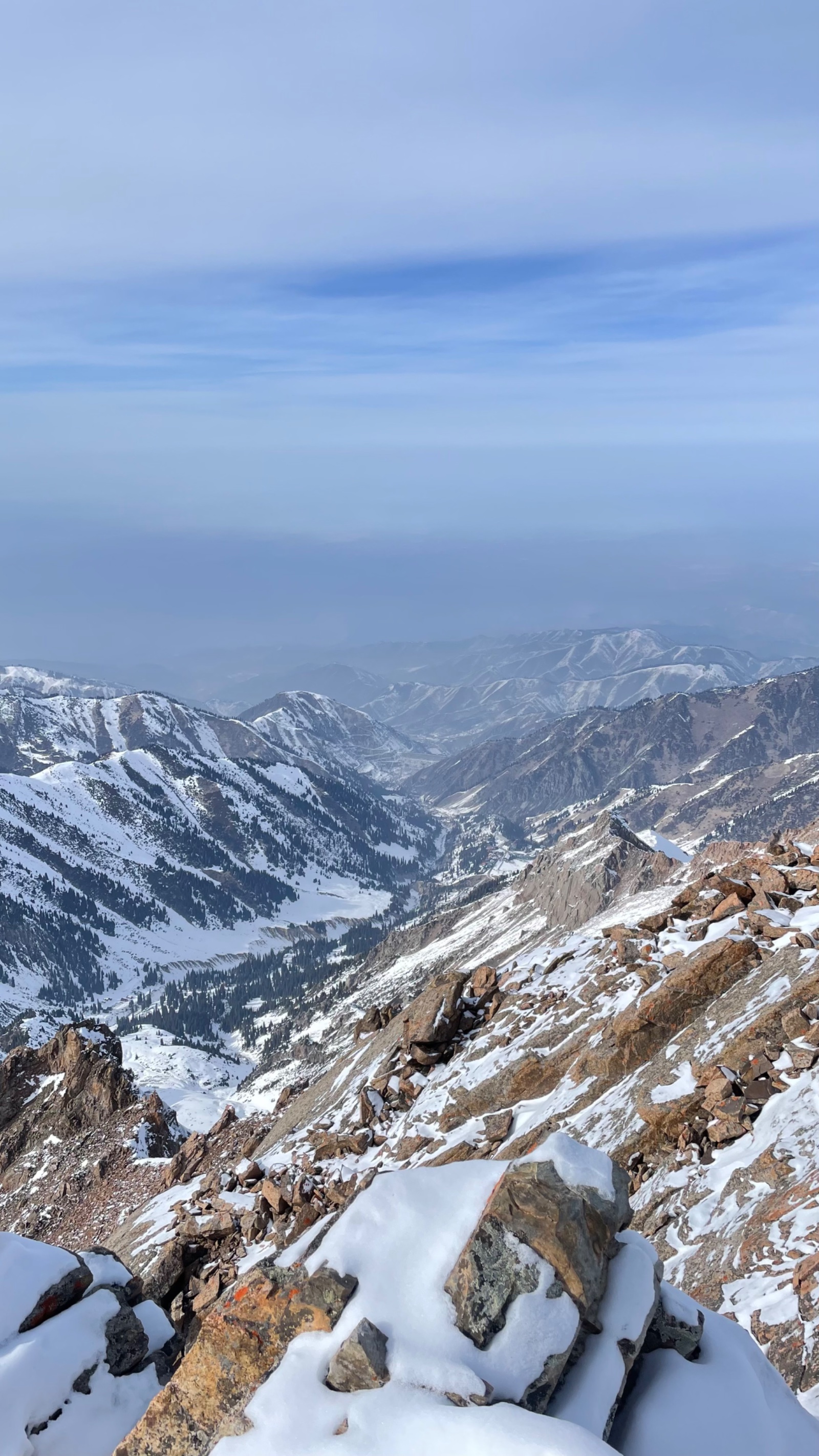
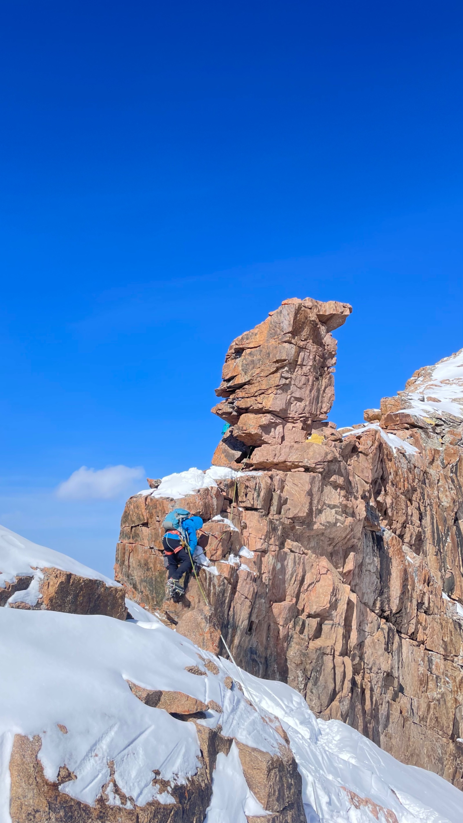
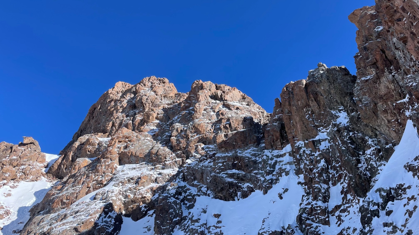
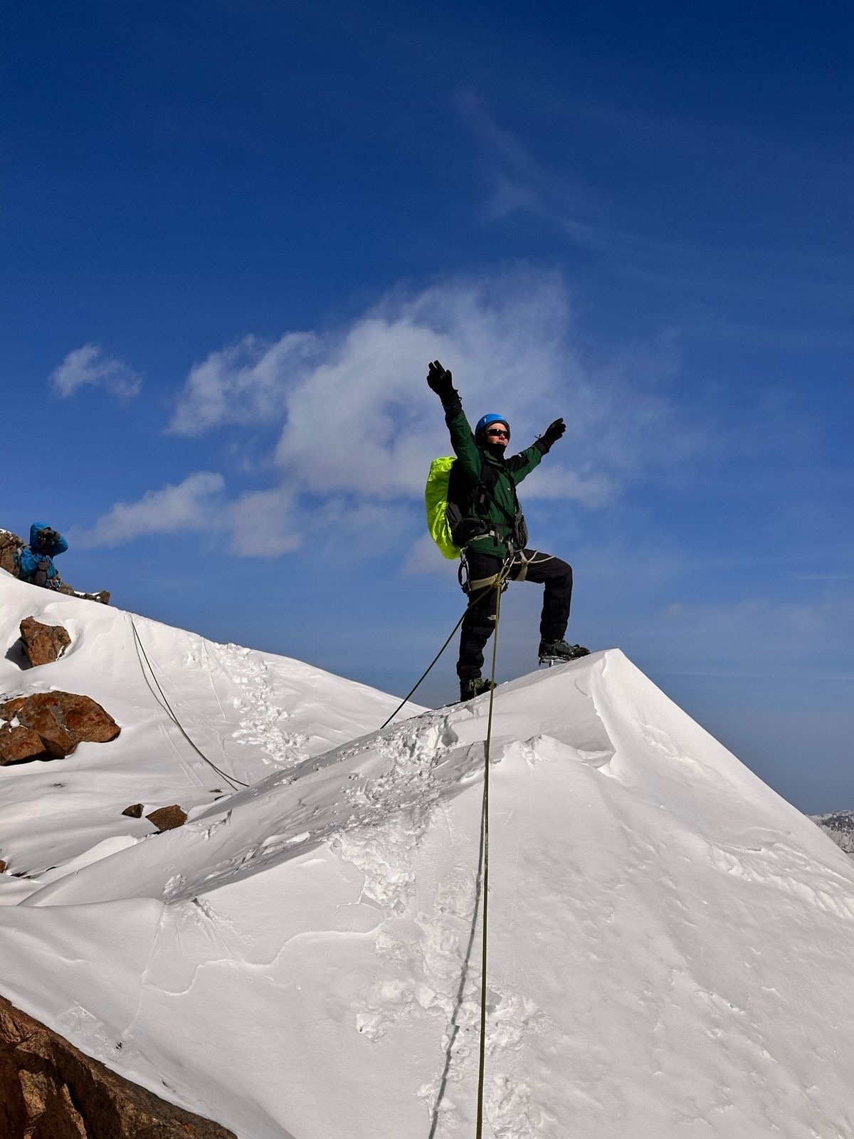
Komsomol Pass (~4,000 m): The glacier tops out at the saddle. From here, the terrain transitions from ice to talus and scree. The view from the pass is the reward:
South: The world drops away. The far side of the pass plunges steeply — over 1,200 metres down to the Left Talgar River valley. This is the same remote valley described in our Left Talgar Gorge article — no roads, no buildings, no cell service, “evacuation only by helicopter.” Seeing it from above, from the pass, gives visceral understanding of its scale and isolation.
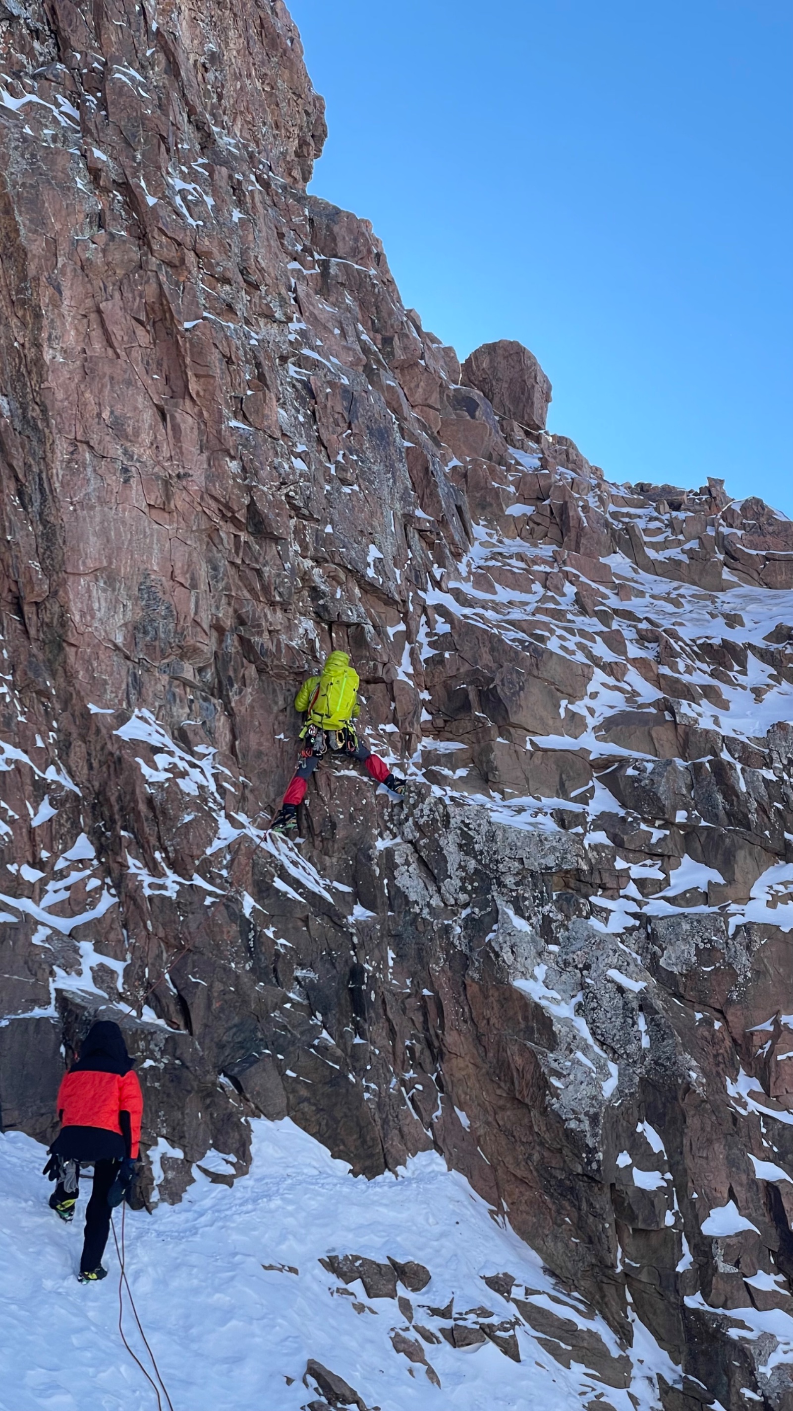
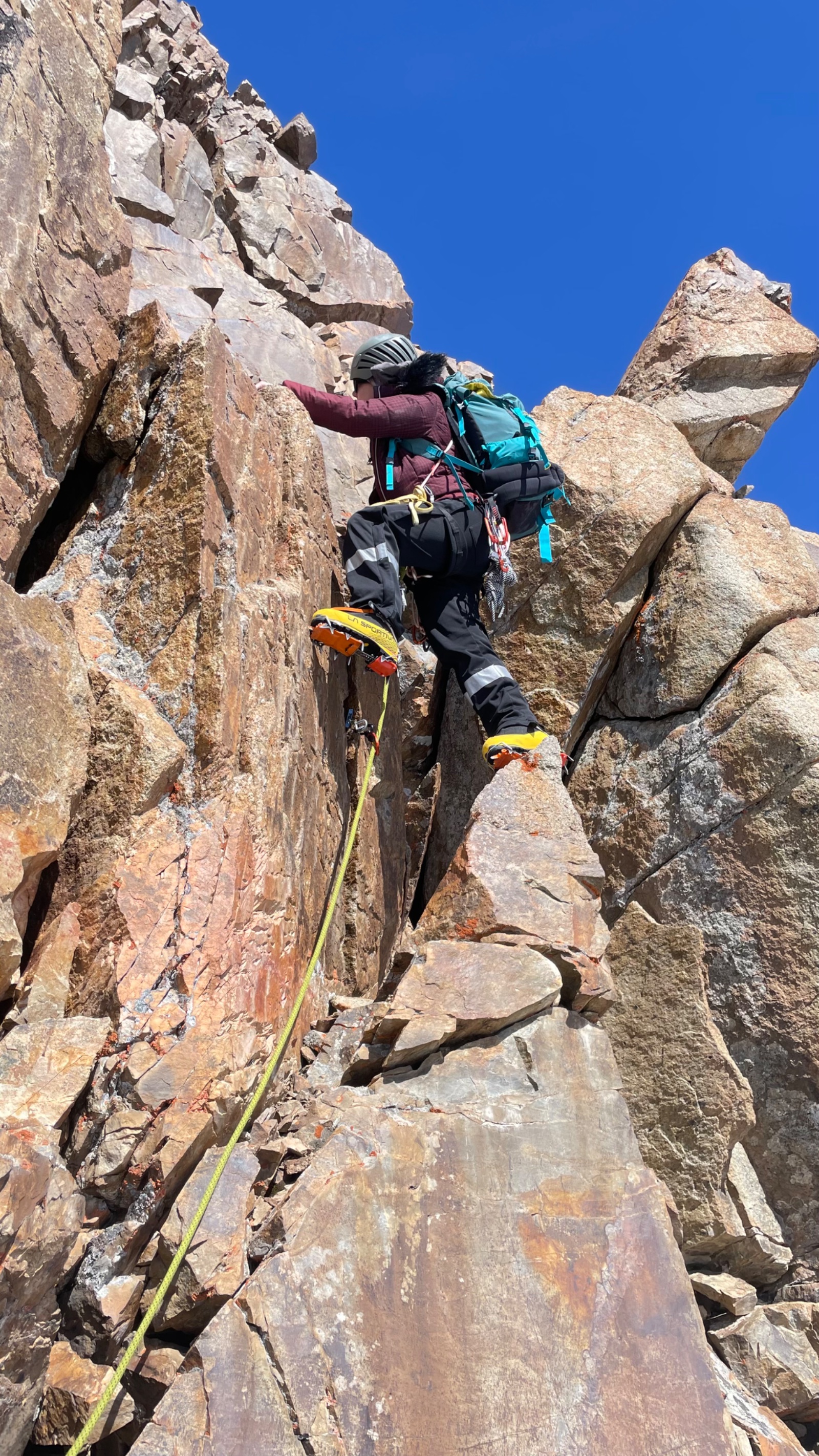
East: Komsomol/Almaty Peak (4,376 m) rises 376 metres above you. Its northern face — the face visible from Almaty city — is a wall of rock and ice. The summit route (category 2A-2B) continues up from here via rock walls, inclined shelves, and couloirs. You can see climbers’ tracks on the scree above.
Southeast: On clear days, Talgar Peak (5,017 m) — the highest point of the entire Zailiyskiy Alatau — is visible. A glacier-clad colossus.
West: Karlytau Peak (4,170 m), its ice dome gleaming. Further west along the ridge: the passes Panfilov Heroes (3,950 m) and Uchitel (4,045 m).
North: The Bogdanovich Glacier stretching back toward Nunatak, Talgar Pass, and — far below, hazy on the plain — Almaty city.
Time at the pass: 30–45 minutes. This is not a place to linger — weather changes rapidly at 4,000 m, and the return across the glacier needs adequate daylight.
Return: Komsomol Pass → Nunatak → Talgar Pass → Medeo → Almaty (5–7 hours)
Descent retraces the ascent: glacier, moraine, valley track, cable car. The return across the glacier is faster (downhill, known terrain). We break camp at Nunatak, pack gear, and continue to Talgar Pass. Cable car down to Medeo, vehicle transfer to Almaty. Return to hotel by late afternoon or evening.
Why book a guided Komsomol Pass hike?
Glacier travel requires a guide. The Bogdanovich Glacier has crevasses. While many are visible on bare summer ice, conditions change — fresh snowfall can hide them, and the crevasse pattern shifts from year to year. Your guide knows the current safe line and carries rescue equipment.
Navigation above 3,500 m is non-trivial. The trail vanishes on the moraine. Above the glacier tongue, there is no path at all — you’re navigating by terrain reading on ice and rock. In cloud or whiteout conditions, the glacier is featureless. A guide who knows this specific glacier is essential.
Altitude management. At 4,000 m, most people from sea level experience some altitude effects. Your guide controls the pace, enforces hydration, and makes the decision to turn back if altitude sickness symptoms appear. The overnight at Nunatak (3,600 m) provides crucial acclimatisation before the final push to the pass.
This is the threshold between hiking and mountaineering. The Komsomol Pass sits exactly on the line where hiking ends and technical climbing begins. With a guide and crampons, experienced hikers can reach it. Without those, it’s dangerous. Beyond the pass — up the rocks to the summit — requires ropes, belaying, and climbing skills. The pass is the highest point you can reach on pure determination and fitness.
The peak with four names
The mountain that dominates Almaty’s southern skyline has been renamed more than any other peak in Kazakhstan — a reflection of the country’s turbulent modern history.
Malyy Almaty (pre-Soviet): “Little Almaty” — the peak’s original name, echoing the river (Malaya Almatinka) and the gorge (Small Almaty Gorge) below it. A simple geographical descriptor.
Komsomol (1935): After the Soviet Alpiniad of 1935 — a mass climbing event organised by the All-Union Leninist Young Communist League (Komsomol) — the peak was renamed in honour of the organisation. The first ascent had been made five years earlier, on July 17, 1930, by Almaty climbers G. Beloglazov, V. Gorbunov, and I. Mysovsky. The Komsomol name stuck for over six decades.
Nursultan Peak (1997/1998): After Kazakhstan’s independence, the peak was renamed in honour of Nursultan Nazarbayev, the country’s first president. This name was used on official maps and in climbing literature for over two decades.
Almaty Peak (current): Following political changes, the summit plaque now reads “Almaty Peak” in both Latin and Cyrillic — a partial return to the original name and a deliberate echo of the city it watches over. The peak’s renaming history mirrors Kazakhstan’s broader process of place-name evolution.
The pass, however, retains the Soviet-era designation: Komsomol Pass. In climbing literature and route descriptions, this remains the standard name.
Acclimatisation strategy
Attempting Komsomol Pass (4,000 m) without acclimatisation is risky and unpleasant. We strongly recommend completing at least one high-altitude hike before this trip:
Ideal acclimatisation hikes (in progression order):
- Mynzhylki Plateau — 3,000 m, difficulty 3/5. The minimum recommended pre-acclimatisation
- T-1 Glaciological Station — 3,440 m, difficulty 3.5/5. Gets you close to Nunatak camp altitude
- Bogdanovich Glacier Day Hike — 3,500 m, difficulty 3/5. Same approach route. You’ll see exactly where Day 1 ends and Day 2 begins
- Kumbel Peak — 3,200 m, difficulty 4/5. Tests your fitness at altitude
The ideal preparation for Komsomol Pass is the Bogdanovich Glacier day hike 2–3 days before the pass attempt. You acclimatise to 3,500 m, familiarise yourself with the route, and can assess whether the full 2-day trip is right for you.
Frequently asked questions
How is this different from the Bogdanovich Glacier day hike? The day hike goes from Talgar Pass (3,200 m) to the glacier tongue (~3,500 m) and back — approximately 13 km round trip, 4 hours walking, no glacier travel. The Komsomol Pass trip continues beyond the day hike endpoint: you camp at Nunatak (3,600 m), then cross the glacier to the pass at 4,000 m. It requires crampons, glacier travel skills (provided by your guide), and two days.
Do I need climbing experience? No technical climbing experience required. The route to the pass is steep hiking and glacier walking — not rock climbing. However, you need strong fitness, comfort walking on ice with crampons, and altitude tolerance tested to at least 3,000 m on a previous hike.
Can I continue from the pass to the summit? The summit of Komsomol/Almaty Peak (4,376 m) from the pass requires multi-pitch rock climbing — rock walls, couloirs, and belayed climbing at category 2A-2B. This is a separate, more technical product. If you’re interested, see our Komsomol Peak page. The pass hike is the natural “trial run” before committing to the summit.
What are the other passes on the glacier? The Bogdanovich Glacier system contains several passes: Komsomol (~4,000 m, 2A), Panfilov Heroes (3,950 m), Uchitel (4,045 m), and Pioneer Pass (3,840 m, 1B). Your guide can discuss which is most appropriate based on conditions and group ability.
What’s a nunatak? A nunatak is a rocky outcrop that protrudes through a glacier or ice sheet — literally an island of rock surrounded by ice. The Nunatak on the Bogdanovich Glacier is a prominent rock feature in the middle of the moraine, with flat areas at its base that serve as the standard campsite for glacier expeditions. The name comes from Greenlandic Inuit — a reminder that glacier terminology is universal.
What if weather prevents the pass attempt? Your guide assesses conditions. If the glacier is unsafe (fresh snow hiding crevasses, whiteout, storm), the pass attempt is postponed or cancelled. In bad weather, the trip defaults to an overnight glacier camping experience with the pass attempt reserved for a future trip.
Itinerary
Detailed itinerary will be provided upon booking. Our typical tour includes daily hikes through diverse terrains and cultural experiences.
Pricing
| Group Size | 1 person | 2 people | 3 people | 4 people | 5 people | 6 people Best value |
|---|---|---|---|---|---|---|
| Standard | $375 $375 total | $235 $470 total | $189 $567 total | $165 $660 total | $151 $755 total | $142 $852 total |
100% private tour — prices are per person based on group size. The more friends you bring, the less everyone pays!
What's Included
Included
Not Included
Our Guarantee
If weather forces a cancellation, we reschedule at no cost. If you're not satisfied with your experience, we'll work with you to make it right. No questions, no hassle.
Private tours only (max 6) · Free cancellation up to 48 hours before · No upfront payment
Traveler Stories
James & Lisa
Did the 2-day Altyn-Emel trip. The Singing Dune at sunset was magical. Our guide handled everything - permits, accommodation, meals. We just showed up and enjoyed. Already planning our next trip with Zabugorshiki.
Anna W.
Solo traveler here. I was nervous about hiking alone in a foreign country but the guide made me feel completely safe. The trail to Kok-Zhailau was beautiful and the photos he took of me were amazing. Only wish the hike was longer!
David R.
Third time booking with these guys. Butakovka, Big Almaty Lake, and now Titov Peak. Every single time the service is flawless. The fact that it's always private and max 6 people makes such a difference compared to other operators.
Share Your Experience
1 hiker
completed this trail
Tour At A Glance
Book This Tour
Weekend slots fill up fast — book early to get your preferred date
Pay securely after confirmation


Weather Forecast
broken clouds
H: -7°C
L: -8°C
Tue, Mar 31
overcast clouds
-2°C
-9° / 4°
Wed, Apr 1
overcast clouds
-2°C
-5° / 0°
Thu, Apr 2
few clouds
-1°C
-5° / 3°
Tour Location
Similar trails
Komsomol Peak: A Journey to 4,376 Meters
From $199/person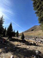
Day Hiking Tour to Kaskelen Gorge from Almaty
From $73/person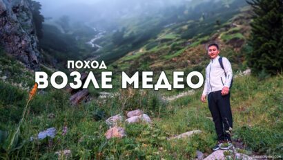
Day Hike to Sarkyrama Waterfall near Medeo
From $54/personFrom $142
per person · free cancellation
Complete Your Booking
Tour:
Date:
Participants:
Price:
You're Almost There!
We'll contact you within 24 hours to confirm your spot and share everything you need to prepare for your adventure.
165
Videos on the channel
13,000+
16,000+
59
Hikes Filmed
704,000 m
Total Distance
44,439 m
Total Elevation Gain
812 cups
Grand Cru Tea Cups
27
Countries Visited
83 hours
Drone Flight Hours
10 videos
Sports: Running, Snowboard
3 videos
Healthy Eating
1
Living on the Edge