Day Hiking Tour to Mynzhylki Plateau from Almaty
From $72 per person


Overview
Is this hike right for you?
Perfect if you…
No experience needed
Description
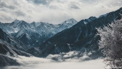
A guided day hike from Shymbulak ski resort up the Small Almaty Gorge to the Mynzhylki Plateau — a wide alpine valley at 3,000 m that serves as the gateway to the Tuyuksu glaciers, Lake Manshuk Mametova, and the highest peaks of the Zailiyskiy Alatau.
📹 Mynzylki video
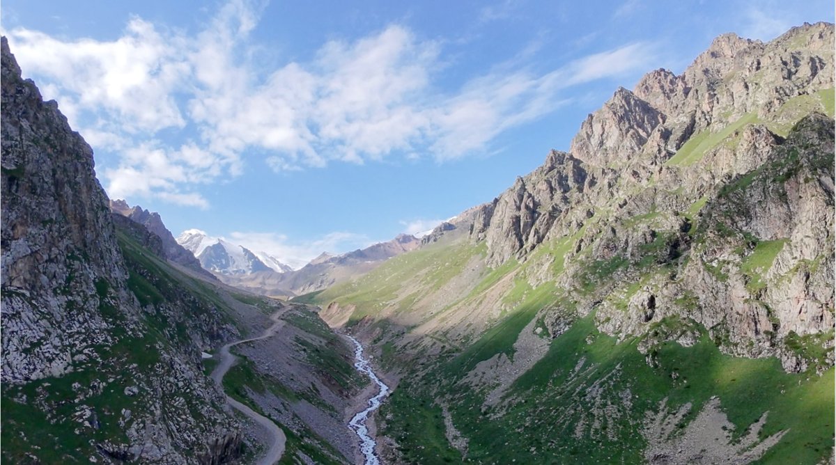
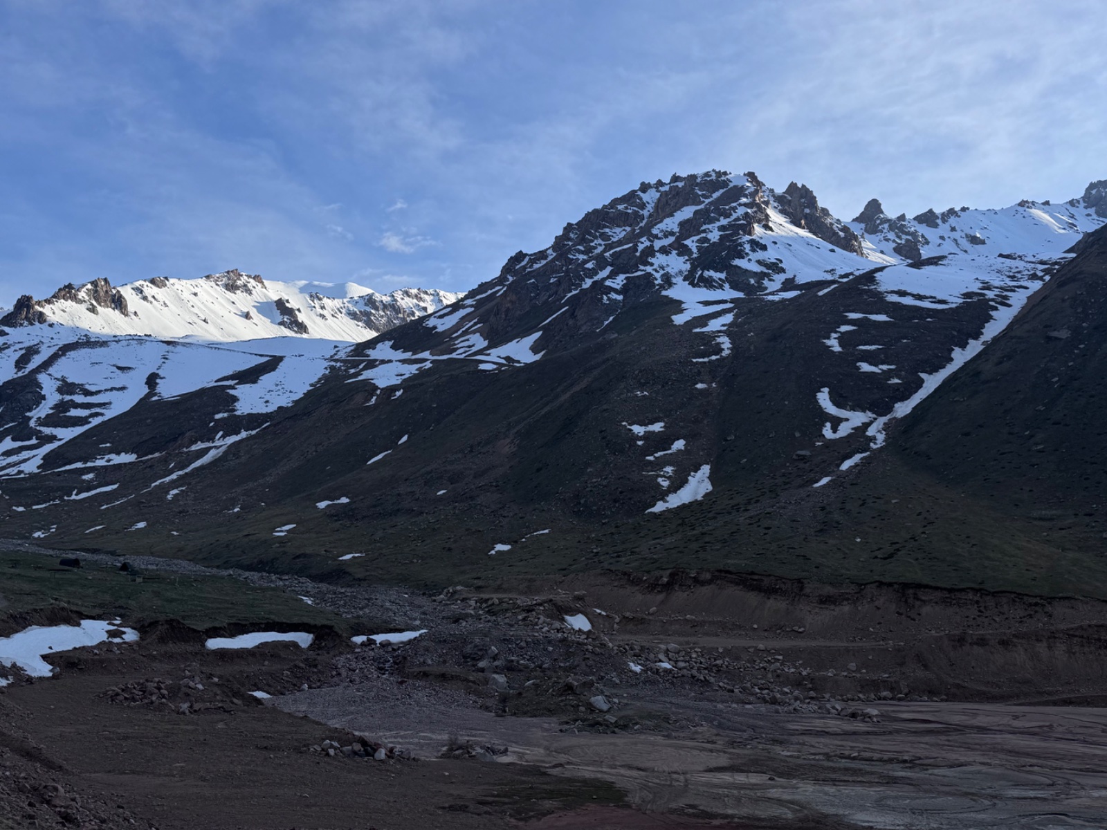
The Mynzhylki plateau hike from Almaty takes you to 3,000 metres — the altitude where forests stop, glaciers begin, and the peaks of the Northern Tien Shan fill the horizon. This is the highest standard day hike that starts from genuine infrastructure (Shymbulak ski resort), which means you begin at 2,270 m and gain only about 730 m to reach the plateau. The total distance from Shymbulak is roughly 7–8 km one way. The trail is not steep. The challenge is altitude.
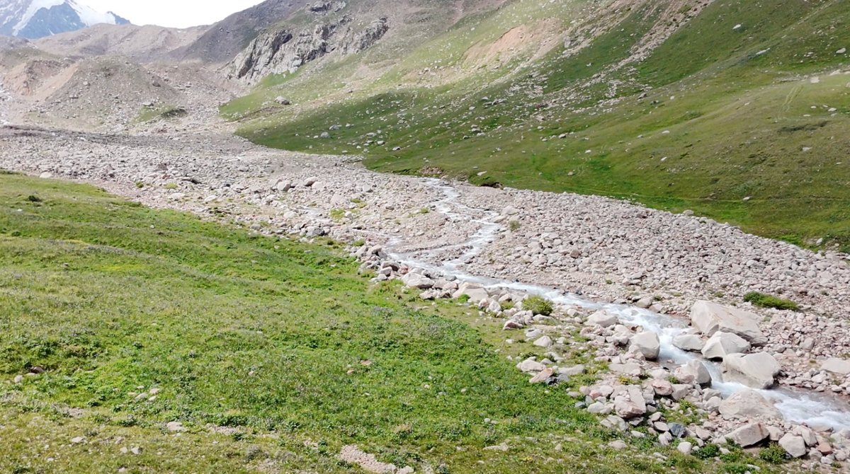
The name tells you what this place once was: “Mynzhylki” translates from Kazakh as “a thousand mares” — a place spacious enough to graze a thousand horses. Today there are no horses, but the wide, flat valley surrounded by glacier-draped peaks still conveys that sense of vast alpine openness. The Malaya Almatinka (Small Almaty) River — the same river that flows through Medeo and downtown Almaty — is born here, emerging from snowmelt and glacier runoff at the base of the Tuyuksu ice field.
What makes this hike remarkable is the sequence of landmarks on the way up. The trail from Shymbulak follows the main gorge road past a series of increasingly dramatic features:
The Alpine Rose Hotel — one of the few mountain lodges in the gorge, marking the end of tourist infrastructure.
The Tuyuksu Mountaineering Camp — where generations of Soviet and Kazakh mountaineers trained before attempting the high peaks. The Small Almaty Gorge was the cradle of Kazakhstan’s mountaineering tradition.
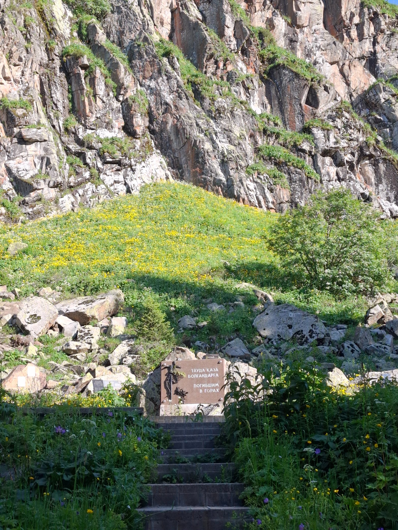
The Memorial to Mountain Victims — a monument at the Tuyuksu Gate honouring climbers who died in the mountains. A sombre and powerful stop.
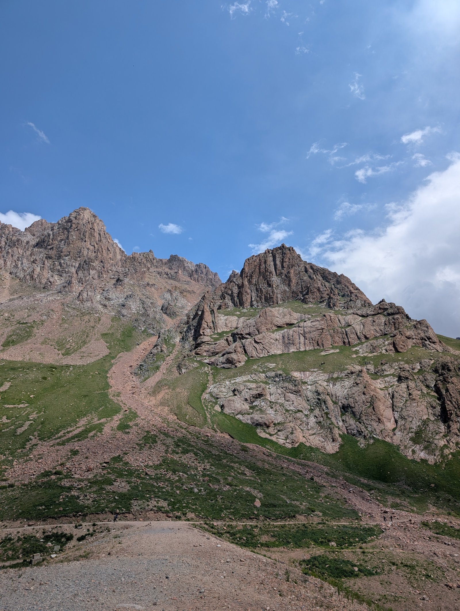
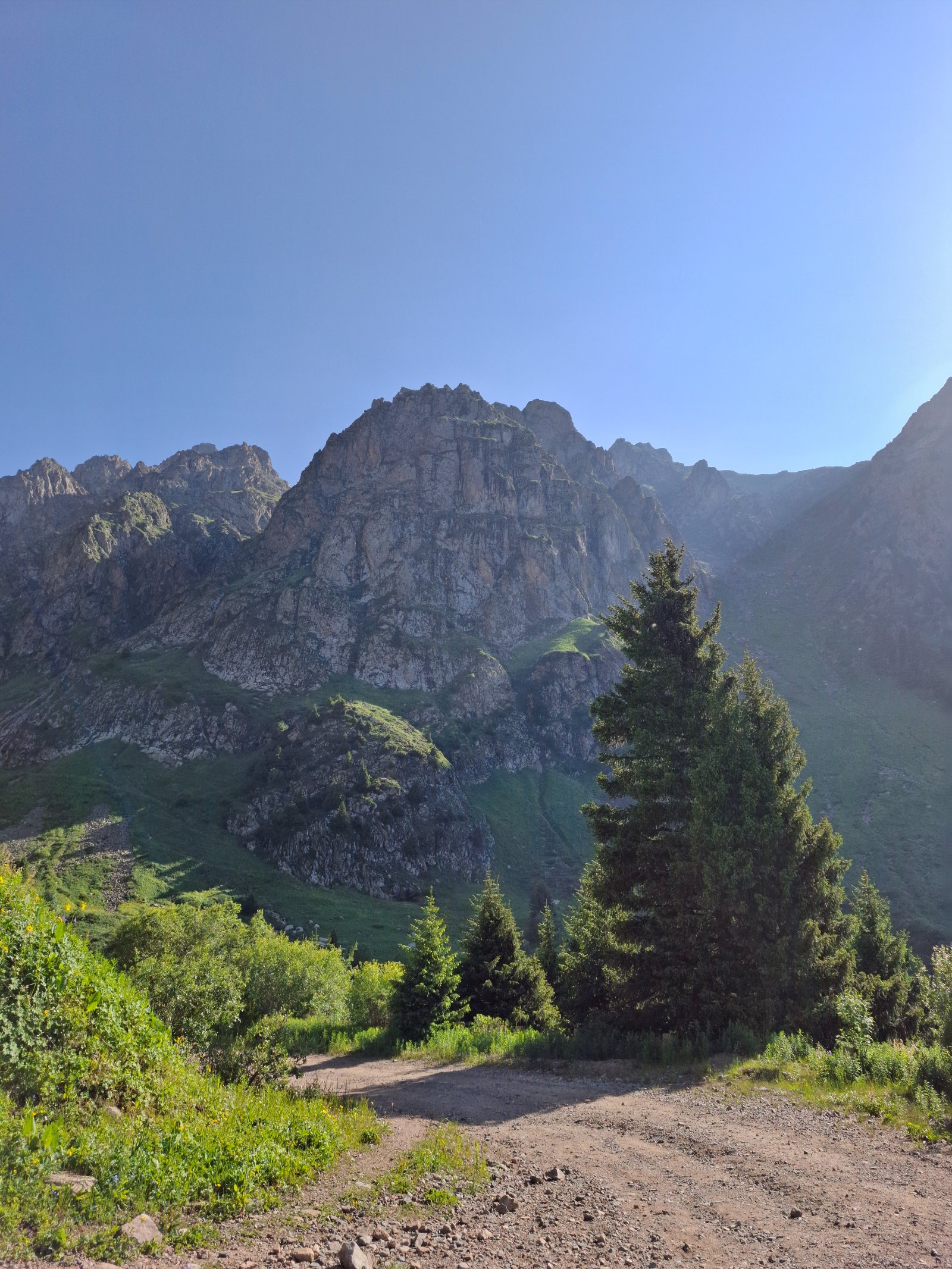
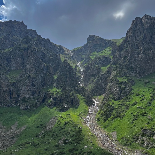
The Bastions — massive vertical rock walls up to 240 metres high that your existing page rightly compares to Yosemite. Professional rock climbers train here. The sheer scale of these granite faces, seen from the narrow gorge floor, is genuinely startling.
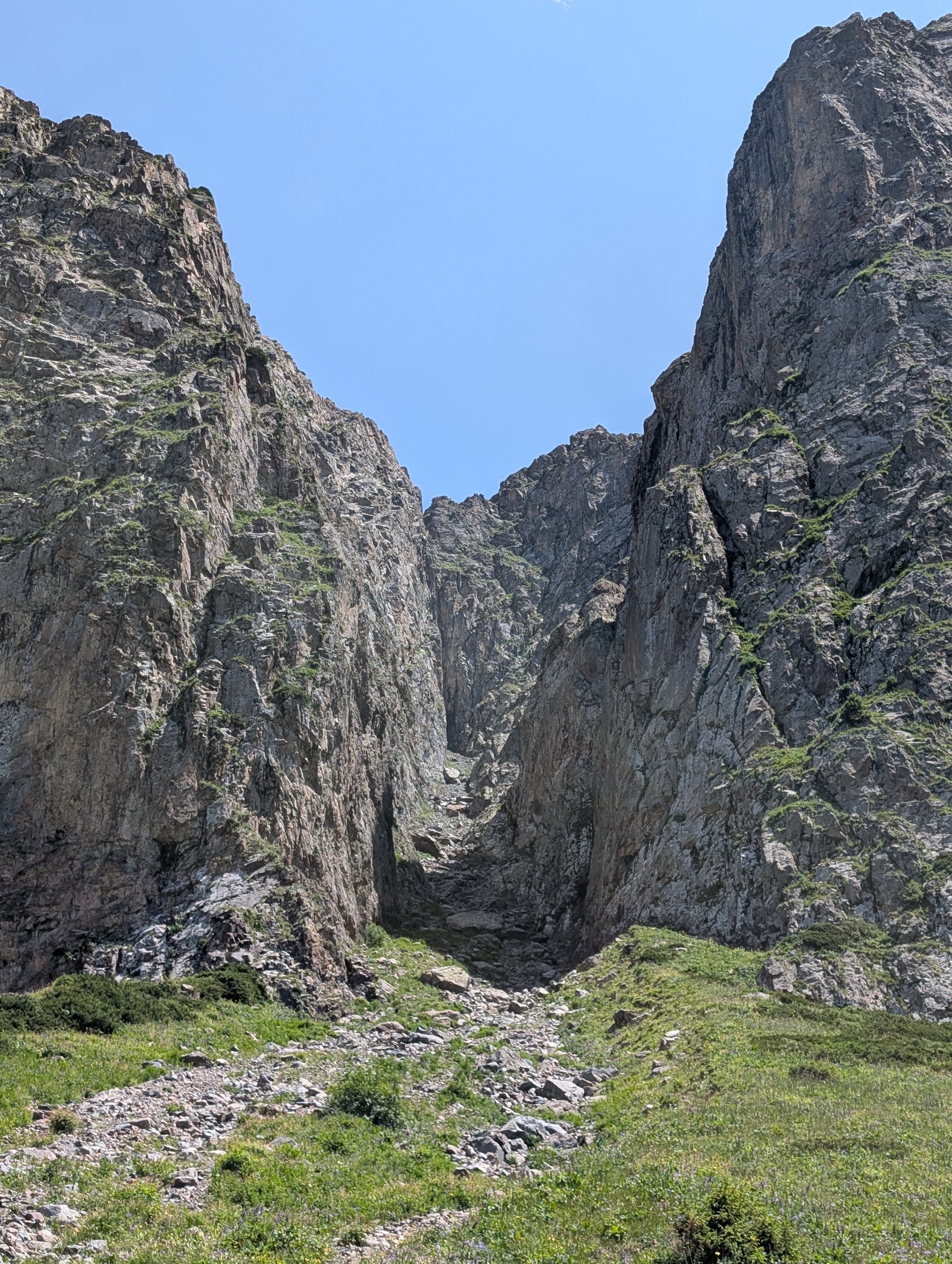
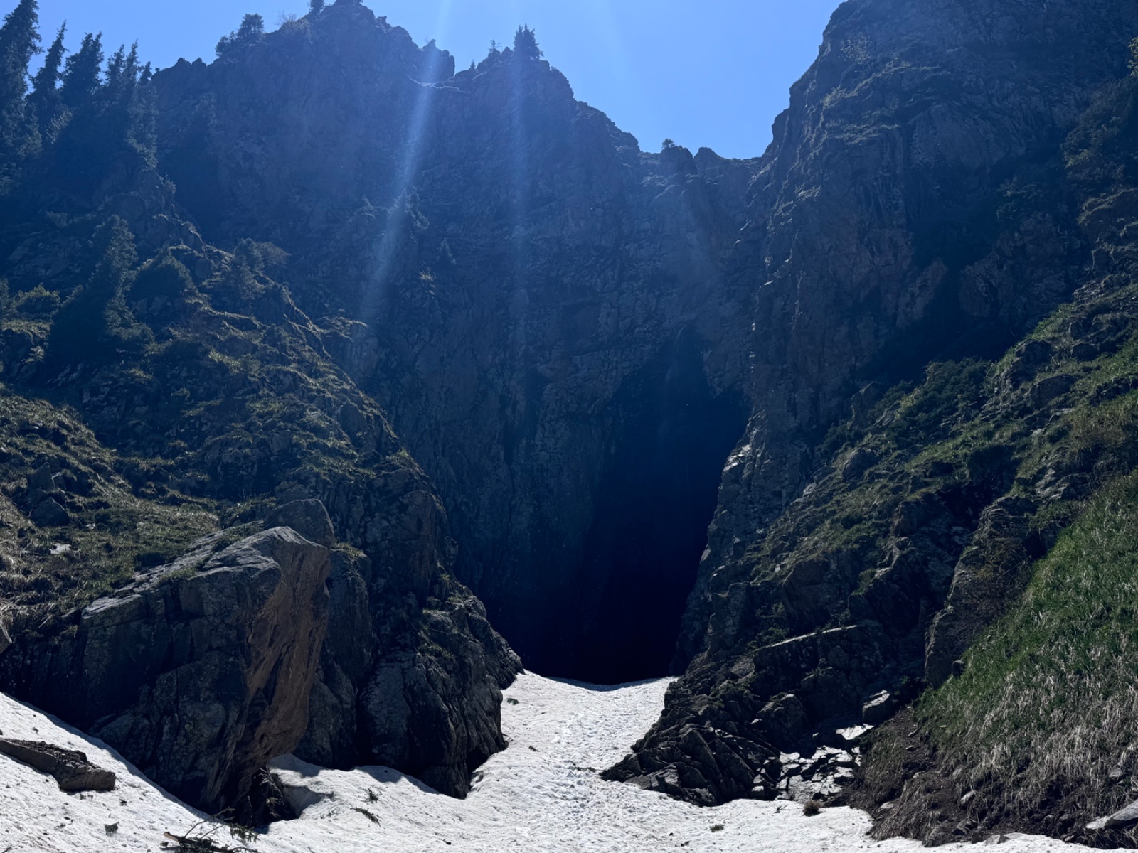
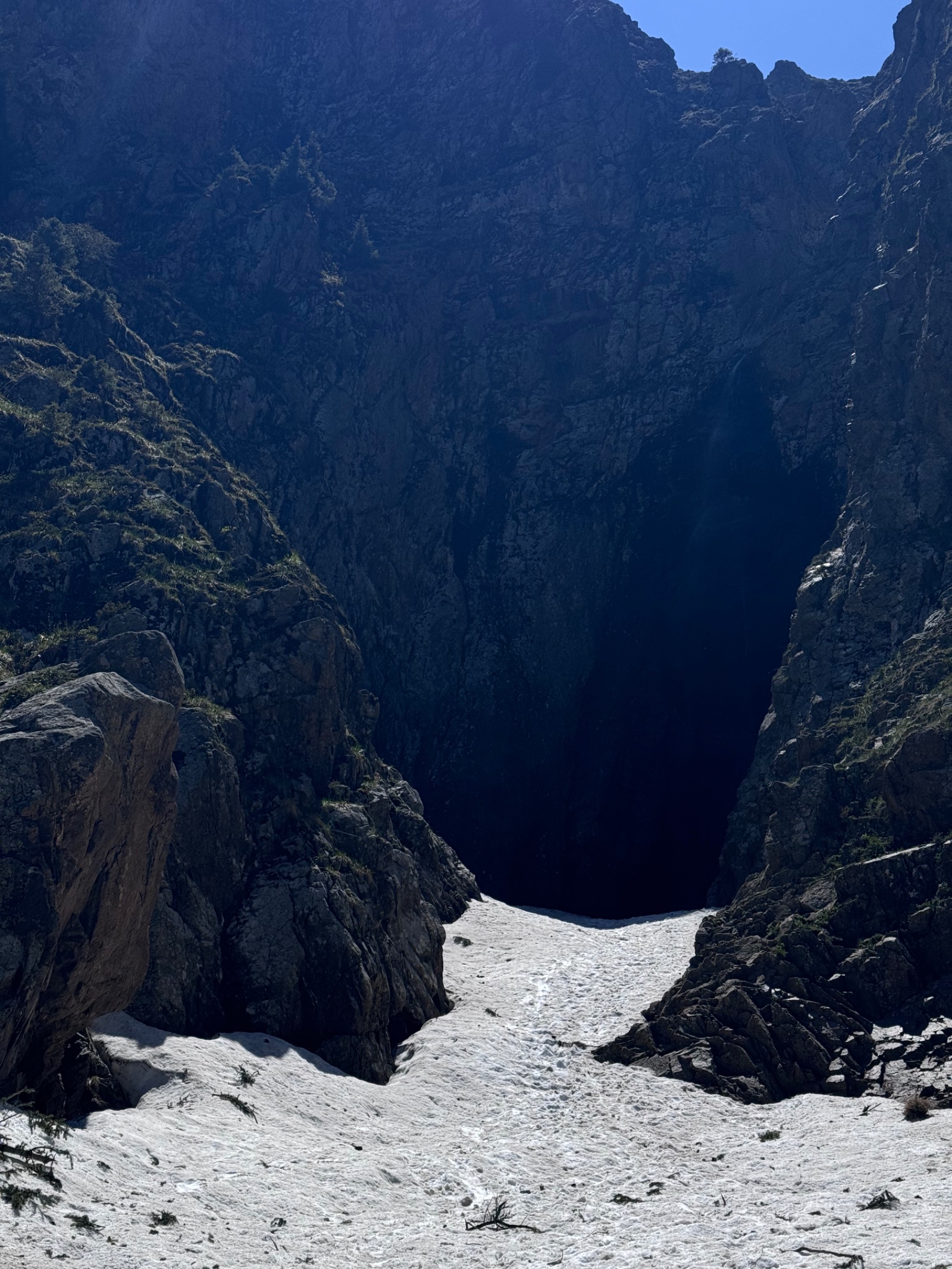
Tuyuksu Gate (2,500–2,700 m) — the narrowest point of the gorge, where enormous rocks on both sides create a natural “gate.” Wind funnels through here with remarkable force. Beyond the gate, the gorge opens into the Mynzhylki valley.
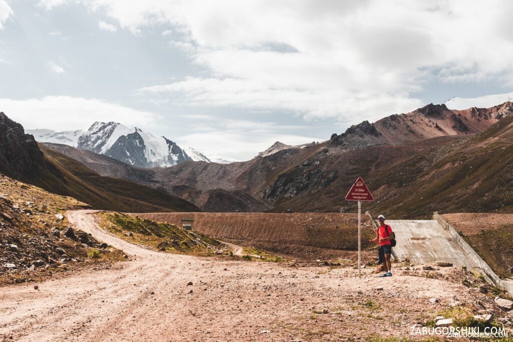
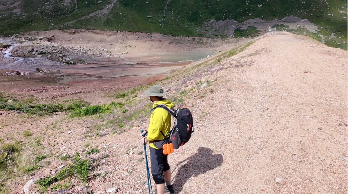
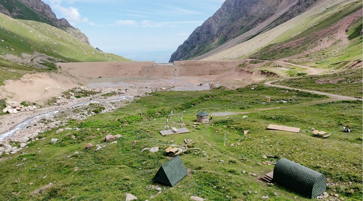
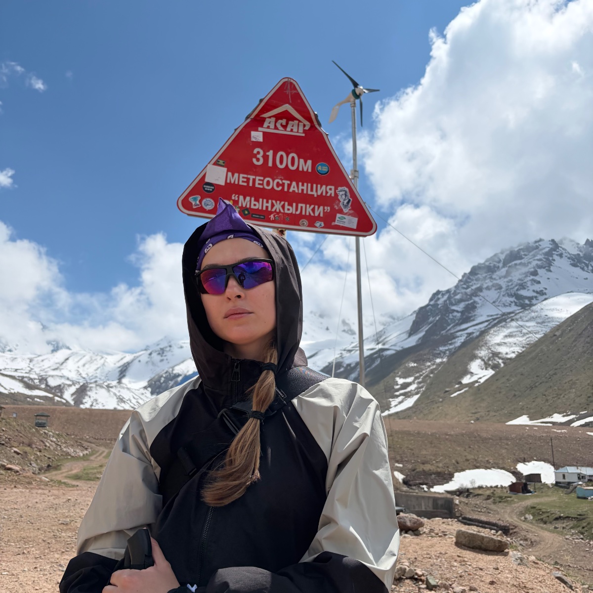
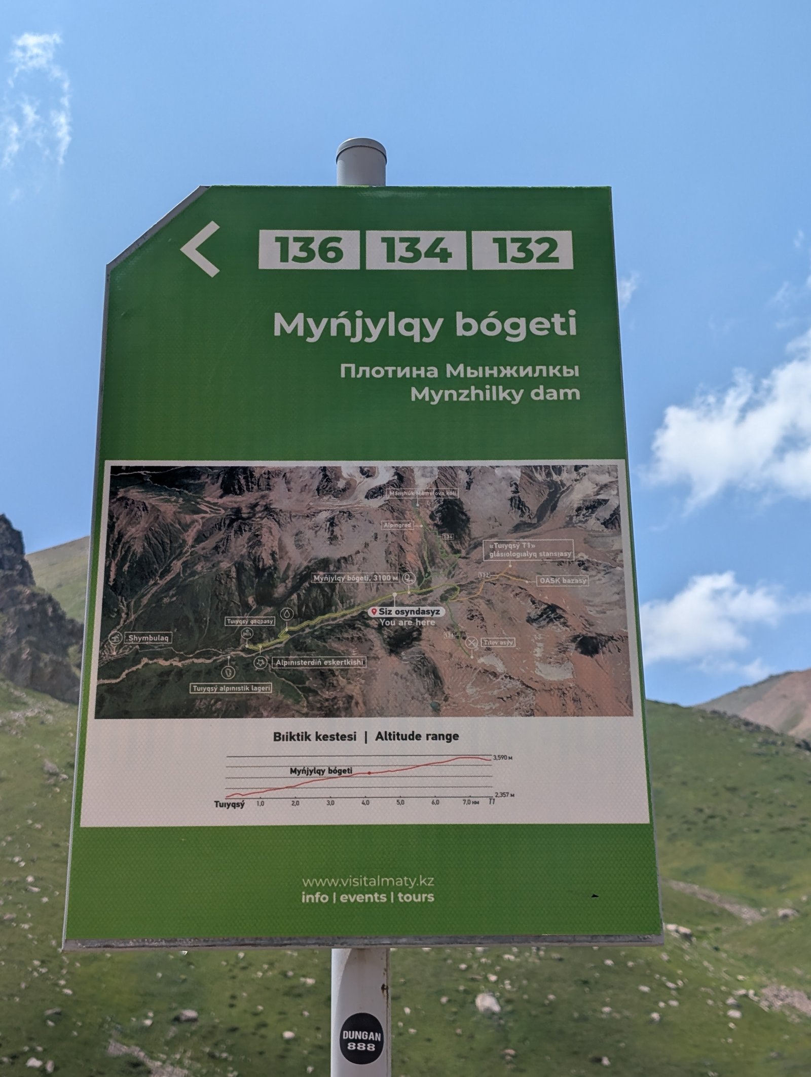
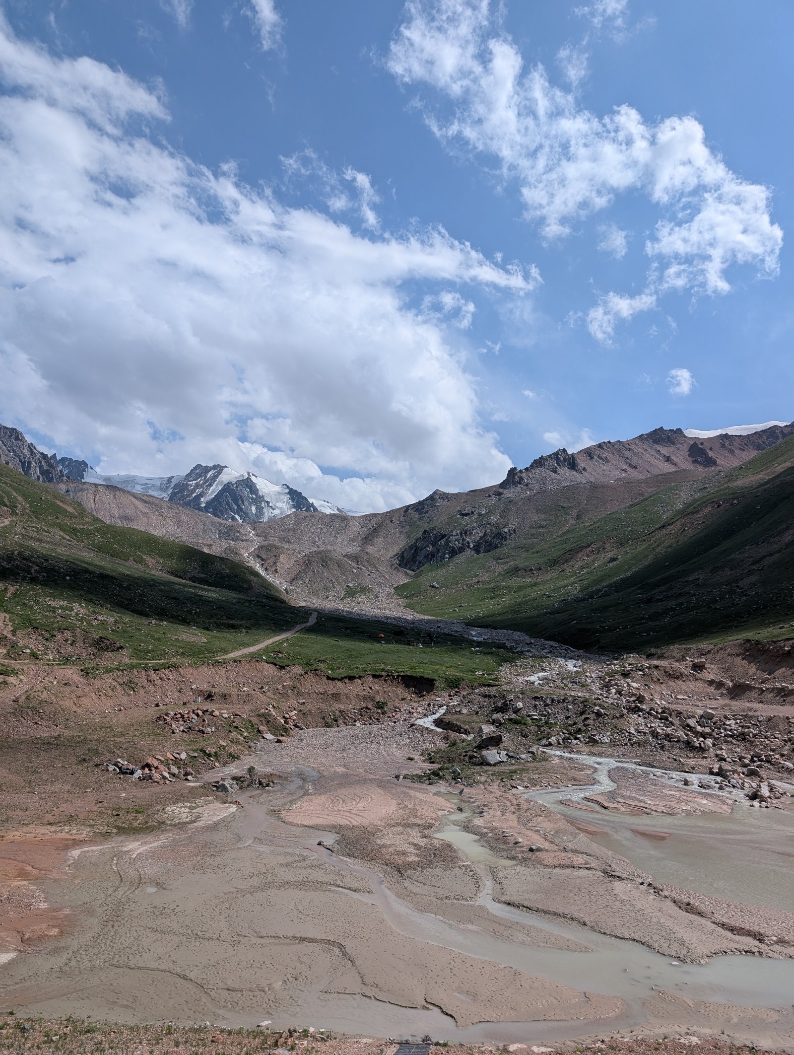
At the plateau itself, you find the Mynzhylki hydrometeorological station — operating continuously since 1936, the oldest in Central Asia. Next to it stands the Mynzhylki dam: 300 metres long and 17 metres high, built for mudflow protection. The dam blocks the Malaya Almatinka, and the resulting reservoir serves as both a scientific instrument and a barrier against the debris flows that periodically threaten Almaty below.
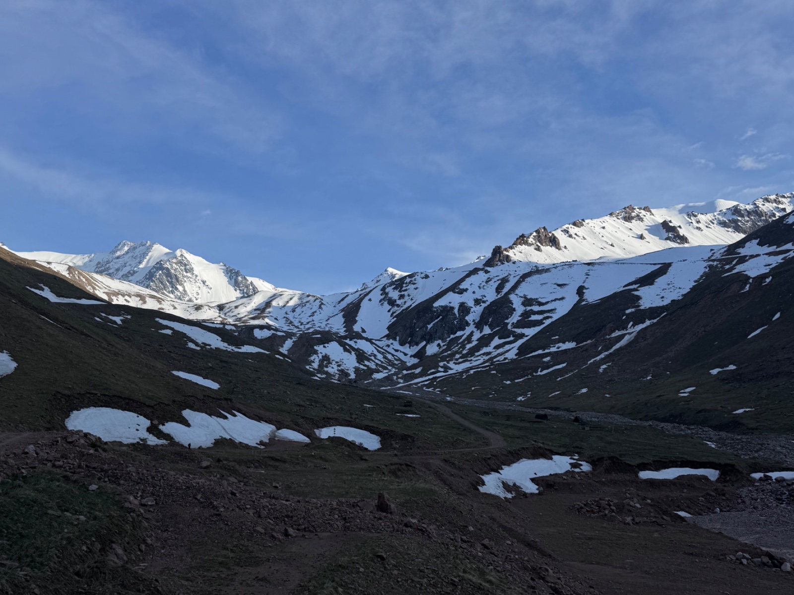
The views from the plateau are the payoff. To the south, a panorama of glaciated four-thousanders: Almaty Peak (4,376 m, formerly Komsomol Peak), Abay Peak (4,010 m, a three-headed red granite mountain that was reportedly single-headed before the 1911 earthquake), Pogrebetsky Peak (4,231 m), and the Tuyuksu glacier system hanging from the main ridge. To the west, the Kumbel spur with peaks Lokomotiv, Kosmodemyanskaya, Molodezhnaya, and Titova. The average annual temperature here is -2.7°C. Snow covers the ground 237 days per year.
Detailed itinerary
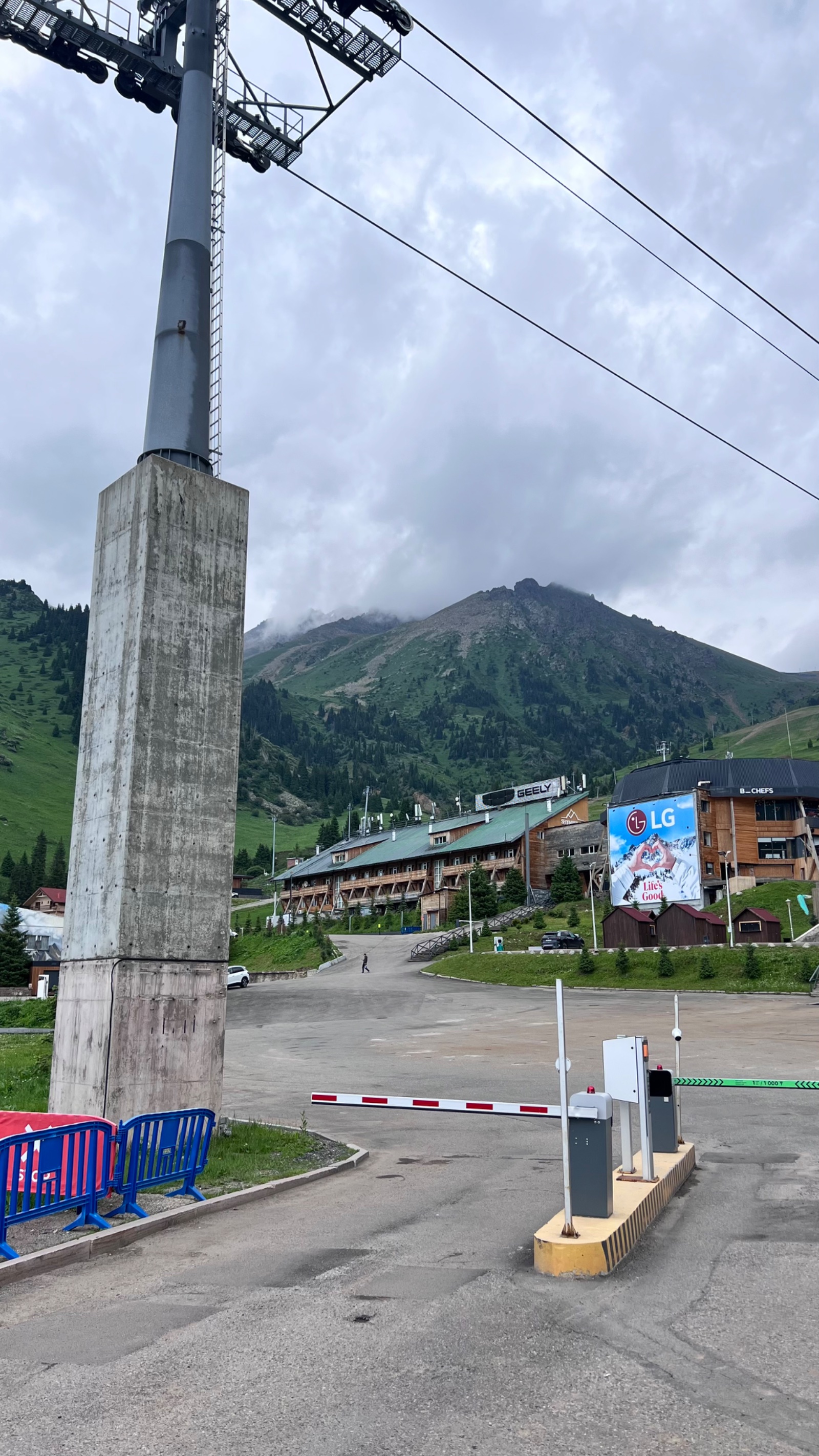
Getting to Shymbulak (1–1.5 hours from hotel)
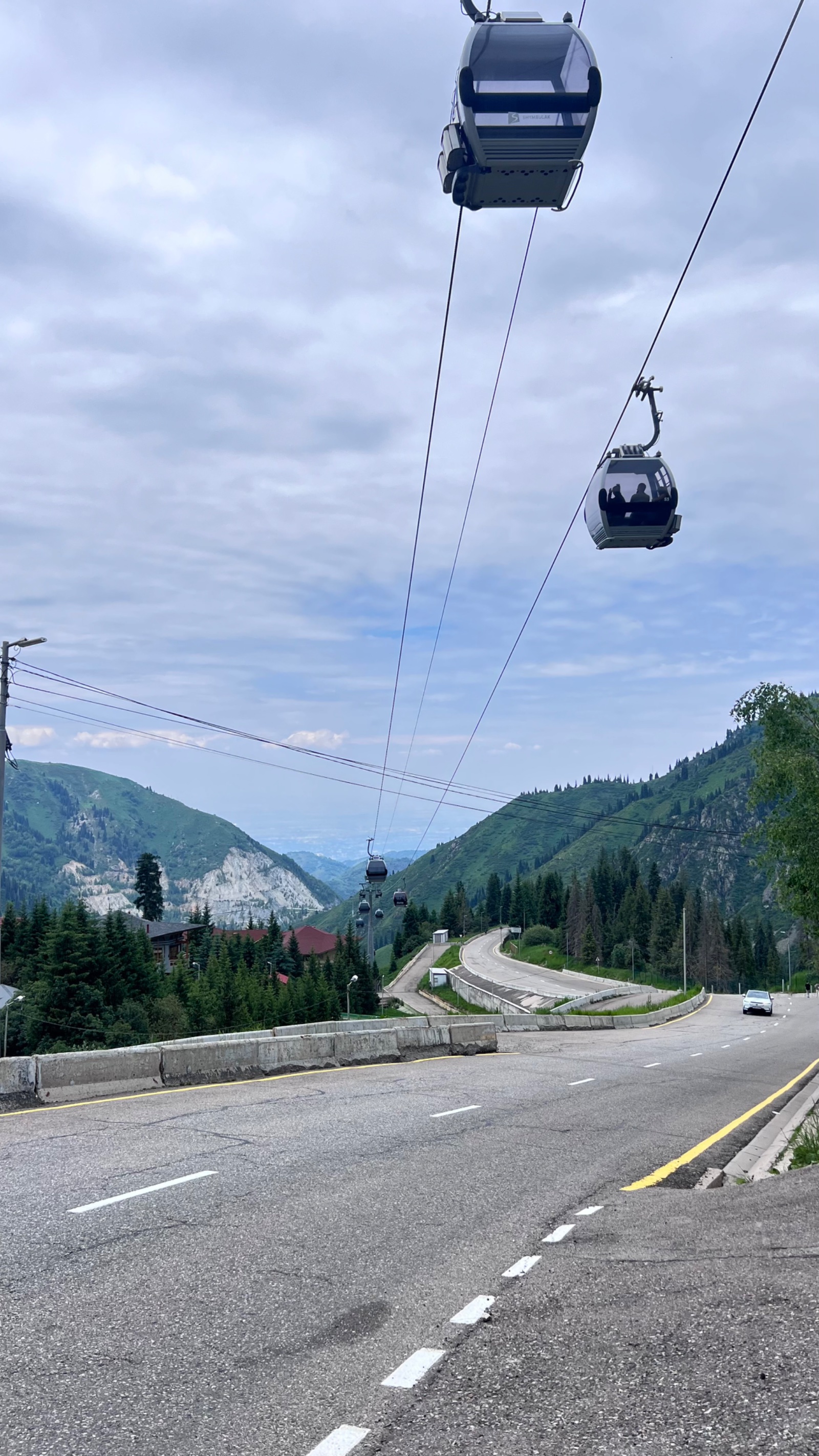
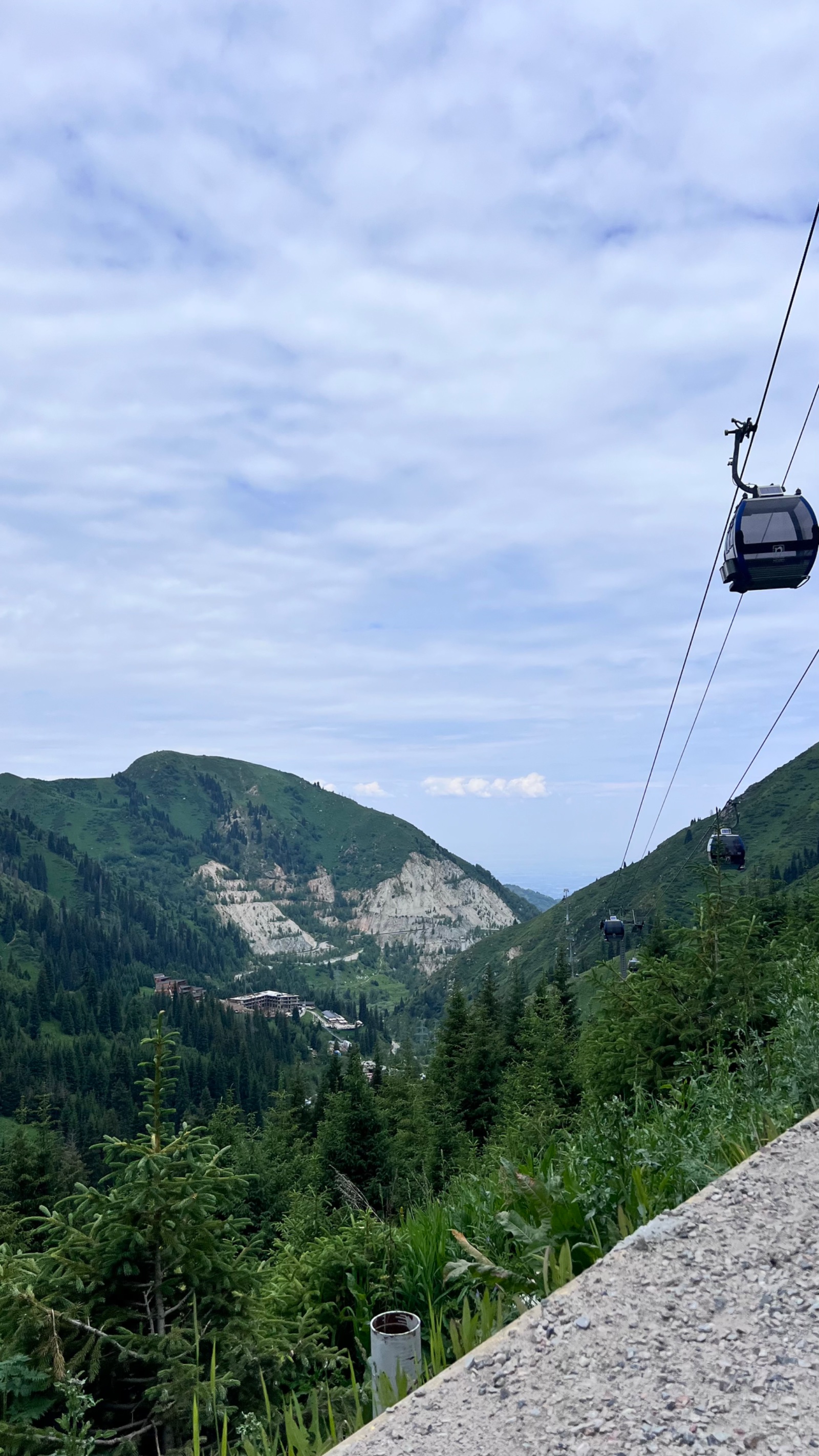
We pick you up from your Almaty hotel at 7:00–8:00 AM and drive to Medeo (1,691 m). From Medeo, we take the cable car or eco-bus to Shymbulak ski resort (2,270 m). This shortcut saves roughly 500 m of elevation and 2 hours of road walking, leaving more energy for the alpine section.
Alternatively, for fit hikers who want the full experience: walk from Medeo up the 848 steps of the “Health Staircase” to the top of the mudflow dam, then follow the asphalt road 6 km to Shymbulak. This adds 2 hours and 500 m of gain but is a rewarding warm-up.
Shymbulak to Tuyuksu Gate (1–1.5 hours)
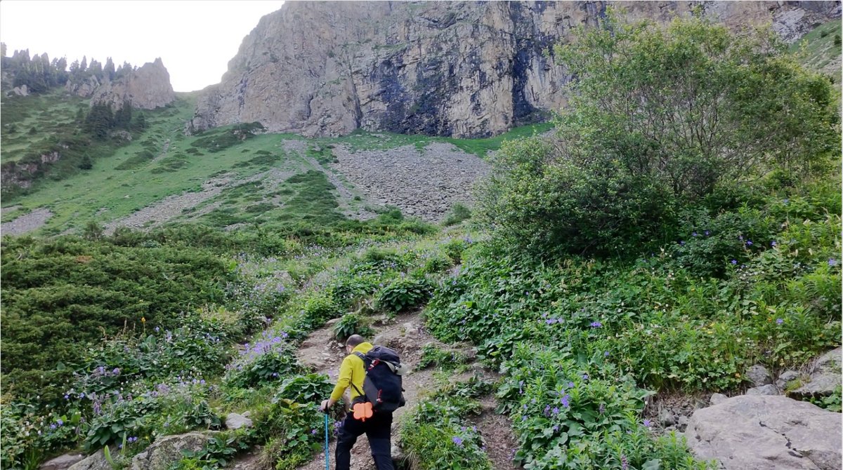
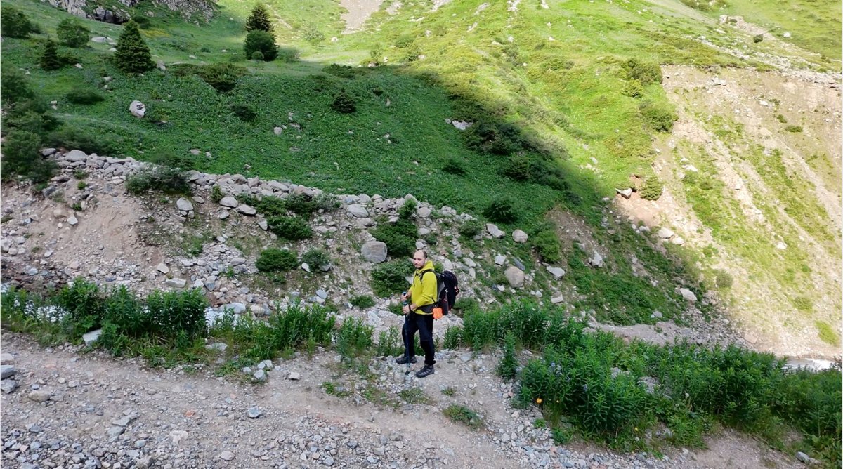
From the ski resort, we follow the dirt road south up the gorge. The asphalt ends after 400 metres and the path becomes a mountain track. After 800 m we pass the Tuyuksu Gate Hotel (currently closed), the hydropost, the Tuyuksu mountaineering camp, and the Memorial to Mountain Victims.
This section is rich in mountaineering history. The Small Almaty Gorge has been the training ground for Kazakhstan’s climbing community since the 1930s. Your guide provides context about the memorial — the names on the stone include climbers who fell on peaks visible from this very spot.
Then come the Bastions — the towering 240-metre granite walls that line both sides of the gorge. If you’re lucky, you’ll spot climbers working routes on the face. The scale is hard to convey in photos; standing at the base of these walls, craning your neck to see the top, is the moment most hikers realise this gorge is something special.
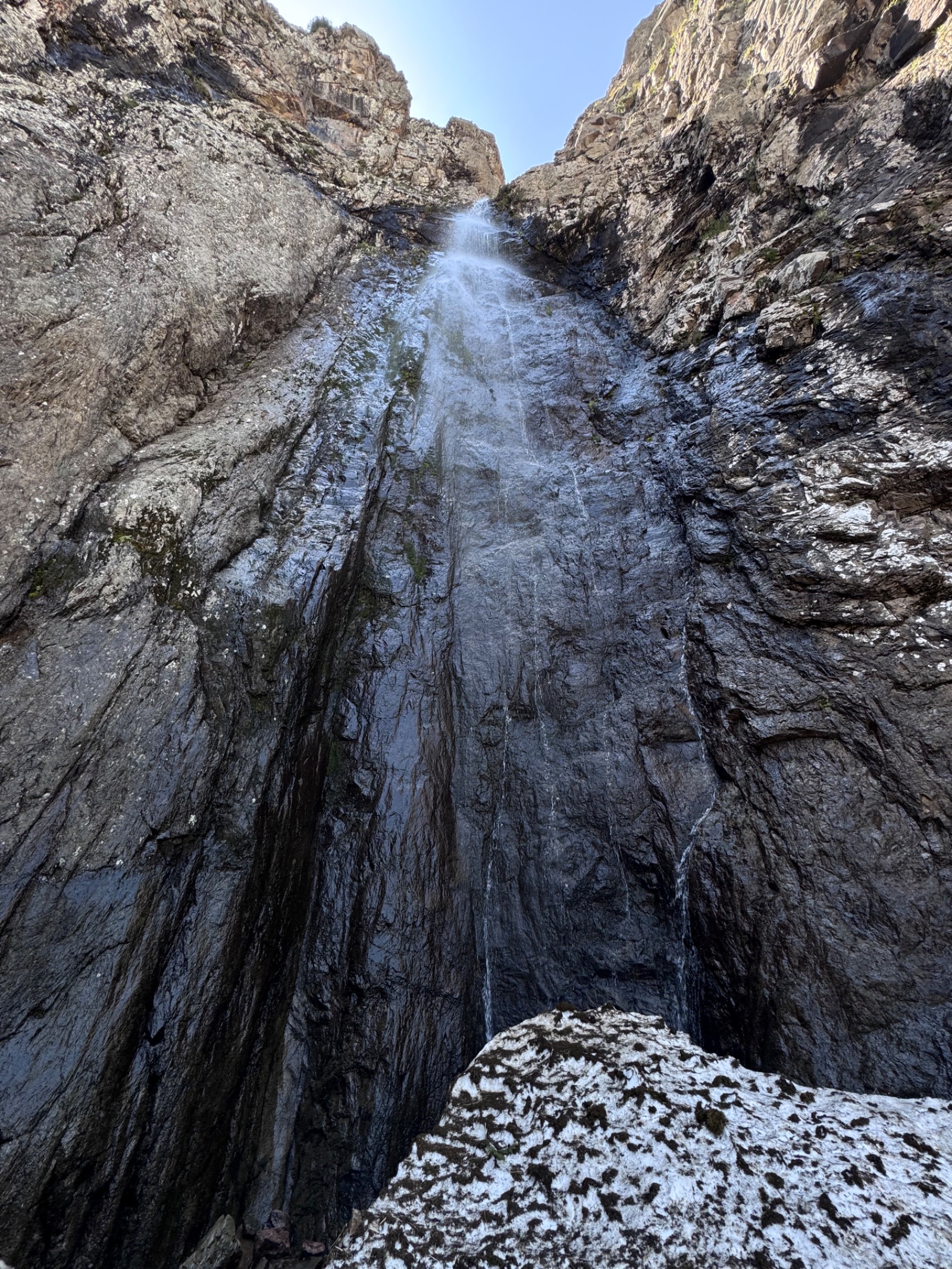
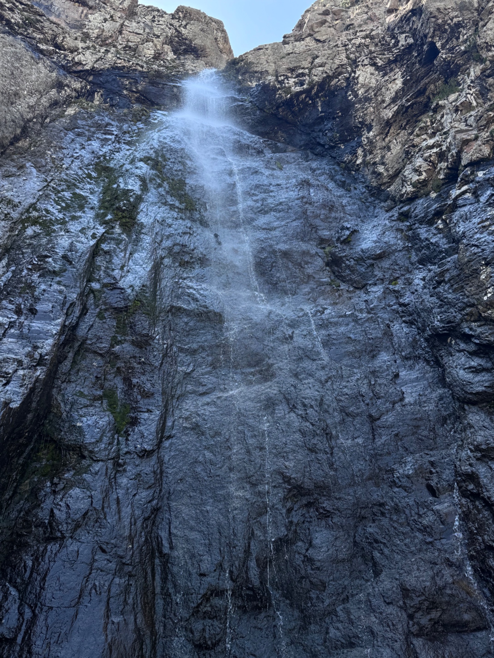
Tuyuksu Gate itself is unmistakable: the gorge pinches to its narrowest point, with vertical rock on both sides. The eastern rock is a spur of Abay Peak (4,010 m) with subordinate summits Oktyabryonok (3,450 m) and Maria (3,750 m). Wind accelerates through the gap — keep your hat secure. Nearby, the Karabulak waterfall cascades down the rock face.
Tuyuksu Gate to Mynzhylki Plateau (1–1.5 hours)
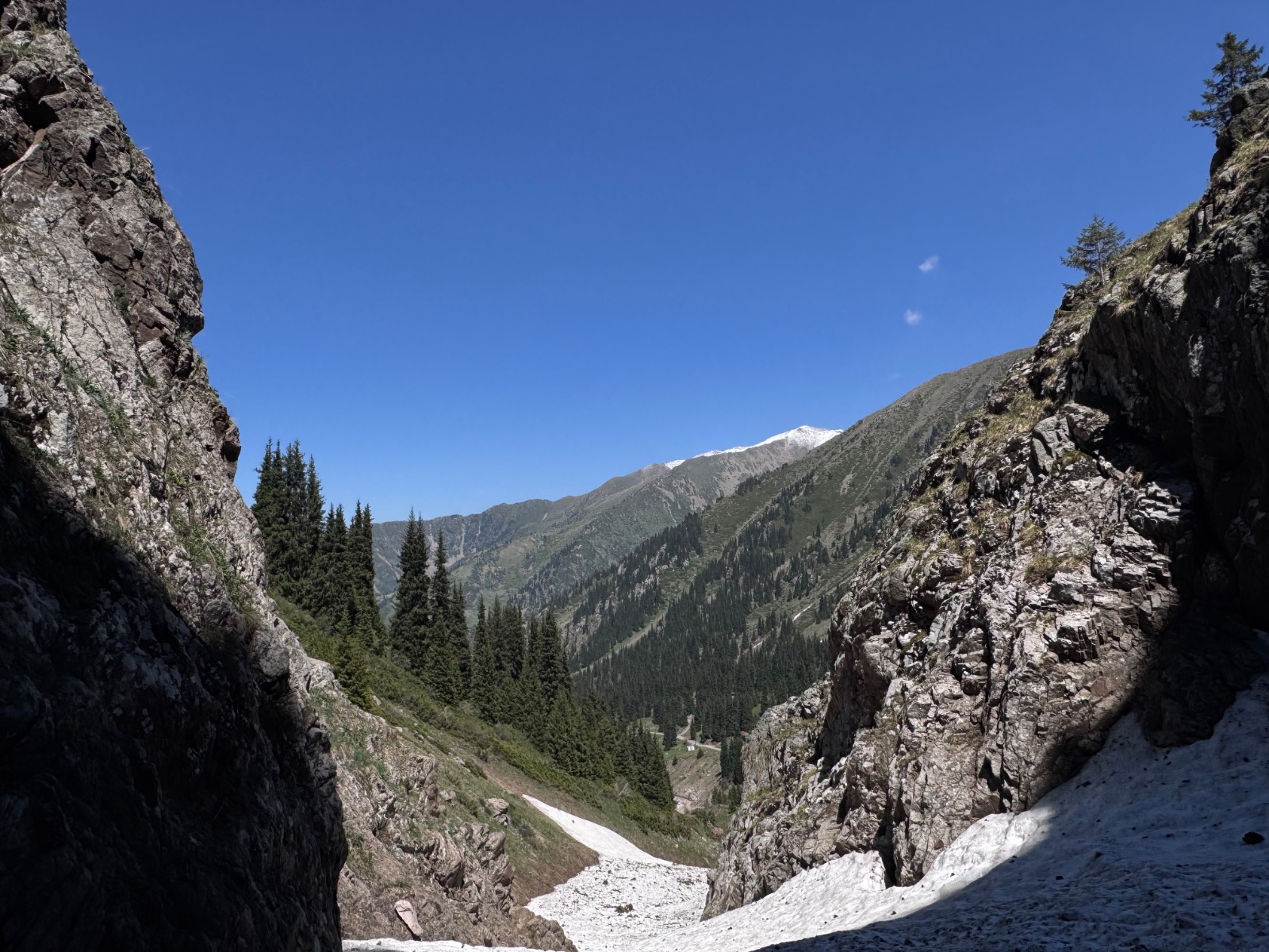
Beyond the gate, the gorge opens dramatically. The trail continues along the river, now strewn with stones of various sizes. Vegetation thins — you’ve crossed above treeline. The landscape becomes increasingly high-alpine: bare rock, glacial debris, sparse grass, and the ever-present sound of running water.
The Mynzhylki dam appears at 3,030 m — a 300-metre-long concrete wall holding back the river. Next to it, the squat buildings of the meteorological station sit where scientists have recorded weather data since 1936. This is the oldest continuously operating high-altitude weather station in Central Asia.
We rest here, have a hot drink, and take in the panorama. The plateau itself is a wide, flat valley — you can see why “a thousand mares” once grazed here. In every direction except north (where you came from), glaciated peaks fill the skyline.
Optional extension: Alpengrad and Lake Manshuk Mametova
For strong hikers wanting more, the hike can continue beyond the plateau:
Alpengrad (3,450 m, +1–1.5 hours from dam): A spacious flat area at the foot of Manshuk Mametova and Antikainen peaks. This is where mountaineers set up base camps for ascents of the surrounding peaks. The trail from the dam to Alpengrad is the steepest section of the entire route — the most demanding part physically and the section most likely to trigger altitude symptoms. Your guide monitors the group carefully through this section.
Lake Manshuk Mametova / Lake No. 6 (3,500 m, +30 min from Alpengrad): A moraine-dammed lake 280 m long, 140 m wide, and 21 m deep, formed by melt from the Manshuk glacier. The turquoise-green water sits in a dramatic cirque of rock and ice. A pipe drains excess water to prevent the lake level rising and creating mudflow risk — a reminder that these mountains are actively managed.
The lake is named after Manshuk Mametova (1922–1943), a Kazakh machine gunner who became the first Soviet Asian woman to receive the title Hero of the Soviet Union, awarded posthumously after she died defending her position at Nevel during World War II. A peak and a pass nearby also carry her name.
Adding Alpengrad and the lake extends the day significantly: total hiking time becomes 10–12 hours, distance 17–18 km, elevation gain ~1,450 m. This is a hard day hike — the difficulty jumps from 3/5 to 4/5.
Descent and return (2–3 hours)
The return follows the same trail downhill to Shymbulak. Cable car or eco-bus back to Medeo, then drive to Almaty. Return to hotel by late afternoon (Mynzhylki only) or early evening (with Alpengrad/lake extension).
Why book this guided Mynzhylki hike?
Altitude management: At 3,000 m, altitude sickness is a real possibility for visitors coming directly from Almaty (800 m). Symptoms include headache, nausea, and weakness. Your guide monitors the group, sets an appropriate pace, enforces rest stops, and makes the call on whether to continue to Alpengrad or turn back at the dam. This judgment is the most important service a guide provides on this route.
Mountaineering history and context: The landmarks along the way — the memorial, the mountaineering camp, the Bastions, the meteorological station — are rich with stories that transform a walk into an experience. Without a guide, you walk past these spots without understanding their significance.
Navigation beyond Mynzhylki: The trail from the dam to Alpengrad and Lake Manshuk Mametova is less defined, crosses glacial terrain, and requires altitude awareness. A guide who knows the route and the mountain’s weather patterns is essential for the extension.
When to visit Mynzhylki
June–September: Standard hiking season. Snow clears from the trail to the dam by mid-June in most years. July–August are warmest but afternoon thunderstorms are common — start early. September offers the best visibility and the most dramatic light on the peaks.
October: Early snow possible. The trail to the dam may still be passable, but Alpengrad is likely snow-covered. Shorter days tighten the timing.
November–May: Winter conditions. The route is done as a winter hike or snowshoe, but the Tuyuksu Gate section can be avalanche-prone. Only with proper winter equipment and experienced guides. TripAdvisor lists a “Winter Hiking to Mynzhylki Plateau” tour — confirming it’s offered year-round by some operators.
Remember: Average annual temperature at 3,000 m is -2.7°C. Even in July, morning temperatures can be near freezing. Bring warm layers regardless of season.
Frequently asked questions
How hard is the Mynzhylki hike? The trail itself is not steep — it follows a dirt road up a gradual gorge. The difficulty (rated 3/5) comes from altitude: you reach 3,000 m, where thin air affects people differently. If you’ve hiked Kok-Zhailau (2,240 m) or Furmanov (3,053 m) comfortably, Mynzhylki should be within your ability. The Alpengrad/Lake extension (4/5) adds genuinely steep terrain and pushes to 3,500 m.
What does “Mynzhylki” mean? “A thousand mares” in Kazakh — indicating a plateau large enough to graze a herd of a thousand horses. The wide, flat valley at 3,000 m is the namesake landscape.
What is the Tuyuksu Gate? The narrowest point of the Small Almaty Gorge at roughly 2,500–2,700 m, where massive vertical rocks on both sides create a natural “gate.” Wind channels through with impressive force. The eastern rock is a spur of Abay Peak (4,010 m). The mountaineering camp and memorial are located here, making it both geologically dramatic and historically significant.
What are the Bastions? Granite cliff walls up to 240 metres high lining the gorge below the Tuyuksu Gate. Your existing page aptly calls them “Almaty’s Yosemite.” Professional rock climbers train on these faces. They’re one of the most visually striking features of the Small Almaty Gorge and are underappreciated by most hiking-focused visitors.
What is the meteorological station? The Mynzhylki hydrometeorological station has operated continuously since 1936 — the oldest high-altitude weather station in Central Asia. It records temperature, precipitation, snow depth, and glaciological data. Scientists stationed here year-round maintain the equipment and provide temporary shelter for climbers and hikers. The average annual temperature at the station is -2.7°C.
Who was Manshuk Mametova? Manshuk Mametova (1922–1943) was a Kazakh machine gunner who became the first Soviet Asian woman to receive the Hero of the Soviet Union title, awarded posthumously. She died defending her position near Nevel in the Pskov region. Lake No. 6, a nearby peak, and a pass in the Zailiyskiy Alatau all carry her name.
Can I see the Tuyuksu glacier from Mynzhylki? From the dam, you can see the Tuyuksu glacier cirque and surrounding peaks. To reach the glacier’s base, you need to continue past the dam to the T-1 glaciological station (3,400 m) — roughly an additional hour. This extension offers close-up views of the ice and the moraine lake beneath Molodezhniy Peak.
Is the cable car always running? The Medeo–Shymbulak cable car operates year-round but hours vary by season. Check schedules before your trip — the last descent car limits your return time. Eco-buses provide an alternative when the cable car is closed for maintenance.
Can I camp at Mynzhylki? Yes — the plateau is a traditional camping spot for mountaineers heading to higher peaks. Flat ground and water access near the dam. Temperatures drop well below freezing at night even in summer, so bring a proper sleeping bag (comfort rating 0°C to -5°C minimum).
How does this compare to Big Almaty Peak? Both reach above 3,000 m, but the experiences are completely different. Big Almaty Peak (3,682 m) is a summit hike — steep, exposed, and focused on reaching a single point. Mynzhylki is a valley/plateau hike — gradual, scenic throughout, and focused on the journey through the gorge landmarks (Bastions, Tuyuksu Gate, meteorological station). Mynzhylki is the better choice for first-time high-altitude hikers; Big Almaty Peak is for those who want summit achievement.
Itinerary
Detailed itinerary will be provided upon booking. Our typical tour includes daily hikes through diverse terrains and cultural experiences.
Pricing
| Group Size | 1 person | 2 people | 3 people | 4 people | 5 people | 6 people Best value |
|---|---|---|---|---|---|---|
| Standard | $142 $142 total | $100 $200 total | $86 $258 total | $79 $316 total | $74 $370 total | $72 $432 total |
100% private tour — prices are per person based on group size. The more friends you bring, the less everyone pays!
What's Included
Included
Not Included
Our Guarantee
If weather forces a cancellation, you choose a free reschedule or a full refund. If you're not satisfied with your experience, we'll work with you to make it right. No questions, no hassle.
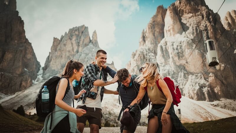
Private tours only (max 6) · Reschedule or full refund if weather cancels · No payment until confirmed
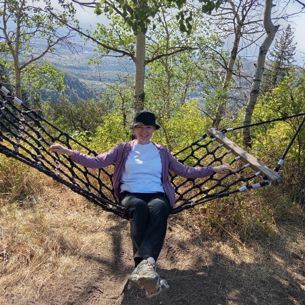
Traveler Stories
Sarah K.
Our guide was incredible - he adjusted the pace perfectly for our group and knew exactly where to stop for the best photos. The whole experience felt effortless, like everything was taken care of before we even thought to ask.
Marco T.
We were a group of 4 friends and the per-person price made it a no-brainer. Private 4x4, lunch included, and the canyon was breathtaking. Way better than the big bus tours we saw there.
Anna W.
Solo traveler here. I was nervous about hiking alone in a foreign country but the guide made me feel completely safe. The trail to Kok-Zhailau was beautiful and the photos he took of me were amazing. Only wish the hike was longer!
David R.
Third time booking with these guys. Butakovka, Big Almaty Lake, and now Titov Peak. Every single time the service is flawless. The fact that it's always private and max 6 people makes such a difference compared to other operators.
Share Your Experience


19+ hikers
completed this trail
Tour At A Glance
Book This Tour
Private tours run any day of the week — weekends fill up fastest, so book early
Pay securely after confirmation


Weather Forecast
light rain
H: 10°C
L: 5°C
Mon, Jul 27
clear sky
8°C
4° / 13°
Tue, Jul 28
clear sky
7°C
3° / 11°
Wed, Jul 29
clear sky
8°C
4° / 13°
Tour Location
Similar trails
From $72
per person · weather refund
Complete Your Booking
Tour:
Date:
Participants
Add-ons
You're Almost There!
We'll contact you within 24 hours to confirm your spot and share everything you need to prepare for your adventure.
Request sent
We confirm your spot
within 24 hours
Summoning perfect weather
Hit the trail
On the channel
83 h
Drone flight hours
What we’ve filmed
59
Hikes filmed
704 km
Kilometers covered
44,439 m
Elevation gained
27
Countries visited
Plan your hike with us
A few quick questions and we will email you a tailored hike plan & quote.
When do you want to hike?
What's your experience?
How many of you?
Where do we send your plan?
Private guided hikes · no obligation.