Manshuk Mametova lake: how to get there, route, Mynzhylki
From $70 per person


Overview
Is this hike right for you?
Perfect if you…
Good to know
Description
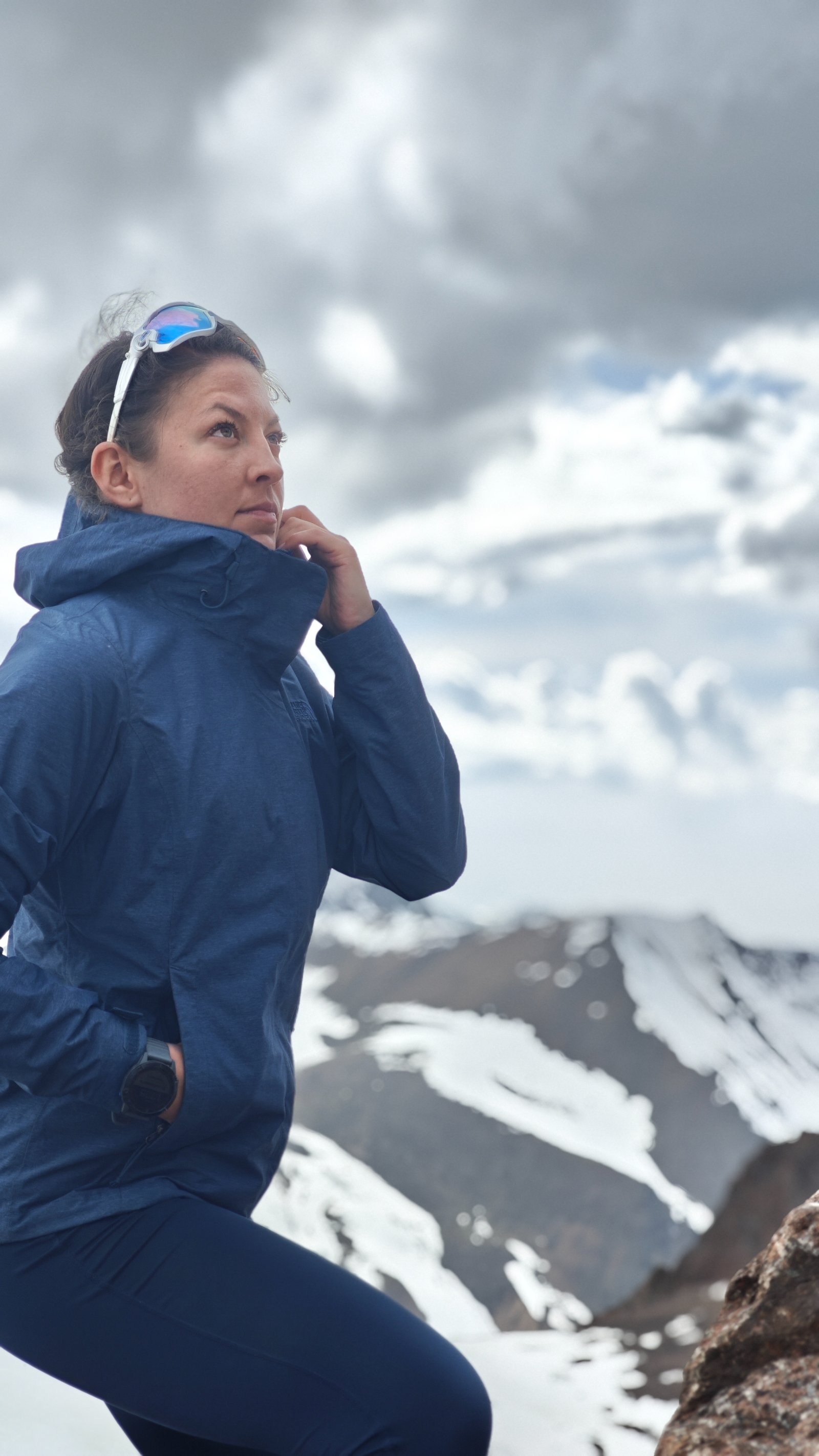
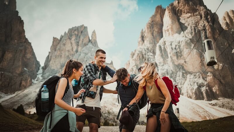
Today we are hiking to one of the most beautiful destinations in Almaty mountains – Manshuk Mametova lake.
📹 Manshuk Mametova lake video
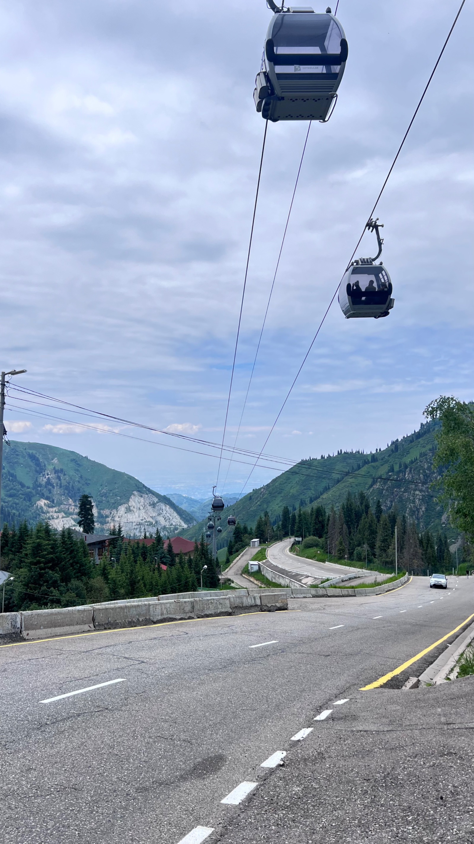
🥾 How to get there
And you only need to get to the high-altitude skating rink “Medeo” and you can do it in different ways. We know 5!
- Public transport – we take the bus number 12 and reach the stop near the beginning of the cable car. It will cost 150 tenge per person. Well, if you have an Onay card, then the cost is reduced to 80 Kazakhstani tenge.
- Taxi – the average cost of a ride from the city to the point of disembarkation on “Medeo” is 2500 tenge.
- Personal transport is quite simple here. It costs 500 tenge to put an iron horse in the stall of the Medeo parking lot. Don’t lose your receipts!
- “Hitchhiking groups” – are becoming popular in social networks. So, in them you can find not only a “neighbor on the trail”, but also, in fact, a britzka, on which you can have fun getting to the collection point.
- On foot – is an amateur way.
⛳ Start
Well, then… The “X” day always starts the day before the publication.
- You should definitely check the weather forecast – not the one that everyone has on their phone, but the one that shows cyclones, thunderstorms and everything like that.
- Preparation of video equipment – charge all batteries, check memory cards, etc.
- Collecting provisions – everything should be clear here. If you take a lot , you will carry too much, if you do not understand it, it may come to a fight for a pie. We have enough 1.5-2 liters of water and 2-3 snacks per person .
- Clothing is always chosen according to the weather. But the weather in the mountains is changeable, so it’s better to take something light, but warm.
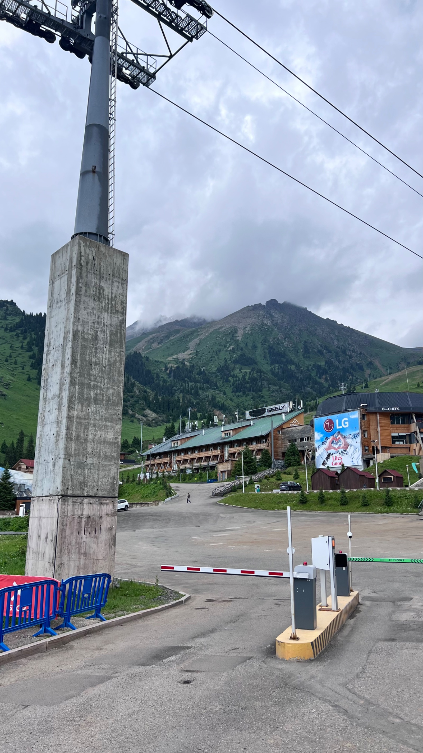
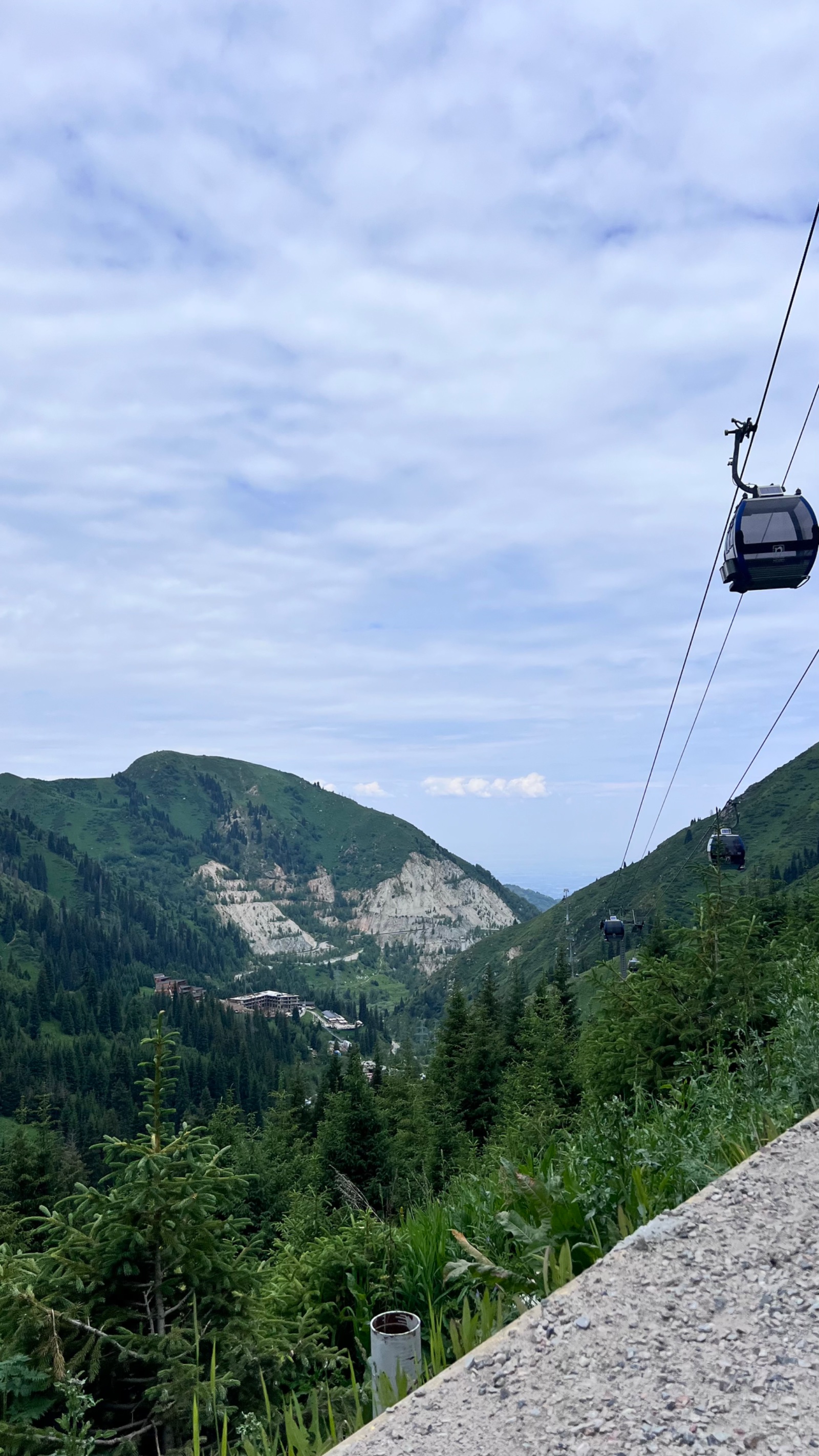
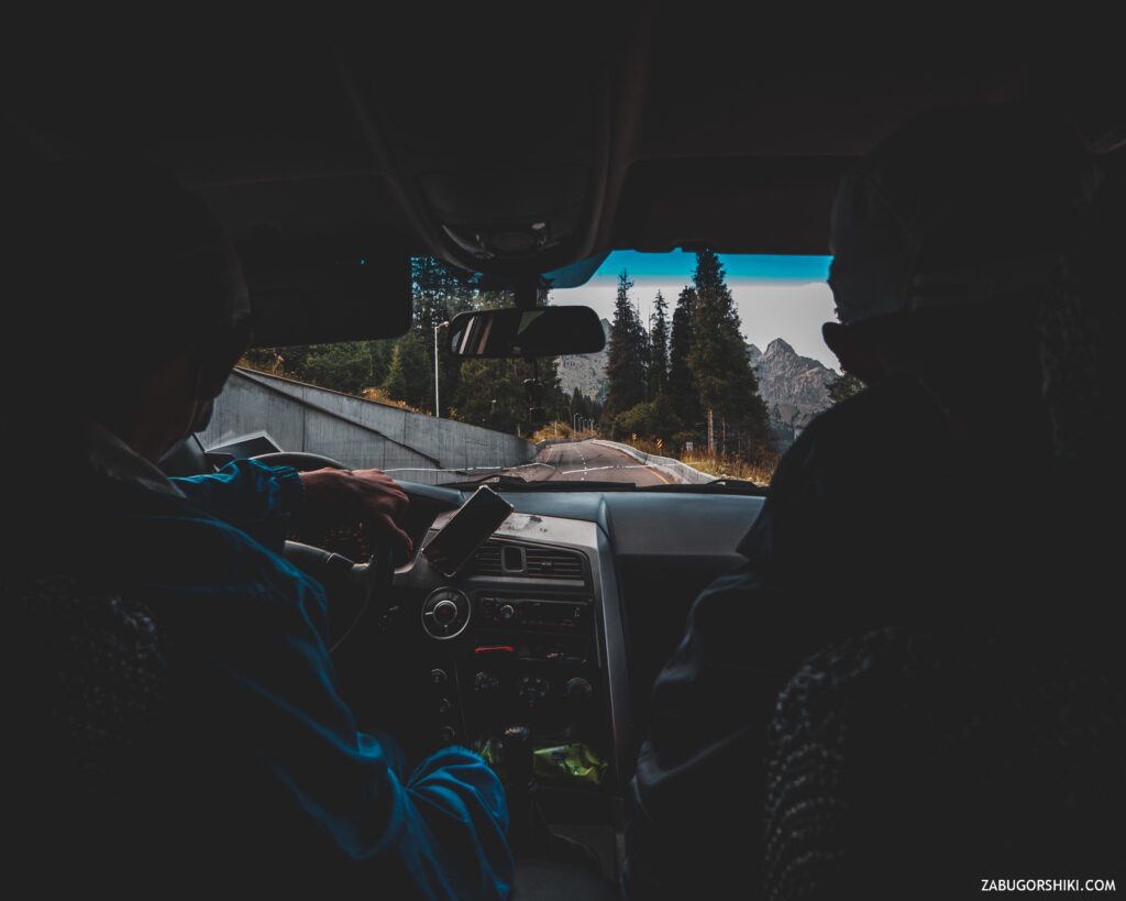
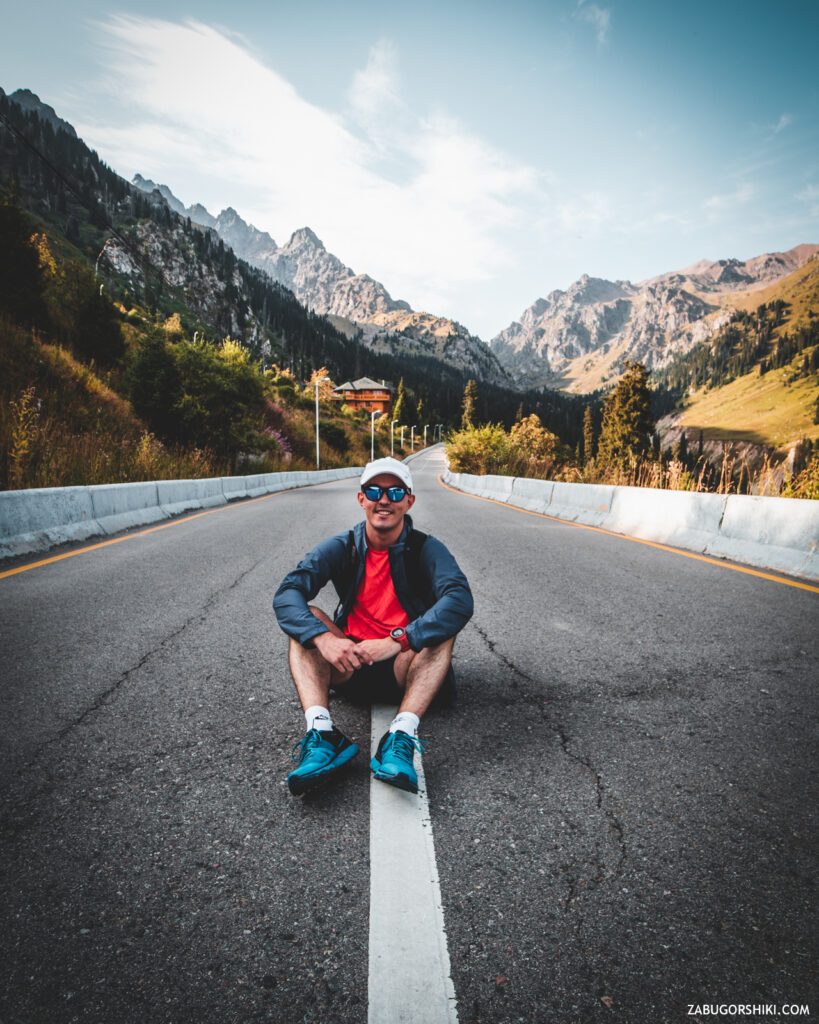
Get up early, have a light breakfast and GO AHEAD to meet the adventures! While we were driving on the “chariot of fire” to the portal on the Shymbulak, we discussed the route, the time of arrival at a particular point, the return descent and where it is best to launch the “bird-drone”. BUT! we forgot about point #5 – always check the accuracy of information, ANY INFORMATION! We assumed that the cable car starts working at 8: 00 (GMT+6), we are just in time for the beginning… it is not clear what start we have time for, since her work starts at 9: 00. Well, here’s one for you. Tense up! We remembered about the ” eco ” taxi. We passed a little above the parking lot, and they are right there. For 3000 tenge, it will carry with the breeze and even allow you to open the window. Let’s go!
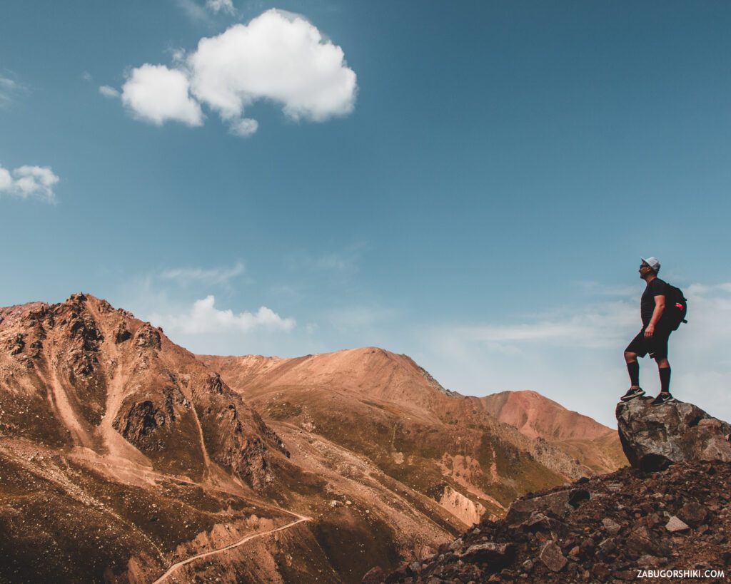
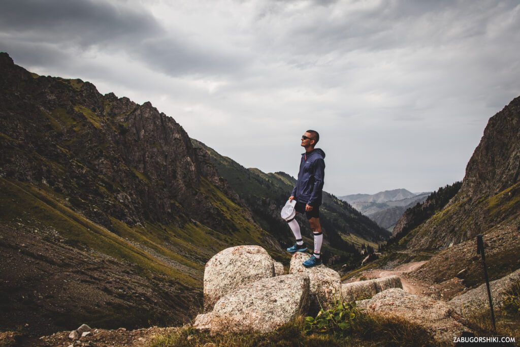
In 12 minutes, we flew to Shymbulak. In my memory, it has NEVER been so empty and deserted. The time is 8:25 am, the altitude is 2329 meters above sea level. IT’S TIME FOR ADVENTURE!
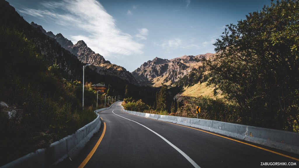
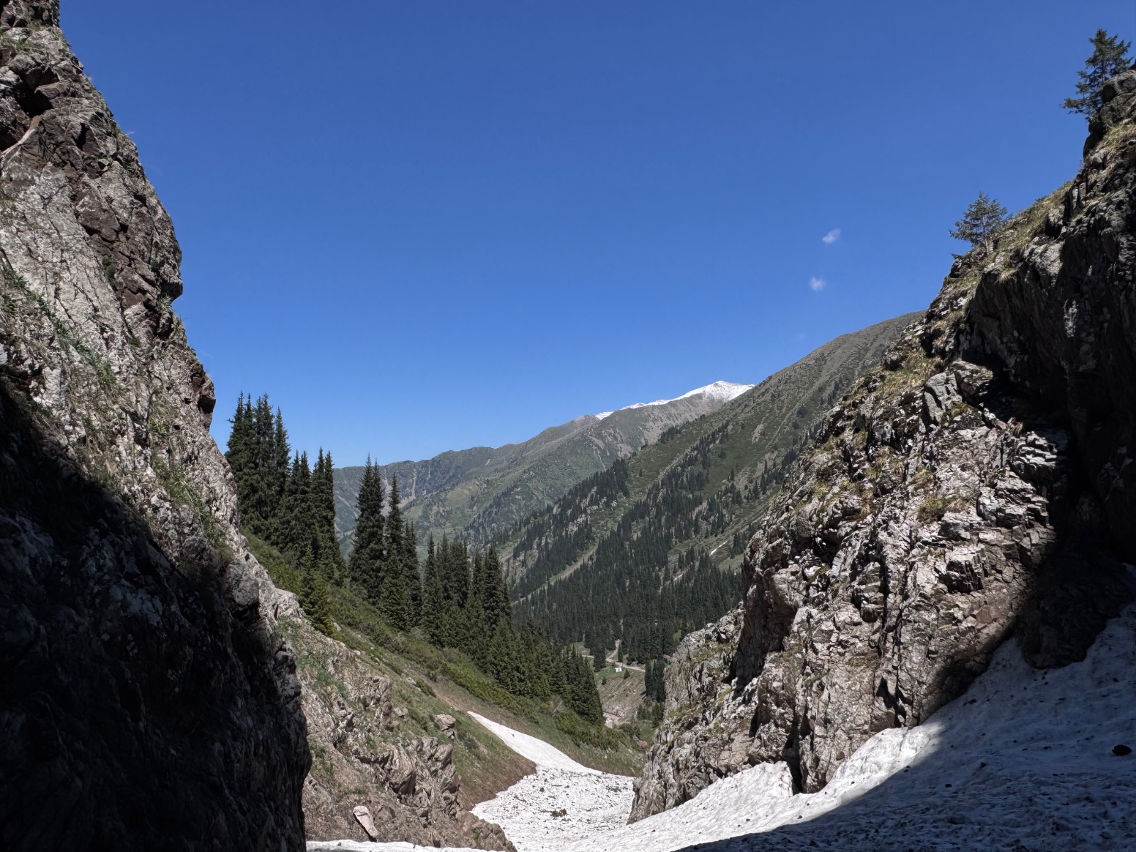
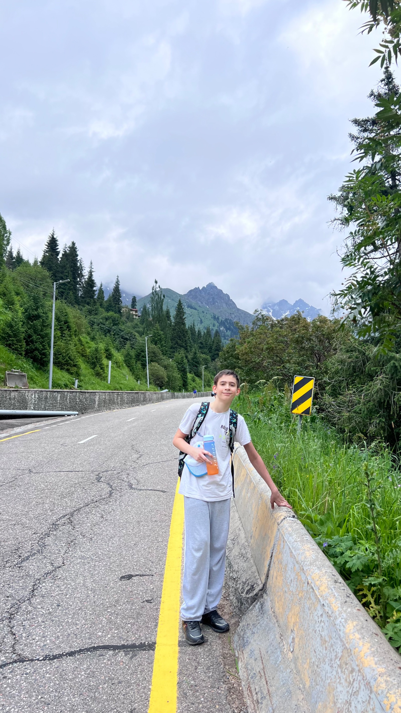
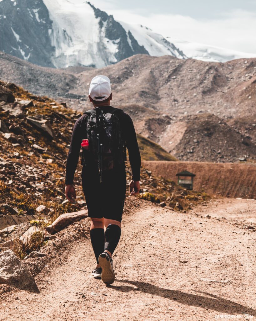
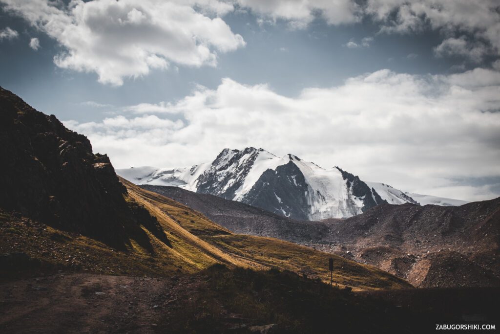
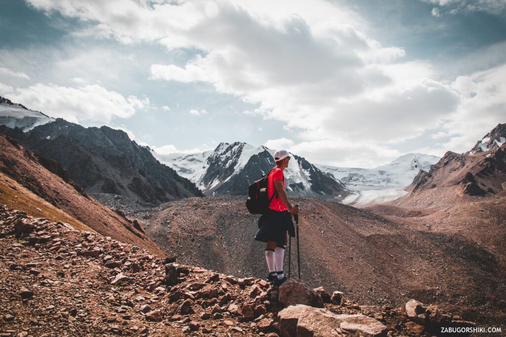
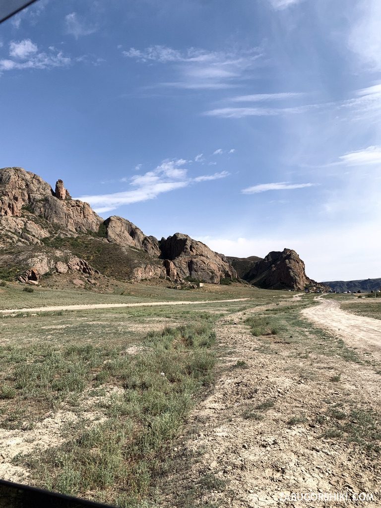
On the asphalt road we pass by beautiful wooden houses, leaving behind the ski resort, the city bustle and doubts about our own capabilities. It is especially fresh in the mountains in the early morning, and the air, which has not yet had time to soak up the city, is intoxicating at the first breaths. The barely started hike has already shown us the “Tuyuksu Gate” (mountains located on both sides of the trail), through which we need to pass. Let’s go get high! Beautiful!
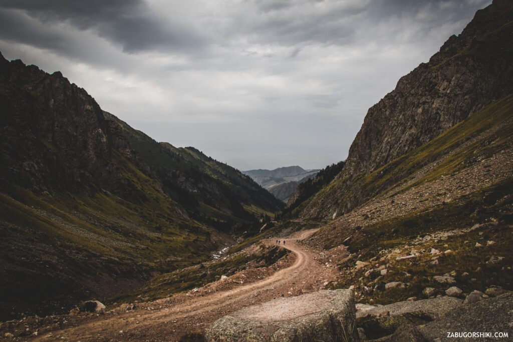
After 1.5 km, the asphalt ceases to accompany us. We go to the ground, stones, sand… everything is as we like it. Taking your eyes off the road surface and looking ahead, you can see the peak of Abai and the peak of Yoshkar ola. We smile and wave.
So far, the trail does not require much effort and this pleases. On the way, we pass through the Tuyuk-su alpine camp and the Khan-Tengri recreation center.
A little bit about the fact that “mountains do not forgive mistakes”. The mountains are a place with increased danger. And the memorial, which is impossible to pass and not notice, reminds us of this just before passing into beautiful, but also dangerous places. Be careful!
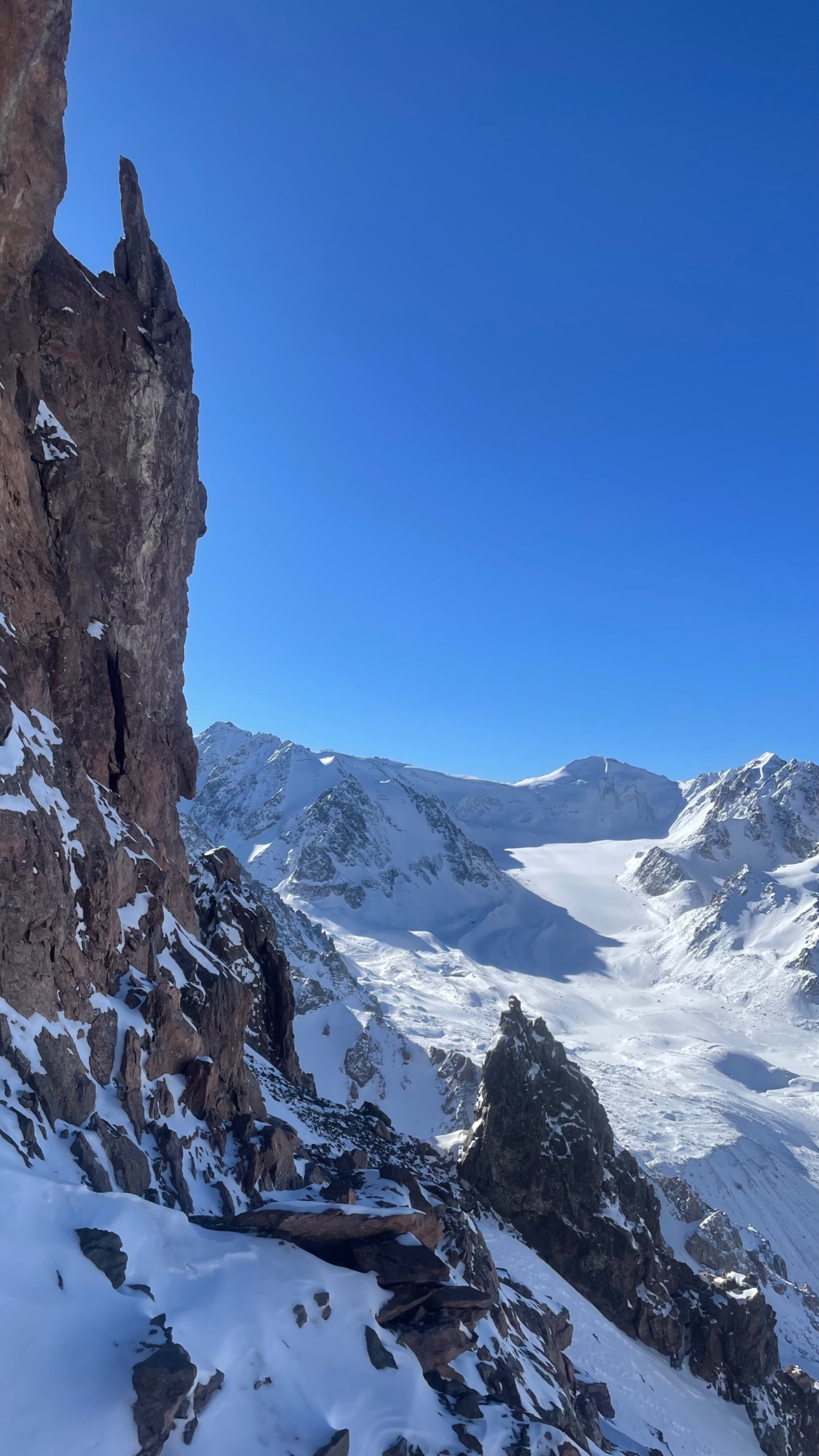
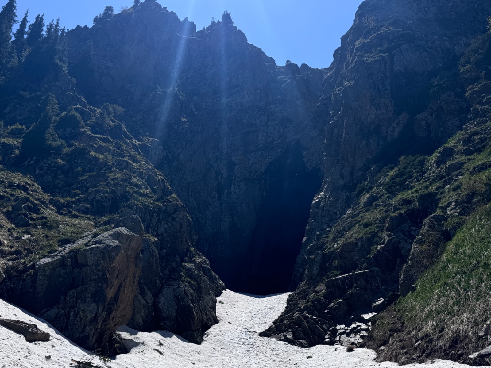
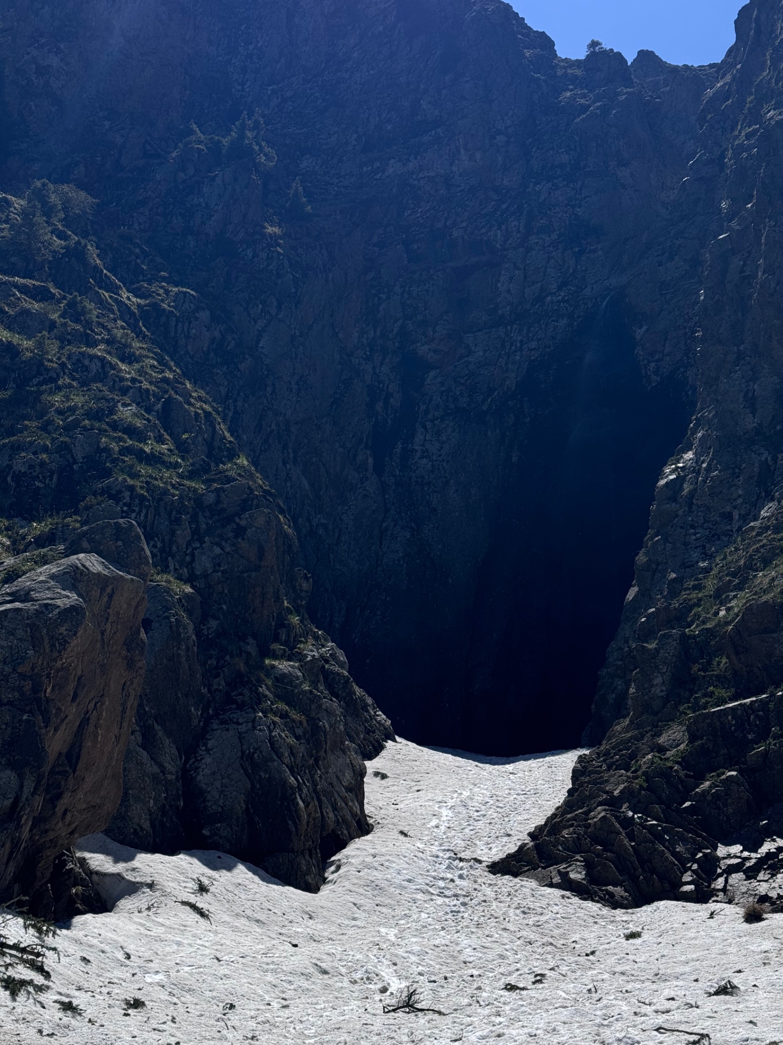
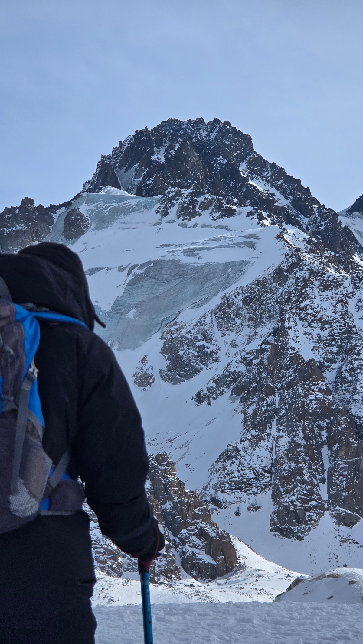
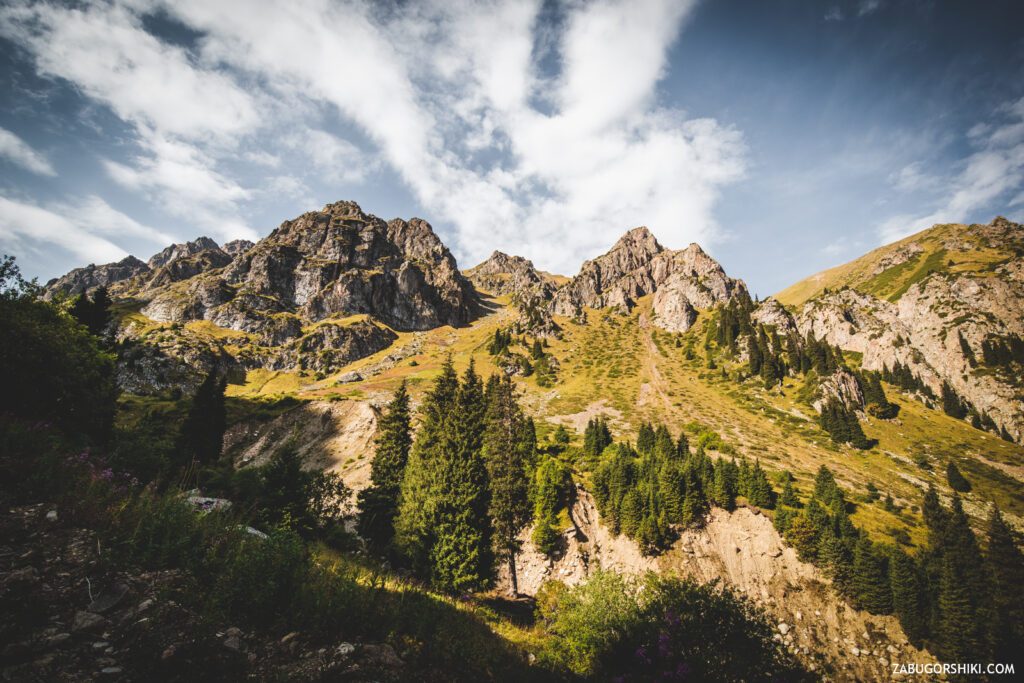
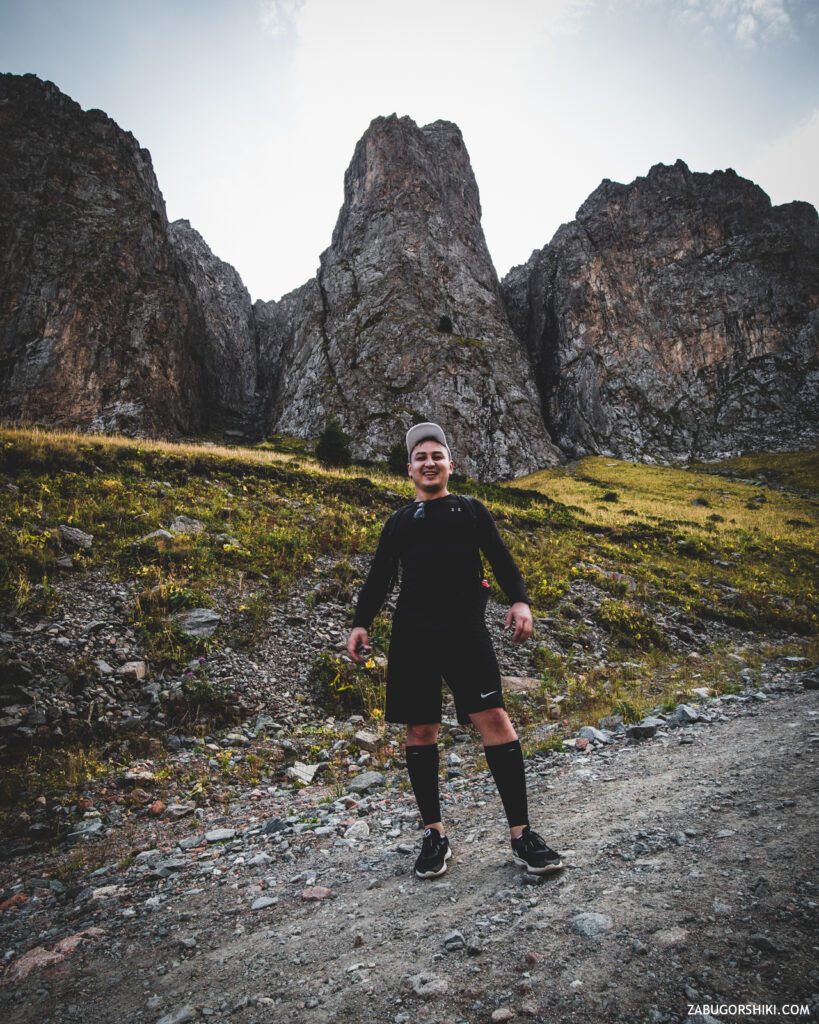
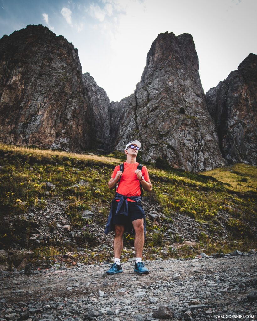
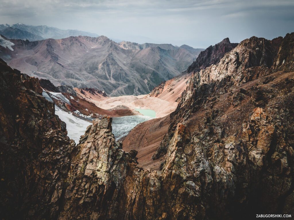
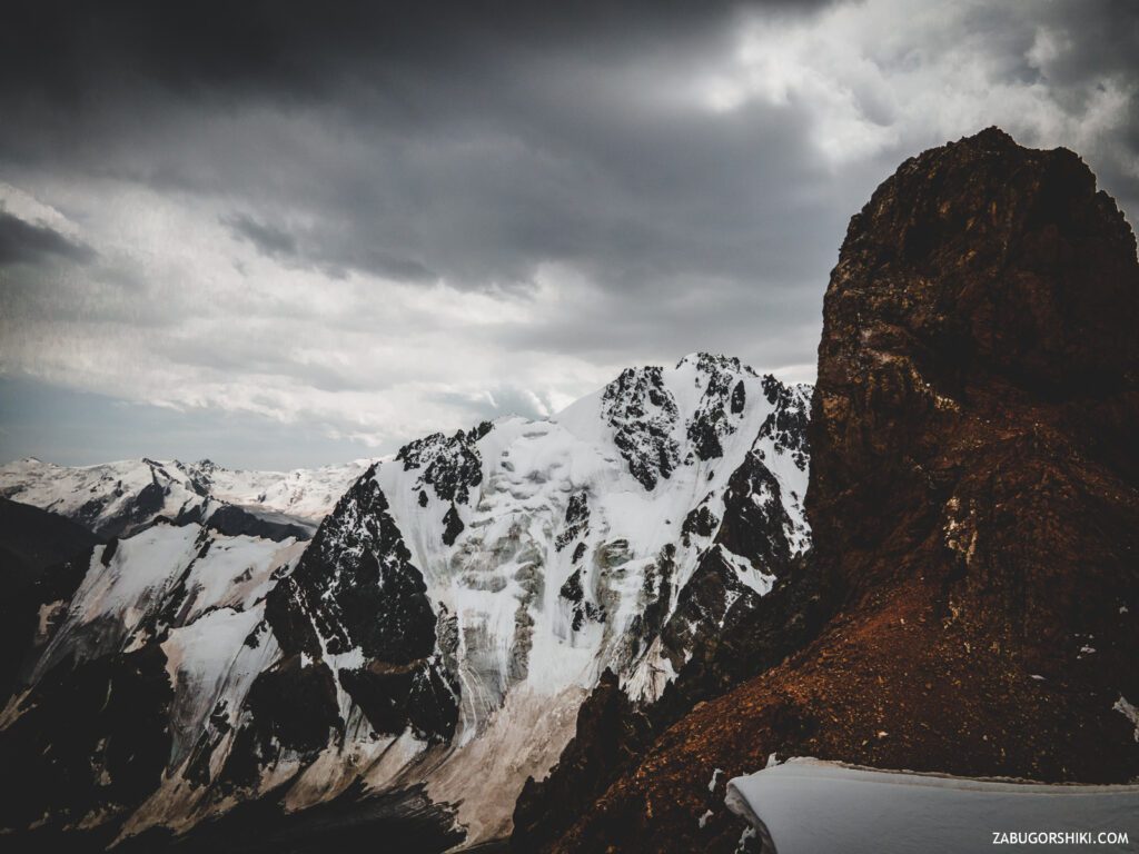
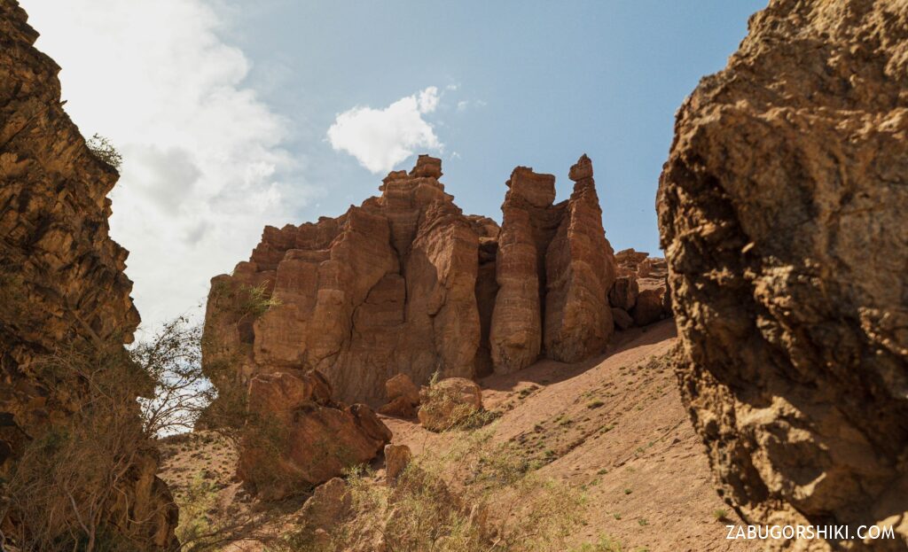
I would like to note that each gorge in our favorite city is beautiful in its own way. Here, too, there is something to admire, something to be surprised at. This hike can be noted as the most beautiful of all that we have passed. The passage to the “Tuyuksu Gate” is guarded by a Bastion, a huge and, at first glance, impregnable rock, divided into “right”, “central” and “left” Bastions. When we reach the “Gate”, we decide to stop and admire the scenery around.
During the 30-minute rest, we managed to have a snack and shoot incredible shots on the drone. We return the “bird” to the nest and continue to pick up the pace. By the way! About the pace of movement in the mountains. We walked quickly and the climb took place quickly(in 1 hour – 400 meters), so we were sometimes visited by dizziness. Where did you run to? What for? We are still surprised ourselves.
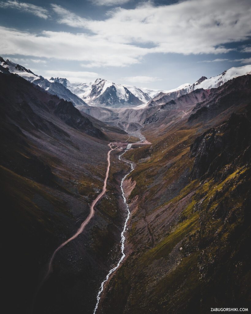
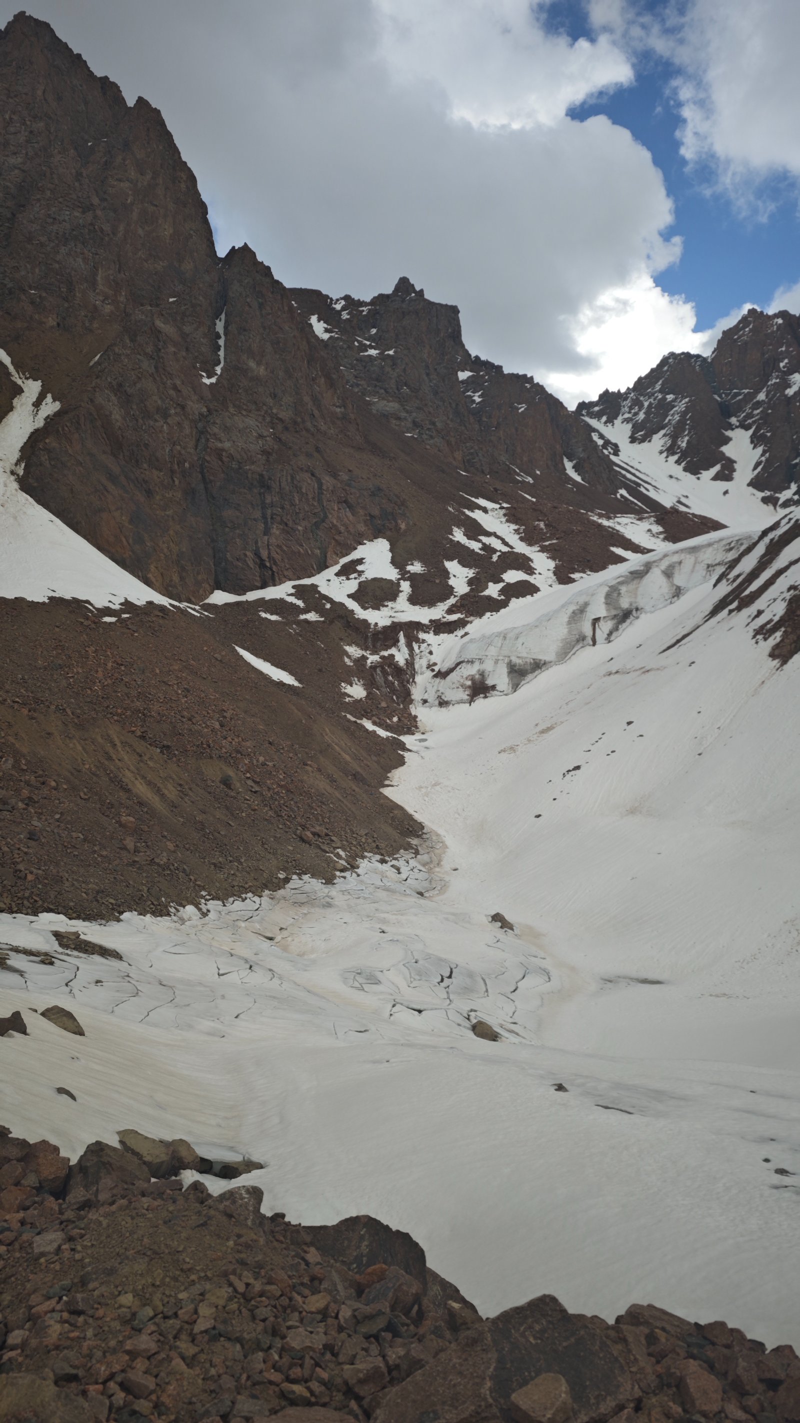
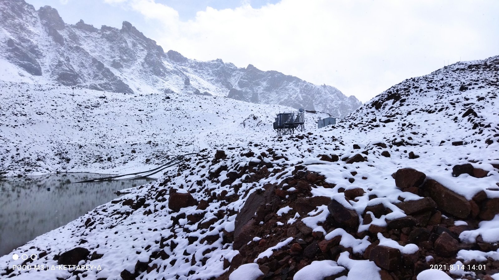
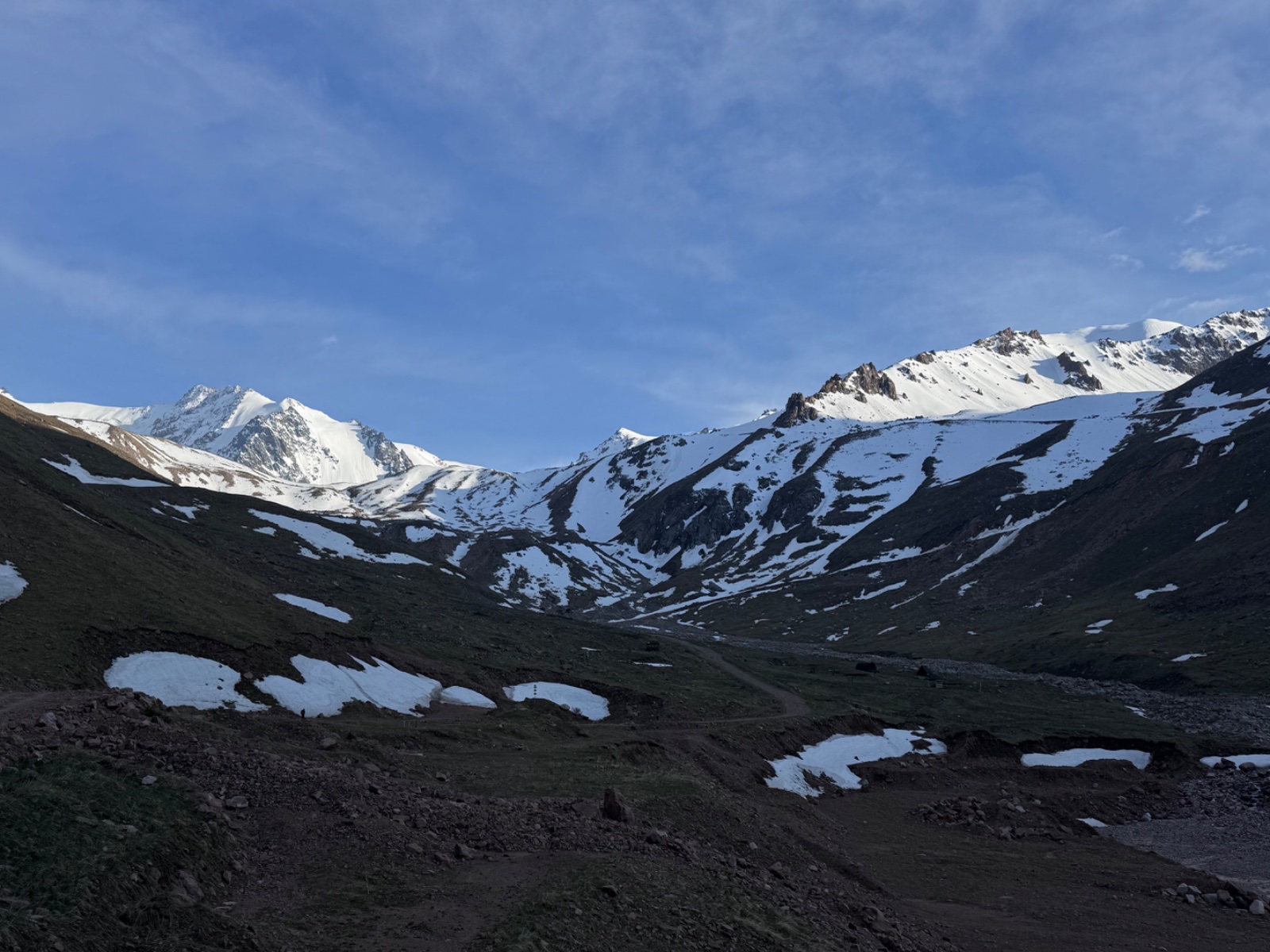
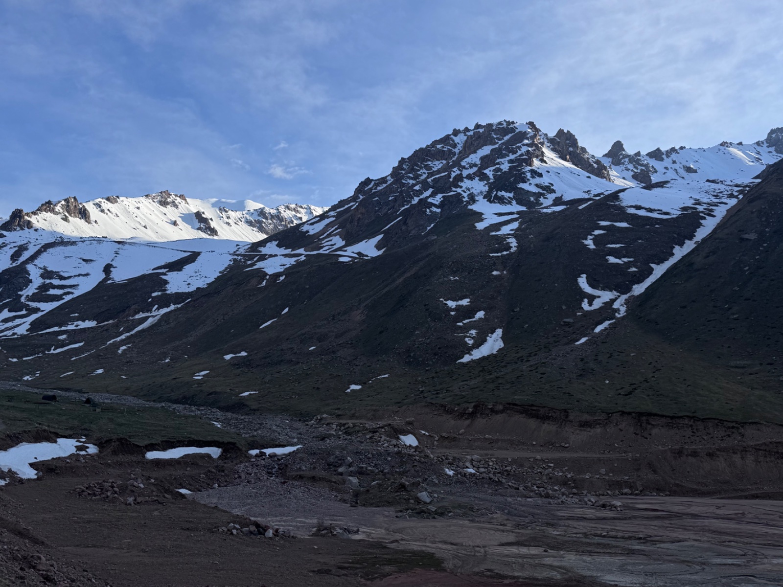
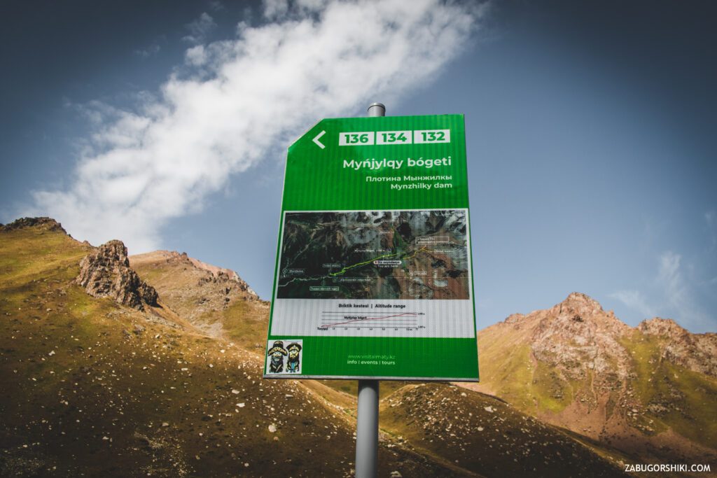
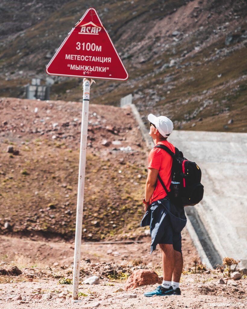
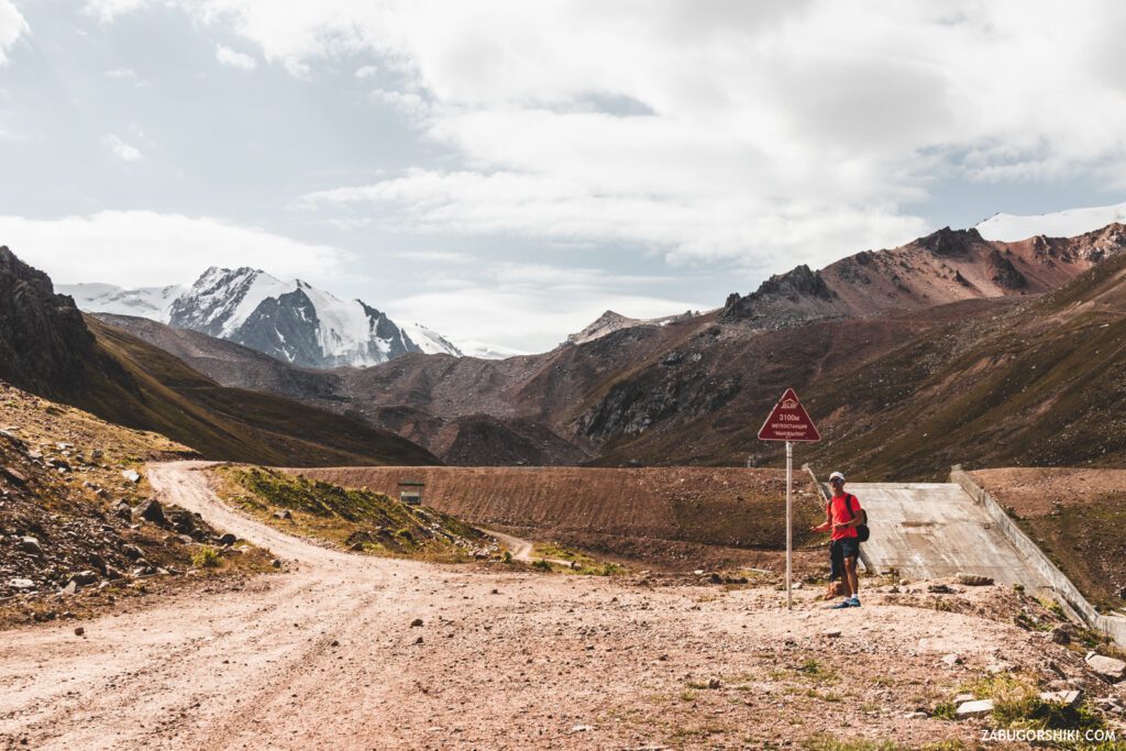
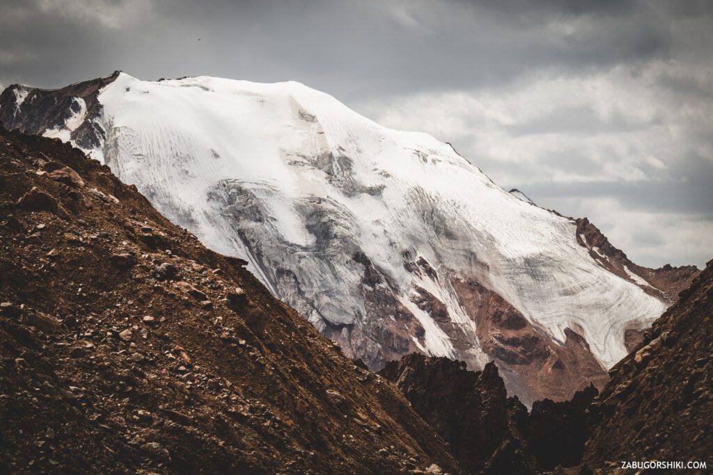
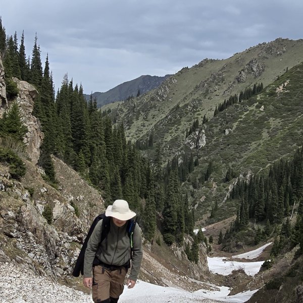
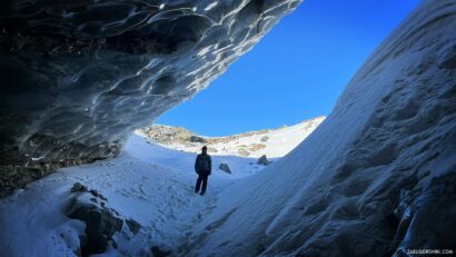
In 2 hours we reached the plateau “Mynzhilki” – translated from the national means “A thousand horses/mares/kazy/zhaya”. There is also a dam of the same name here. The height is 3100 meters above sea level and the Tuyuk-su glacier is already visible. Half the work is done!
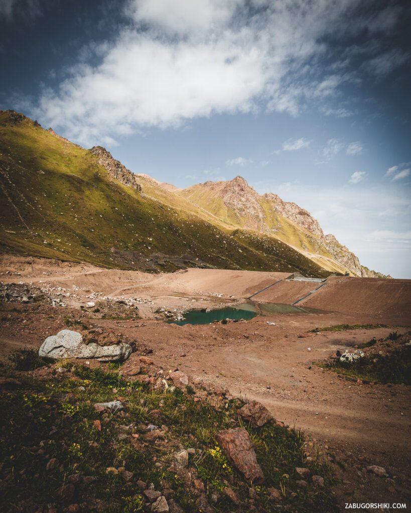
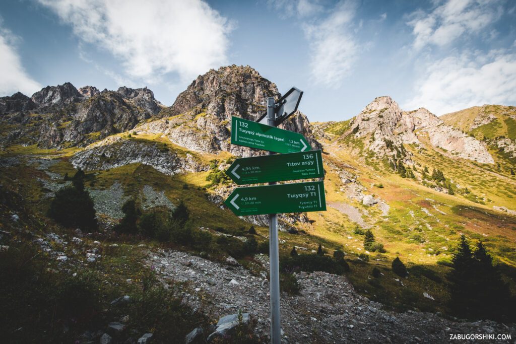
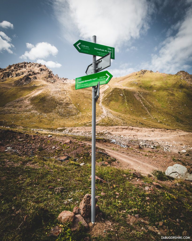
Near the dam there are quite comfortable and cozy places to relax, closed from the wind with plexiglass. A cup of Grand Cru tea and let’s go! There is a difficult part of the route ahead. After the dam, the trail splits. You will go to the right-through the glaciological (studying glaciers) station T1 you will reach the peak “Molodezhny”, you will go to the left-where we need to come today! The road changes the slope not in our favor, but this only encourages us and we move on… a little slower, but we are moving… but slowly now.
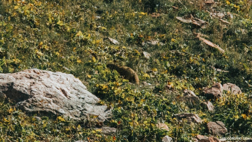
In addition to the incredible nature, changing from a coniferous forest to the complete absence of any vegetation, on this route we met representatives of the fauna – marmots Baibaks, who were basking in the sun. They did not bother them, but simply went on with their business.
Let’s take a break and talk about the improvement of the mountains. We like the fact that along the way of popular routes, signs, benches began to appear (somewhere they are made of a log house, and somewhere just like in a recreation park), signs with information (rules of behavior in the mountains, topographic survey of the area and other useful things). But we would not like the improvement to come to the change of the landscape (for more convenient access to the point and popularization of it), the construction of any (for the first time I write such a set of letters) objects in the mountains. Let’s protect our ecosystem!
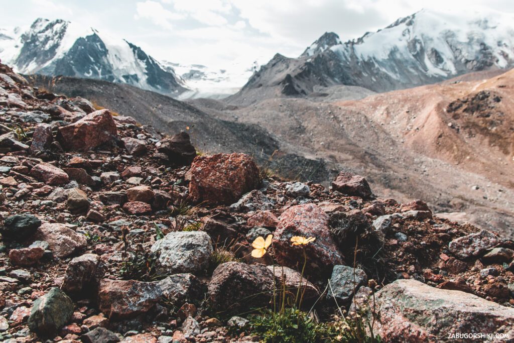
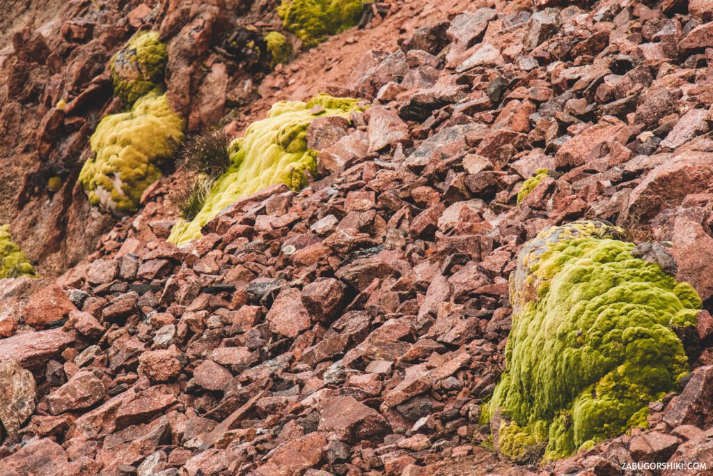
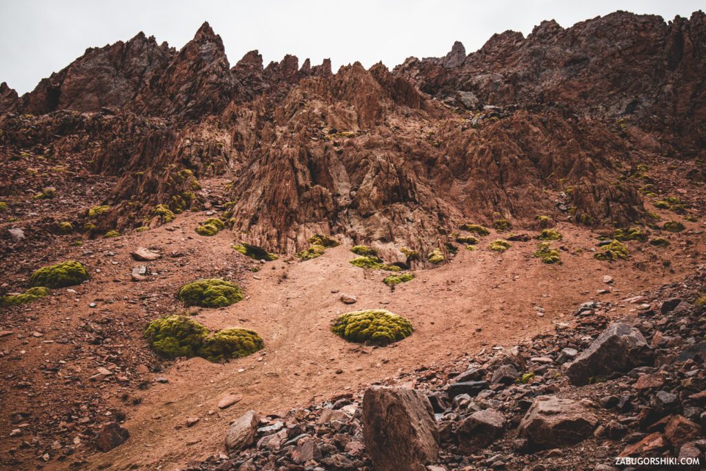
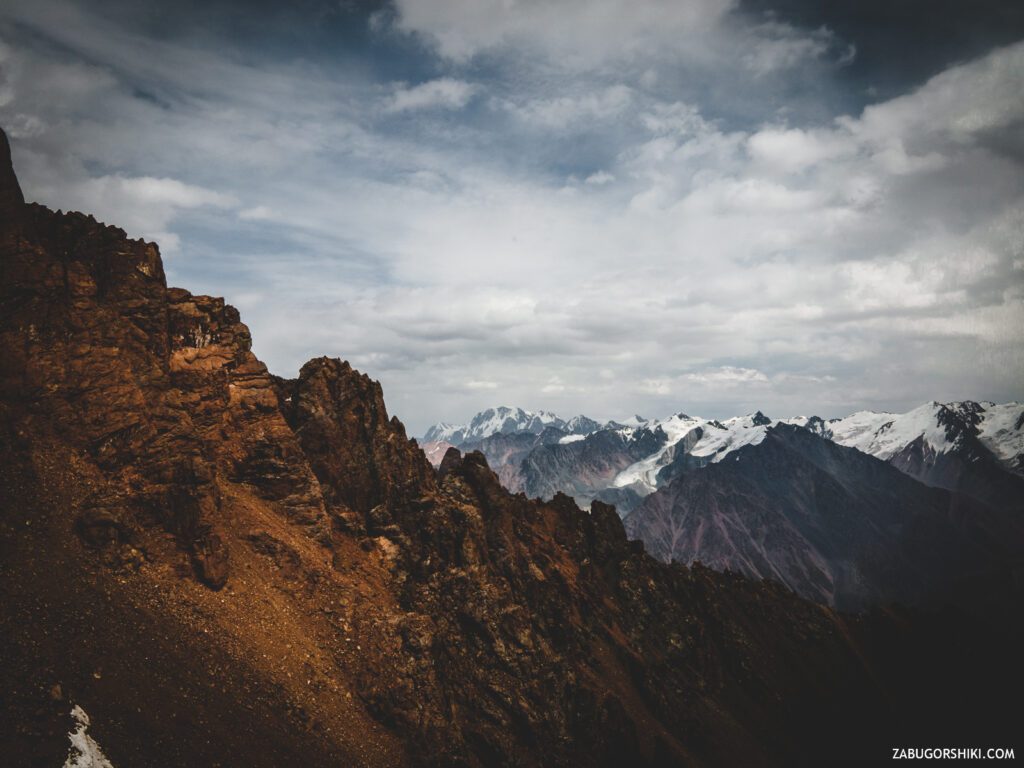
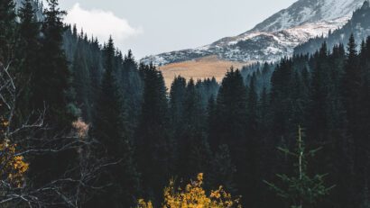
The path from the dam, surrounded by grass and occasionally showing edelweiss, abruptly turned into walking on a desert-rocky territory. Vegetation prefers to live at an altitude of no more than 3000 meters above sea level. Just like that.
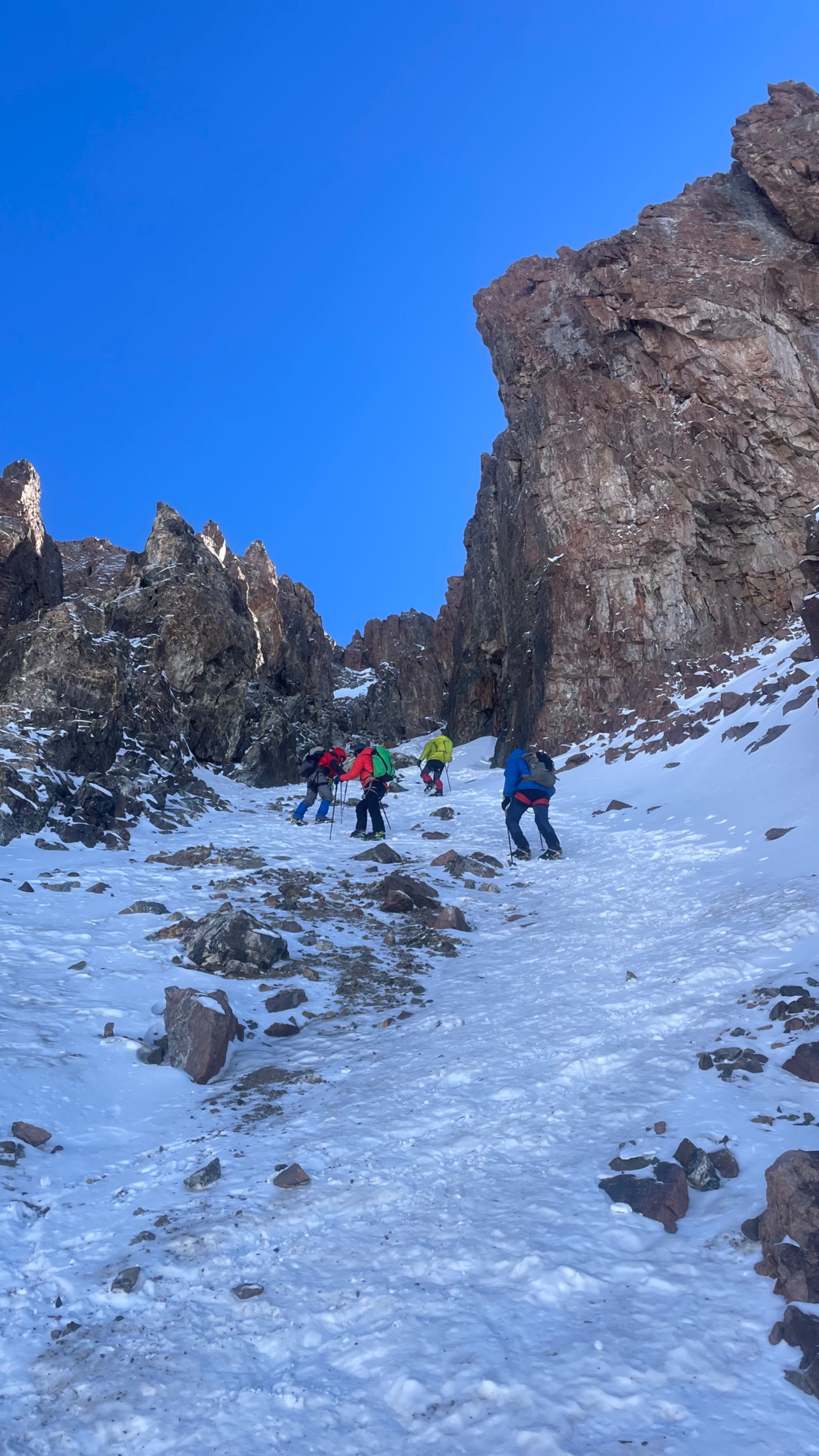
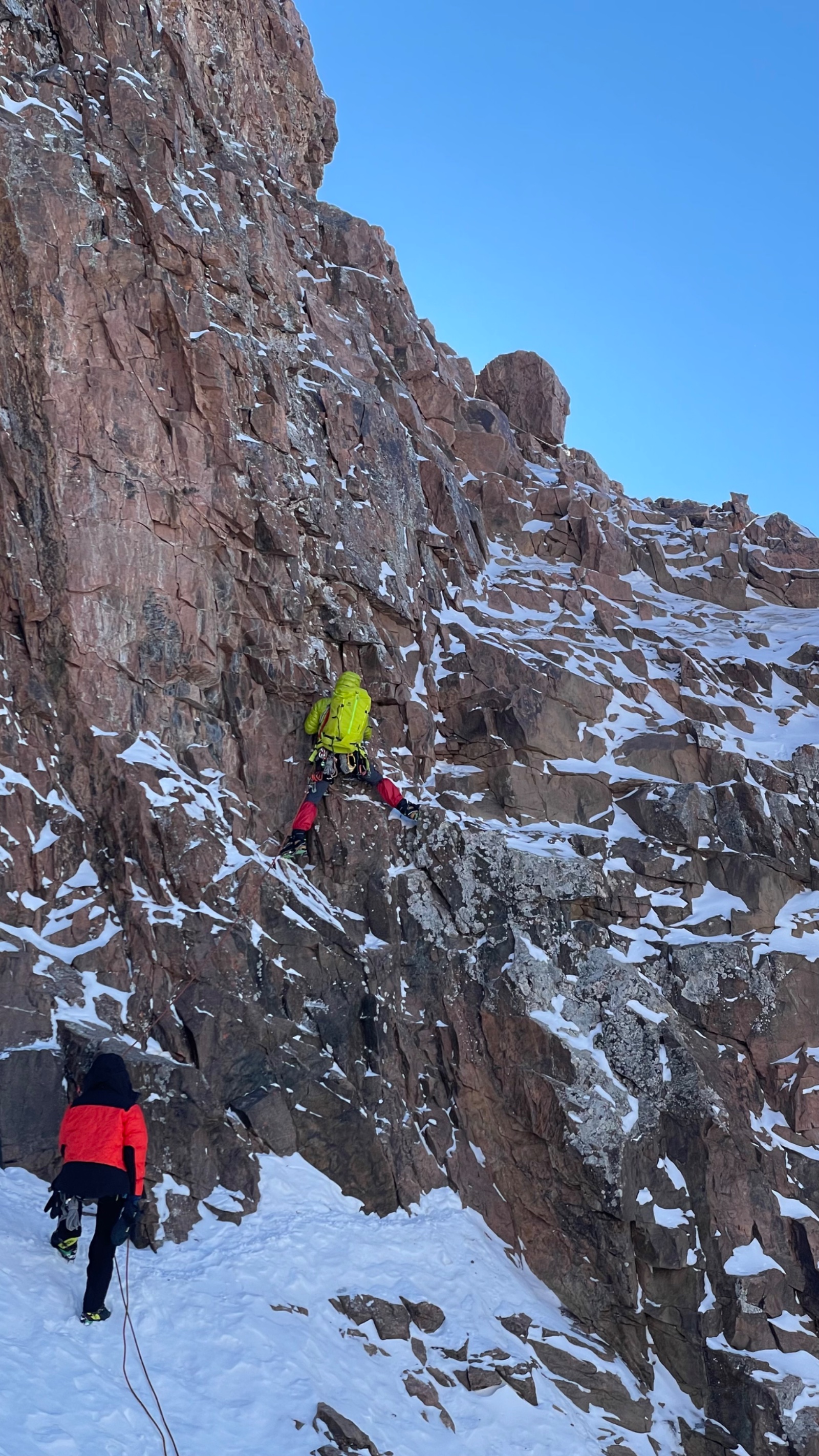
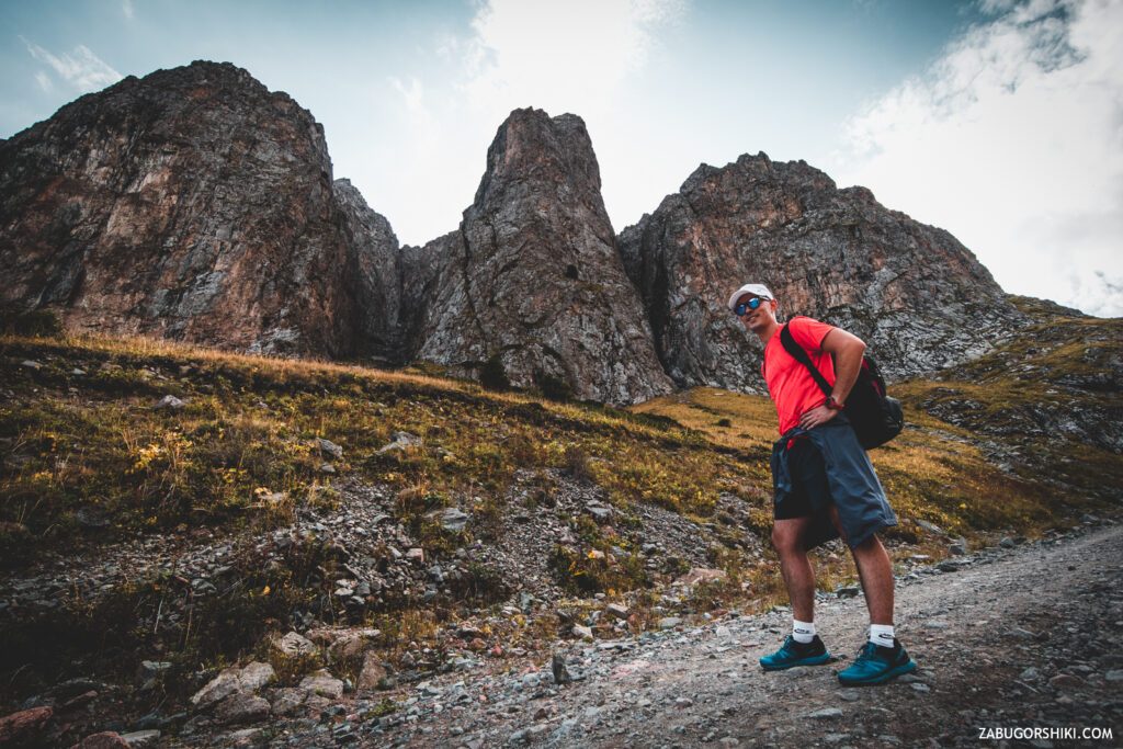
1 hour flew by until we got to the next sign and then the “Chuck Norris slope” began, as we called it. It becomes not easy to go, the slope + crumbling rock = -17 to the speed of movement.
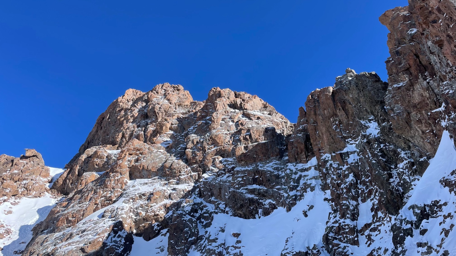
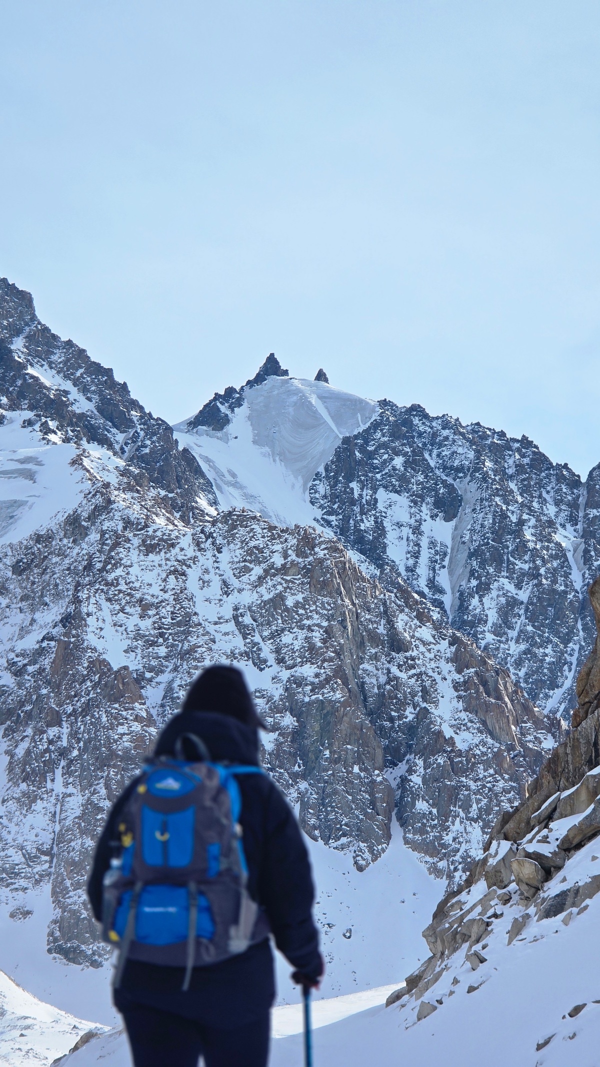
The higher we climbed, the more expressive and alluring the landscapes became. The coolness of the glaciers and the lack of air are already beginning to be felt. After about 30 minutes of walking, the trail, which still looked like a mountain one, finally turned into” trampled “collapsed stones, on which it is not very pleasant to walk, since there is a possibility that” tired and crooked ” legs can easily slip, get stuck and just go in the other direction.
The height makes it clear that it is not to be trifled with and every step requires titanic efforts… And there was nothing to rush so headlong at the beginning of the journey. The correct distribution of forces on the route plays an important role.
We reached the next “mocking” sign that says about the final 15 MINUTES of walking… It was the longest 15 minutes. Perhaps as long as the last seconds of warming up food in the microwave.
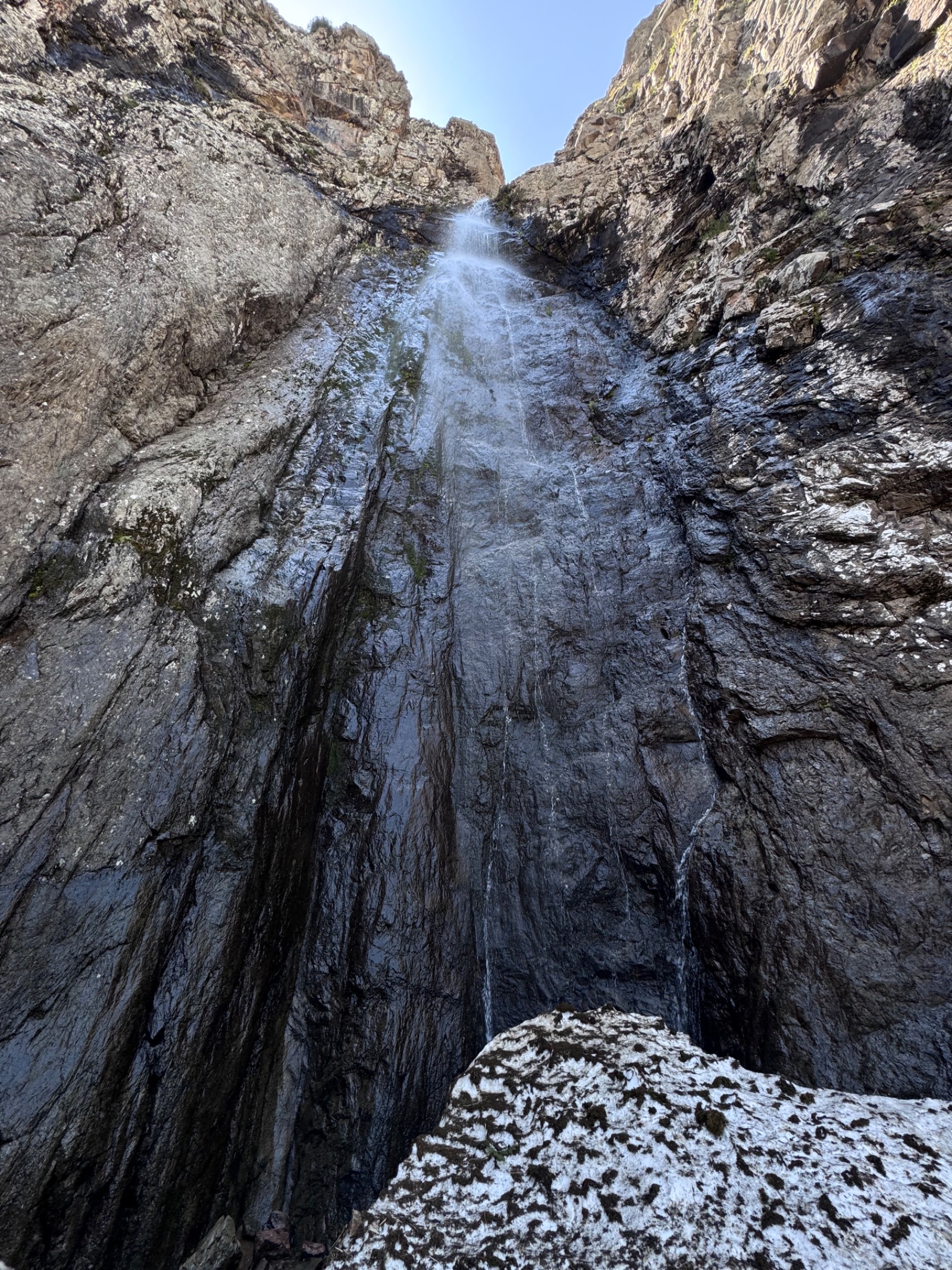
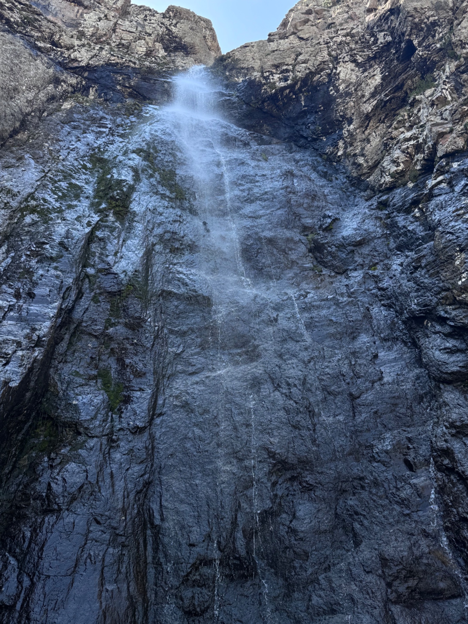
If you saw a pipe in the middle of the slope, from which water flows, then there is very little left!
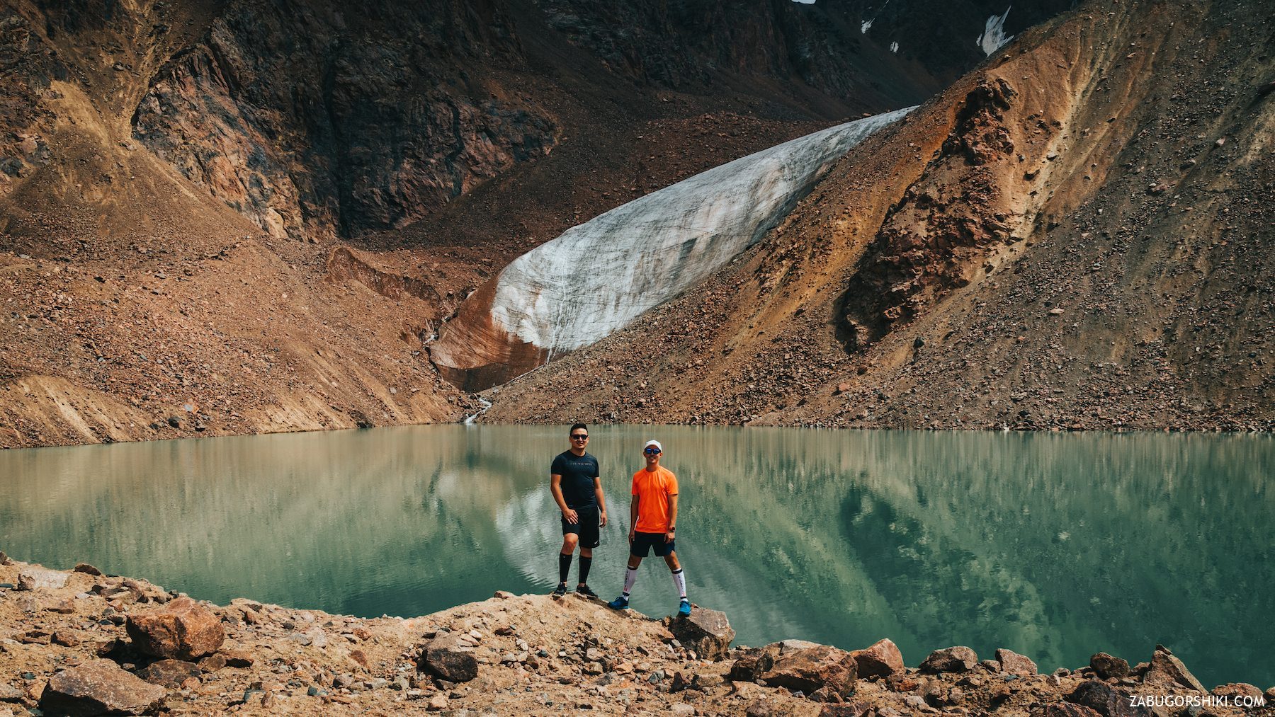
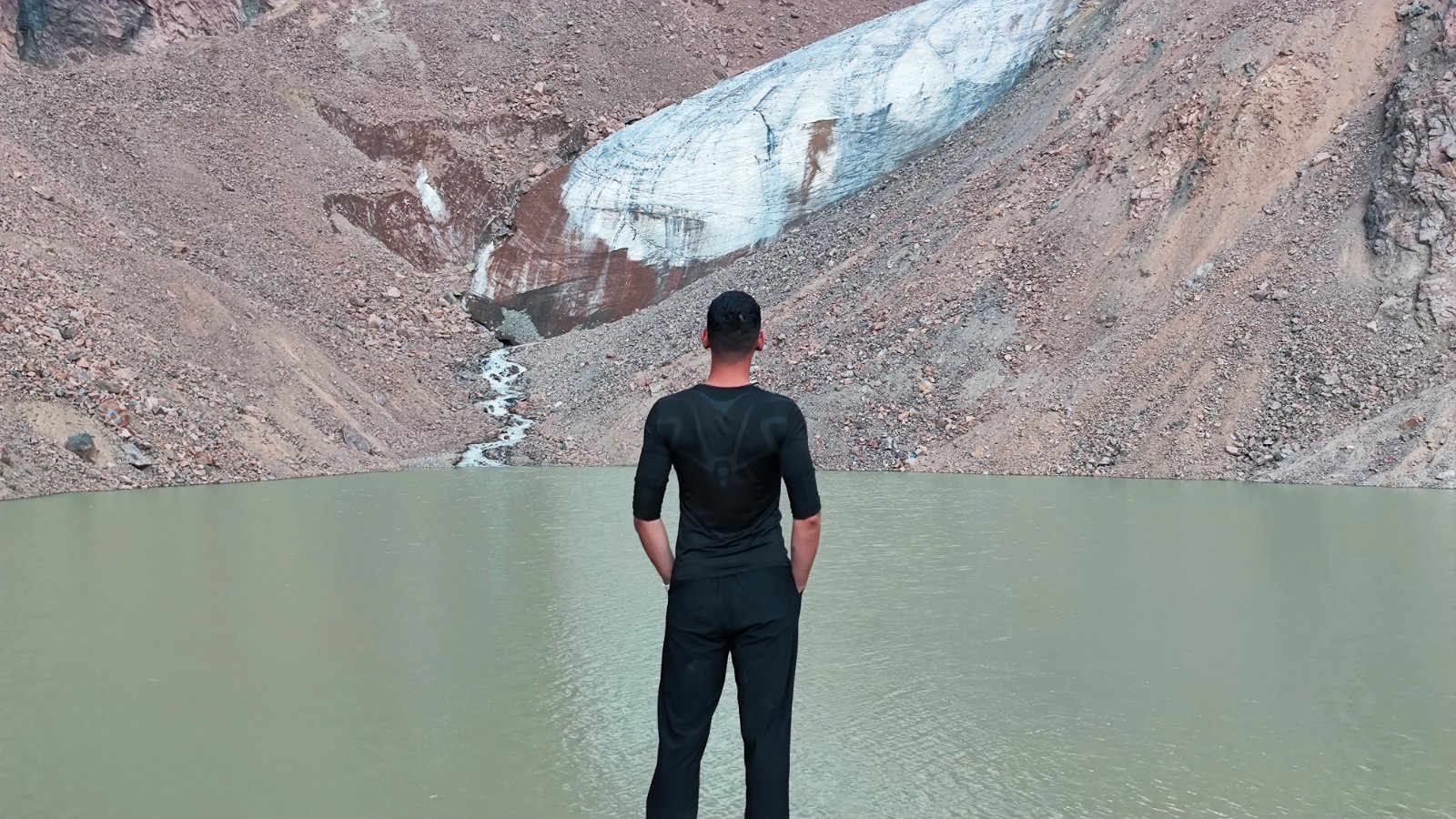
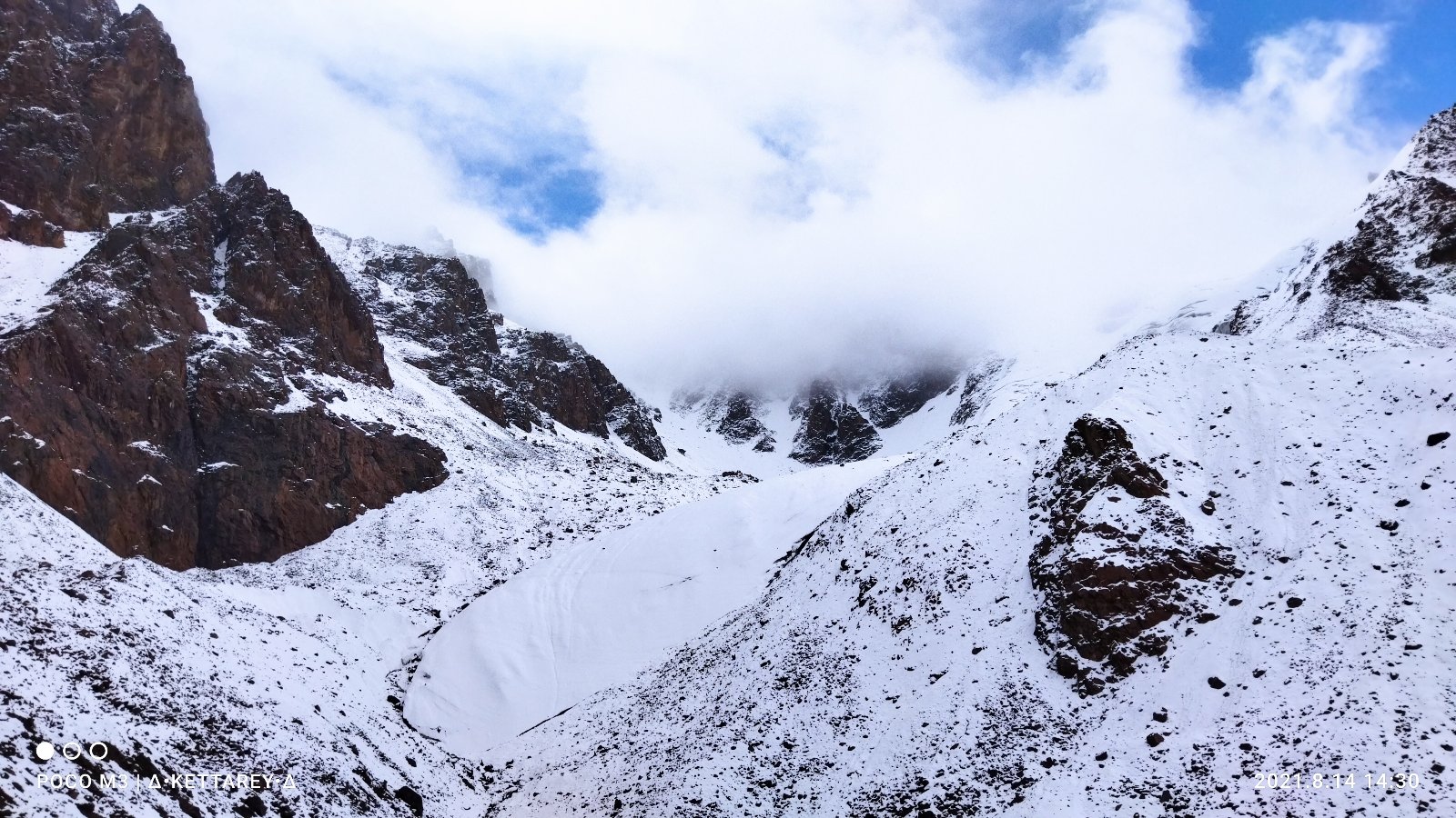
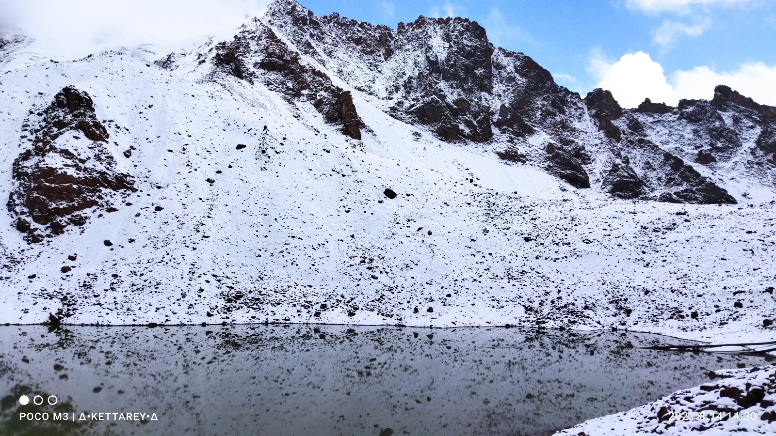
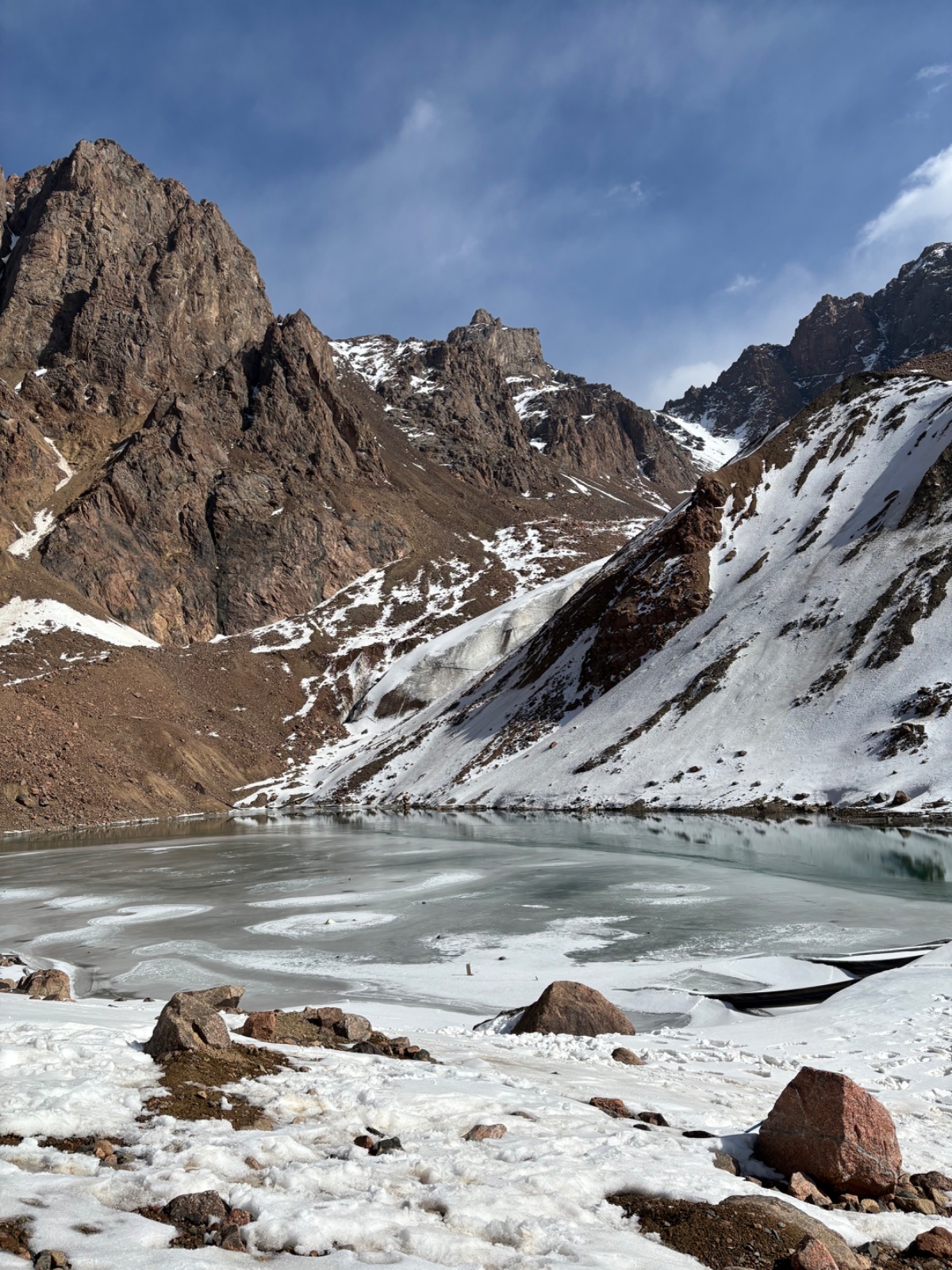
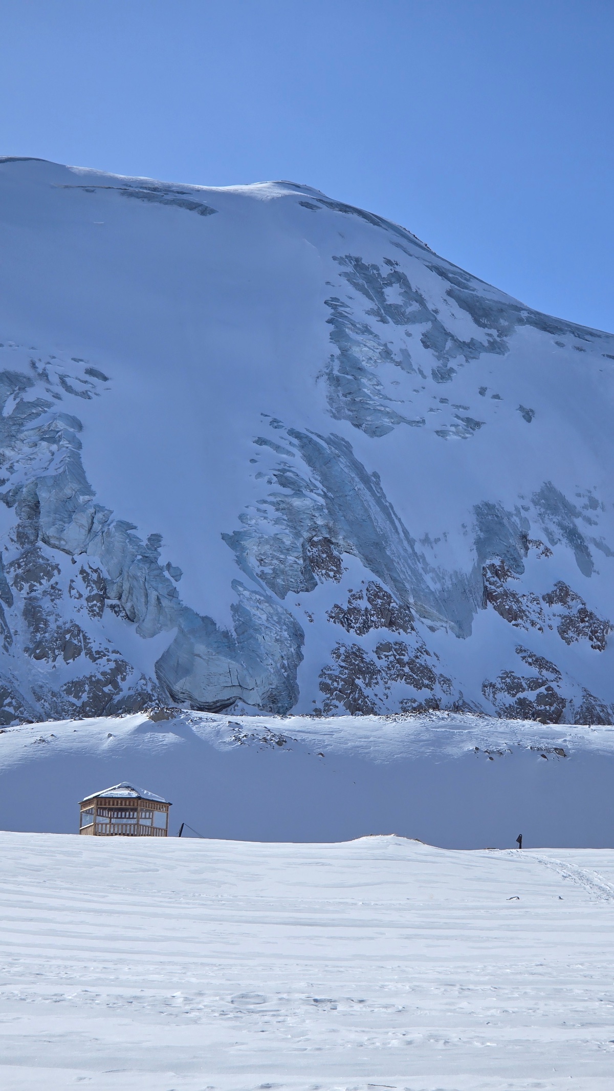
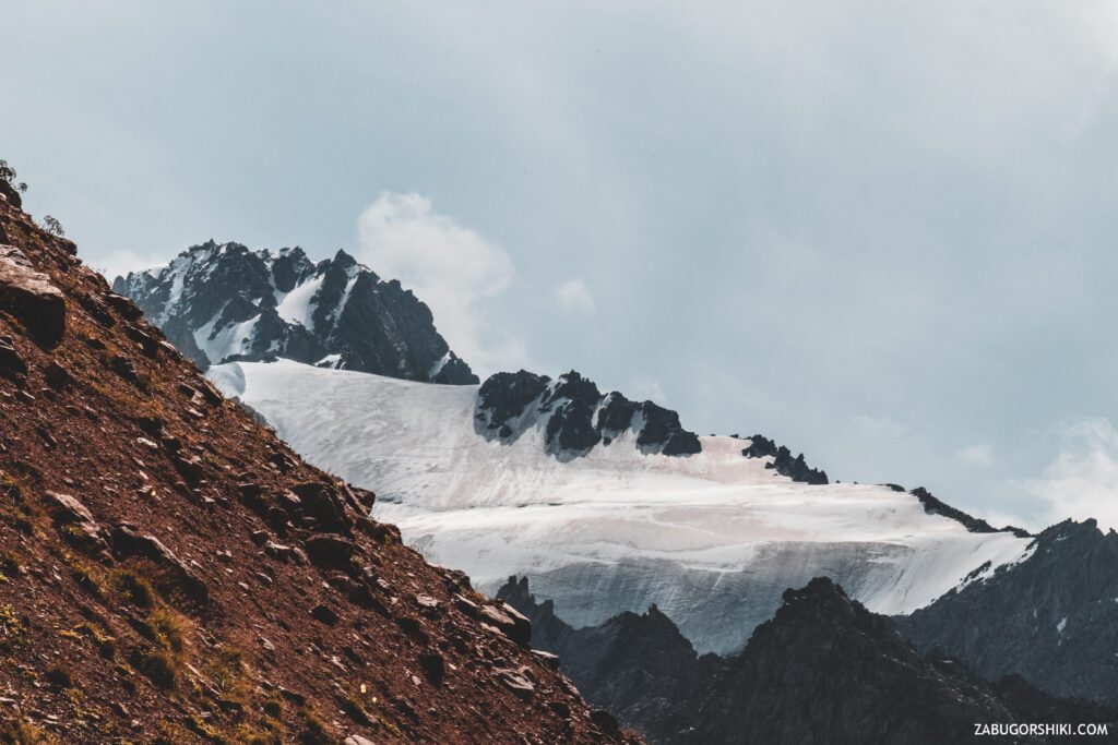
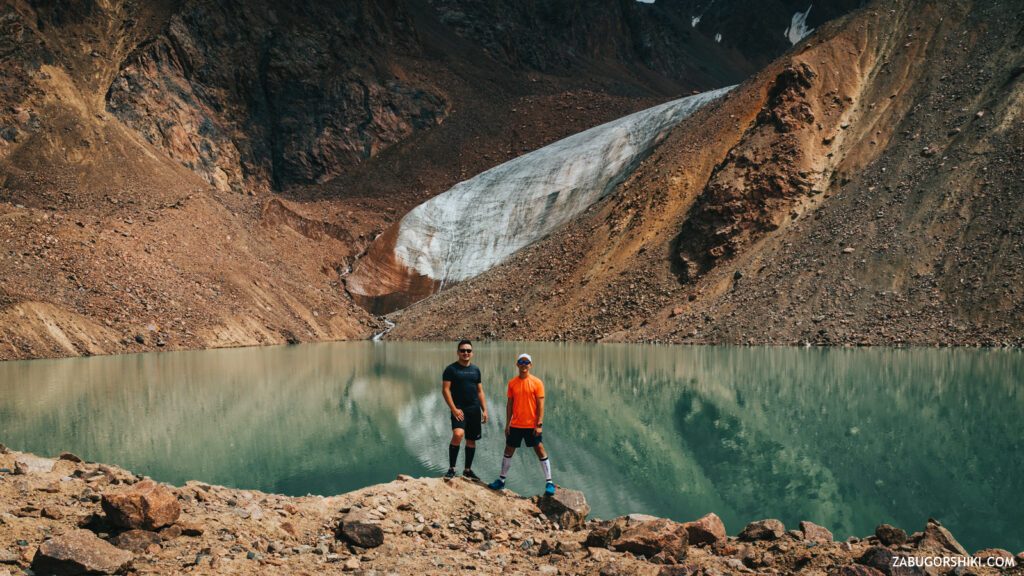
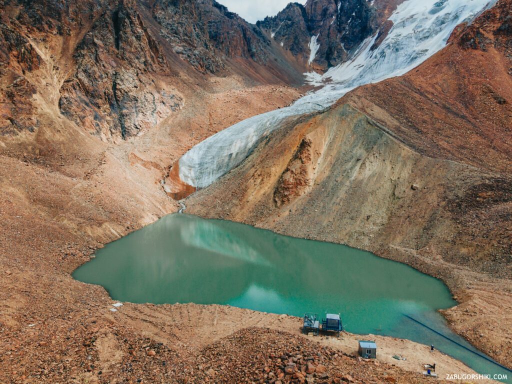
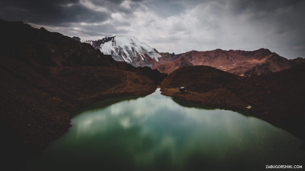
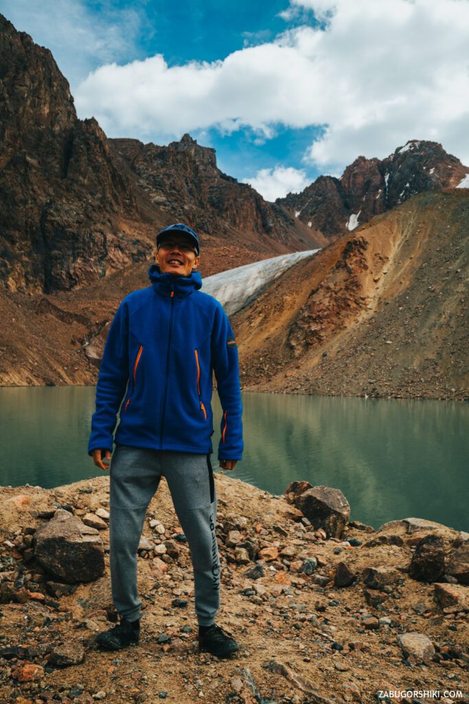
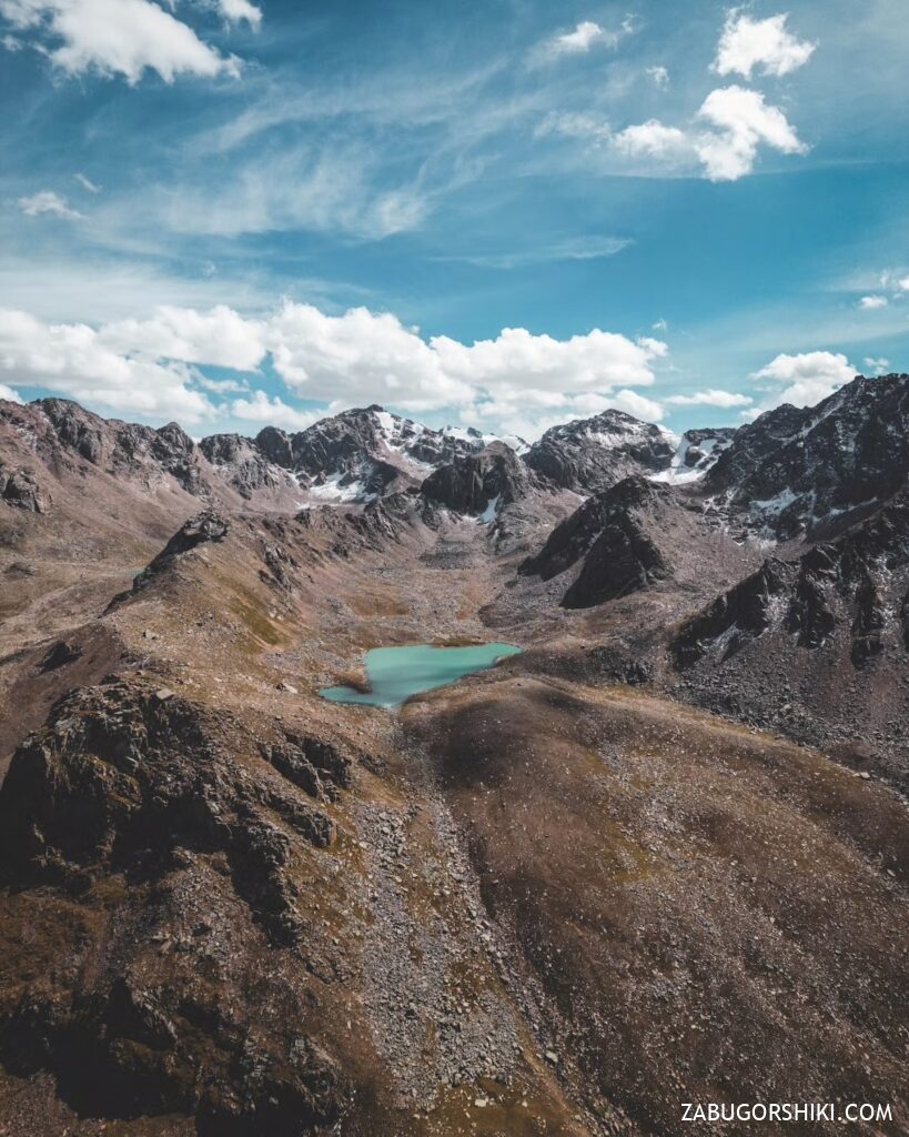
AND HERE IT IS! Quite unexpectedly, it appears around the next turn! Lake No. 6. Lake Manshuk Mametova, named after the heroine of the Great Patriotic War.
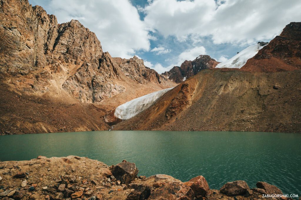
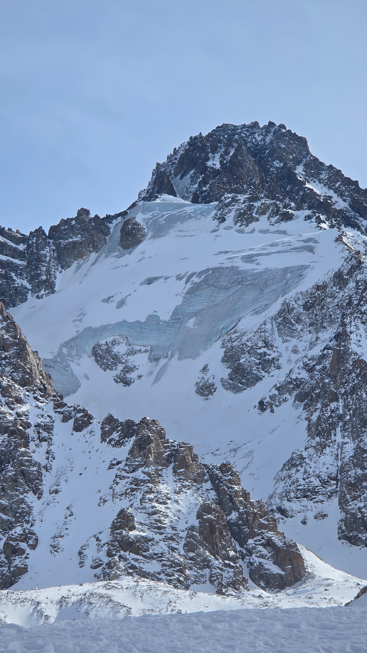
After a lot of effort made in order to get to this beauty, there are two feelings… On the one hand, you rejoice in this beauty and the achieved goal, the coolness of the air and the monumentality of this “intersection” of latitude and longitude. And on the other hand, remembering photos from a certain time ago, you can immediately see the differences in the size of the glacier… significant reduction.
The water is so icy that when you put your hands in it, your fingers instantly “fall off” with a creak. It makes sense! This is glacial water.
“The” arena ” of the lake is surrounded by the peaks of Amangeldy, the Student, the Teacher, M. Mametova and Antikainen, who are watching those who came to visit them with a menacing look.
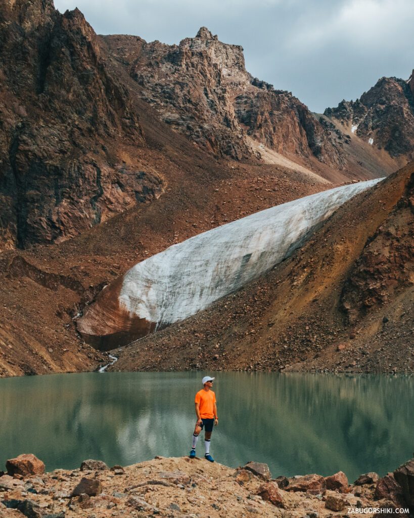
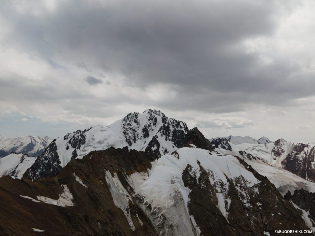
We throw off our backpacks. My back is wet, my legs are a little weak from the load, and my head is spinning from the height. Looking into the passage from the lake, you can see the peak of Youth, which at that time began to cover the clouds… At such a height, the phrases “Are there clouds” and “There will be no rain” do not sound so convincing. So, while “not bears at all” and we are not covered, we take out a drone, a camera, change the lenses and start shooting. Photos are impossible to convey the feelings that you experience while being THERE. Technologies and the “Wright Brothers” allow you to explore the territory up to the peak of Karlytau (4170 m).
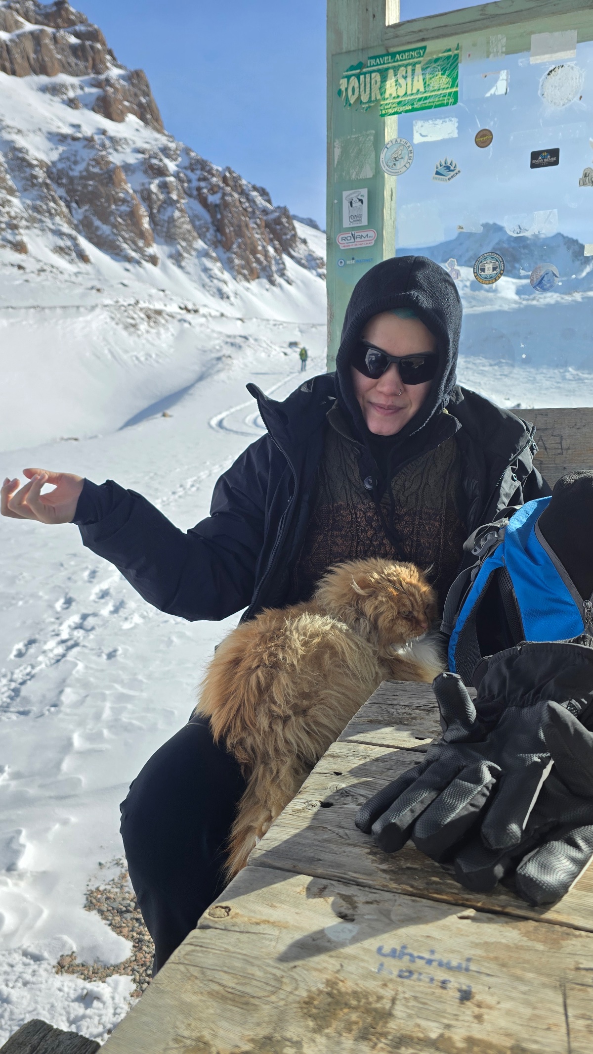
Where have you met the most friendly and friendly people? And we are in the mountains. So this time I met a wonderful solo tourist Rinat, in a conversation with whom it turned out that he tried to “push” us away from the “Tuyuk-su Gate” itself))) He told us that this is his second coming to clean drinking. Well done!
The material for the release has been filmed, the “bird” has safely returned to the case. Now the most pleasant part of the campaign begins – “THE BEST LUNCH IS WATER, YOU WILL NEVER BE FAT”.
What is the” set ” of food and what kind of tea is this “Grand Cru”? This time the diet consisted of boiled buckwheat with sausages, boiled eggs, dried figs (special brought from Cairo. Thank you, BRO), man-made samsushki, rejuvenating apples, well water, energy (fast energy, let it be) and of course, the miraculous Tea itself!
The time is 14:00, the weather begins to frown, and we continue to feast. Life doesn’t teach you ANYTHING. Until the cold wind blew, this “last supper”would have continued. We collected our junk, we definitely take away the garbage, took doping and again “on skis”.
The descent began with the accompaniment of a fine rain. There were two large garbage bags in stock, which passed for a raincoat….and to be more precise, they were only enough to cover the backpacks. But we are not in danger of getting wet today, as we quickly left the “SunStrike” zone.
We stopped to finish the material on the throne. While the material is being collected, we will talk about the topic “Time to visit the mountains”. We do not undertake to teach, condemn or instruct anyone on the right path. What time do you go out to the mountains and what time do you go down? On the way home, we met several groups that were climbing. The time is 15:00, and they still have to go to the top for at least an HOUR…SO WHEN DO YOU PLAN TO GO DOWN???
We flew in, we go down further. The return to the plateau was quick and without unnecessary words. It has already become quite hot downstairs and again the windbreakers are sent to the backpack. On the way back, you can fully enjoy what you missed during the climb.
By the time we returned to Cimbulac, 8.5 hours had passed. 23 km have been covered. The climb is 1363 meters. And the ski resort itself was flooded with people, as if he had gone to the school corridor for a break. Everyone ignores the observance of social distance during the quarantine period. The queue at the ticket office for tickets is the same as for the “trailer” itself to Medeo. There is no point in waiting, we took a taxi again and drove home.
See you soon!
Want an exact route?
Go to the link to get access to the GPS track of the hike and other exclusive content on our new community site for hiking enthusiasts
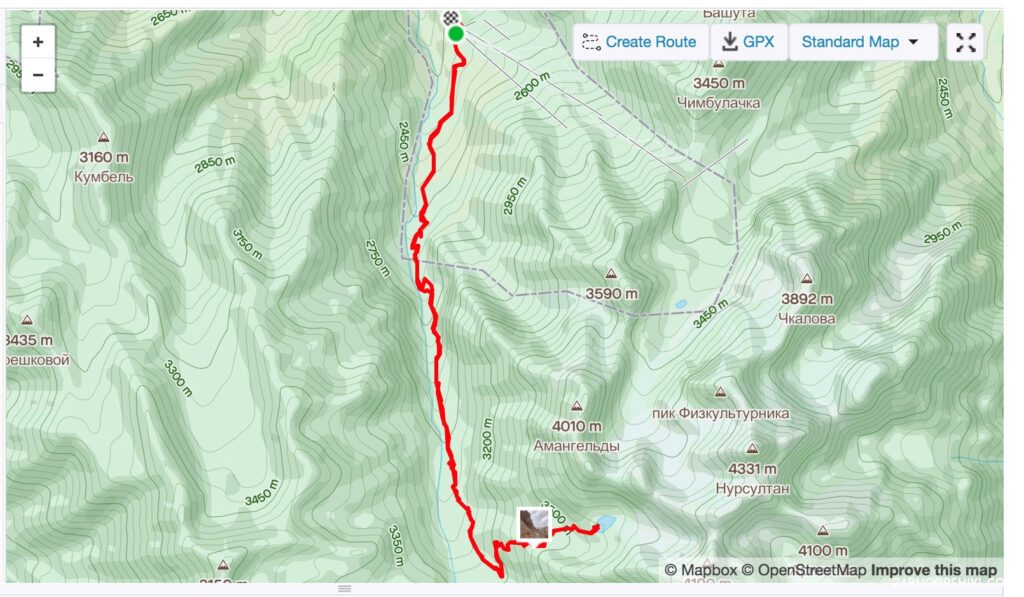
Download GPS track🗺️ Route map to Manshuk Mametova lake
🎒 Other routes
Subscribe to our channel and follow the updates on the website. There is a lot of interesting material ahead!
Thank you for your attention. If you liked this post, leave comments and read other posts in the section Journeys.
Zabugorshiki
PS: want to share it with your friends?
👉zabugorshiki.com/en/manshuk
Itinerary
Detailed itinerary will be provided upon booking. Our typical tour includes daily hikes through diverse terrains and cultural experiences.
Pricing
| Group Size | 1 person | 2 people | 3 people | 4 people | 5 people | 6 people Best value |
|---|---|---|---|---|---|---|
| Standard | $174 $174 total | $112 $224 total | $91 $273 total | $81 $324 total | $74 $370 total | $70 $420 total |
100% private tour — prices are per person based on group size. The more friends you bring, the less everyone pays!
What's Included
Included
Not Included
Our Guarantee
If weather forces a cancellation, you choose a free reschedule or a full refund. If you're not satisfied with your experience, we'll work with you to make it right. No questions, no hassle.
Private tours only (max 6) · Reschedule or full refund if weather cancels · No payment until confirmed
Traveler Stories
Sarah K.
Our guide was incredible - he adjusted the pace perfectly for our group and knew exactly where to stop for the best photos. The whole experience felt effortless, like everything was taken care of before we even thought to ask.
Marco T.
We were a group of 4 friends and the per-person price made it a no-brainer. Private 4x4, lunch included, and the canyon was breathtaking. Way better than the big bus tours we saw there.
Anna W.
Solo traveler here. I was nervous about hiking alone in a foreign country but the guide made me feel completely safe. The trail to Kok-Zhailau was beautiful and the photos he took of me were amazing. Only wish the hike was longer!
David R.
Third time booking with these guys. Butakovka, Big Almaty Lake, and now Titov Peak. Every single time the service is flawless. The fact that it's always private and max 6 people makes such a difference compared to other operators.
Share Your Experience


17+ hikers
completed this trail
Tour At A Glance
Book This Tour
Private tours run any day of the week — weekends fill up fastest, so book early
Pay securely after confirmation


Weather Forecast
light rain
H: 10°C
L: 5°C
Mon, Jul 27
clear sky
8°C
3° / 12°
Tue, Jul 28
clear sky
7°C
3° / 11°
Wed, Jul 29
clear sky
8°C
4° / 13°
Tour Location
Similar trails
From $70
per person · weather refund
Complete Your Booking
Tour:
Date:
Participants
Add-ons
You're Almost There!
We'll contact you within 24 hours to confirm your spot and share everything you need to prepare for your adventure.
Request sent
We confirm your spot
within 24 hours
Summoning perfect weather
Hit the trail
On the channel
83 h
Drone flight hours
What we’ve filmed
59
Hikes filmed
704 km
Kilometers covered
44,439 m
Elevation gained
27
Countries visited
Plan your hike with us
A few quick questions and we will email you a tailored hike plan & quote.
When do you want to hike?
What's your experience?
How many of you?
Where do we send your plan?
Private guided hikes · no obligation.