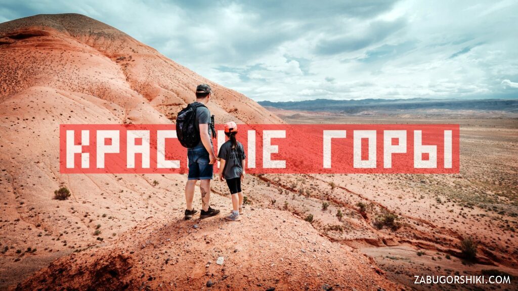
Red Mountains Boguty, Kazakhstan. Mars-like views, desert, route
From $70 per person


Overview
Is this hike right for you?
Perfect if you…
No experience needed
Description
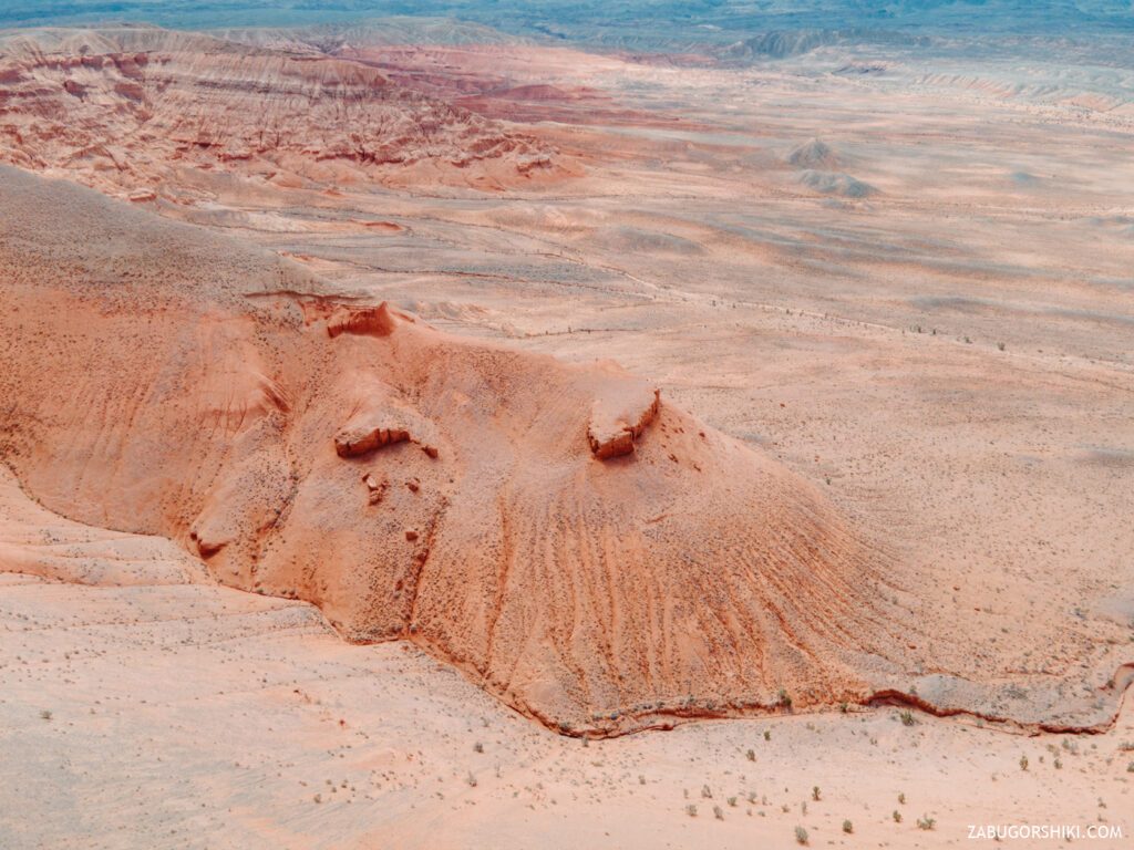
Red Mountains Boguty are located 150 km from Almaty. Their color and relief resemble the surface of Mars. How to get there, the route and the flight on the drone! In the new episode of Zabugorshiki!
📹 Red Mountains video
🚗 How to get to the Red mountains Boguty from Almaty, Kazakhstan
It is most convenient to get there by car, and it is better to take a personal one. We go to the A351 highway and drown (observing the speed limit) in the direction of Chilik, Khorgos, Charyn canyon. In short, 100-120 km will have to go on a very decent asphalt, and then turn onto the ground, potholes, pits and other slides).
🌵 Red Mountains
We welcome all those who are looking for adventure and can’t live without active recreation!!!!!
Today we have not exactly a hike, or rather not a hike at all, but a Jeep tour!

Precipitation in the form of rain began in the city, a thunderstorm was expected in the nearby mountains, so we decided to move away to the East.
6: 00 am on the wall silent. I got up, washed my face, forgot to wake up. The porridge prepared in advance is sent to warm up, and at this time I go to wake the child. My daughter got up quickly enough, as she went to bed quite on time. After a short morning procedures, collecting things and “sitting on the track”, we went out. Downstairs, Renat has been waiting for us “for an eternity”. He will never show his lateness because “this does not happen” he will tell everyone. Having shoved the bags and bodies around the car, we set off on our way. But first, go to the gas station. A full tank of fuel, delicious hot dogs with heat from the heat, a great team and “the jungle is calling”, what could be better.
It was necessary to get out of the city with a small fight, since the “interchanges of the century” are still being built, and people do not stop going. We go to the “Kuldzhinka” and gas to the floor. We decided to bypass the toll section of the A-351 highway. We go to it either through Tonkeris or further, see how it is more convenient for you. But it is better to think over the route in advance!
By 8:00, according to the machine panel, we have already left for the “highway to Boguty”. The coverage is excellent, there are few cars. From this distance, you can already see how the city and the mountains that are nearby are covered not only with clouds, but also with smog mixed with dust. The ridges of the inaccessible mountains look even more formidable in comparison with the city.
We pass one river, the second, two more and there is no water in any of them. Although the fields around are already dotted with flowering rapeseed, lavender and other colorful vegetation. “We have a lot of gulls in the city of Almaty” and in the region, too, it turns out. These are not just lines from the same song, but a real confirmation that we have seagulls. Away from big water)
We have to go all the way to the easternmost part of the Trans-Ili Alatau. In the back seat, a child who realized that nothing interesting is expected yet, can take a nap. Along the way, there were small settlements, gas stations with “suspicious” names, birds flying from one side of the road to the other and cows grazing peacefully. All this idyll lasted until we turned off the regional highway onto a country road.
Here the adventures in the spirit of “survive at any cost” began. A gray long-eared hare, which ran across our path, hastily disappeared among the bushes. The absence of tall deciduous trees immediately became noticeable. The road, which looked more like a washout or a riverbed, led us through bends between crumbling edges, cracks in the ground, thorny bushes and the desire to “not kill the suspension”.
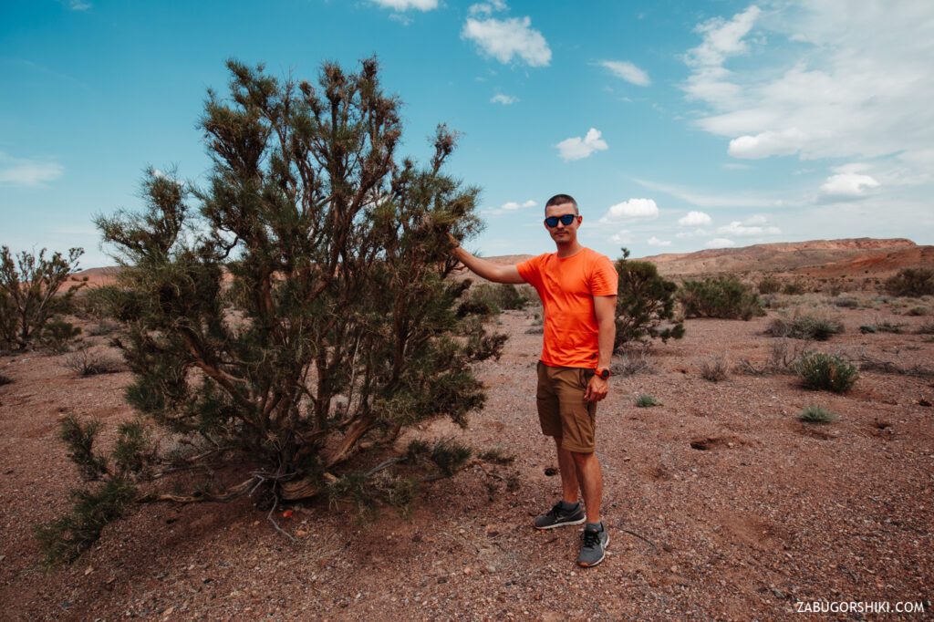
After about 20 minutes of such a wonderful ride, we still stop. A sound like the sound of cicadas comes from the bushes. And from which bushes?? Yes, of all of them. These bushes do not grow boring, but are evenly spread across the field and equidistant from each other. The time is about 10 am judging by the sun. The air has already warmed up, but the heat has not shown its full strength.
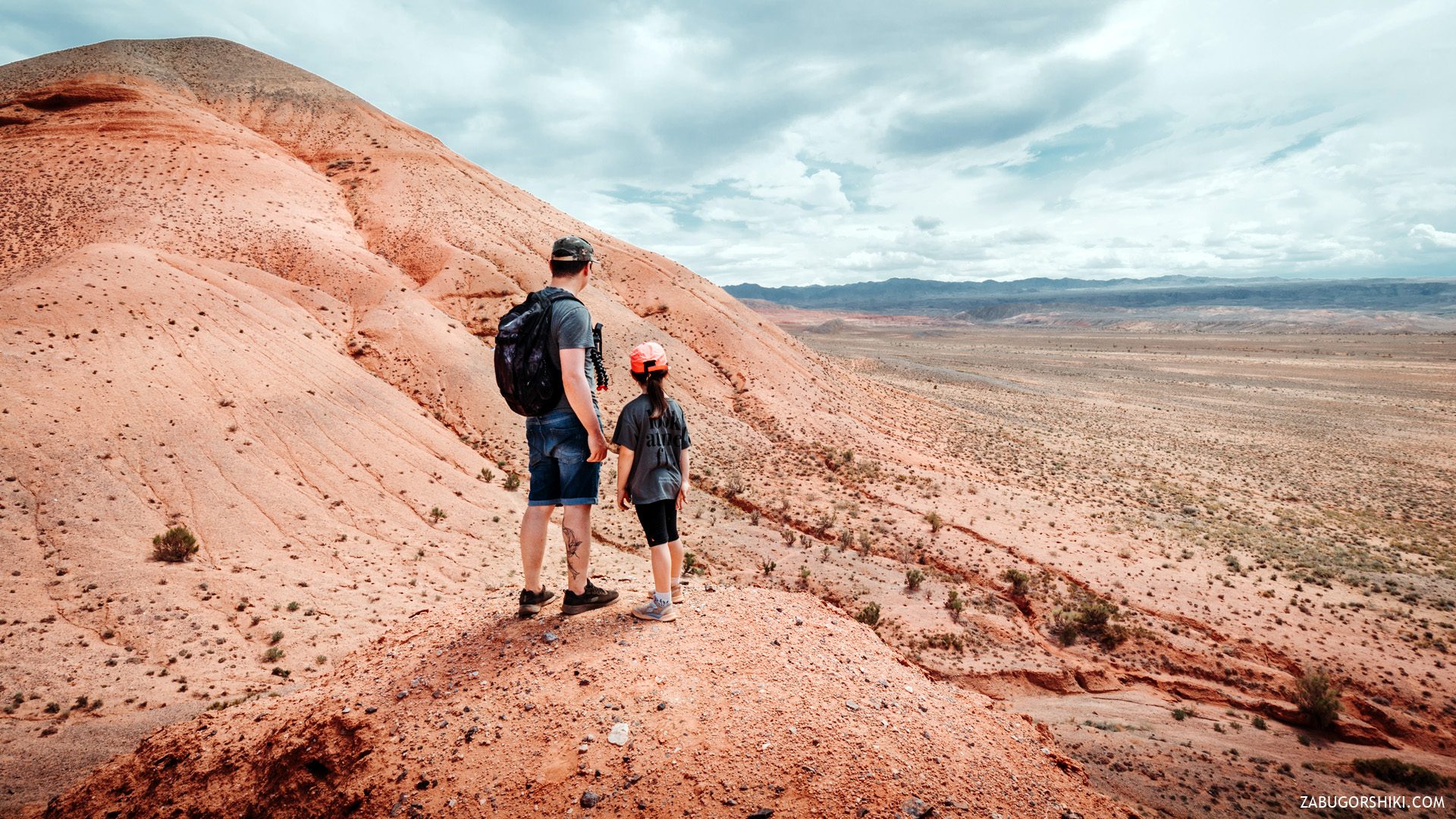
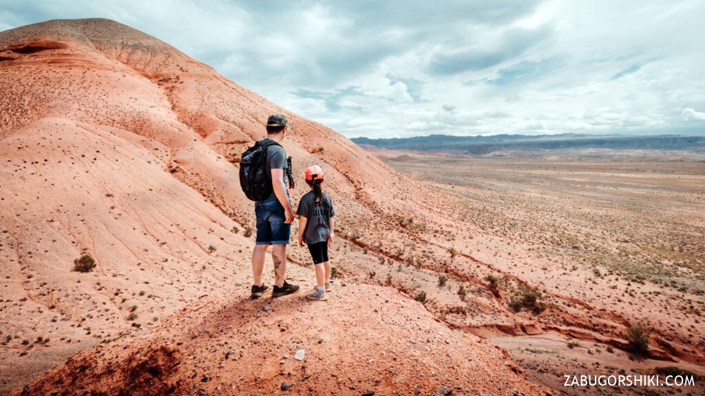
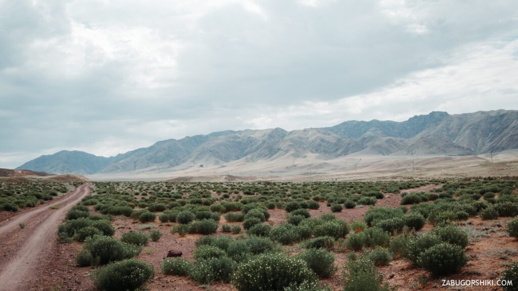
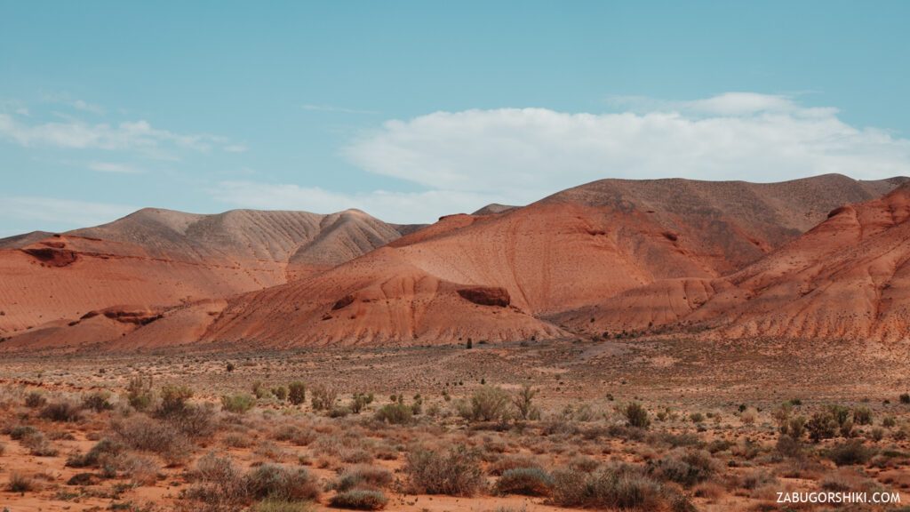
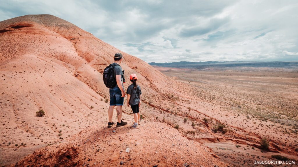
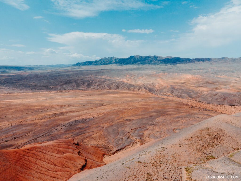
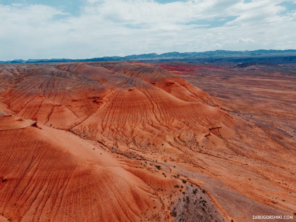
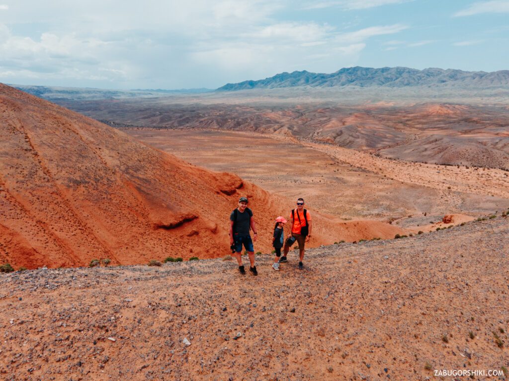
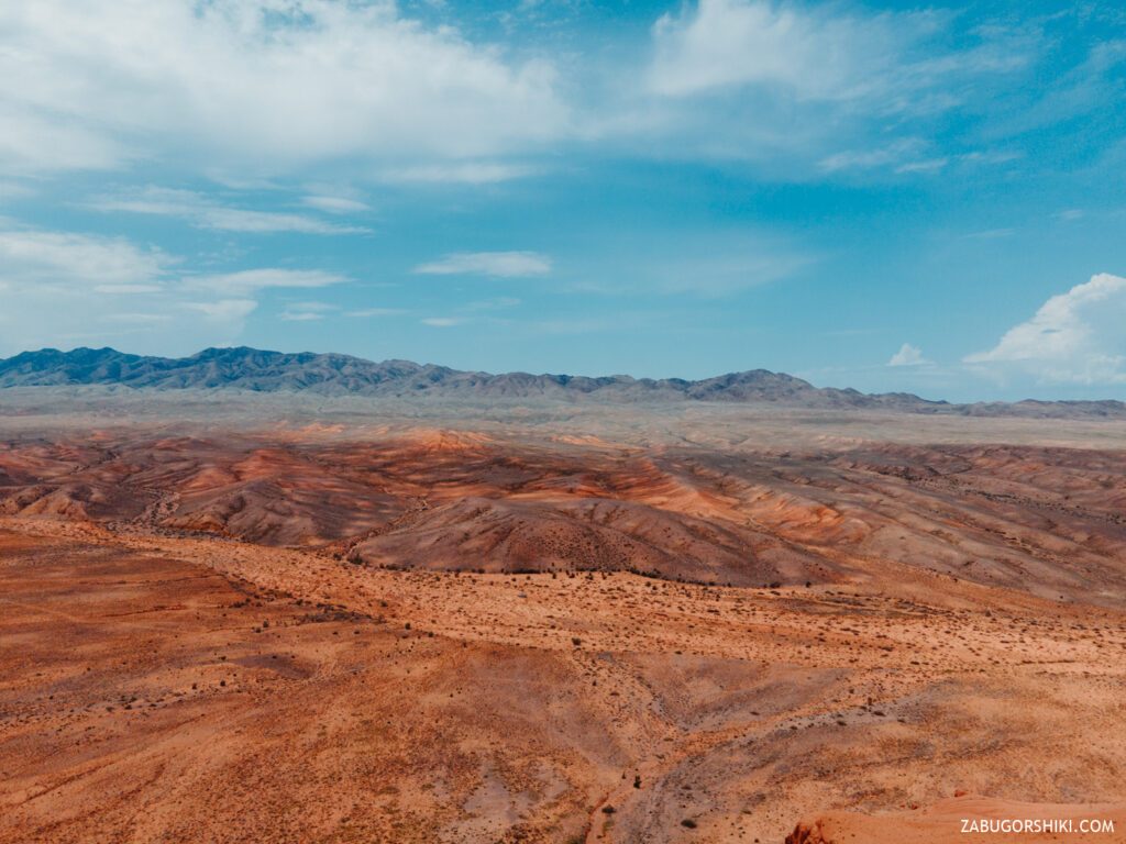
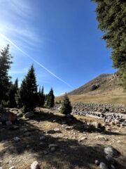
We continue to loop, stare around and wonder. After a while, we leave for the plateau. The road surface does not change, but the scenery does… They stopped and got out of the car. The very ones that caused this trip are already visible. Bright shades of red stand out against the blue sky and the yellowing desert.
On the right side, the mountains are located as if they form their own “circle of communication” and in the middle you can see a huge clearing with overhanging clouds. On the left are the hills and the steppe. And if you listen carefully, you can hear birds in the field, which, due to the zero presence of trees, decided to build their home in the ground. Right in the minks. There are a lot of mountains and holes in the ground.
Keep moving.
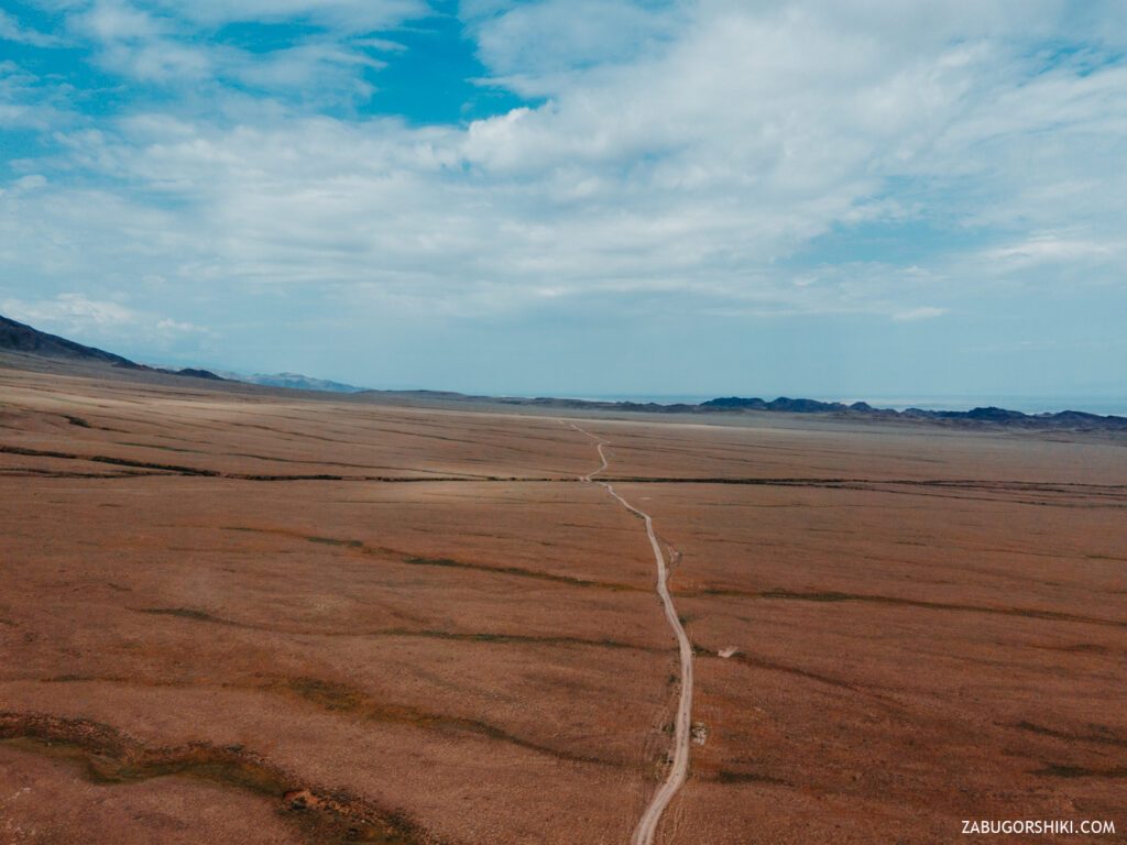
There are 10 kilometers left to the cherished goal. Now we are driving through an area that finally resembles the Mexican desert or some shots from the TV series “Breaking Bad”. There are only not enough cacti for a complete entourage.
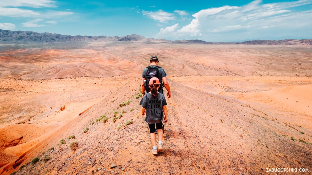
Having decided on the parking lot and choosing the route (or rather the direction) to the hills, we unload from the car, pack only the most necessary things in backpacks — water, sunscreen, shooting equipment. On the “gaz-on foot” we make our way through the cracked earth, from which there was a smell of drought. The chirping bushes still urge us to abandon this idea, but we do not care. When they got out of the car, they realized that the territory was “not ours”. Everywhere something flies, buzzes, crawls, chirps.
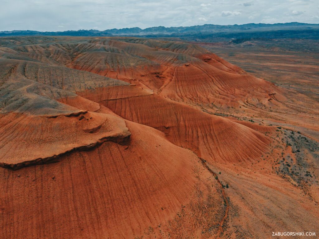
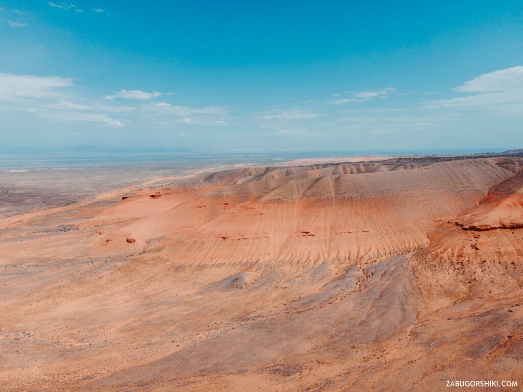
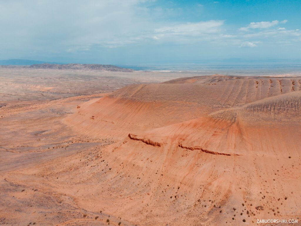
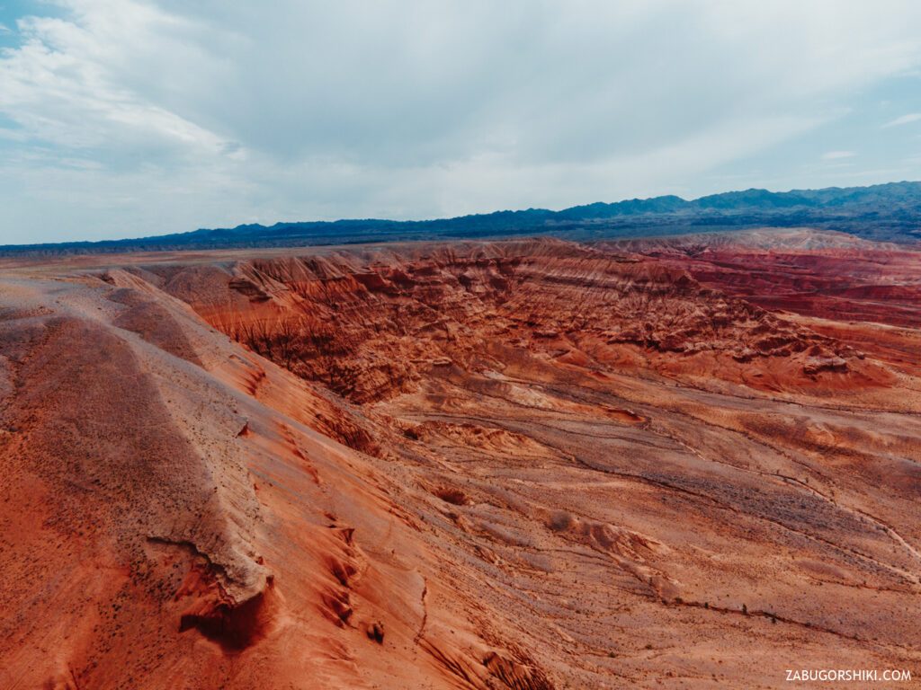
The relief resembles the dried-up bottom of an ancient ocean. Walking is complicated by the fact that every step is sunk into the sand. The season of ticks and the presence of all kinds of living creatures, makes you go around the bushes in a zigzag, increasing the distance to the foot. If you look closely at the entrances to the burrows, you can see cobwebs and occasionally sticking out the paws of not quite hospitable residents. Huge black “helicopters” fly from one bush to another, and now and then you have to dodge them.
The closer we got to the hills, the more red they became. It is not difficult to climb them to the peaks because of the low altitude, but you will gain sand in your runners with a vengeance
We came to the rock. The color cannot be conveyed by the camera, it is very unusual. It feels very dry to the touch, but it looks porous and sometimes a transparent material like glass is visible.
The intermediate height is taken. Immediately I want to admire the scenery of the valley. Shaking off another bug, they realized with horror that it was a TICK. A large, fat and very fast tick. It became not up to the beauties of nature. We immediately check for the presence of “tenants”. The verification was successful. Now you can also admire the surrounding world.
Walking through the red mountains, clearly resembles the movie “Mission to Mars”. The red “lifeless” planet attracts to go further and further… The sun is doing its job, now the sand is not just in the shoes — it is also hot.
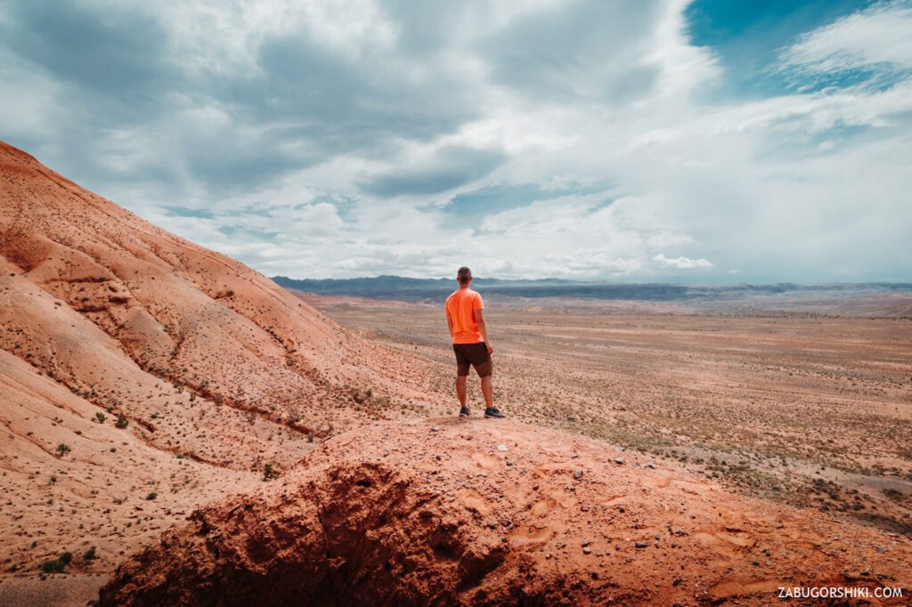
Another stop and the marsolet rushes into the sky. While Renat is piloting in search of” water and civilization”, the child and I are studying the world around us. It is not possible to stand in one place for a long time, because every living thing strives to get to know each other better. So we will not delay the pleasure. The descent from this small peak is complicated by sliding straight into the burrows))) We try not to step on”traps”.
A break.
Almaty and the surrounding region are located in such an amazing place, where several climatic and geographical zones come into contact at once. From an unprecedented hot desert with hot sand to dark green and almost impenetrable forests, from the bottom of an ancient ocean and a canyon with many species of small poisonous animals, to inaccessible mountain peaks covered with eternal snow and prehistoric ice. And all this is within the reach of one day’s journey.
The Return of the Jedi.
We are located exactly between the Charyn and Chilik rivers. And there is no hint of a fertile land at all)
But there is beauty and romance in this wasteland. Only shrubs with thorns, dry vegetation and a rare red-book Saxaul, which was entered in this book by the civilized themselves. Mass use for cooking meat on coals, because of its good gorenje and the issuance of a large amount of heat, led to the extermination of this seemingly stunted shaft. However, everything, as usual, is first destroyed uncontrollably, then we shake over the remaining crumbs. Take care of nature.
We got to the transport. The car warmed up under the scorching sun, and the interior became a microwave oven. It’s lunch time!!!
The child who went to the car on the “last couple”, now runs around it and spends the newly accumulated energy)) Why do children have so much strength to enjoy the world? In their purity of acceptance of this world. How I want to delay the moment of the first bitterness and disappointment of their naivety in this sometimes cruel world as far as possible.
After a short walk in the heat, the appetite in the rough is particularly brutal, but it is necessary to eat. After all, there is still a way back ahead.
While they were eating the dishes, small columns of cars began to pass by. Why is there such a movement here???
Each of them stopped and asked if we were all right and if we needed help. Special thanks to everyone for their attention. Not always there are such literate travelers, many can simply fly past and leave only columns of dust.
It became more and more interesting where they were going. But in response, they just smiled and left))) “There’s something not quite legal going on there,” we thought. We learned a masterfully veiled answer, or rather a clarifying question, only from the 20 car – ” And go to the festival in that direction?”. Then it became clear that the party was planned for more than one day. But there was no time to” fall on the tail and arrange surveillance”. It’s time to go on a reverse course.
About 10 minutes after our start of the “way home”, the sky was covered with clouds. And from a bright yellow desert with reddish mountains, the area turned into a dark valley.
It will take another 40 minutes before leaving for the “carpet” road home, and during this time we will meet many more interesting things. Herds of horses, herds of sheep and goats.
The road along the highway has become very hot again. The sun decided not to interrupt the rule “there will be no rain in our campaigns” and accompany us all the way home. Periodically falling asleep, Yasminka admired the multicolored nature, the changing landscape and the gradually returning notes of civilization. On the way, we stopped at a rapeseed field. Beautiful juicy yellow colors did not allow you to pass by. A couple of photos and again on the horses. Approaching the city, its fussiness and gas pollution became visible. But there is no getting away from it yet. Congestion, which has become an integral part of all residents, prevented the winners from entering the city through the open gates.
The result of the adventure: we did not go to the mountains, we left the city for the desert to find other mountains.
Difficulty: all the difficulties fell to the share of the pilot of a sports car. To conquer the hill is not even for the first time. BE sure to study the route and trails so as not to get lost.
Conclusion: even a small trip will bring you to Mars.
📷 Photos
🚁 Photos from drone

Itinerary
Detailed itinerary will be provided upon booking. Our typical tour includes daily hikes through diverse terrains and cultural experiences.
Pricing
| Group Size | 1 person | 2 people | 3 people | 4 people | 5 people | 6 people Best value |
|---|---|---|---|---|---|---|
| Standard | $190 $190 total | $118 $236 total | $94 $282 total | $82 $328 total | $74 $370 total | $70 $420 total |
100% private tour — prices are per person based on group size. The more friends you bring, the less everyone pays!
What's Included
Included
Not Included
Our Guarantee
If weather forces a cancellation, you choose a free reschedule or a full refund. If you're not satisfied with your experience, we'll work with you to make it right. No questions, no hassle.
Private tours only (max 6) · Reschedule or full refund if weather cancels · No payment until confirmed
Traveler Stories
Sarah K.
Our guide was incredible - he adjusted the pace perfectly for our group and knew exactly where to stop for the best photos. The whole experience felt effortless, like everything was taken care of before we even thought to ask.
Marco T.
We were a group of 4 friends and the per-person price made it a no-brainer. Private 4x4, lunch included, and the canyon was breathtaking. Way better than the big bus tours we saw there.
Anna W.
Solo traveler here. I was nervous about hiking alone in a foreign country but the guide made me feel completely safe. The trail to Kok-Zhailau was beautiful and the photos he took of me were amazing. Only wish the hike was longer!
David R.
Third time booking with these guys. Butakovka, Big Almaty Lake, and now Titov Peak. Every single time the service is flawless. The fact that it's always private and max 6 people makes such a difference compared to other operators.
Share Your Experience
Tour At A Glance
Book This Tour
Private tours run any day of the week — weekends fill up fastest, so book early
Pay securely after confirmation


Weather Forecast
overcast clouds
H: 31°C
L: 23°C
Mon, Jul 27
clear sky
27°C
22° / 32°
Tue, Jul 28
clear sky
26°C
21° / 30°
Wed, Jul 29
clear sky
26°C
20° / 31°
Tour Location
Similar trails
From $70
per person · weather refund
Complete Your Booking
Tour:
Date:
Participants
Add-ons
You're Almost There!
We'll contact you within 24 hours to confirm your spot and share everything you need to prepare for your adventure.
Request sent
We confirm your spot
within 24 hours
Summoning perfect weather
Hit the trail
On the channel
83 h
Drone flight hours
What we’ve filmed
59
Hikes filmed
704 km
Kilometers covered
44,439 m
Elevation gained
27
Countries visited
Plan your hike with us
A few quick questions and we will email you a tailored hike plan & quote.
When do you want to hike?
What's your experience?
How many of you?
Where do we send your plan?
Private guided hikes · no obligation.