
Overview
Is this hike right for you?
Perfect if you…
No experience needed
Description
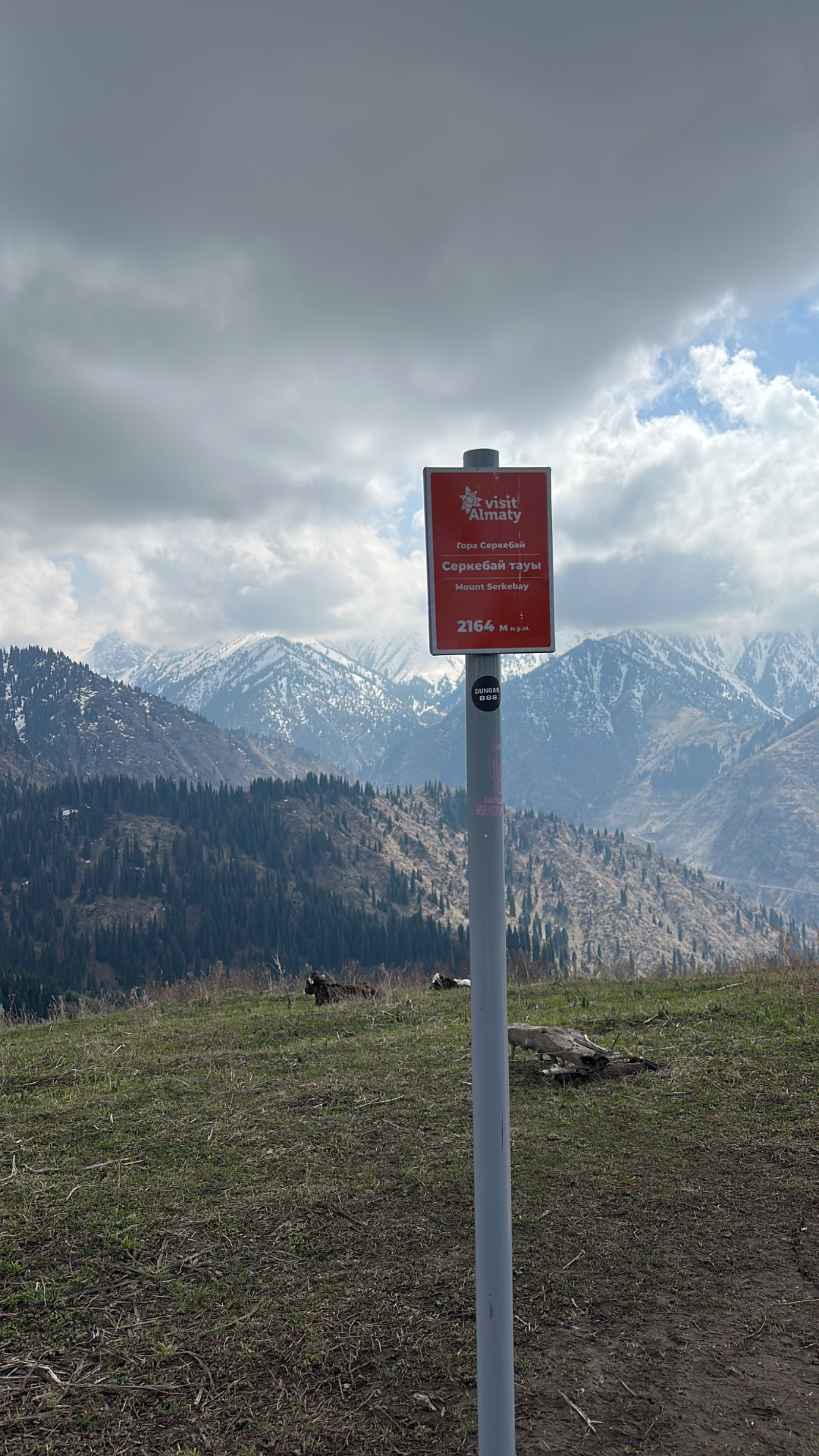
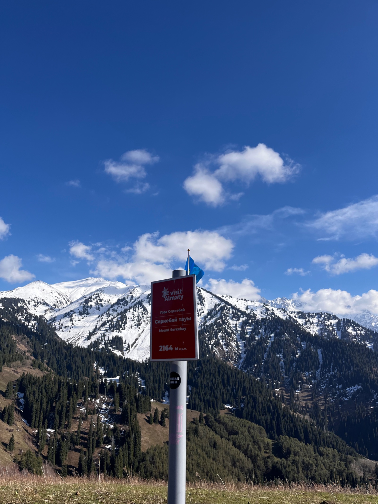
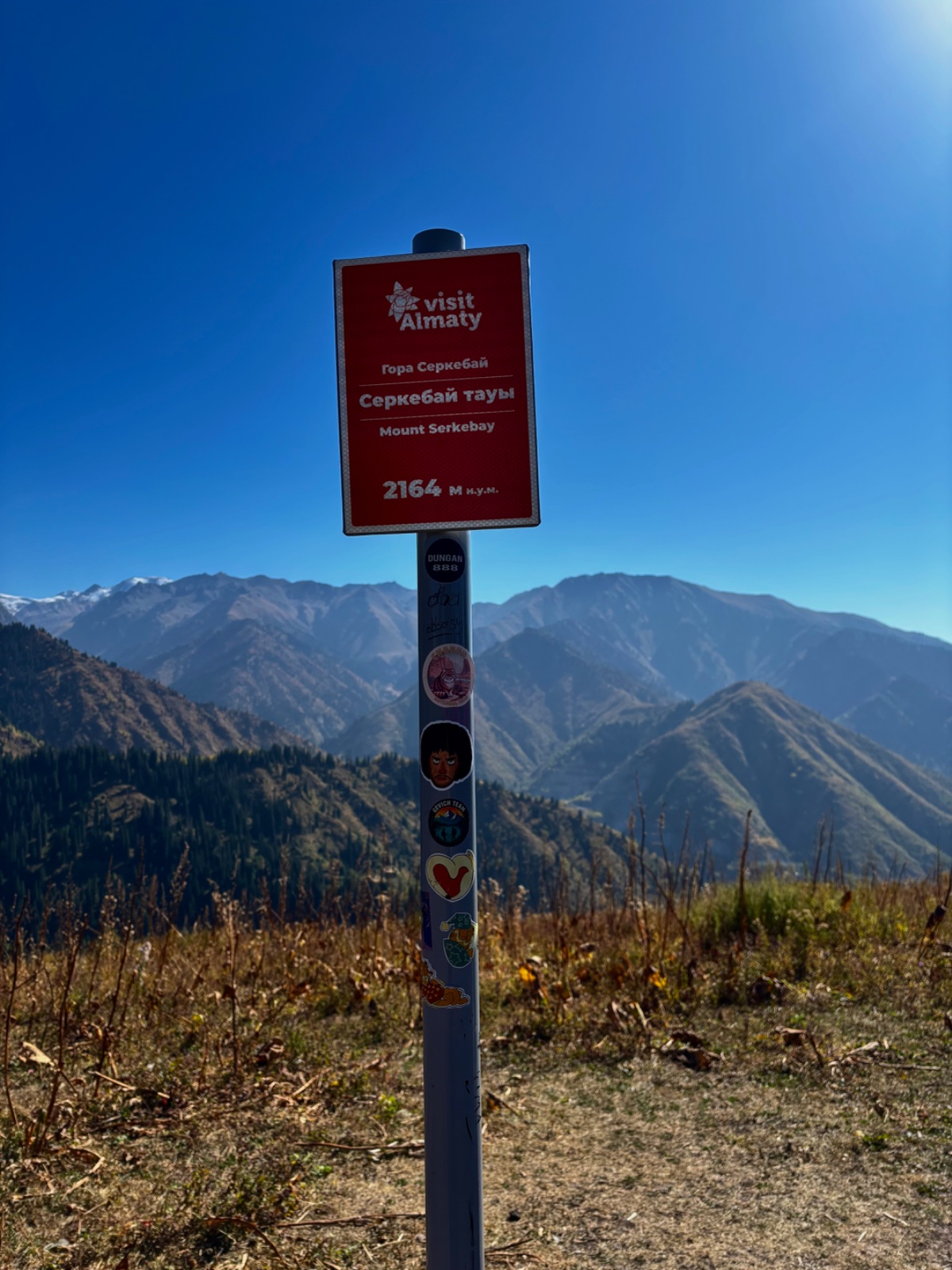
An easy loop hike from Medeo over Serkebay Mountain (2,170 m) — also known as Altynbas, the “Golden Head” — through birch groves and spruce forest on the Karakungei ridge, with views of the Medeo dam, the snow-capped peaks of the Small Almaty Gorge, and a descent through the Kim Asar gorge back to Medeo.
What to expect on the Serkebay hike from Almaty
The Serkebay hike from Almaty is one of the easiest summit experiences in the mountains near the city — a true mountaintop that you can reach in 2–3 hours on a well-marked trail with benches, signposts, and even steps in the steepest sections. It’s a mountain hike with training wheels, and that’s not a criticism. For families with children, first-time hikers, or travelers who want mountain views without mountain suffering, Serkebay is ideal.
The mountain has two names, each telling a different story. “Serkebay” was the name of a local forester who worked these slopes — the mountain bears his memory. “Altynbas” is Kazakh for “Golden Head,” named for the way the south-facing summit slope turns bright yellow in summer when the grass dries in the sun, and again in autumn when the surrounding birch and aspen forests turn gold and amber. Both names are used locally; you’ll see them on maps and signposts interchangeably.
At 2,170 m, Serkebay sits below the treeline. This means the summit itself has trees growing on it — unusual for a “mountain summit” experience and something your page notes as a departure from the typical 3,000 m+ peaks that Zabugorshiki usually climb. The trees create a sheltered, intimate summit atmosphere quite different from the exposed, windswept tops of higher peaks.
The route works beautifully as a loop: up via the Karakungei ridge from the Medeo gondola base station, summit Serkebay, then descend via the Kim Asar Pass into the Kim Asar gorge and back to Medeo. This circuit shows you two completely different landscapes — the sunny ridge with panoramic views on the ascent, and the shaded forest gorge on the descent.
Detailed Itinerary
Pickup and drive to Medeo (20–30 minutes)
We pick you up from your accommodation in Almaty and drive to Medeo, approximately 14 km south of the city center. The starting point is the lower gondola station of the Medeo-Shymbulak cable car. Elevation at the start: approximately 1,620 m.
Bus 12 from Dostyk Avenue runs to the Medeo terminus for independent travelers.
Through the birch grove and onto the ridge (40–60 minutes)
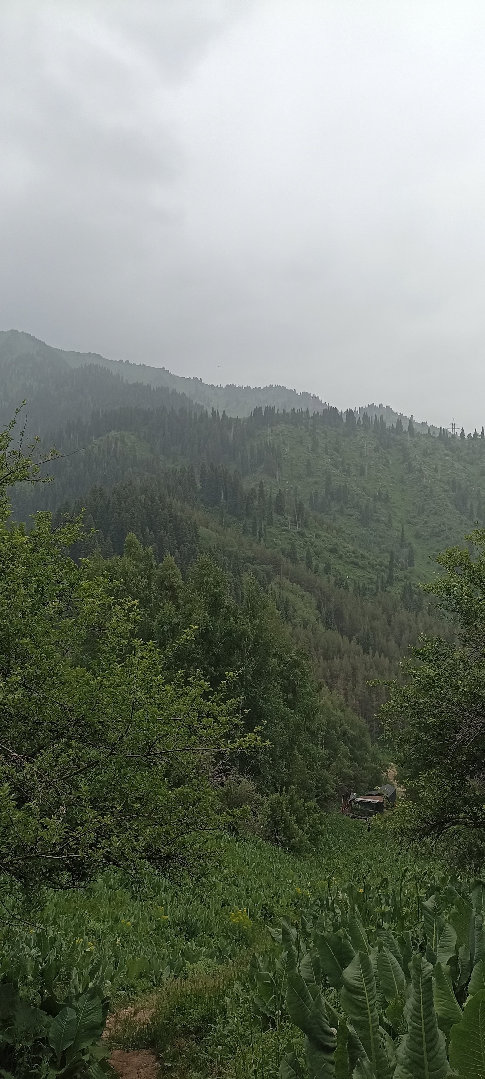
From the gondola base station, we cross a bridge and enter a beautiful birch grove. This is the start of the “Health Trail” (Tropa Zdorovya) — a maintained path with signposts, benches, and wooden steps built into the steeper sections. The trail climbs through birch, aspen, and pine woodland, with the steepest section right at the beginning.
As you gain elevation, the birch grove transitions to spruce forest and then opens onto the Karakungei ridge. The ridge runs between the Malaya Almatinka (Small Almaty Gorge) to the west and the Butakovka/Kim Asar gorge to the east. You’ll pass the wooden fire watchtower that marks the Karakungei ridge crest (around 1,950 m) — a landmark also used on the shorter Karakungei Peak hike.
The benches along the trail make natural rest stops, and many locals use this section for morning trail runs or casual weekend walks.
Along the Karakungei ridge to Serkebay (40–60 minutes)
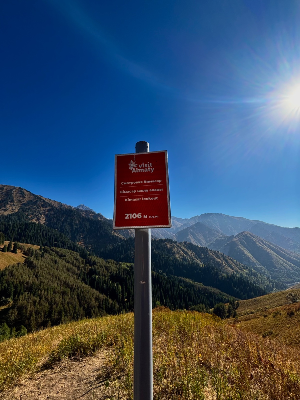
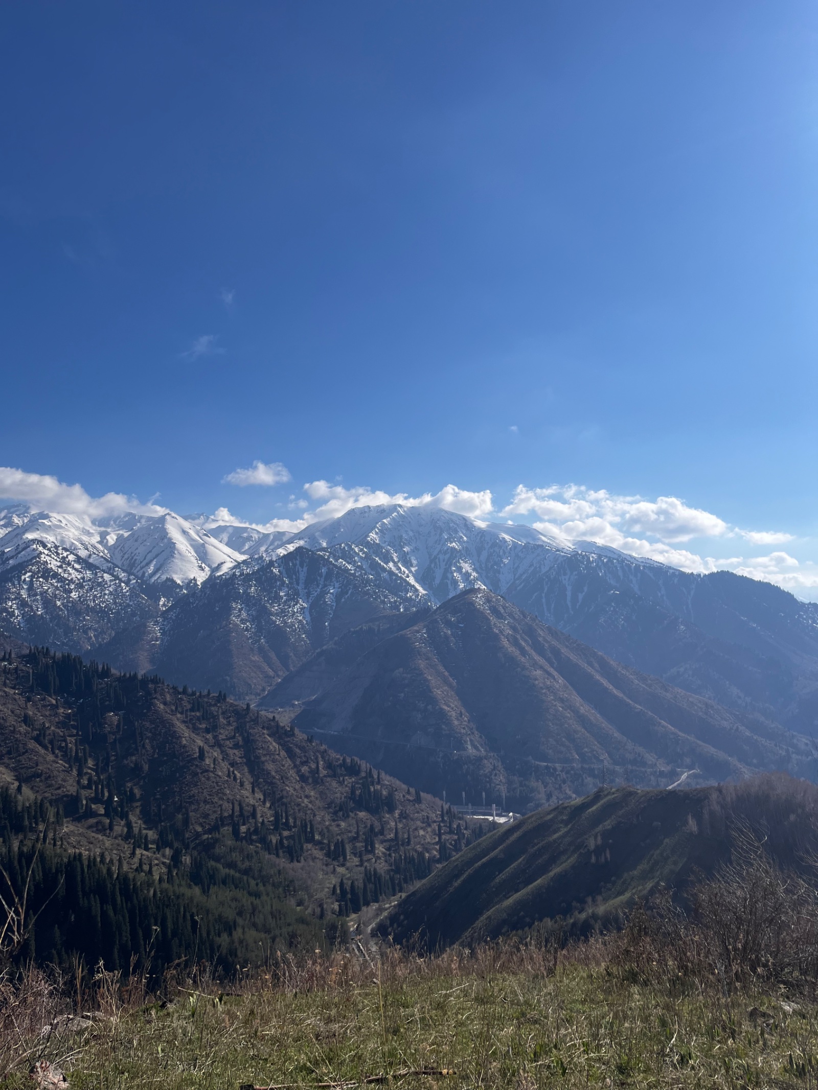
From the Karakungei ridge crest, the trail continues southwest along the ridge toward Serkebay. This is the most scenic section of the ascent — a gentle, rolling ridge walk with expanding views in both directions. To the west, you look down into the Small Almaty Gorge, with the Medeo skating rink, the Medeo dam, and the road winding up toward Shymbulak visible below. To the east, the Kim Asar gorge opens up with its forest and meadows.
The ridge passes through alternating sections of open meadow and light forest. In spring (April–May), wildflowers bloom across the sunny south-facing slopes. In autumn (September–October), the birch and aspen along the ridge create brilliant displays of gold and orange foliage — the Karakungei ridge is considered one of the best spots near Almaty for autumn colors because of its south-facing exposure and diverse tree cover.
The final approach to Serkebay is a gentle climb of about 1 km. You arrive at the summit without drama — there’s no final scramble or exposed ridge, just a trail through trees that opens to the highest point.
At the summit (20–40 minutes)
Serkebay’s summit at 2,170 m is unusual: trees grow here. You’re below the treeline, so the summit area is a mix of open grassy clearings and scattered trees. This creates a pleasant, sheltered environment — you can sit in the sun on the grass or find shade under a tree, making it an excellent picnic spot.
The views from the summit and surrounding clearings include:
- West/Southwest: The Medeo dam and skating rink complex, with the snow-capped peaks of the upper Small Almaty Gorge behind — Peak Abay (4,010 m), Kumbel (3,160 m), and the Shymbulak ski resort visible up the valley
- East: The Kim Asar gorge stretching below, with the Kim Asar swings viewpoint visible on the opposite ridge
- Southeast: The Furmanov Peak (3,053 m) and Panorama (3,260 m) ridge — the popular ridgeline hike visible from an unusual angle
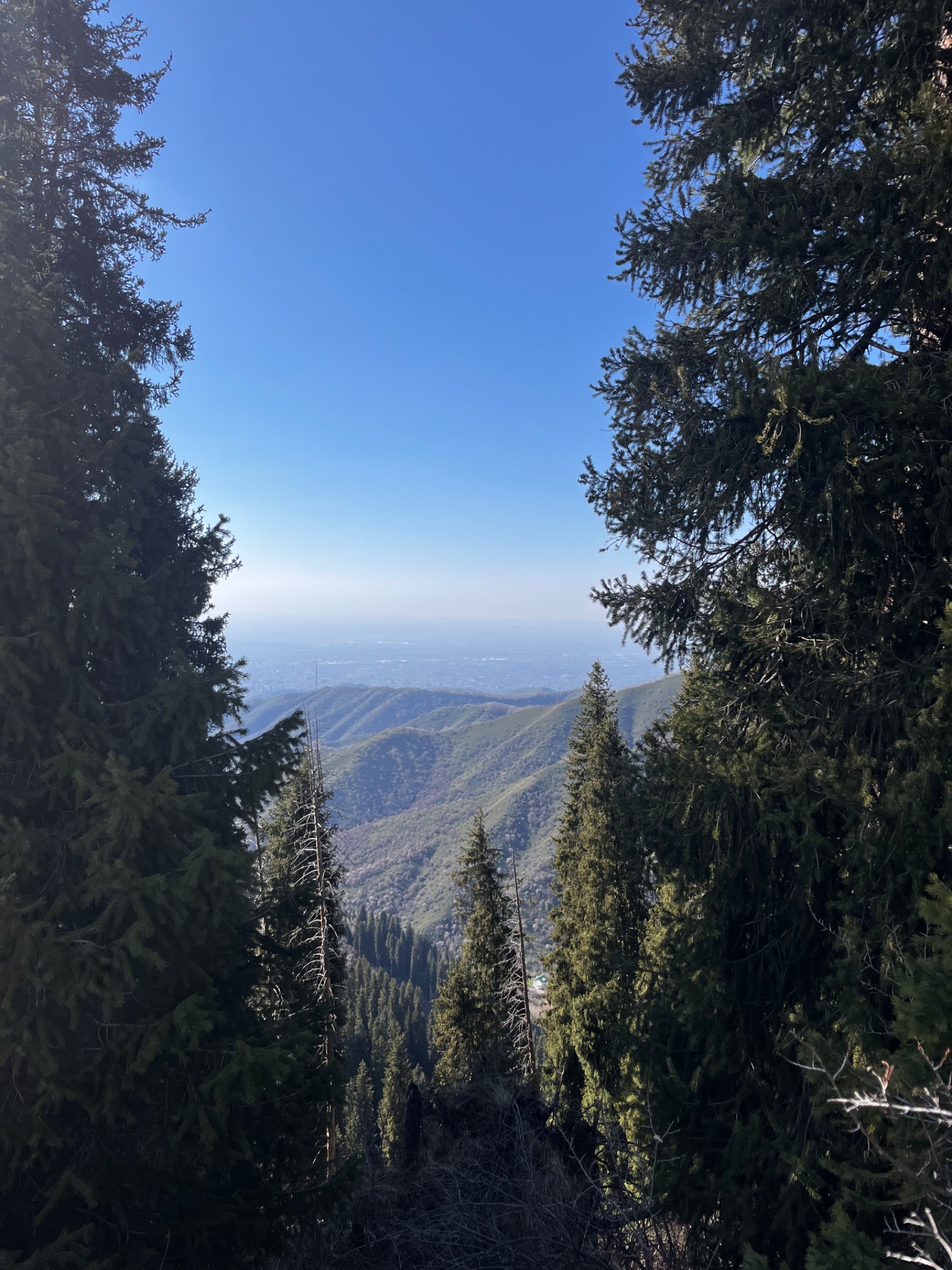
- North: Almaty city spread below
- South: The Karakungei ridge extending back toward Karakungei Peak and the Slonikha (Elephant) viewpoint
The summit is a popular picnic spot for locals who know the area. Your page describes encountering groups of regulars who hike here frequently — a sign that this route has genuine local appeal beyond the tourist circuit.
Descent via Kim Asar Pass (30–40 minutes to the pass)
From Serkebay, the trail descends southeast toward the Kim Asar (Kimasarovsky) Pass at approximately 2,060 m. This is a well-marked section with a clear trail. The pass connects the Karakungei ridge system to the Butakovka gorge network — from here, you could continue toward the Butakovka waterfalls, though our loop turns northeast toward Kim Asar gorge and Medeo.
Along the descent, you’ll pass an abandoned all-terrain vehicle rusting in the forest — a well-known trail landmark that makes for an interesting photo stop and conversation about how it got there.
Kim Asar gorge back to Medeo (1–1.5 hours)
From the Kim Asar Pass, the trail descends through the Kim Asar gorge back to the Medeo road. This section passes through dense spruce forest — a different atmosphere from the sunny ridge ascent. The trail follows a road/track through the gorge, eventually emerging near the Kim Asar gorge entrance on the road leading to Medeo.
The final 1.5 km along the road brings you back to the bus 12 terminus at Medeo, completing the loop.
Drive back to Almaty (20–30 minutes)
Two names, two stories
The dual naming of Serkebay/Altynbas captures two different relationships with this mountain.
“Serkebay” preserves the memory of a real person — a forester who worked on these slopes, maintaining the trails and forests that people still walk today. Naming mountains after the people who cared for them is a Central Asian tradition that connects landscape to human history in a personal way. When you hike to Serkebay, you’re walking through a forester’s workplace.
“Altynbas” — “Golden Head” — describes what you see from a distance. The south-facing summit slope catches the full force of the sun, drying the grass to a golden-yellow in summer. In autumn, the surrounding birch and aspen forests add their own gold to the palette. From the Medeo road below, the mountain’s crown glows golden against the darker spruce forests on either side. The name is pure description, but it’s accurate — this is one of the most photogenic mountains near Almaty in autumn.
A training ground for bigger adventures
Serkebay’s moderate difficulty, well-marked trail, and loop format make it an excellent “calibration hike” — a way for tourists to test their fitness, break in their hiking boots, and acclimatize to the altitude before attempting harder routes. At 2,170 m, it introduces you to mountain air without pushing into the altitude where some people feel uncomfortable.
The loop format is also valuable: you experience two different trail styles (ridge walk and gorge descent) in a single hike, which helps you understand what to expect on longer routes. And because the Karakungei ridge connects to trails leading to Kok-Zhailau, Mokhnatka, and Kim Asar, a guide can point out these routes and discuss which ones might suit you for subsequent days.
Many repeat visitors to Almaty use Serkebay as their Day 1 hike — an arrival-day walk that stretches the legs, provides mountain views, and sets the tone for more ambitious outings later in the trip.
Why book a guided Serkebay hike?
Serkebay is one of the most accessible hikes near Almaty — the trail is well-marked and starts from a major landmark. But a guided tour adds value in several ways:
Optimal route selection: There are multiple ways to reach Serkebay (from the gondola station, from the Medeo parking lot, from the Kim Asar gorge). In 2022, the old entrance via the Kim Asar ecopost became paid, and a fence was installed, making some approach routes less convenient. A guide navigates these access changes and takes the current best route.
Loop logistics: The loop requires knowing which turn to take at the Kim Asar Pass and navigating the gorge descent. While the trail is marked, a guide ensures smooth navigation and can adjust the loop if conditions change.
Combination tours: Serkebay works perfectly as a morning hike combined with an afternoon visit to Medeo/Shymbulak (cable car ride), the Kim Asar swings (viewpoint with panoramic swings), or even a second short hike like Karakungei Peak.
Context and natural history: The guide explains the vegetation zones, identifies the peaks visible from the ridge, shares the story behind both names, and points out features like the abandoned ATV in the forest.
FAQ: Serkebay Mountain Hike
How difficult is the Serkebay hike? Rated 2/5 — easy to moderate. The loop gains about 600 m over 7–8 km, with the steepest section at the very beginning of the trail (which has built-in wooden steps). Most of the route follows a well-marked ridge with gentle grades. Comparable in difficulty to Kok-Zhailau but shorter.
Is this suitable for children and families? Yes — Serkebay is widely recommended as a family-friendly hike. Children aged 6+ with normal energy can complete the route. The trail has benches for rest stops, and the summit is a pleasant picnic spot. The loop format keeps things interesting because you’re not retracing the same path.
What are the two names for this mountain? “Serkebay” — named after a local forester who worked on these slopes. “Altynbas” (Алтын Бас) — Kazakh for “Golden Head,” because the south-facing summit slope turns golden-yellow from dried grass in summer and autumn foliage. Both names appear on maps and signposts.
Where does the trail start? The most convenient current starting point is the lower gondola station of the Medeo-Shymbulak cable car. This avoids fee and access issues at the Kim Asar ecopost entrance.
Can I do this year-round? Largely yes. The south-facing Karakungei ridge clears of snow early in spring (often by April) and stays accessible late into autumn. In winter, the trail is walkable with appropriate traction devices, though the Kim Asar gorge descent can be icy.
How does Serkebay compare to Kok-Zhailau? They’re similar in difficulty and time commitment. Kok-Zhailau takes you to a broad alpine plateau at ~2,300 m; Serkebay takes you along a ridge to a forested summit at 2,170 m. Kok-Zhailau is more famous and more crowded. Serkebay is quieter and offers a loop format. They complement each other well.
Can I combine Serkebay with Karakungei? Absolutely — Karakungei Peak (1,821 m) is a waypoint on the same ridge, passed during the ascent. You’ll see both viewpoints naturally on the loop. Adding Karakungei doesn’t increase the time significantly since it’s on the way.
What’s the abandoned vehicle on the trail? An old all-terrain vehicle rusting in the forest near the Kim Asar Pass area. It’s become a well-known trail landmark — nobody seems to know exactly how it ended up there, which adds to its charm. Good photo opportunity.
Is there water on the trail? No reliable water source on the ridge. There’s a stream in the Kim Asar gorge on the descent, but bring at least 1–1.5 liters from the start.
When is the best time for autumn colors? Late September through mid-October. The birch and aspen on the Karakungei ridge turn brilliant gold, and the sun-dried grass on the south slopes adds warm amber tones. This is when the “Golden Head” name makes most sense.
Itinerary
Detailed itinerary will be provided upon booking. Our typical tour includes daily hikes through diverse terrains and cultural experiences.
Pricing
| Group Size | 1 person | 2 people | 3 people | 4 people | 5 people | 6 people Best value |
|---|---|---|---|---|---|---|
| Standard | $122 $122 total | $85 $170 total | $72 $216 total | $66 $264 total | $62 $310 total | $60 $360 total |
100% private tour — prices are per person based on group size. The more friends you bring, the less everyone pays!
What's Included
Included
Not Included
Our Guarantee
If weather forces a cancellation, we reschedule at no cost. If you're not satisfied with your experience, we'll work with you to make it right. No questions, no hassle.
Private tours only (max 6) · Free cancellation up to 48 hours before · No upfront payment
Traveler Stories
Sarah K.
Our guide was incredible - he adjusted the pace perfectly for our group and knew exactly where to stop for the best photos. The whole experience felt effortless, like everything was taken care of before we even thought to ask.
Marco T.
We were a group of 4 friends and the per-person price made it a no-brainer. Private 4x4, lunch included, and the canyon was breathtaking. Way better than the big bus tours we saw there.
Anna W.
Solo traveler here. I was nervous about hiking alone in a foreign country but the guide made me feel completely safe. The trail to Kok-Zhailau was beautiful and the photos he took of me were amazing. Only wish the hike was longer!
David R.
Third time booking with these guys. Butakovka, Big Almaty Lake, and now Titov Peak. Every single time the service is flawless. The fact that it's always private and max 6 people makes such a difference compared to other operators.
Share Your Experience


7+ hikers
completed this trail
Tour At A Glance
Book This Tour
Weekend slots fill up fast — book early to get your preferred date
Pay securely after confirmation


Weather Forecast
overcast clouds
H: 3°C
L: 2°C
Tue, Mar 31
overcast clouds
9°C
2° / 16°
Wed, Apr 1
overcast clouds
9°C
7° / 13°
Thu, Apr 2
few clouds
11°C
7° / 15°
Tour Location
Similar trails
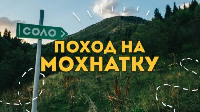
Day Hiking Tour to Mokhnatka Mountain from Almaty
From $72/person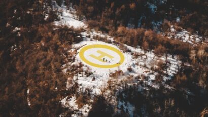
The Helipad Walk
From $43/person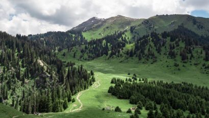
Day Hiking Tour to Kok-Zhailau from Almaty
From $72/person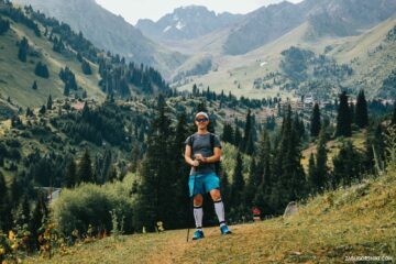
Gorelnik Gorge: Hiking Hub of the Almaty Mountains
From $60/personFrom $60
per person · free cancellation
Complete Your Booking
Tour:
Date:
Participants:
Price:
You're Almost There!
We'll contact you within 24 hours to confirm your spot and share everything you need to prepare for your adventure.
165
Videos on the channel
13,000+
16,000+
59
Hikes Filmed
704,000 m
Total Distance
44,439 m
Total Elevation Gain
812 cups
Grand Cru Tea Cups
27
Countries Visited
83 hours
Drone Flight Hours
10 videos
Sports: Running, Snowboard
3 videos
Healthy Eating
1
Living on the Edge