Small Almaty Circumnavigation (MAK) – Four-Summit Ridge Traverse from Medeo to Shymbulak
From $75 per person

Overview
Is this hike right for you?
Perfect if you…
No experience needed
Description
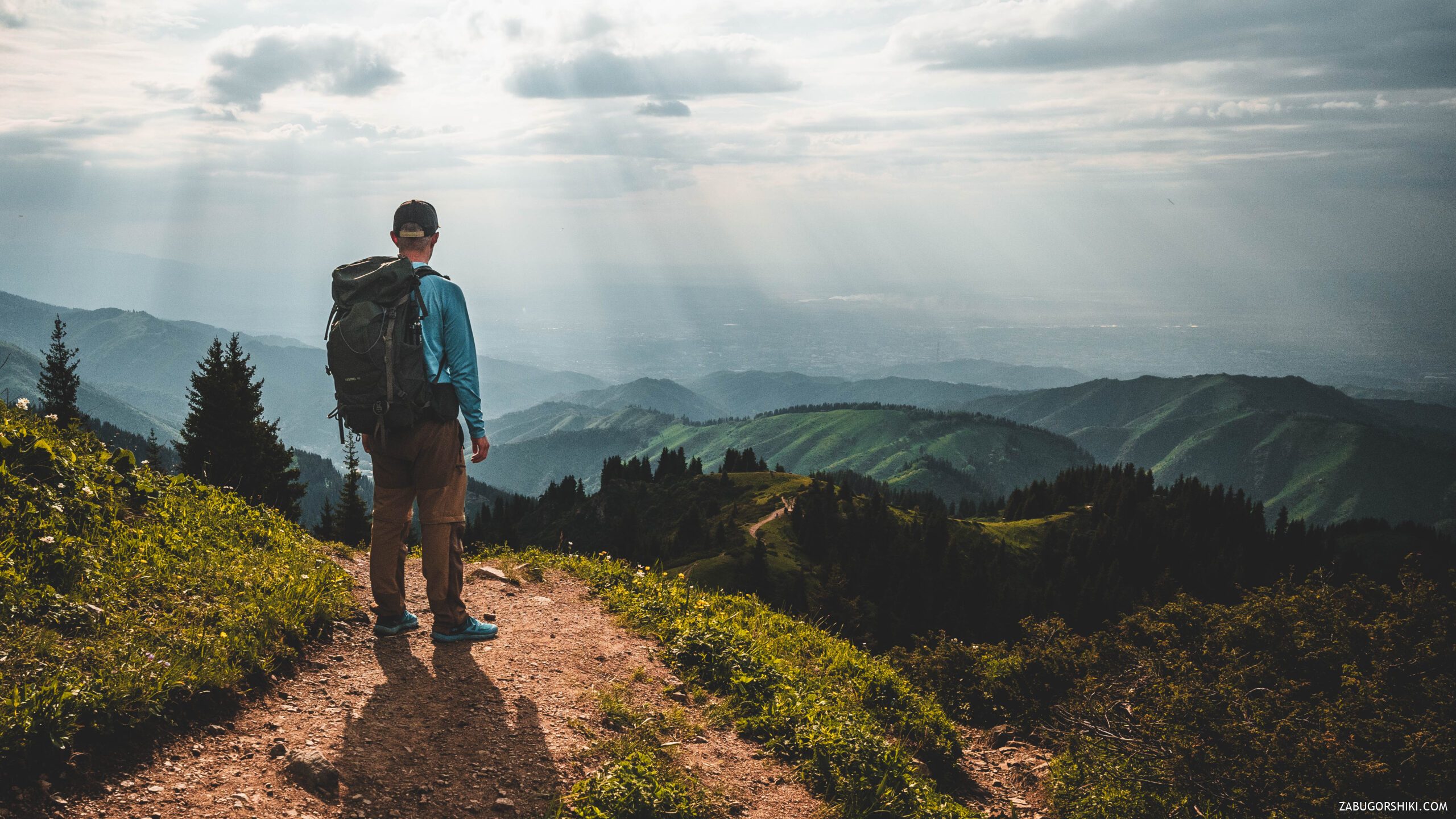
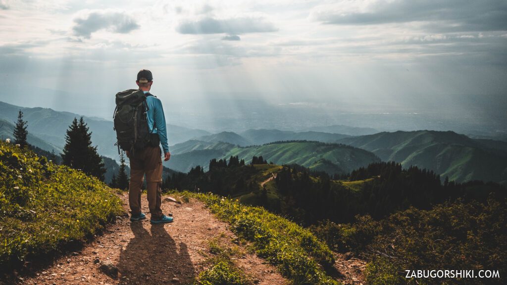
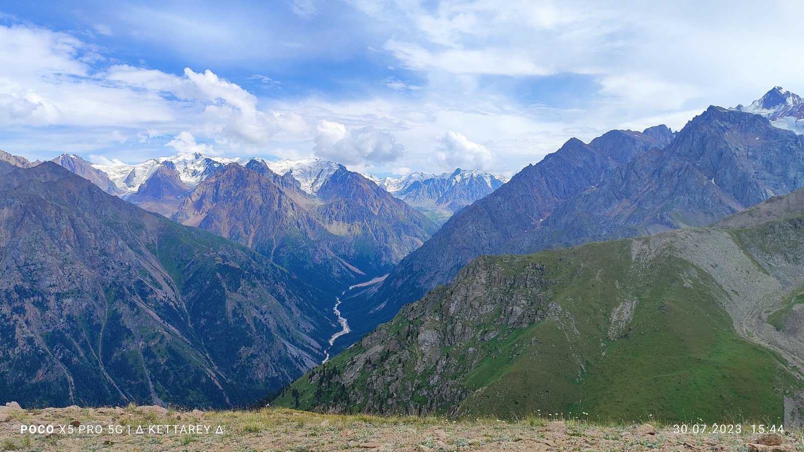
The Small Almaty Circumnavigation — known locally as MAK (Малая Алматинская Кругосветка) — is a ridgeline traverse of four summits above 3,000 metres, completed in a single day. It’s the most demanding day hike in the Almaty catalogue and one of the most rewarding: a skyline walk that connects Furmanov Peak (3,053 m), Panorama Peak (3,260 m), Bashuta Peak (3,355 m), and Chimbulachka Peak (3,450 m) before descending to Talgar Pass (3,200 m) and the Shymbulak cable car.
The route can be done in two directions — classic (bottom to top) and reverse (top to bottom) — with very different physical demands.
What to expect
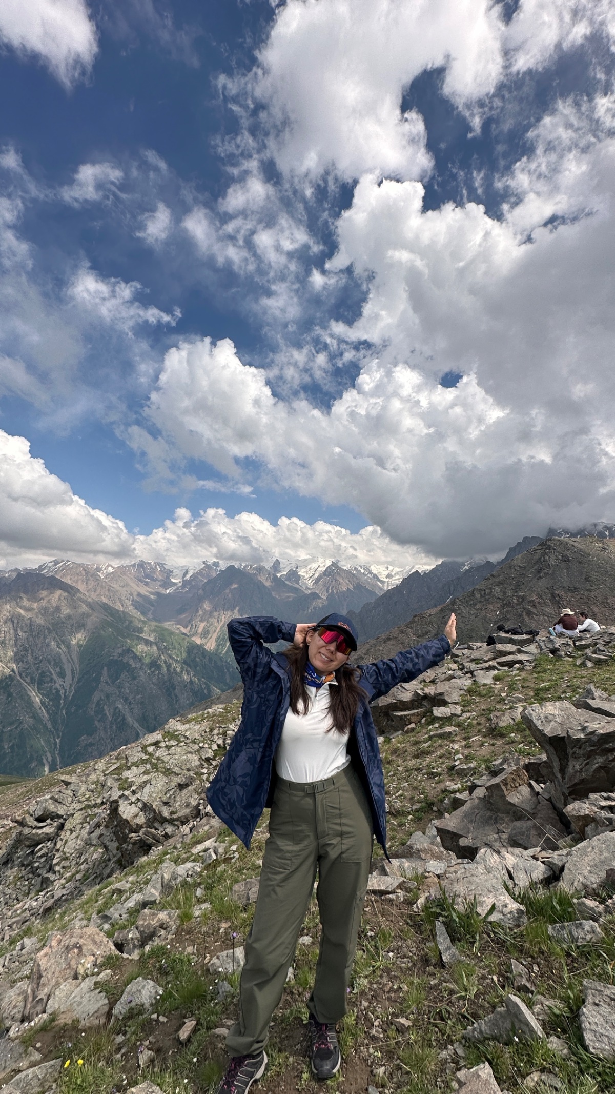
MAK is the hike that every regular Almaty hiker aspires to complete. It’s sometimes called the Celestial Traverse (Подnебесный Траверс), and the name is earned: for most of the route you’re walking a ridgeline above 3,000 m with the city spread out on one side and the high Tian Shan glaciers on the other.
This is not a beginner’s route. The classic direction involves approximately 1,400–1,800 m of cumulative elevation gain over 12–17 km, with four separate summit pushes connected by ridge walking. The terrain transitions from forest trail to exposed ridgeline to rocky scramble to alpine scree. The day typically takes 7–10 hours of continuous movement. You need prior mountain hiking experience, solid fitness, and — critically — a guide who knows the route, because the trail is poorly marked and easy to lose above treeline.
The reward is a perspective on the Almaty mountains that no single-summit hike can match. Instead of climbing one peak and coming down, you traverse the entire skyline ridge that separates the Kimasar Gorge from the Malaya Almatinka valley. Every step changes the panorama. You see the city from four different angles, watch Almaty Peak/Komsomol (4,376 m) and Talgar (5,017 m) rotate around you as you progress along the ridge, and finish the day by riding a cable car down from exactly the mountain range you just walked across.
The two directions
Classic route: Bottom to top (Medeo → Shymbulak)
The traditional direction. You start at Medeo (1,680 m), climb the entire elevation gain on foot, summit all four peaks in ascending order, and descend via cable car from Talgar Pass. This is the harder option but the more satisfying one — you earn every metre.
Reverse route: Top to bottom (Shymbulak → Medeo)
The easier alternative. You take the Medeo–Shymbulak cable car to Talgar Pass (3,200 m), summit the peaks in descending order, and walk down through Kimasar Gorge to Medeo. Approximately 80% of the route is downhill. Significantly less cardiovascularly demanding — but harder on the knees. Not recommended for people with knee problems due to the extended steep descent.
Detailed itinerary: Classic route (bottom to top)
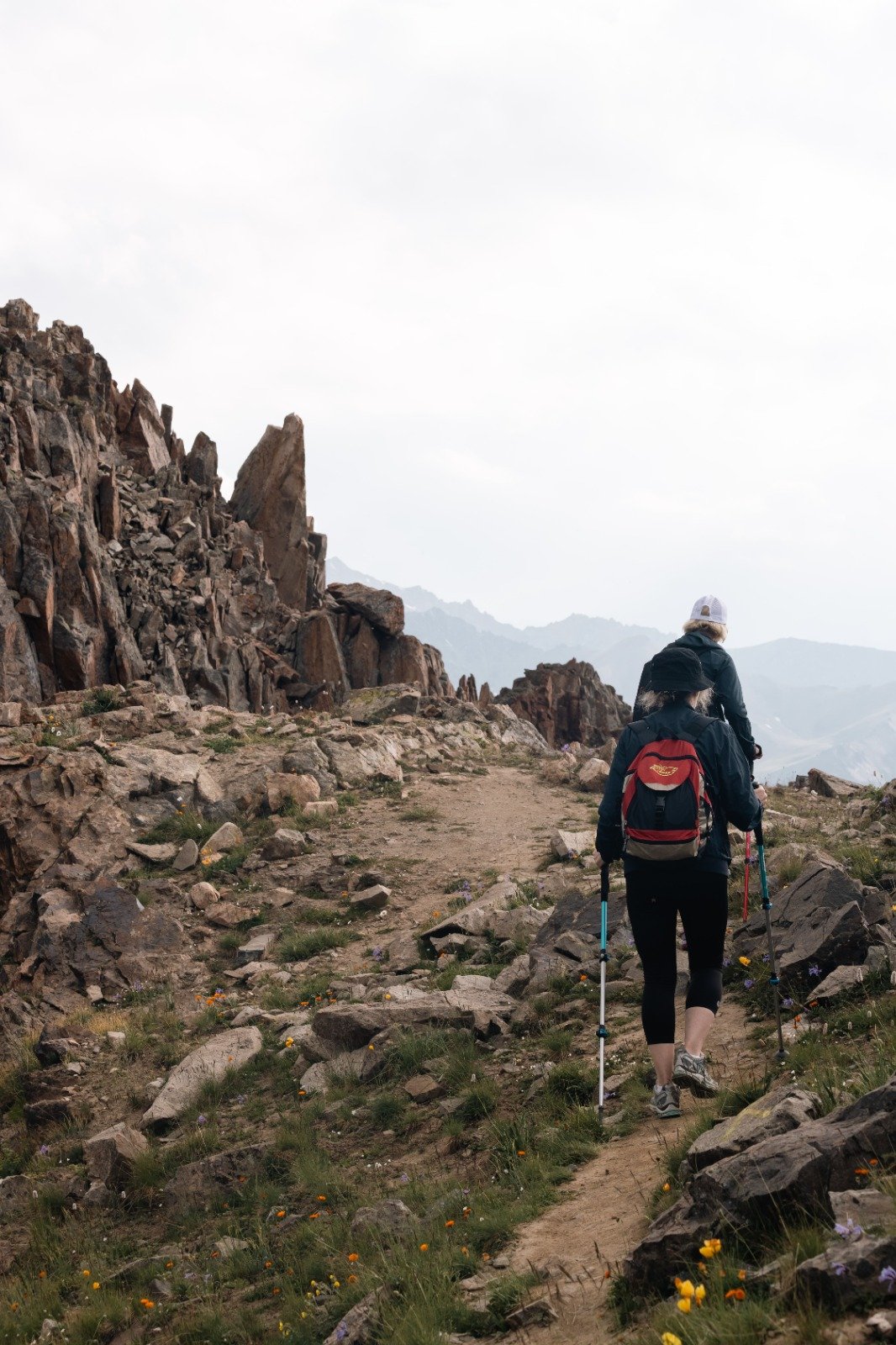
Stage 1: Medeo → Kimasar Gorge → Furmanov Swing (1,680 m → 2,500 m)
Distance: ~5 km | Time: 2–2.5 hours | Elevation gain: +820 m
Meet your guide at the Medeo skating rink fountain at 6:00–7:00 AM. Early start is essential — you need daylight and must reach Talgar Pass before the last cable car descends.
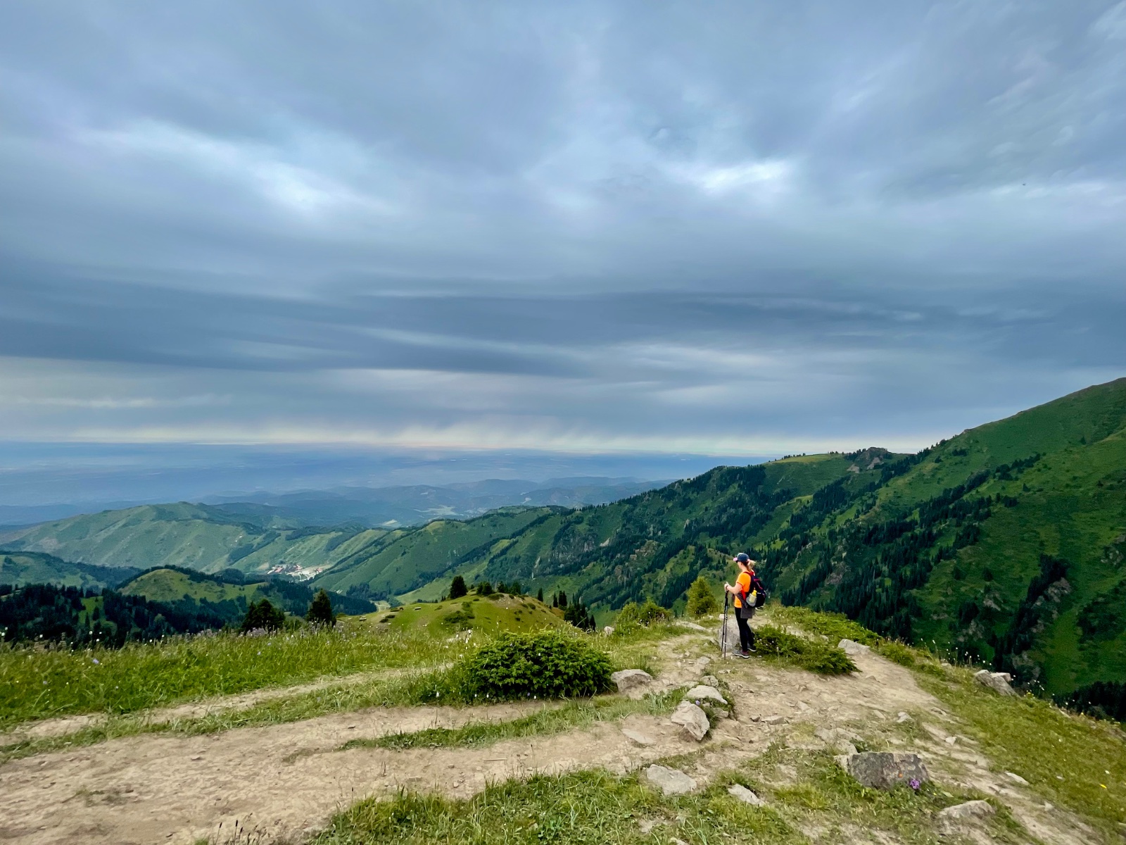
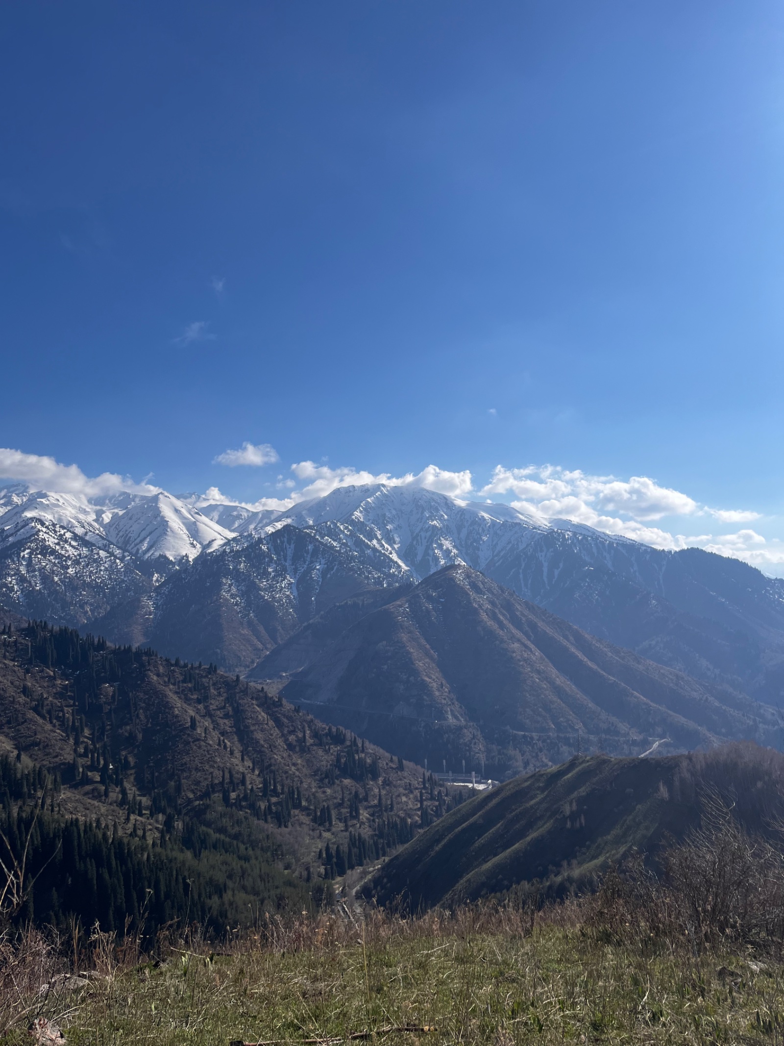
Turn immediately into Kimasar Gorge (Кимасарское ущелье), leaving the main Medeo–Shymbulak road behind. The trail follows a paved road that quickly becomes a mountain track along the Kimasar stream. The gorge is forested with Tian Shan spruce, shaded and cool in the morning.
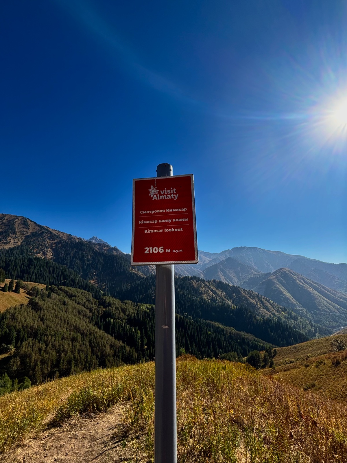
After approximately 3 km, the trail exits the gorge floor and climbs onto the eastern ridge of the gorge. At approximately 2,500 m, you reach the famous Furmanov swing — a wooden swing installed on the ridgeline with views over Almaty. This is the most photographed spot on the route, where hikers and Instagram visitors alike stop.
For most casual hikers, the swing is the destination. For MAK hikers, it’s the warm-up.
Stage 2: Furmanov Swing → Furmanov Peak (2,500 m → 3,053 m)
Distance: ~2 km | Time: 1–1.5 hours | Elevation gain: +553 m
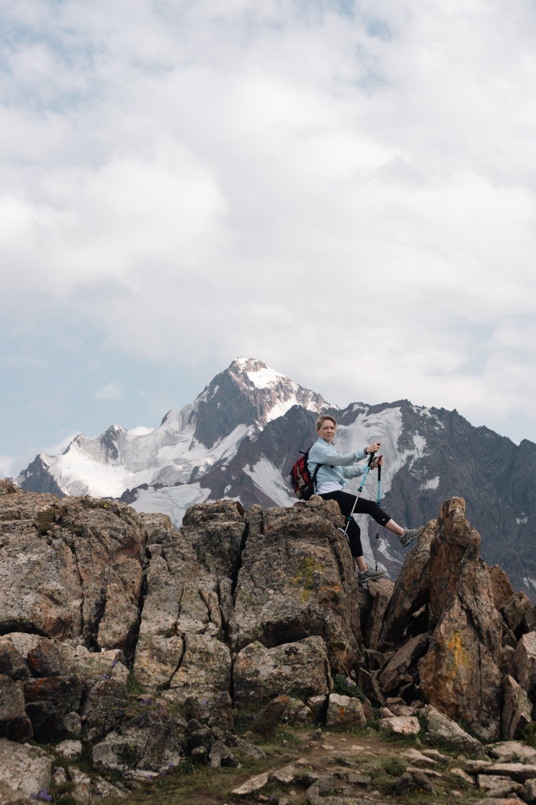
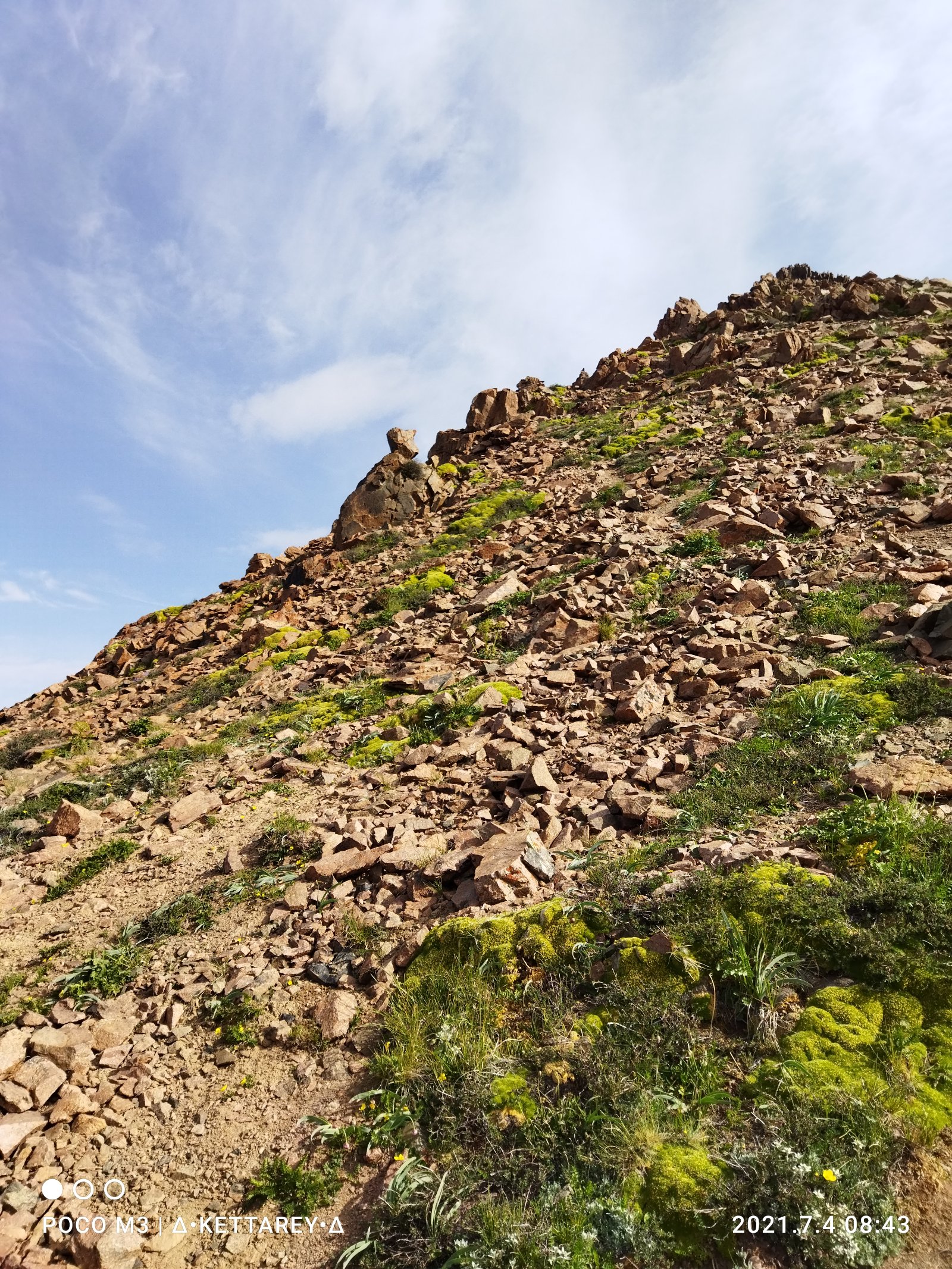
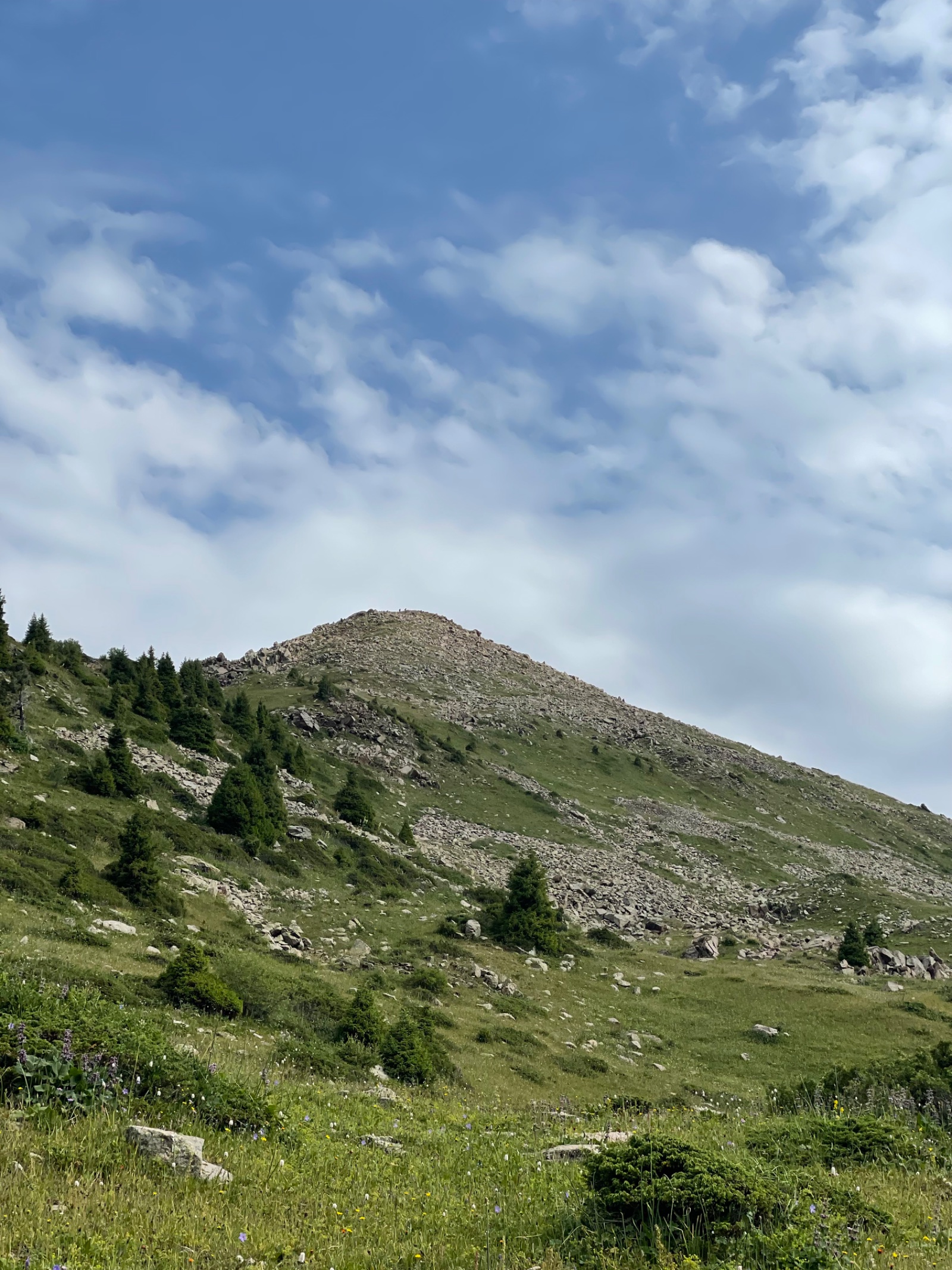
From the swing, the trail continues along the ridge, which narrows and steepens. The last kilometre to Furmanov’s summit involves scrambling over rocky terrain — not technical climbing, but requires hands in places. The vegetation thins and disappears. You enter the alpine zone.
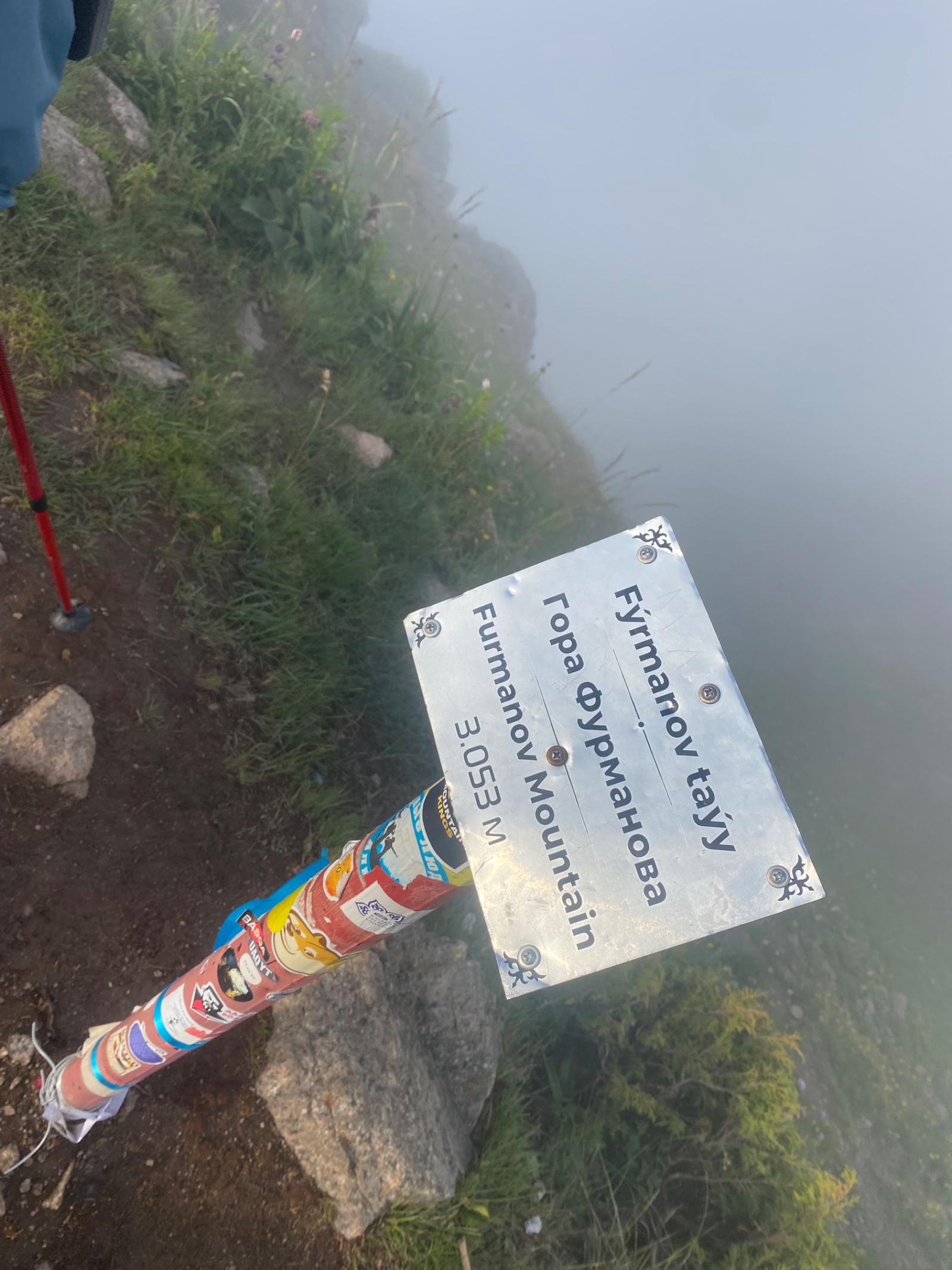
Furmanov Peak (3,053 m) — the first summit. Named after Dmitry Furmanov, a Soviet Civil War political commissar and author. From the top: the city of Almaty spreads north below you, Kok-Tobe and its TV tower visible. South: the ridge continues upward toward Panorama and beyond — the rest of your day laid out before you.
Stage 3: Furmanov → Panorama Peak (3,053 m → 3,260 m)
Distance: ~1.5 km | Time: 45 min–1 hour | Elevation gain: +207 m
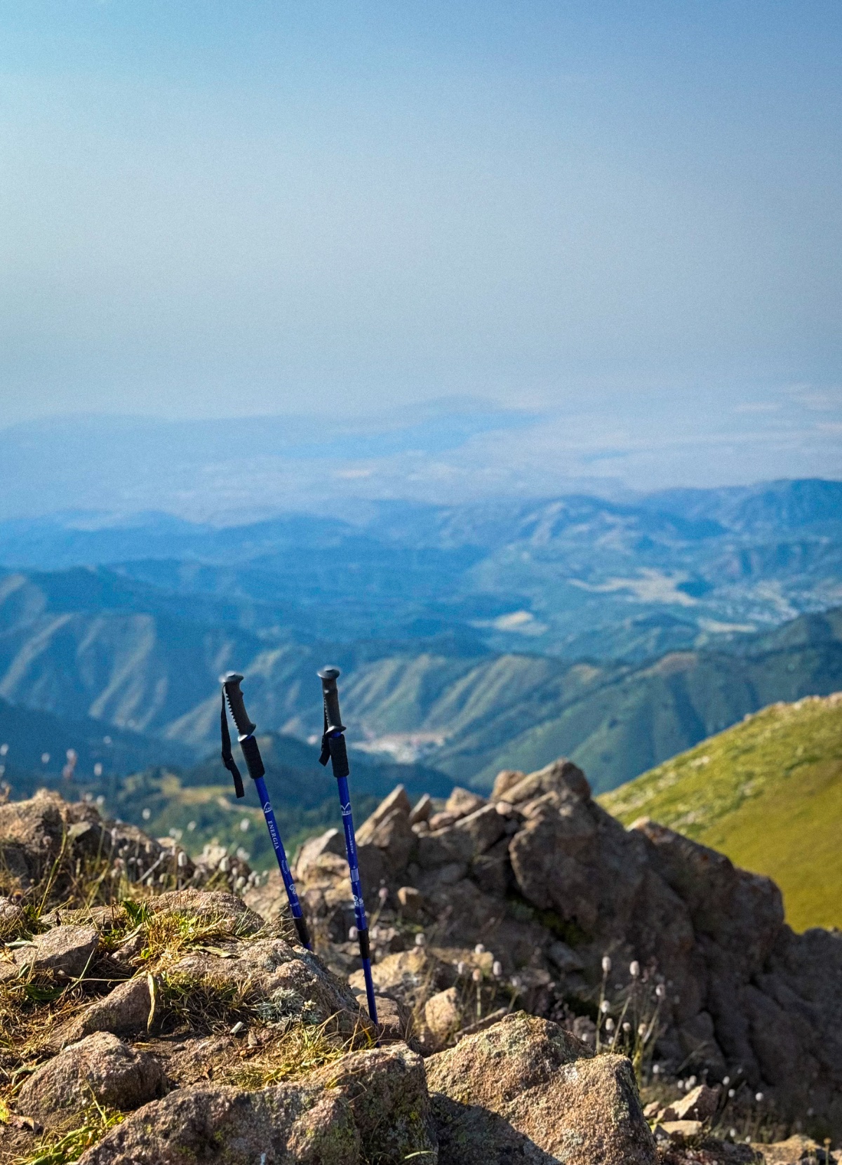
Descend briefly from Furmanov, then climb again along the connecting ridge. The terrain is exposed ridgeline — wind can be strong. The views open dramatically: Butakov Gorge appears to the east, the Left Talgar valley visible in the distance.
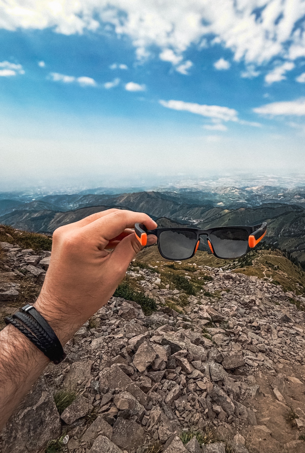
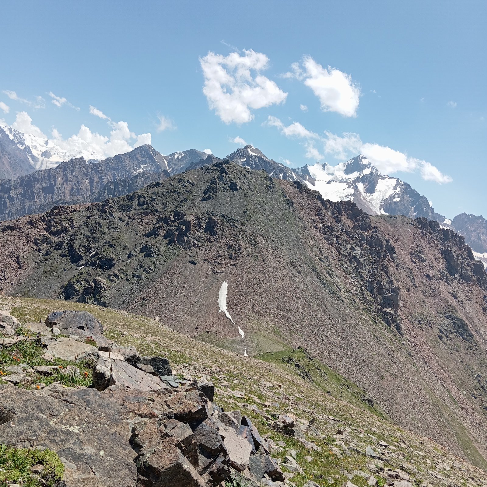
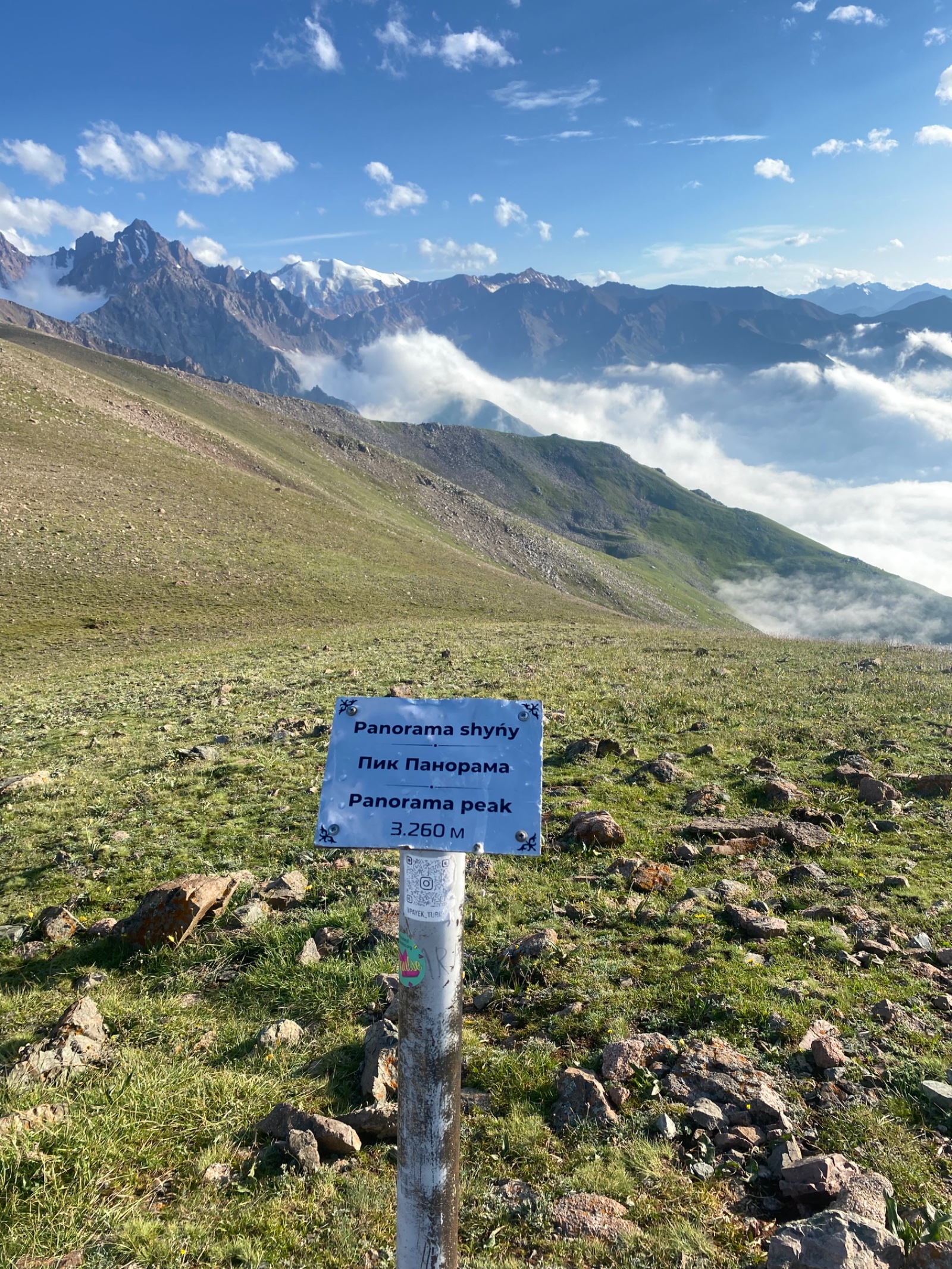
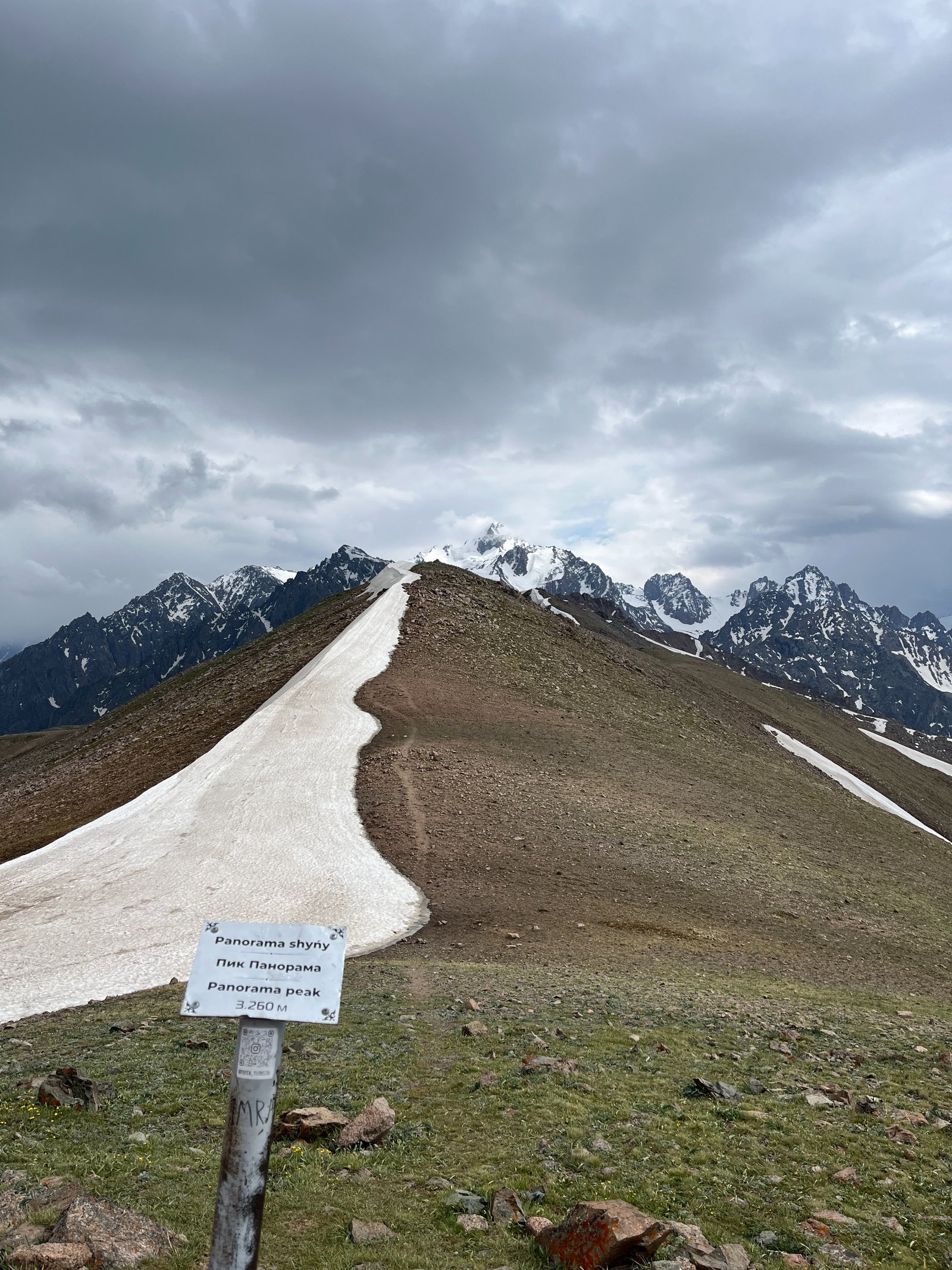
Panorama Peak (3,260 m) — the second summit. True to its name, this peak offers an unobstructed 360° view. North: Almaty city, the steppe beyond. South: the main Zailiyskiy Alatau ridge with Almaty Peak (4,376 m), Molodezhniy (4,147 m), and Talgar Peak (5,017 m) visible. East: the deep cut of the Malaya Almatinka valley with Mynzhylki Plateau below. West: the Kimasar Gorge you ascended from.
Stage 4: Panorama → Bashuta Peak (3,260 m → 3,355 m)
Distance: ~1.5 km | Time: 45 min–1 hour | Elevation gain: +95 m
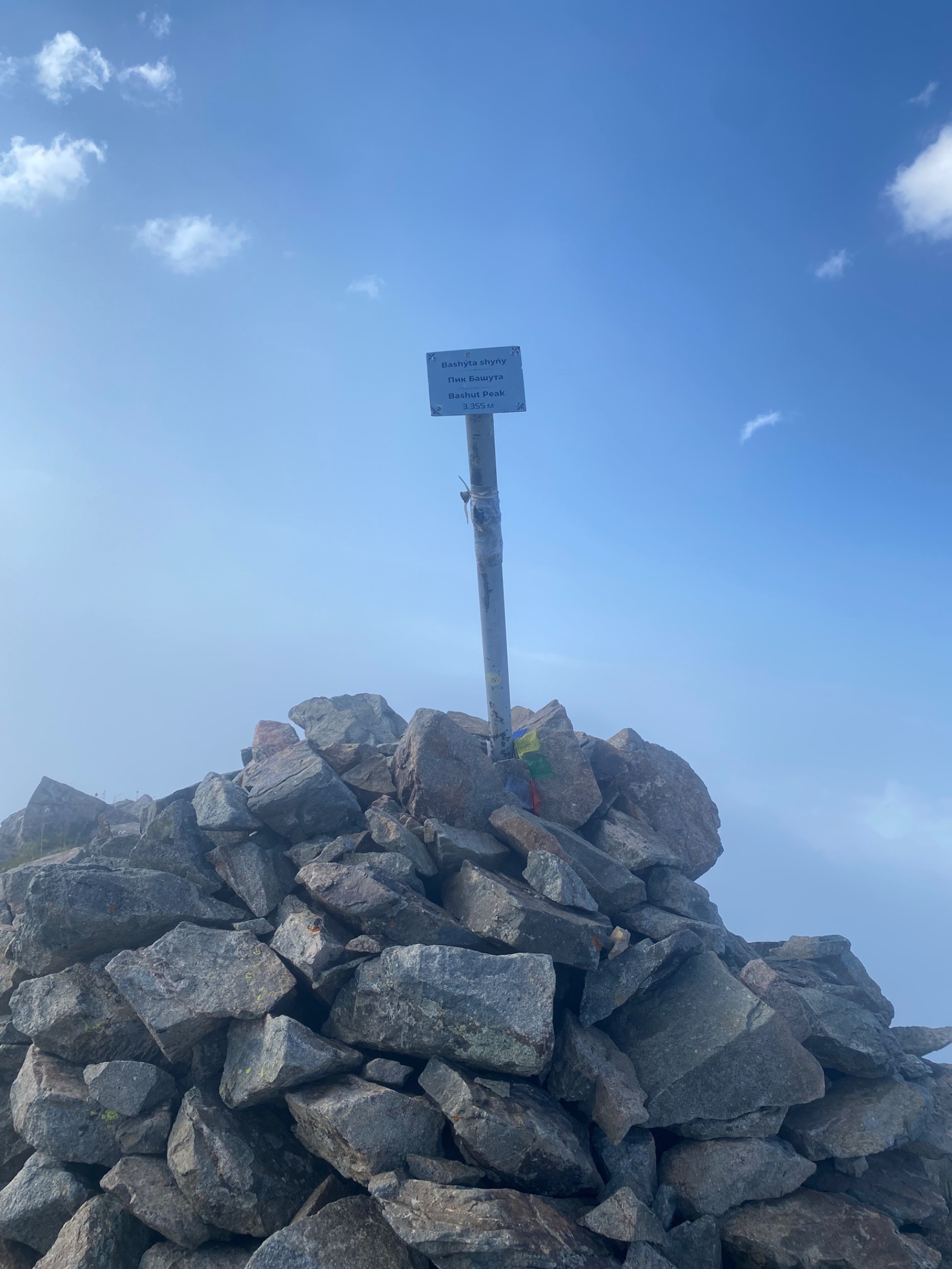
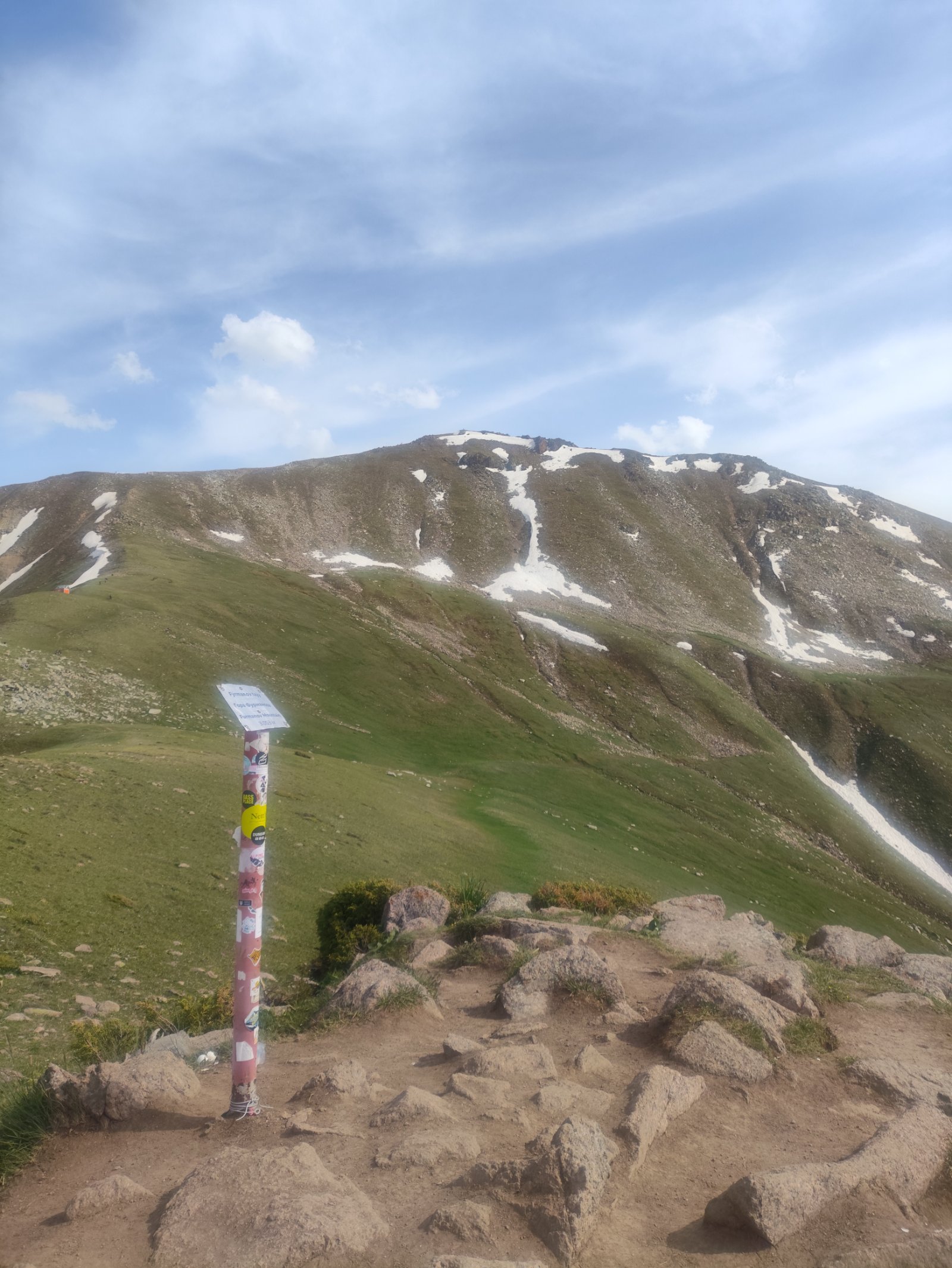
From Panorama, another descent-then-climb along the ridge. The trail becomes rockier. Bashuta is marked by a large stone cairn (tur) at its summit.
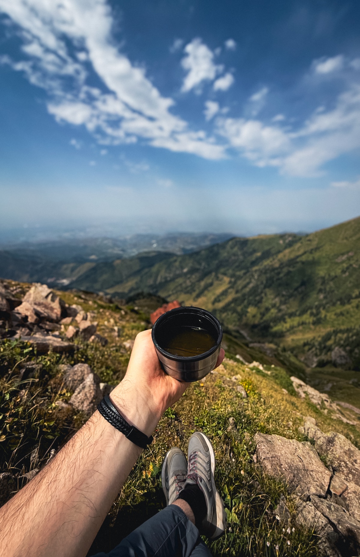
Bashuta Peak (3,355 m) — the third summit. Less dramatic than Panorama in terms of views (you’ve already seen the panorama from multiple angles by now), but the cumulative altitude and distance start to weigh. This is where less fit hikers feel the day catching up. Your guide manages pace and ensures hydration.
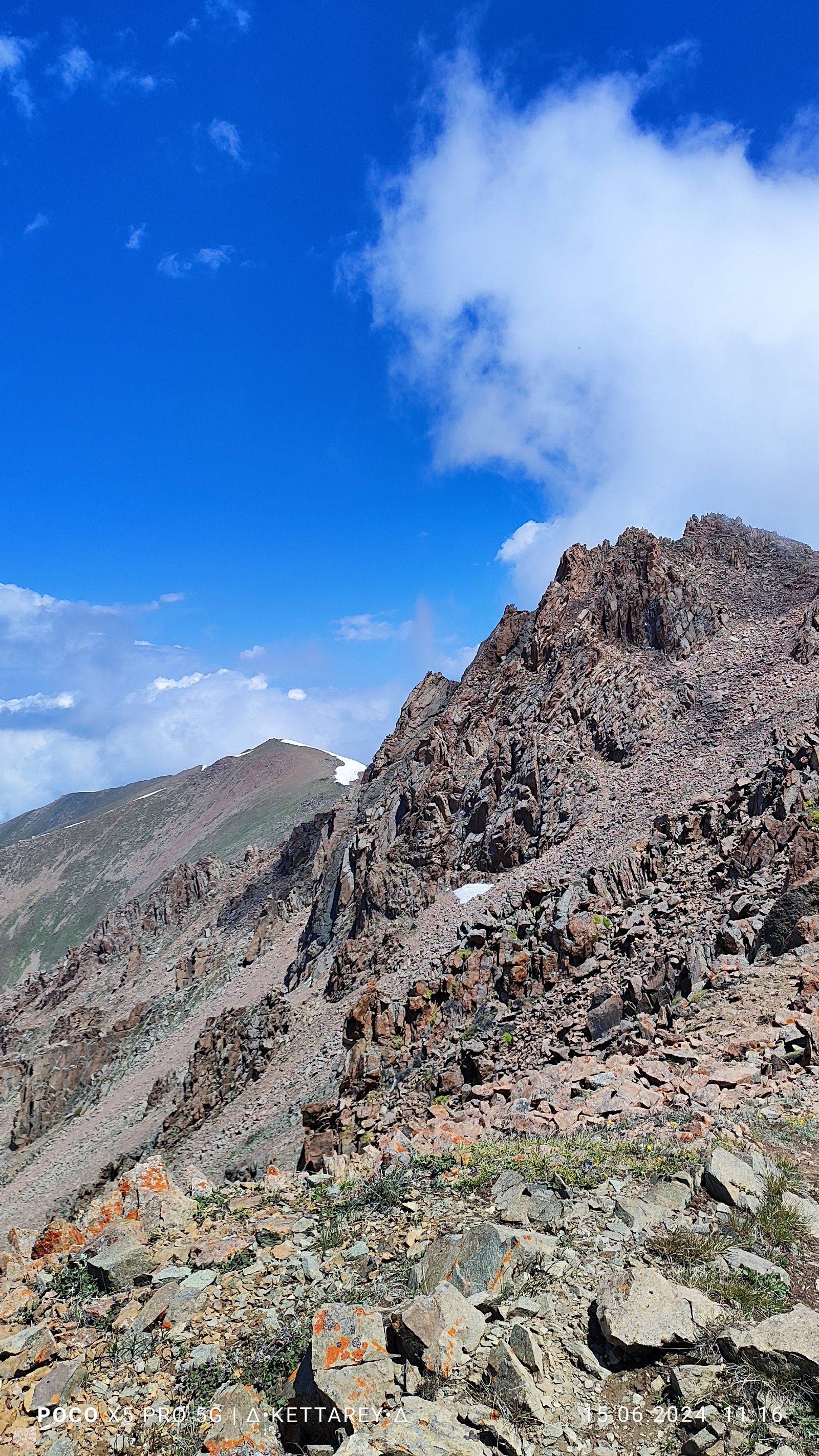
Stage 5: Bashuta → Chimbulachka Peak (3,355 m → 3,450 m)
Distance: ~1.5 km | Time: 45 min–1 hour | Elevation gain: +95 m
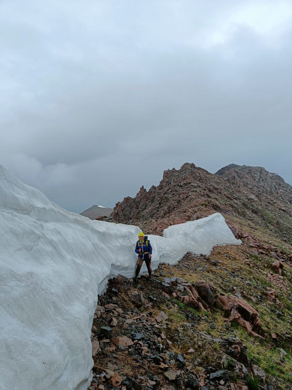
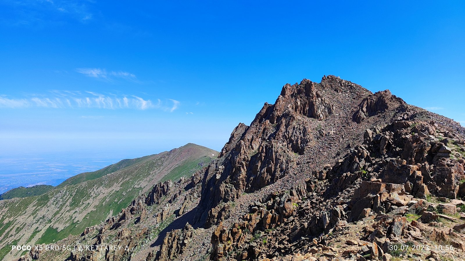
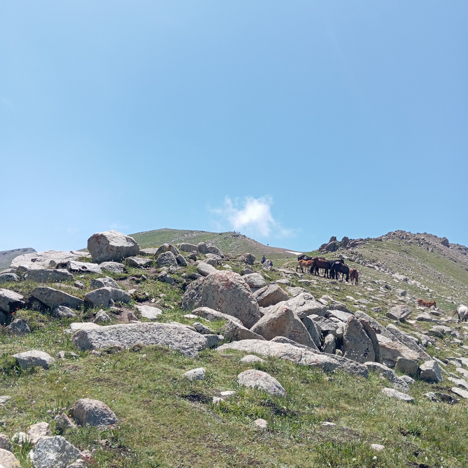
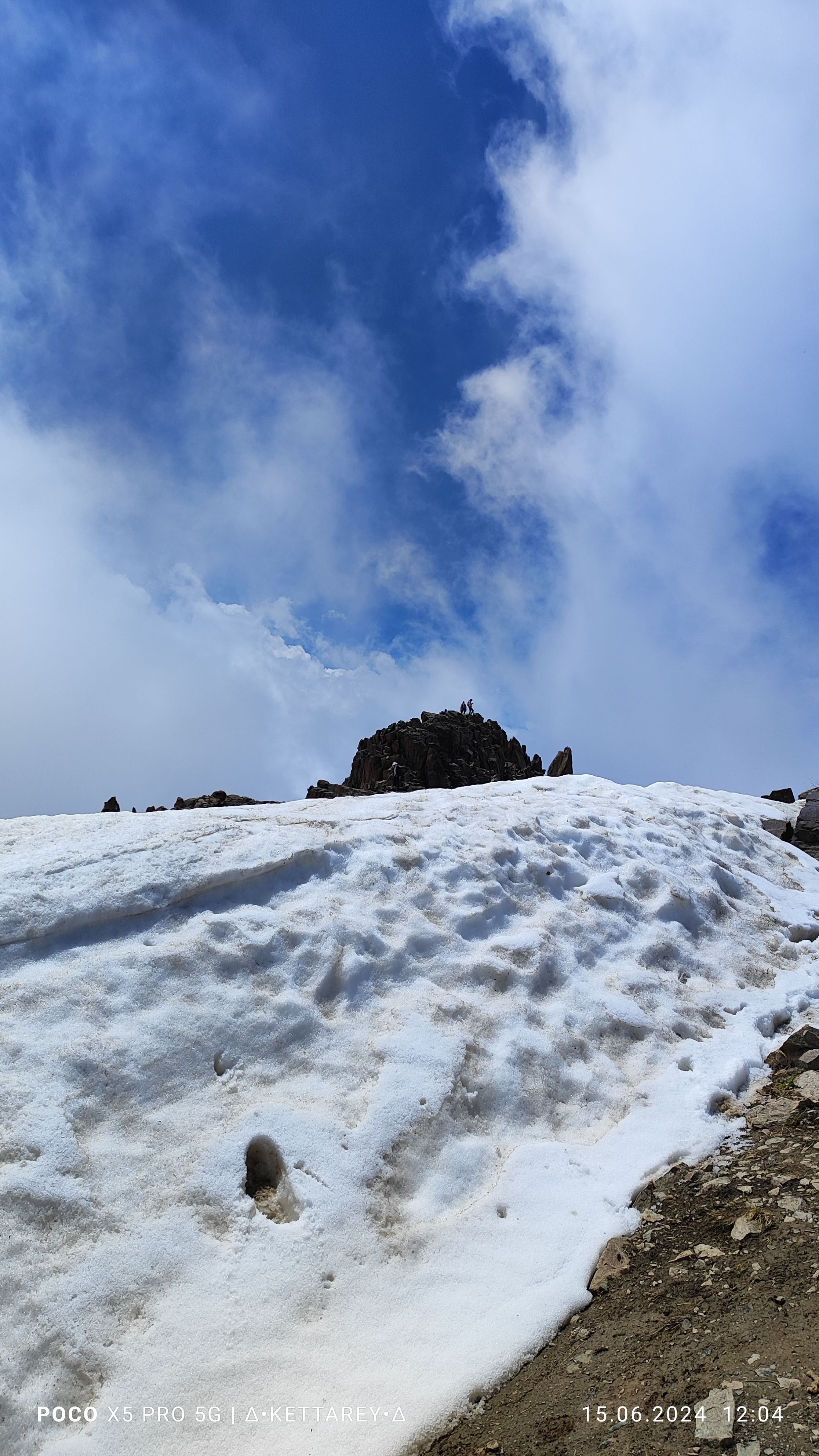
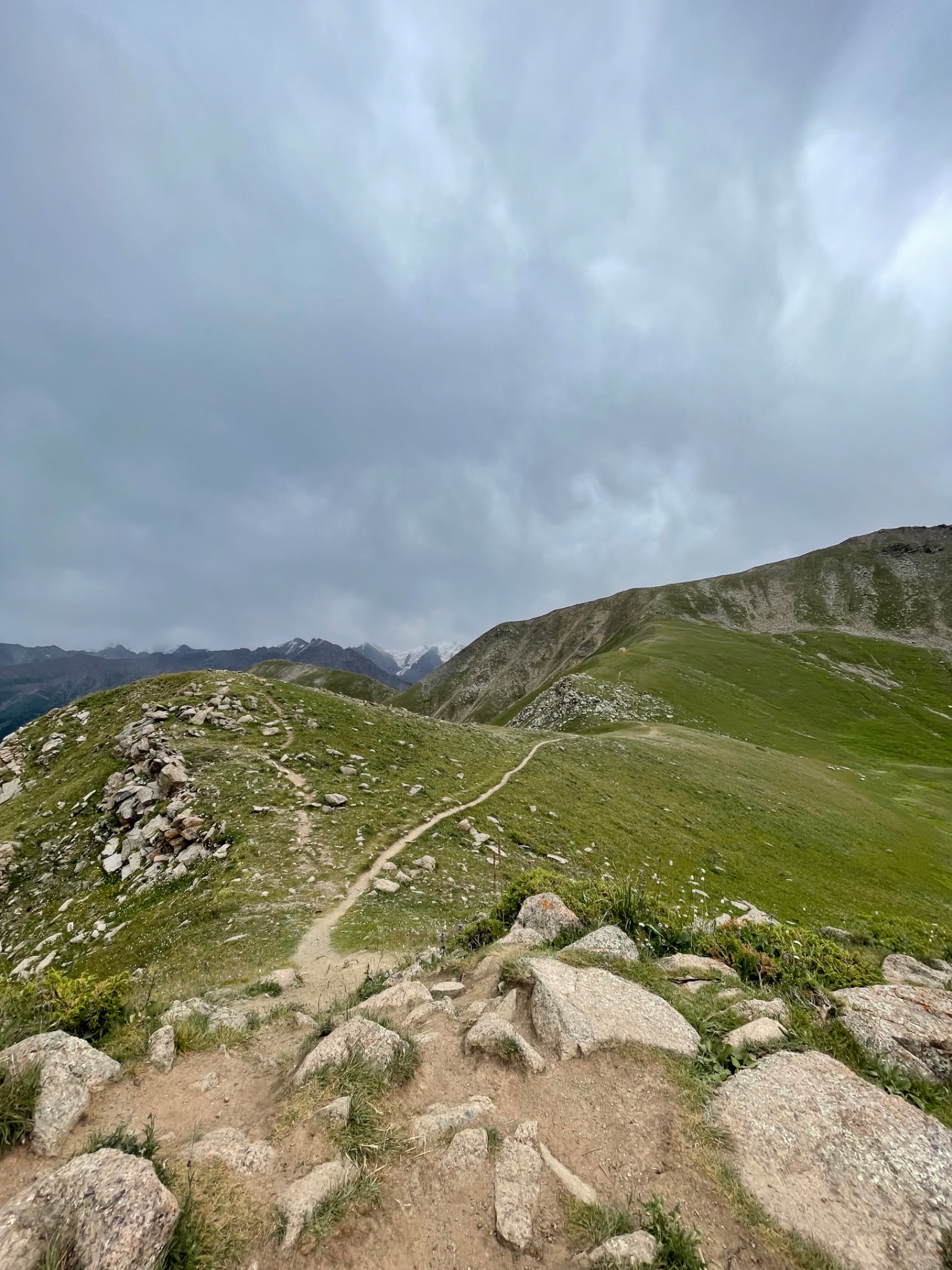
The final and highest summit of the traverse. The ridge continues southeast, with the Shymbulak ski resort becoming visible below to the east. The terrain is scree and rock — exposed and alpine.
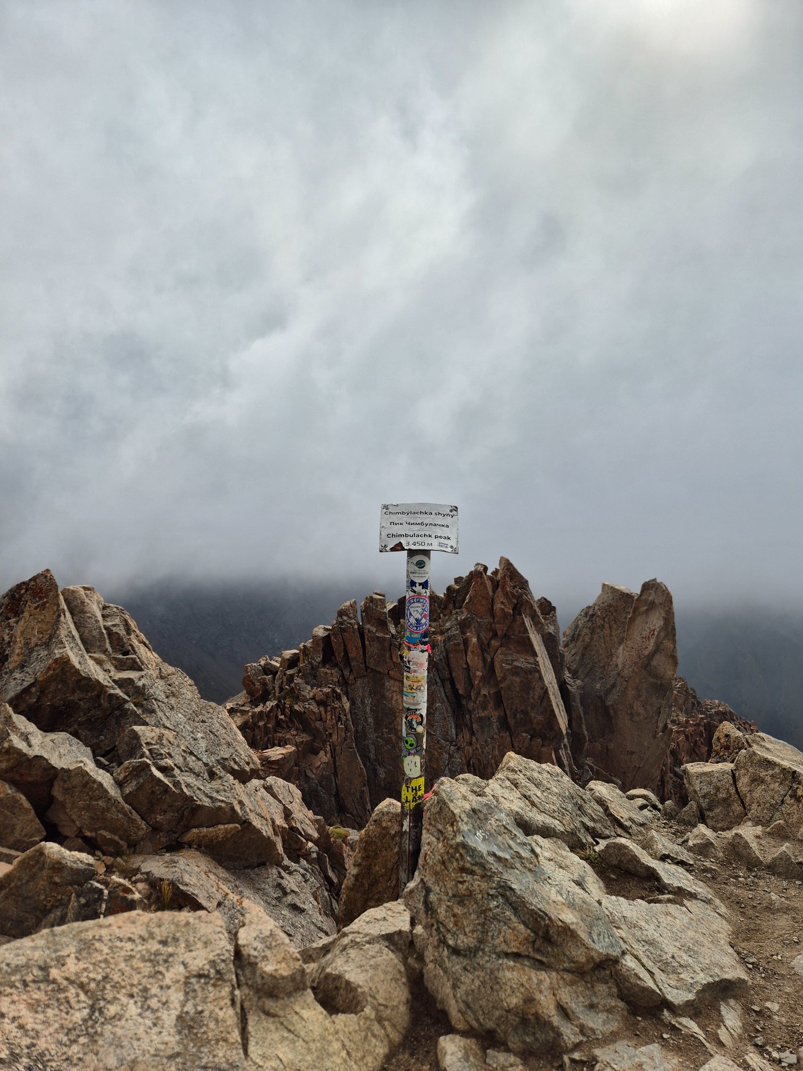
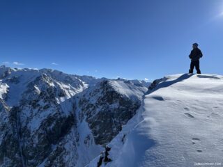
Chimbulachka Peak (3,450 m) — the fourth and final summit. The highest point of the MAK. From here, you can see the entire route you’ve traversed — the ridge stretching back northwest over Bashuta, Panorama, and Furmanov to where you started at Medeo, 1,770 metres below and many hours ago. Ahead: Talgar Pass and the cable car station. The sense of achievement at this point is visceral — you’ve walked the entire skyline.
Stage 6: Chimbulachka → Talgar Pass → Cable car → Medeo (3,450 m → 3,200 m → 1,680 m)
Distance: ~2 km hike + cable car | Time: 30–45 min hike + cable car
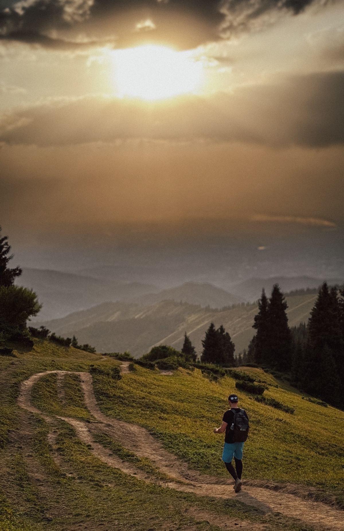
Descend from Chimbulachka to the Talgar Pass (3,200 m), where the Shymbulak ski resort’s upper cable car stations are located. Take the cable car down to the base station, then the eco-bus or eco-taxi back to Medeo.
Critical timing: Check cable car operating hours before the hike. Typically: weekdays 9:00–17:30/18:00 for upper stations, weekends slightly later. If you miss the last cable car, you must walk down to Medeo on the road — an additional 1.5–2 hours on tired legs. Your guide monitors pace throughout the day to ensure you arrive at the pass in time.
Detailed itinerary: Reverse route (top to bottom)
Stage 1: Medeo → Cable car → Talgar Pass (1,680 m → 3,200 m)
Take the Medeo–Shymbulak cable car to the base station, then the upper lifts (Combi-1 → Combi-2) to the top station near Talgar Pass at approximately 3,200 m. Travel time: approximately 30–45 minutes total.
Stage 2: Talgar Pass → Chimbulachka → Bashuta → Panorama → Furmanov
Walk the same ridge in reverse — summiting the four peaks in descending order. The key difference: you start at altitude and descend overall. The ridge sections between peaks still involve short climbs (you must ascend to each summit before descending the other side), but the cumulative climbing is far less — approximately 400–500 m total vs 1,400–1,800 m in the classic direction.
Stage 3: Furmanov → Kimasar Gorge → Medeo
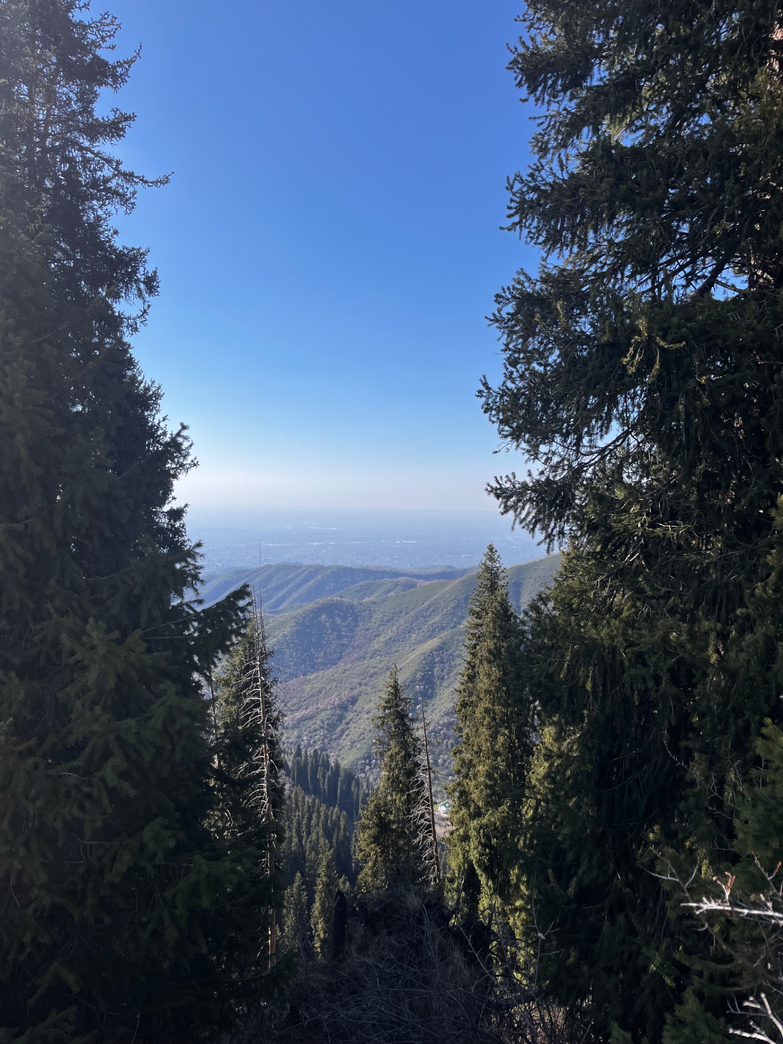
Descend from Furmanov through the Kimasar Gorge back to Medeo. This is a long, steep descent (1,370 m drop) that is hard on knees, ankles, and toes. Trekking poles are strongly recommended. The forest section provides shade and a psychological lift after hours on the exposed ridge.
Why book a guided MAK hike?
Route-finding. The trail above the Furmanov swing is poorly marked and crosses exposed ridgelines where visibility can drop suddenly in cloud. Between Bashuta and Chimbulachka, the path traverses scree slopes where the “trail” is little more than boot prints on loose rock. Your guide knows every cairn, every fork, and every section where hikers commonly go wrong.
Time management. Missing the last cable car at Talgar Pass means an additional 1.5–2 hour road walk on exhausted legs. Your guide monitors group pace from Stage 1 and adjusts speed, rest stops, and summit time to guarantee you reach the pass before the lifts close.
Weather exposure. You’re above 3,000 m on an exposed ridge for 4–6 hours. Weather changes rapidly — cloud, wind, rain, and even snow are possible at any time of year. Your guide reads conditions and carries emergency gear.
Altitude. The route reaches 3,450 m and spends hours above 3,000 m. Altitude headaches, nausea, and impaired coordination are possible, especially if you’ve recently arrived from near sea level. Your guide monitors symptoms and manages the turnaround decision if someone is struggling.
The knees question. The reverse route is 80% downhill — approximately 1,800 m of descent. This is genuinely punishing on knees and ankles. Your guide assesses the group’s joint condition beforehand and recommends the appropriate direction.
Itinerary
Detailed itinerary will be provided upon booking. Our typical tour includes daily hikes through diverse terrains and cultural experiences.
Pricing
| Group Size | 1 person | 2 people | 3 people | 4 people | 5 people | 6 people Best value |
|---|---|---|---|---|---|---|
| Standard | $154 $154 total | $107 $214 total | $91 $273 total | $83 $332 total | $78 $390 total | $75 $450 total |
100% private tour — prices are per person based on group size. The more friends you bring, the less everyone pays!
What's Included
Included
Not Included
Our Guarantee
If weather forces a cancellation, we reschedule at no cost. If you're not satisfied with your experience, we'll work with you to make it right. No questions, no hassle.
Private tours only (max 6) · Free cancellation up to 48 hours before · No upfront payment
Traveler Stories
Sarah K.
Our guide was incredible - he adjusted the pace perfectly for our group and knew exactly where to stop for the best photos. The whole experience felt effortless, like everything was taken care of before we even thought to ask.
Marco T.
We were a group of 4 friends and the per-person price made it a no-brainer. Private 4x4, lunch included, and the canyon was breathtaking. Way better than the big bus tours we saw there.
Anna W.
Solo traveler here. I was nervous about hiking alone in a foreign country but the guide made me feel completely safe. The trail to Kok-Zhailau was beautiful and the photos he took of me were amazing. Only wish the hike was longer!
David R.
Third time booking with these guys. Butakovka, Big Almaty Lake, and now Titov Peak. Every single time the service is flawless. The fact that it's always private and max 6 people makes such a difference compared to other operators.
Share Your Experience


28+ hikers
completed this trail
Tour At A Glance
Book This Tour
Weekend slots fill up fast — book early to get your preferred date
Pay securely after confirmation


Weather Forecast
light snow
H: 0°C
L: -5°C
Wed, Mar 25
clear sky
-3°C
-8° / 1°
Thu, Mar 26
clear sky
0°C
-3° / 4°
Fri, Mar 27
clear sky
0°C
-3° / 4°
Tour Location
Similar trails
Manshuk Mametova lake: how to get there, route, Mynzhylki
From $70/person
Day Hiking Tour to Kairak Waterfall in Turgen Gorge from Almaty
From $70/person
From $75
per person · free cancellation
Complete Your Booking
Tour:
Date:
Participants:
Price:
You're Almost There!
We'll contact you within 24 hours to confirm your spot and share everything you need to prepare for your adventure.
165
Videos on the channel
13,000+
16,000+
59
Hikes Filmed
704,000 m
Total Distance
44,439 m
Total Elevation Gain
812 cups
Grand Cru Tea Cups
27
Countries Visited
83 hours
Drone Flight Hours
10 videos
Sports: Running, Snowboard
3 videos
Healthy Eating
1
Living on the Edge