Day Hiking Tour to the T-1 Glaciological Station (Tuyuksu Glacier) from Almaty
From $65 per person
Overview
Is this hike right for you?
Perfect if you…
No experience needed
Description
A guided day hike from Shymbulak ski resort through the Mynzhylki Plateau to the T-1 Glaciological Station at 3,440 m — the oldest continuously operating glacier monitoring station in Central Asia — with panoramic views of the Tuyuksu glacier cirque and surrounding peaks above 4,000 m.
What to expect on the Tuyuksu glacier hike
The Tuyuksu glacier hike from Almaty takes you to one of the most scientifically important places in Central Asia’s mountains. The T-1 Glaciological Station sits at 3,440 m on the moraine of the Tuyuksu glacier, where scientists have conducted uninterrupted observations since 1956 — making it one of the longest continuous glacier monitoring records on Earth.
This matters because Tuyuksu is not just any glacier. It’s one of the World Glacier Monitoring Service’s reference glaciers — part of a global network whose data shapes our understanding of climate change. And it’s the only glacier in all of Central Asia where continuous year-round monitoring survived the collapse of the Soviet Union. Every other station was abandoned. Tuyuksu kept going.
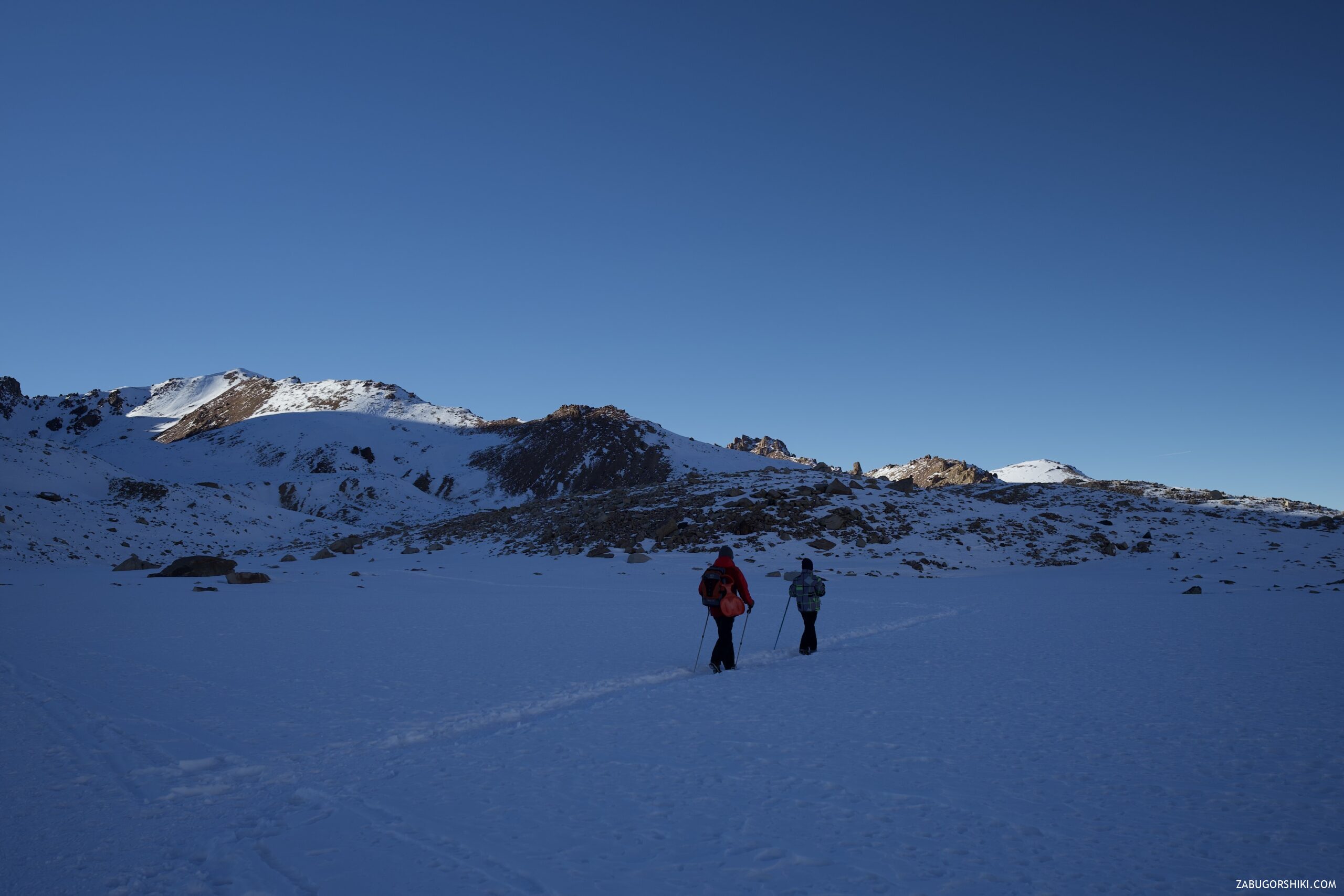
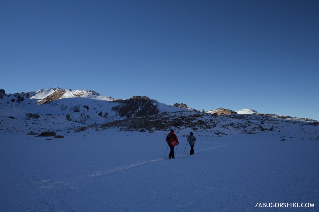
The hike follows the same route as the Mynzhylki plateau walk, but continues beyond the dam for another 1.5 km and 400+ m of elevation gain to reach the station. This final section — from the Mynzhylki dam at 3,030 m to the station at 3,440 m — is the steepest and most demanding part. The trail crosses glacial moraine: loose rock, uneven ground, and thin air.
The reward is the panorama from the station. You stand on the glacier’s moraine — the rubble belt pushed ahead by centuries of ice movement — and look south into the Tuyuksu cirque. The Central Tuyuksu glacier (2.6 km², spanning 3,415–4,219 m) is right there, hemmed by nine glaciers in total: Igli Tuyuksu, Molodezhniy, Mametova, Kosmodemyanskaya, Mayakovsky, Ordzhonikidze, and others. The peaks surrounding the cirque exceed 4,000 m: Nursultan (4,376 m), Pogrebetsky (4,231 m), Sovetov (4,317 m). The sense of scale is difficult to convey — you are standing in the innermost sanctum of the Zailiyskiy Alatau, surrounded by ice and rock.
Beyond the station, if conditions allow, you can walk further toward the glacier’s tongue and see the moraine lake formed by Molodezhniy glacier, which “hangs” from the northern slope of its peak. The Molodezhniy lake sits in a dramatic cirque of its own.
Detailed itinerary
Getting to Shymbulak (1–1.5 hours from hotel)
Pickup from your Almaty hotel at 7:00 AM. Drive to Medeo (1,691 m), cable car or eco-bus to Shymbulak (2,270 m). Early start is essential — this is a long day.
Shymbulak to Mynzhylki dam (2–2.5 hours)
The familiar route up the Small Almaty Gorge: asphalt ends after 400 m from Shymbulak, then dirt road past the Tuyuksu mountaineering camp (founded 1939), the Memorial to Mountain Victims, the Bastions (240 m granite walls), and the Tuyuksu Gate (wind-swept narrows at ~2,600 m). Beyond the gate, the gorge opens into the Mynzhylki Plateau. We reach the dam at 3,030 m with the meteorological station (operating since 1936, oldest in Central Asia).
Rest, hot tea, snack. Your guide checks the group for altitude symptoms before continuing.
Mynzhylki dam to T-1 station (1–1.5 hours)
This is the hardest section. The dirt road continues rising from the dam, crosses the Malaya Almatinka River (now a small stream this close to its source), and makes a large zigzag. At approximately 3,450 m, the road forks: right leads to the glaciological station buildings, left leads toward Alpengrad and Lake Manshuk Mametova.
We take the right fork. The T-1 station consists of three buildings — two wooden houses built in 1971 by the Zaili glacier expedition (54 m² each) and the main station structure. These buildings have housed glaciologists year-round through Soviet winters, post-independence collapse, and ongoing research partnerships with international universities.
At the station (30–60 minutes)
We spend time at the station taking in the Tuyuksu glacier panorama. Your guide explains the science: how mass balance is measured (accumulation versus ablation), how the glacier has retreated several hundred metres since the station was built, and what the data tells us about Central Asia’s water future.
Key facts your guide shares:
- The glacier has lost roughly 30% of its area since the 1950s
- The glacier’s tongue was once close to where the station buildings stand — now it’s over a kilometre away
- Average annual temperature at the station: -6.4°C (January: -15.5°C, July: +2.8°C)
- Frosts reach -40°C
- Peak water discharge from the glacier has already been reached; decline is expected from the 2040s
- Complete glacier dissolution is forecast by approximately 2050
If time and conditions allow, we walk further toward the glacier or the Molodezhniy moraine lake.
Descent (2.5–3 hours)
Return via the same route to Shymbulak. The descent from T-1 to the dam requires care — loose moraine, steep terrain. Cable car back to Medeo, drive to Almaty. Return by late afternoon or early evening.
Why book a guided Tuyuksu glacier hike?
Altitude management: At 3,440 m, altitude sickness affects many visitors — headache, nausea, weakness, difficulty breathing. Your guide monitors the group, controls the pace, enforces hydration, and decides whether to continue past the Mynzhylki dam or turn back. This is not a decision to make alone at altitude.
Scientific context transforms the experience. Without a guide, you see grey rocks, white ice, and distant peaks. With a guide, you understand that those grey rocks are a moraine pushed by a glacier that was hundreds of metres larger within living memory, that the three wooden houses are the outpost where scientists maintained a 70-year data record through political collapse, and that the ice you’re looking at supplies drinking water to 1.8 million people in Almaty.
Navigation above Mynzhylki. The trail from the dam to T-1 crosses glacial moraine — terrain that looks similar in every direction. The fork at 3,450 m is not signed. In cloud or snow, finding the station without local knowledge is genuinely difficult.
Frequently asked questions
What is the T-1 glaciological station? A scientific research station at 3,440 m on the moraine of the Tuyuksu glacier, operated by the Institute of Geography of Kazakhstan. Founded in 1956 during the International Geophysical Year, it has maintained continuous year-round glacier monitoring for nearly 70 years — the only station in Central Asia to survive the post-Soviet collapse. It’s part of the World Glacier Monitoring Service reference network.
How hard is this hike compared to Mynzhylki? Significantly harder. Mynzhylki reaches the dam at 3,030 m on a dirt road (3/5 difficulty). The T-1 station adds another 400+ m of elevation gain on steep, loose moraine (3.5/5 difficulty). The altitude difference — 3,030 m versus 3,440 m — is felt disproportionately as you approach the station.
Can I see the glacier up close? From the station, the glacier cirque is directly in front of you. The Central Tuyuksu glacier’s tongue was once near the station; it has since retreated over a kilometre. To touch the glacier ice, you would need to continue another 1–1.5 km beyond the station (requires more time and appropriate footwear). The Molodezhniy moraine lake nearby offers glacier-adjacent views.
Will the glacier still be there when I visit? Research projects complete dissolution by approximately 2050. The glacier is visibly smaller each year. What you see today will not exist in 25 years. The T-1 station was built on the glacier’s moraine — once the glacier retreats beyond the cirque walls, the moraine and the station will remain, but the ice will not.
What is the Tuyuksu glacier’s significance for Almaty? The Tuyuksu glacier feeds the Malaya Almatinka (Small Almaty) River, which is a water source for Almaty’s 1.8 million residents. The glacier’s retreat directly affects the city’s water supply. Peak water flow has already been reached; scientists expect discharge to decline from the 2040s. The T-1 station’s data underpins water security planning for the entire region.
How many glaciers are in the Tuyuksu group? Nine glaciers, the largest being Central Tuyuksu (2.6 km²). The others are Igli Tuyuksu, Molodezhniy, Mametova, Kosmodemyanskaya, Mayakovsky, Ordzhonikidze, and Partizan. All are in retreat.
What’s the difference between T-1 and the Mynzhylki meteorological station? Two different stations at different elevations. The Mynzhylki meteo station (3,017 m, founded 1936) records weather data. The T-1 glaciological station (3,440 m, founded 1956) specifically monitors the glacier’s mass balance, movement, and melt. Both contribute to the scientific record.
Can I combine this with the ice grottos? In winter, yes — the grottos and the station are reached from the same fork at ~3,400 m. Visiting both in one day is possible but creates a very long day (12+ hours). In summer, only the station is accessible (grottos are dangerous when warm).
Can I stay overnight at the station? The station has historically provided temporary shelter for mountaineers and researchers. Check with your guide about current availability — this is a working scientific facility, not a hotel.
Itinerary
Detailed itinerary will be provided upon booking. Our typical tour includes daily hikes through diverse terrains and cultural experiences.
Pricing
| Group Size | 1 person | 2 people | 3 people | 4 people | 5 people | 6 people Best value |
|---|---|---|---|---|---|---|
| Standard | $144 $144 total | $97 $194 total | $81 $243 total | $73 $292 total | $68 $340 total | $65 $390 total |
100% private tour — prices are per person based on group size. The more friends you bring, the less everyone pays!
What's Included
Included
Not Included
Our Guarantee
If weather forces a cancellation, we reschedule at no cost. If you're not satisfied with your experience, we'll work with you to make it right. No questions, no hassle.
Private tours only (max 6) · Free cancellation up to 48 hours before · No upfront payment
Traveler Stories
Sarah K.
Our guide was incredible - he adjusted the pace perfectly for our group and knew exactly where to stop for the best photos. The whole experience felt effortless, like everything was taken care of before we even thought to ask.
Marco T.
We were a group of 4 friends and the per-person price made it a no-brainer. Private 4x4, lunch included, and the canyon was breathtaking. Way better than the big bus tours we saw there.
Anna W.
Solo traveler here. I was nervous about hiking alone in a foreign country but the guide made me feel completely safe. The trail to Kok-Zhailau was beautiful and the photos he took of me were amazing. Only wish the hike was longer!
David R.
Third time booking with these guys. Butakovka, Big Almaty Lake, and now Titov Peak. Every single time the service is flawless. The fact that it's always private and max 6 people makes such a difference compared to other operators.
Share Your Experience
Tour At A Glance
Book This Tour
Weekend slots fill up fast — book early to get your preferred date
Pay securely after confirmation


Similar trails
Day Hiking Tour to Eagle’s Nest Viewpoint from Almaty
From $77/person
Day Hiking Tour to Butakovka Waterfalls from Almaty
From $72/person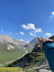
Guided Climb of Peak Yukon (3,540 m)
From $147/person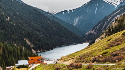
Day Tour to Kolsai Lakes from Almaty
From $68/personFrom $65
per person · free cancellation
Complete Your Booking
Tour:
Date:
Participants:
Price:
You're Almost There!
We'll contact you within 24 hours to confirm your spot and share everything you need to prepare for your adventure.
165
Videos on the channel
13,000+
16,000+
59
Hikes Filmed
704,000 m
Total Distance
44,439 m
Total Elevation Gain
812 cups
Grand Cru Tea Cups
27
Countries Visited
83 hours
Drone Flight Hours
10 videos
Sports: Running, Snowboard
3 videos
Healthy Eating
1
Living on the Edge